Opens in a new tab
Geoscopy
Geology, explained.
Generic selectors
Exact matches only
Search in title
Search in content
Post Type Selectors

Rocks

An atlas of rocks and minerals: each one a record of the conditions that made it.

Glossary

Filter - Radio

Sort by

Y

Yasawa Group

The Yasawa Group is an island chain in Fiji, composed of volcanic.. more →

Y

Yazoo Backwater Area 

The Yazoo Backwater Area is a floodplain region in the Mississippi Delta.. more →

Y

Yellow Dune 

A yellow dune is a type of coastal sand dune that is.. more →

Y

Yellow River (Huang He) 

The Yellow River, also known as the Huang He, is the second-longest.. more →

Y

Yellow Soil 

Yellow soil, also known as yellow earth, is a type of soil.. more →

Y

Yellowcake 

Yellowcake is a concentrated form of uranium oxide (U₃O₈) produced during the.. more →

Y

Yellowstone Caldera 

The Yellowstone Caldera is a large volcanic caldera located in Yellowstone National.. more →

Y

Yemen Volcanic Group

The Yemen Volcanic Group consists of a series of volcanic rocks in.. more →

Y

Yenisei Ridge

The Yenisei Ridge is a mountainous region in Siberia, Russia, characterized by.. more →

Y

Yukon-Koyukuk Basin

The Yukon-Koyukuk Basin is a large sedimentary basin in Alaska, filled with.. more →

Y

Yukon-Tanana Terrane 

The Yukon-Tanana Terrane is a geologic terrane in the Canadian Yukon and.. more →

Y

Yungas Region

The Yukon-Tanana Terrane is a geologic terrane in the Canadian Yukon and.. more →

Y

Yungas Region 

The Yungas region is a transitional zone between the Andean highlands and.. more →

Z

Zebra Rock

Zebra rock is a type of banded, sedimentary rock characterized by alternating.. more →

Z

Zeta Potential 

Zeta potential is a measure of the electrostatic potential at the interface.. more →

Z

Zigzag Fold

A zigzag fold is a type of chevron fold characterized by angular,.. more →

Z

Zircon Fission Track Dating 

Zircon fission track dating is a geochronological method used to determine the.. more →

Z

Zircon Thermochronology 

Zircon thermochronology is a technique used to study the thermal history of.. more →

Z

Zonal Soil 

Zonal soil refers to soil types that are characteristic of specific climatic.. more →

Z

Zonation 

Zonation refers to the arrangement or patterning of ecosystems or communities in.. more →

Z

Zooplankton 

Zooplankton are small, drifting organisms found in aquatic environments, including oceans, seas,.. more →

Z

Zosterophylls 

Zosterophylls are an extinct group of early vascular plants that lived during.. more →

YYasawa Group

The Yasawa Group is an island chain in Fiji, composed of volcanic and sedimentary rocks. These islands are significant in volcanic geology and tectonics for their role in understanding the processes of island arc formation, the evolution of volcanic island chains, and the tectonic setting of the South Pacific. 

Reference: Nunn, P. D. (1998). “Pacific Island Landscapes.” Institute of Pacific Studies. 
Share 

Open entry →
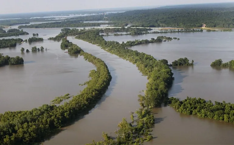
Aerial view of river flooding over forested area (Yazoo backwater area)

YYazoo Backwater Area 

The Yazoo Backwater Area is a floodplain region in the Mississippi Delta that experiences frequent flooding due to the overflow of the Mississippi and Yazoo Rivers. This area is significant in hydrology and flood management for understanding the dynamics of river flooding, the impact on agriculture and infrastructure, and the strategies for flood control in deltaic regions. 

Reference: Autin, W. J. (2005). “The Mississippi River: A Geomorphological Perspective.” Geomorphology, 70(3-4), 293-314. 

Share 

Open entry →
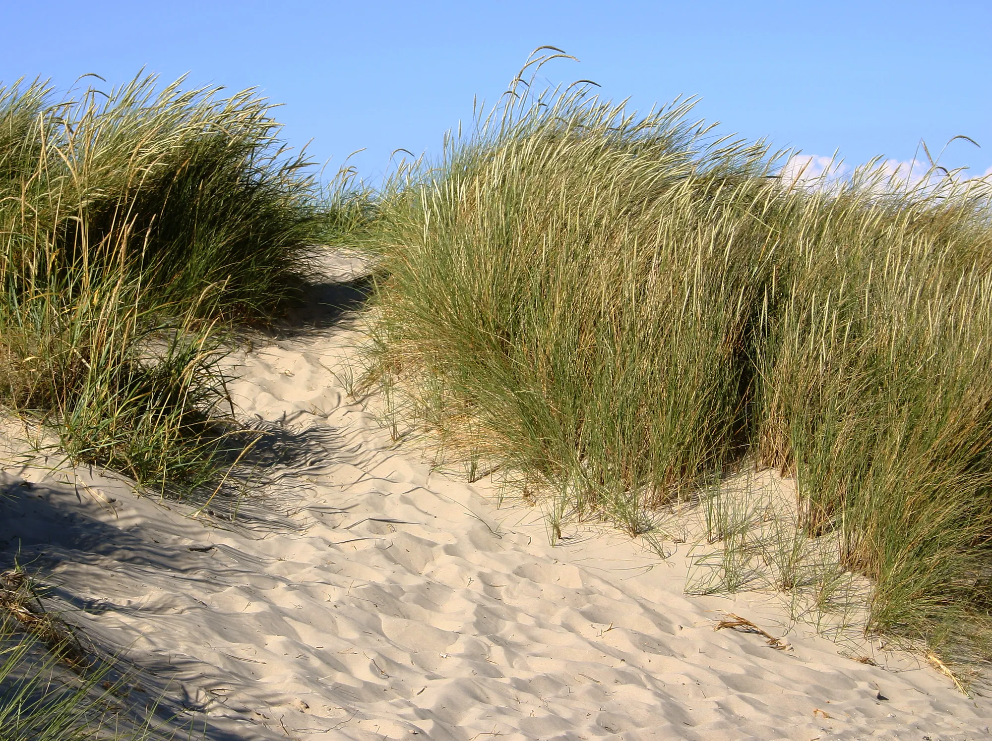
Sandy path through beach grass dunes (yellow dune)

YYellow Dune 

A yellow dune is a type of coastal sand dune that is characterized by its yellowish color, resulting from the presence of iron oxide coatings on sand grains. Yellow dunes are significant in coastal geomorphology for understanding the processes of dune formation, the role of vegetation in stabilizing dunes, and the impact of wind and waves on coastal landscapes. 

Reference: Pye, K., & Tsoar, H. (1990). “Aeolian Sand and Sand Dunes.” Springer. 

Share 

Open entry →
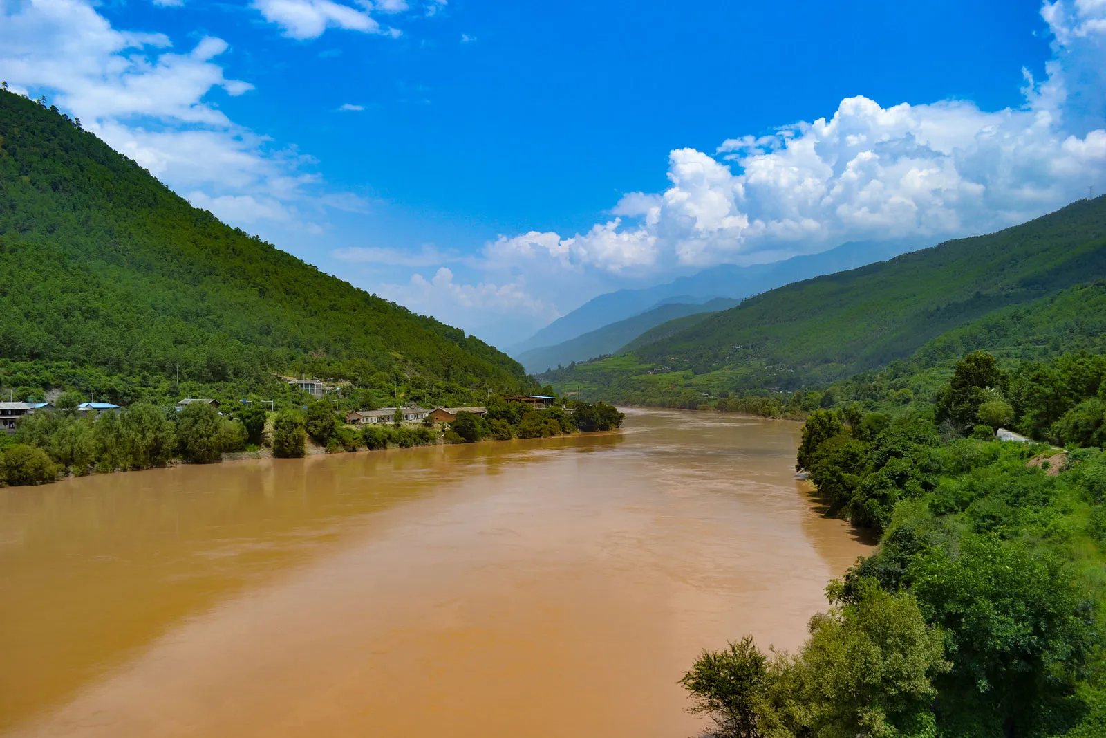
Brown river flowing between lush green mountains (Yellow River, Huang He, in China)

YYellow River (Huang He) 

The Yellow River, also known as the Huang He, is the second-longest river in China, known for its heavy sediment load and frequent flooding. The Yellow River is significant in geomorphology, hydrology, and environmental science for its role in shaping the Chinese landscape, its influence on agriculture and human settlement, and the challenges of flood management and sediment control. 

Reference: Huang, H. Q., & Nanson, G. C. (2007). “Why Some Large Rivers Develop an Anabranching Pattern.” Geology, 35(2), 87-90. 

Share 

Open entry →
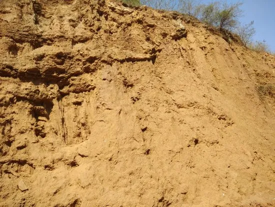
Eroded soil cliff with sparse vegetation (Yellow Soil)

YYellow Soil 

Yellow soil, also known as yellow earth, is a type of soil commonly found in humid subtropical regions, characterized by its yellow color due to the presence of iron oxides. These soils are significant in soil science and agriculture for their fertility, their role in supporting vegetation in tropical and subtropical climates, and their susceptibility to erosion. 

Reference: Lal, R. (2006). “Encyclopedia of Soil Science.” CRC Press. 

Share 

Open entry →
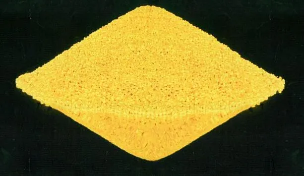
Yellow square foam pad on a black background (yellowcake)

YYellowcake 

Yellowcake is a concentrated form of uranium oxide (U₃O₈) produced during the milling of uranium ore, and it serves as an intermediate step in the production of nuclear fuel. Yellowcake is significant in economic geology and the nuclear industry for its role in the nuclear fuel cycle, from mining to reactor use. 

Reference: Emsley, J. (2011). “Nature’s Building Blocks: An A-Z Guide to the Elements.” Oxford University Press. 

Share 

Open entry →
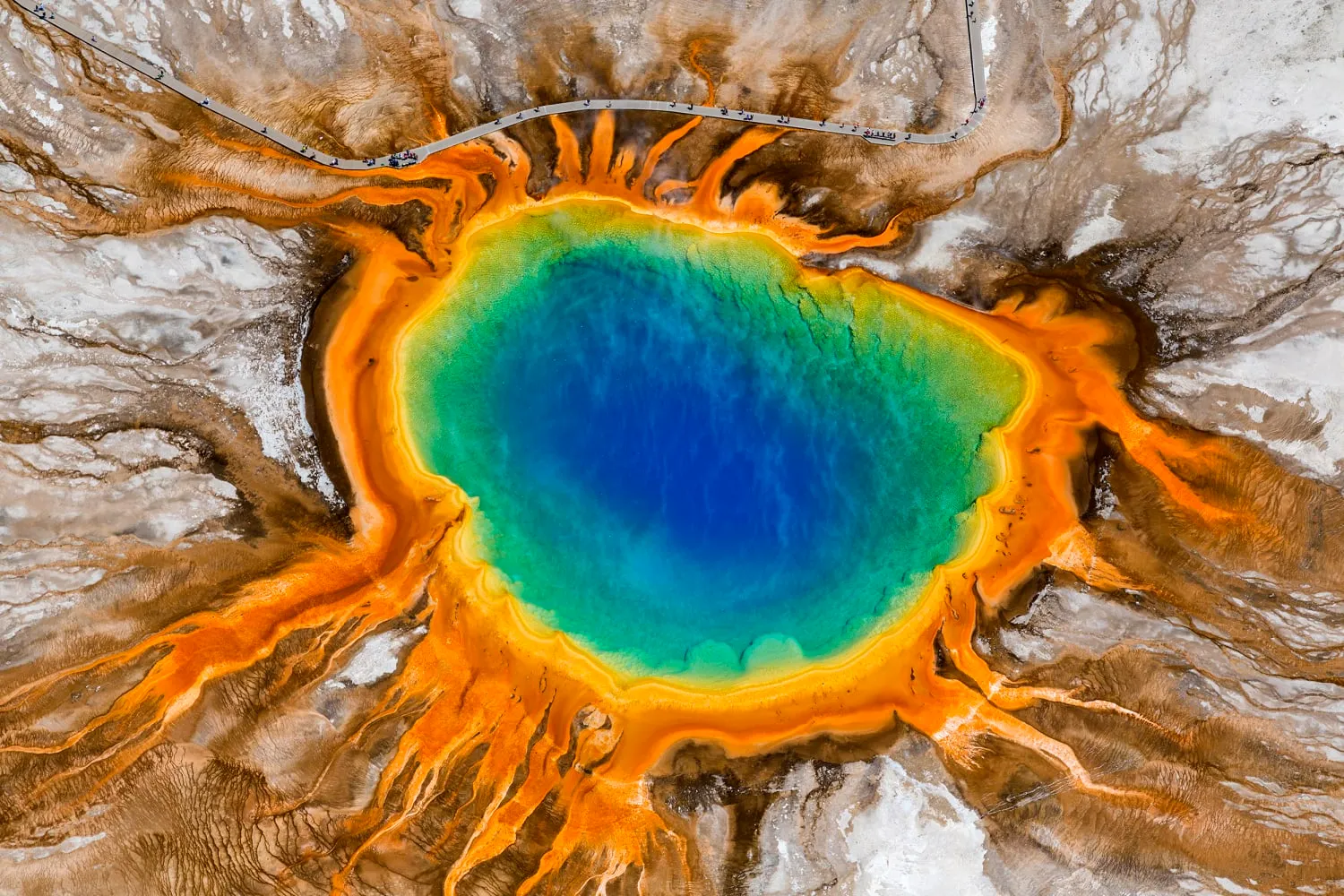
Colorful hot spring with blue and orange rings in Yellowstone National Park, USA

YYellowstone Caldera 

The Yellowstone Caldera is a large volcanic caldera located in Yellowstone National Park, formed by a series of massive volcanic eruptions over the past 2 million years. This caldera is significant in volcanology and geothermal studies for its active geothermal features, potential for future supereruptions, and role in shaping the geology of the region. 

Reference: Smith, R. B., & Siegel, L. J. (2000). “Windows into the Earth: The Geologic Story of Yellowstone and Grand Teton.” Oxford University Press. 

Share 

Open entry →
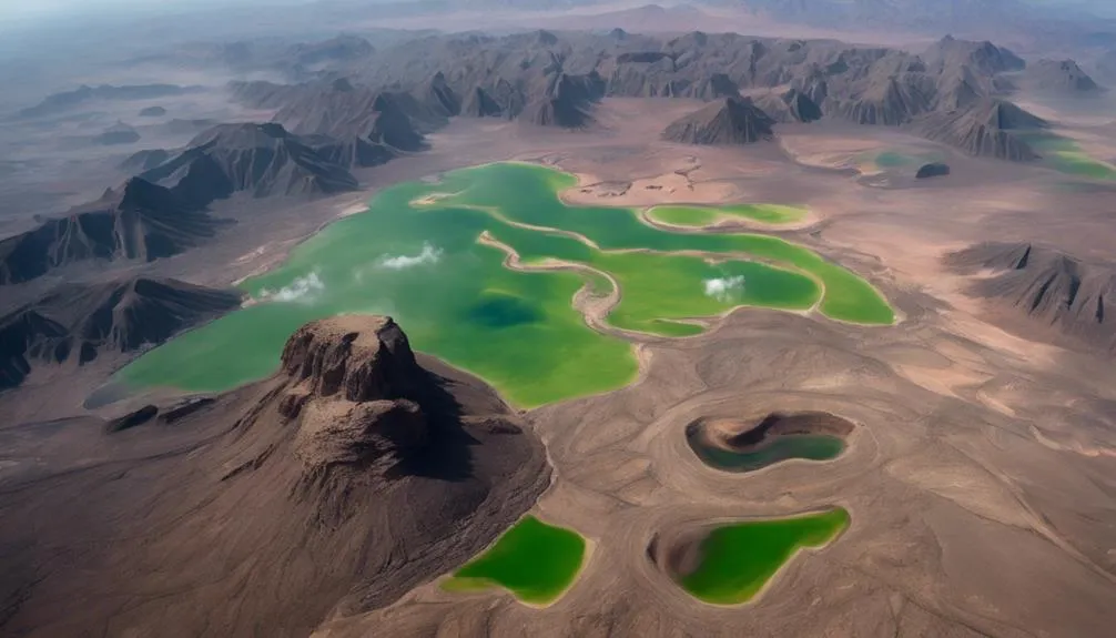
Aerial view of green lakes in volcanic desert (Yemen Volcanic Group)

YYemen Volcanic Group

The Yemen Volcanic Group consists of a series of volcanic rocks in Yemen, ranging from basalt to rhyolite, that formed during the Tertiary period. These volcanic rocks are significant in volcanology and tectonics for understanding the processes of continental rifting, the formation of the Red Sea and Gulf of Aden, and the evolution of the Arabian Peninsula. 

Reference: Baker, J., Snee, L., & Menzies, M. (1996). “A Brief Overview of the Yemen Volcanic Group.” Bulletin of Volcanology, 58(4), 405-414. 

Share 

Open entry →
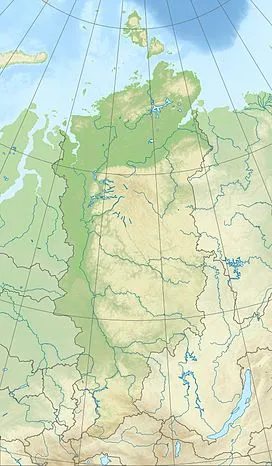
Map showing Siberian region in northern Russia (Yenisei Ridge)

YYenisei Ridge

The Yenisei Ridge is a mountainous region in Siberia, Russia, characterized by complex geological structures, including Precambrian metamorphic rocks and Paleozoic sedimentary formations. This region is significant in geology for understanding the tectonic evolution of Siberia, the history of mountain-building events, and the development of mineral resources in the area. 

Reference: Zonenshain, L. P., & Kuzmin, M. I. (1993). “Tectonics of the Lithosphere Plates of the USSR Territory.” Geotectonics, 27(2), 115-135. 

Share 

Open entry →
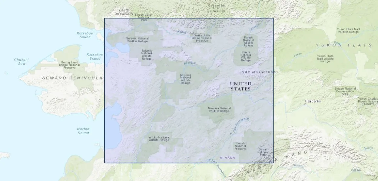
Map of northern Alaska wildlife refuges (Yukon-Koyukuk Basin)

YYukon-Koyukuk Basin

The Yukon-Koyukuk Basin is a large sedimentary basin in Alaska, filled with Mesozoic and Cenozoic sediments. This basin is significant in geology and petroleum exploration for its potential hydrocarbon resources, its role in understanding the tectonic history of Alaska, and the processes of basin formation and sedimentation. 

Reference: Mull, C. G., Houseknecht, D. W., & Bird, K. J. (2002). “Tectonics of the Yukon-Koyukuk Basin, Alaska.” Journal of Geophysical Research, 107(B11), ECV 11-1-ECV 11-22. 

Share 

Open entry →
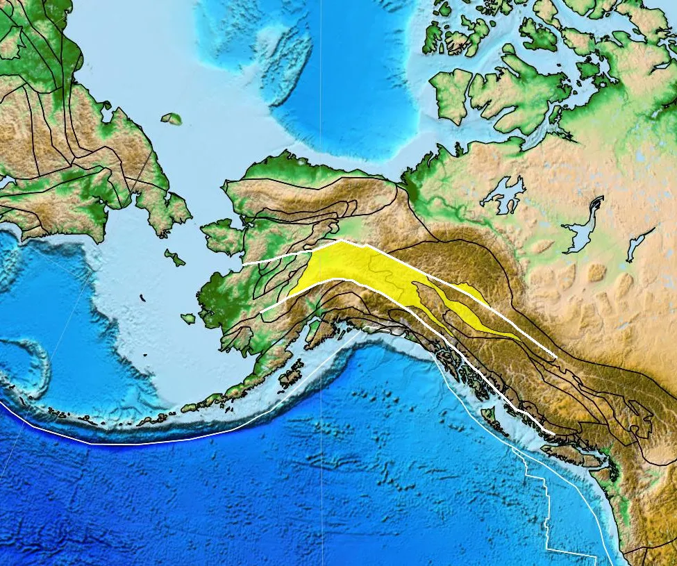
Tectonic map of Alaska and surrounding regions (Yukon-Tanana Terrane)

YYukon-Tanana Terrane 

The Yukon-Tanana Terrane is a geologic terrane in the Canadian Yukon and eastern Alaska, consisting of metamorphic and igneous rocks that have been accreted onto the North American continent. This terrane is significant in tectonics and regional geology for understanding the processes of terrane accretion, the tectonic history of the Cordilleran orogen, and the mineral resources in the region. 

Reference: Mortensen, J. K. (1992). “Pre-Mid-Mesozoic Tectonic Evolution of the Yukon-Tanana Terrane, Yukon and Alaska.” Tectonics, 11(4), 836-853. 

Share 

Open entry →

YYungas Region

The Yukon-Tanana Terrane is a geologic terrane in the Canadian Yukon and eastern Alaska, consisting of metamorphic and igneous rocks that have been accreted onto the North American continent. This terrane is significant in tectonics and regional geology for understanding the processes of terrane accretion, the tectonic history of the Cordilleran orogen, and the mineral resources in the region. 

Reference: Mortensen, J. K. (1992). “Pre-Mid-Mesozoic Tectonic Evolution of the Yukon-Tanana Terrane, Yukon and Alaska.” Tectonics, 11(4), 836-853. 

Share 

Open entry →

YYungas Region 

The Yungas region is a transitional zone between the Andean highlands and the Amazon Basin, characterized by steep slopes, dense forests, and a high level of biodiversity. This region is significant in ecology, geology, and environmental science for its unique ecosystems, the processes of mountain-building, and the challenges of land use and conservation. 

Reference: Young, K. R. (1998). “Discontinuous Vegetation and the Conservation of Edaphic Ridges in the Peruvian Andes.” Mountain Research and Development, 18(3), 169-177. 

Share 

Open entry →
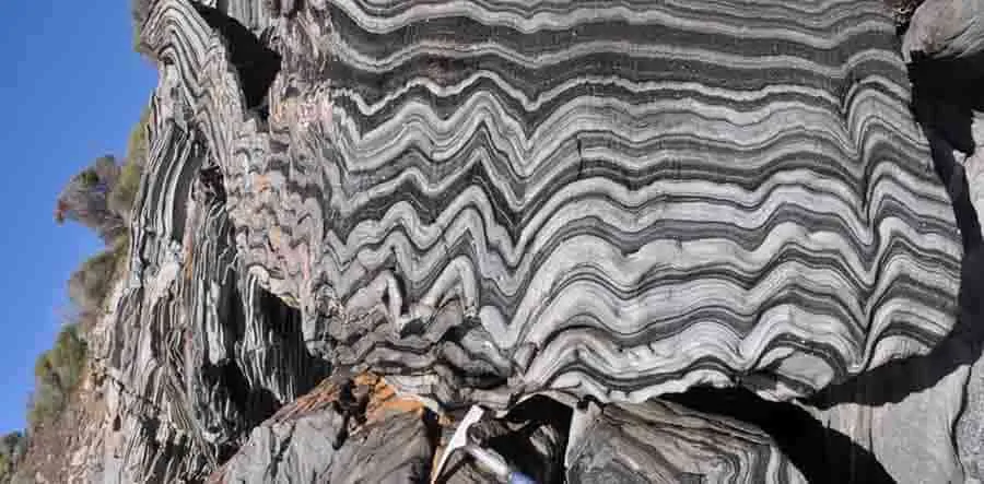
Folded metamorphic rock layers in a mountain cliff (Zebra Rock)

ZZebra Rock

Zebra rock is a type of banded, sedimentary rock characterized by alternating light and dark stripes, typically composed of siltstone or sandstone. Zebra rock is significant in sedimentology for its unusual patterning, which is believed to result from periodic changes in environmental conditions, including chemical precipitation and deposition in ancient shallow marine environments. 

Reference: Coward, A.J., Slim, A.C., Brugger, J., Wilson, S., Williams, T., Pillans, B. and Maksimenko, A., 2023. Mineralogy and geochemistry of pattern formation in zebra rock from the East Kimberley, Australia. Chemical Geology, 622, p.121336. 

Share 

Open entry →
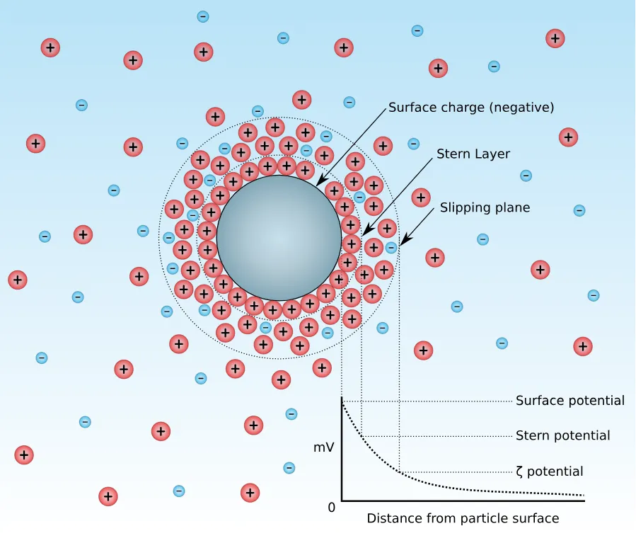
Zeta potential diagram showing charged particle layers

ZZeta Potential 

Zeta potential is a measure of the electrostatic potential at the interface between a solid particle and a surrounding liquid, commonly used to characterize the stability of colloidal suspensions. Zeta potential is significant in sedimentology, soil science, and environmental chemistry for understanding the behavior of fine particles, the aggregation of sediments, and the transport of contaminants in natural waters. 

Reference: Hunter, R. J. (1981). “Zeta Potential in Colloid Science: Principles and Applications.” Academic Press. 

Share 

Open entry →
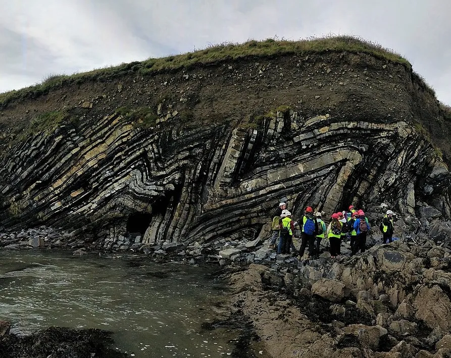
Geology students examining folded rock layers on cliffside (chevron folds) in Ireland (also known as Zigzag Fold)

ZZigzag Fold

A zigzag fold is a type of chevron fold characterized by angular, sharp hinges and relatively straight limbs. These folds are significant in structural geology for understanding the deformation of rocks under compressional stress, the development of fold-and-thrust belts, and the interpretation of subsurface structures in tectonically active regions. 

Reference: Ramsay, J. G. (1967). “Folding and Fracturing of Rocks.” McGraw-Hill. 

Share 

Open entry →
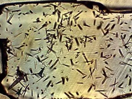
Microscopic view of needle-shaped mineral crystals (Zircon Fission Track Dating)

ZZircon Fission Track Dating 

Zircon fission track dating is a geochronological method used to determine the thermal history of rocks by analyzing the damage tracks left by the spontaneous fission of uranium within zircon crystals. This technique is significant in geology for dating geological events such as volcanic eruptions, mountain building, and the cooling history of rocks. 

Reference: Gleadow, A. J. W., & Duddy, I. R. (1981). “Fission Track Dating of Zircon: Improved Methodology and Applications.” Earth and Planetary Science Letters, 52(1), 41-48. 

Share 

Open entry →

ZZircon Thermochronology 

Zircon thermochronology is a technique used to study the thermal history of rocks by analyzing the diffusion of radiogenic isotopes within zircon crystals. This method is significant in tectonics and geochronology for understanding the cooling and exhumation history of rocks, the timing of tectonic events, and the evolution of mountain belts. 

Reference: Reiners, P. W., & Brandon, M. T. (2006). “Zircon (U-Th)/He Thermochronometry.” Reviews in Mineralogy and Geochemistry, 58(1), 151-179. 

Share 

Open entry →

ZZonal Soil 

Zonal soil refers to soil types that are characteristic of specific climatic zones and are influenced primarily by the prevailing climate and vegetation. These soils are significant in pedology and biogeography for understanding the relationships between climate, vegetation, and soil formation processes, and for classifying global soil types. 

Reference: Buol, S. W., Southard, R. J., Graham, R. C., & McDaniel, P. A. (2011). “Soil Genesis and Classification.” Wiley. 

Share 

Open entry →
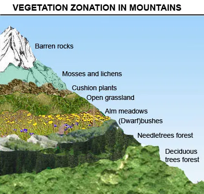
Mountain vegetation zones from forest to barren rocks (zonation)

ZZonation 

Zonation refers to the arrangement or patterning of ecosystems or communities in distinct zones, typically influenced by environmental gradients such as altitude, depth, or temperature. Zonation is significant in ecology and environmental science for understanding the distribution of species in different habitats, the effects of environmental stressors, and the organization of ecological communities. 

Reference: Odum, E. P. (1971). “Fundamentals of Ecology.” Saunders College Publishing. 

Share 

Open entry →
Microscopic marine plankton and larvae under magnification (Zooplankton)

ZZooplankton 

Zooplankton are small, drifting organisms found in aquatic environments, including oceans, seas, and freshwater bodies. They play a crucial role in the food web, serving as primary consumers that feed on phytoplankton and in turn are preyed upon by larger organisms. Zooplankton are significant in marine biology and paleontology for understanding ocean ecosystems, carbon cycling, and the fossil record in marine sediments. 

Reference: Brierley, A. S. (2007). “Biological Oceanography of Zooplankton.” Science, 316(5827), 213-216. 

Share 

Open entry →
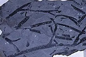
Fossilized worm-like patterns in dark shale rock (Zosterophylls)

ZZosterophylls 

Zosterophylls are an extinct group of early vascular plants that lived during the Silurian and Devonian periods. They are significant in paleobotany and evolutionary biology for their role in understanding the evolution of vascular plants, the transition from aquatic to terrestrial ecosystems, and the origins of modern plant lineages. 

Reference: Kenrick, P., & Crane, P. R. (1997). “The Origin and Early Diversification of Land Plants: A Cladistic Study.” Smithsonian Institution Press. 

Share 

Open entry →

join.me

Geology made clear, in your inbox.

Get clear, visual explainers on rocks, minerals, deep time, and the most fascinating parts of Earth science from Geoscopy.
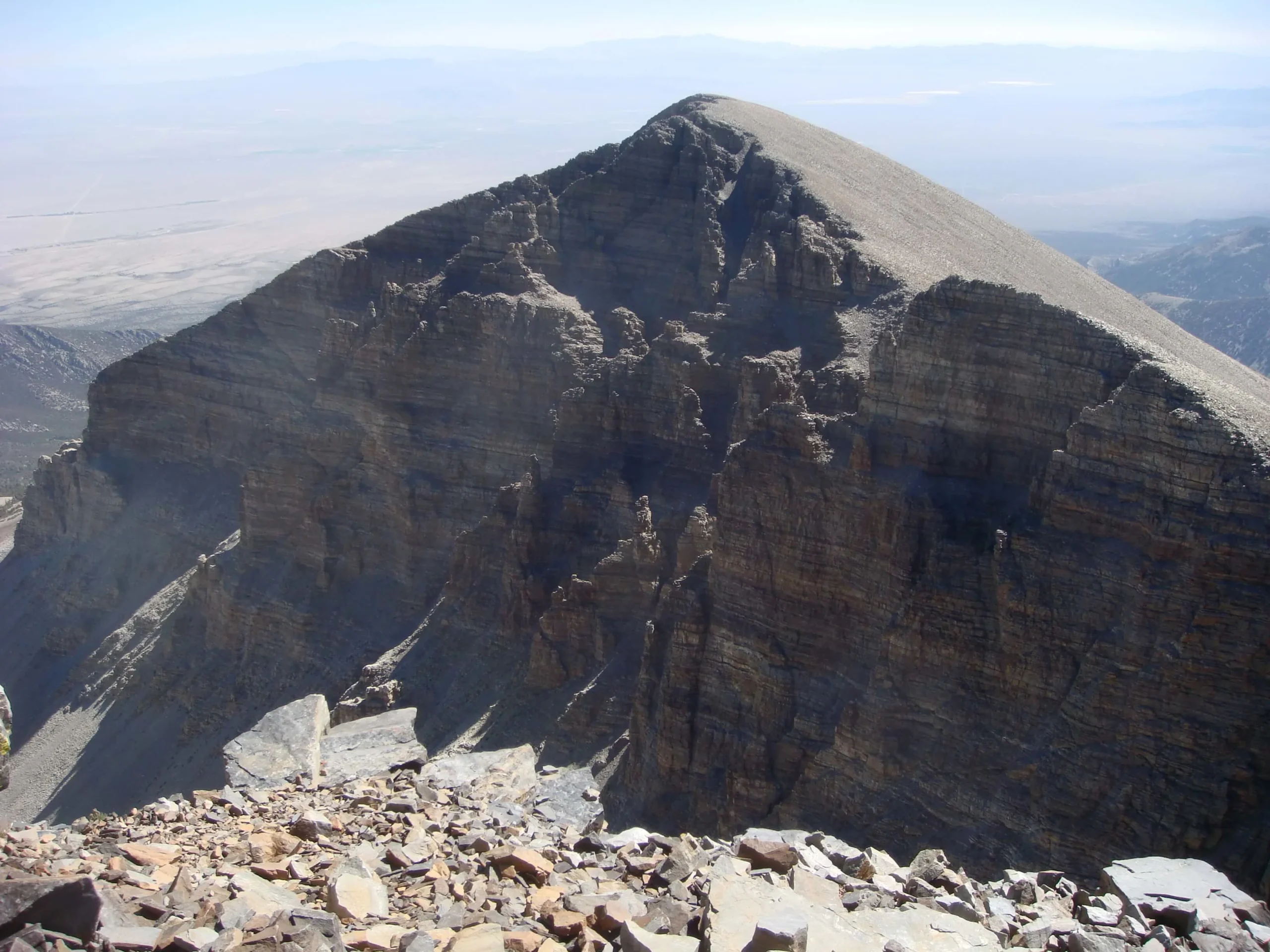
Rocky mountain peak under clear sky (detachment fault)

DArchives: Glossary

A detachment fault is a low-angle normal fault that typically separates highly deformed rocks in its hanging wall from less deformed rocks in its footwall. These faults are often associated with large-scale extensional tectonics and can be linked to the formation of metamorphic core complexes. Detachment faults are significant in understanding the tectonic evolution of extensional terrains. 

Reference: Wernicke, B. (1981). “Low-Angle Normal Faults in the Basin and Range Province: Nappe Tectonics in an Extending Orogen.” Nature, 291(5810), 645-648. 

Share 

Open entry →