
































Opens in a new tab

Glossary

Filter - Radio

Sort by

A

Abyssal Plain 

Abyssal plains are large, flat, and nearly featureless regions of the deep.. more →

A

Accretion 

In geology, accretion refers to the process by which material is added.. more →

A

Accretionary Wedge 

An accretionary wedge is a large, wedge-shaped mass of sediment and oceanic.. more →

A

Active Margin 

An active margin is a type of continental margin that is tectonically.. more →

A

Aeolian Dune 

Description: Aeolian dunes are hills or ridges of sand formed by the.. more →

A

Aeolian Processes 

Aeolian processes involve the erosion, transport, and deposition of sediments by wind... more →

A

Aeolianite 

Aeolianite is a type of sedimentary rock formed from the lithification of.. more →

A

Agglomerate 

Agglomerate is a coarse, volcanic rock composed of angular fragments of volcanic.. more →

A

Albedo 

Albedo is a measure of the reflectivity of a surface, expressed as.. more →

A

Aleutian Arc 

The Aleutian Arc is a volcanic arc located in the northern Pacific.. more →

A

Alkaline Igneous Rock 

Alkaline igneous rocks are a category of igneous rocks that contain higher.. more →

A

Allochthonous 

The term allochthonous refers to rocks or sediments that have been transported.. more →

A

Alluvial Fan 

An alluvial fan is a triangular or fan-shaped deposit of gravel, sand,.. more →

A

Ammonite 

Ammonites are an extinct group of marine mollusk animals that existed from.. more →

A

Amphitheater Valley 

An amphitheater valley is a steep-walled, U-shaped valley that resembles an amphitheater.. more →

A

Anabranch 

An anabranch is a section of a river or stream that diverts.. more →

A

Anaerobic Environment 

An anaerobic environment is one that lacks oxygen, which can significantly affect.. more →

A

Anomalous Magnetic Field 

An anomalous magnetic field refers to deviations in Earth's magnetic field from.. more →

A

Anthracite 

Anthracite is the highest grade of coal, known for its high carbon.. more →

A

Anthropocene 

The Anthropocene is a proposed geological epoch that denotes the current period.. more →

A

Anticline 

An anticline is a type of fold in sedimentary strata that is.. more →

A

Anticlinorium 

An anticlinorium is a large-scale anticline or a series of anticlinal folds.. more →

A

Antiform 

An antiform is a fold that has the shape of an arch,.. more →

A

Aphelion 

Aphelion is the point in the orbit of a planet, asteroid, or.. more →
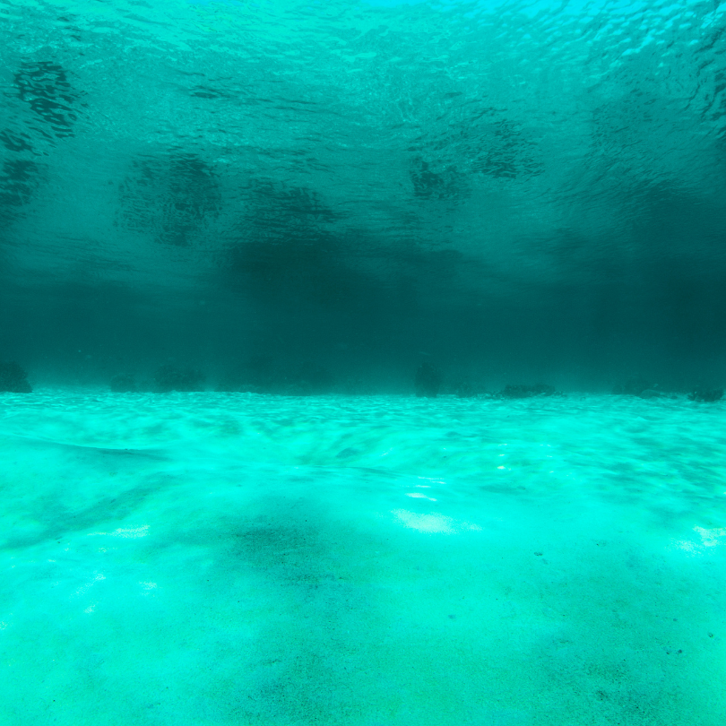
Sunlit sandy seafloor beneath clear turquoise water (Abyssal Plain)

AAbyssal Plain 

Abyssal plains are large, flat, and nearly featureless regions of the deep ocean floor, located at depths between 3,000 to 6,000 meters. These plains are formed through the slow accumulation of fine sediments, including clay and microscopic organisms, that descend from the ocean surface. The creation of abyssal plains is also influenced by the spreading of oceanic plates, which produces new seafloor. These regions are critical to understanding deep-sea sedimentation processes and the geological history of the ocean basins.

Reference: Craig R. Smith; Fabio C. De Leo; Angelo F. Bernardino; Andrew K. Sweetman; Pedro Martinez Arbizu (2008). “Abyssal food limitation, ecosystem structure and climate change” 
Share 

Open entry →
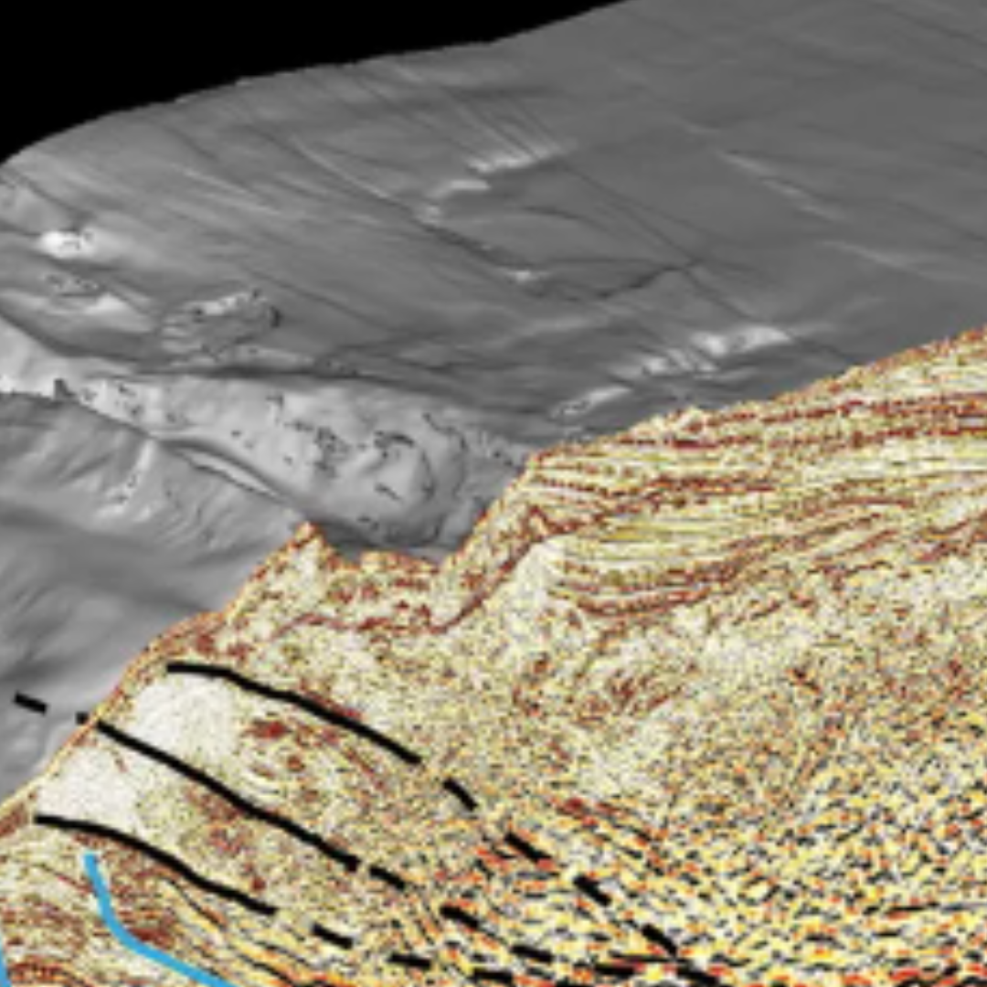
Map showing accretion

AAccretion 

In geology, accretion refers to the process by which material is added to a tectonic plate at convergent boundaries. This material can include sediment, volcanic arcs, and other fragments of crust that are scraped off a subducting plate and attached to the overriding plate, forming an accretionary wedge. Accretion plays a significant role in the growth of continental crust and the formation of mountain ranges. 

Reference: Ballard, Robert D. (1988). Exploring our living planet. National Geographic Book Service., National Geographic Society (U.S.) (Rev. ed.). Washington, D.C.: National Geographic Society. ISBN 0-87044-760-2. OCLC 18325626 

Share 

Open entry →
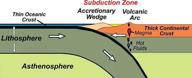
Diagram showing oceanic and continental plate subduction process (accretionary wedge)

AAccretionary Wedge 

An accretionary wedge is a large, wedge-shaped mass of sediment and oceanic crust that accumulates at convergent plate boundaries, where one plate is subducted beneath another. The sediments are scraped off the subducting plate and piled onto the overriding plate, forming complex structures of folded and faulted rocks. Accretionary wedges are key in understanding the tectonic evolution of convergent margins and the processes involved in mountain building. 

Reference: https://www.usgs.gov/media/images/accretionary-wedge. 

Share 

Open entry →
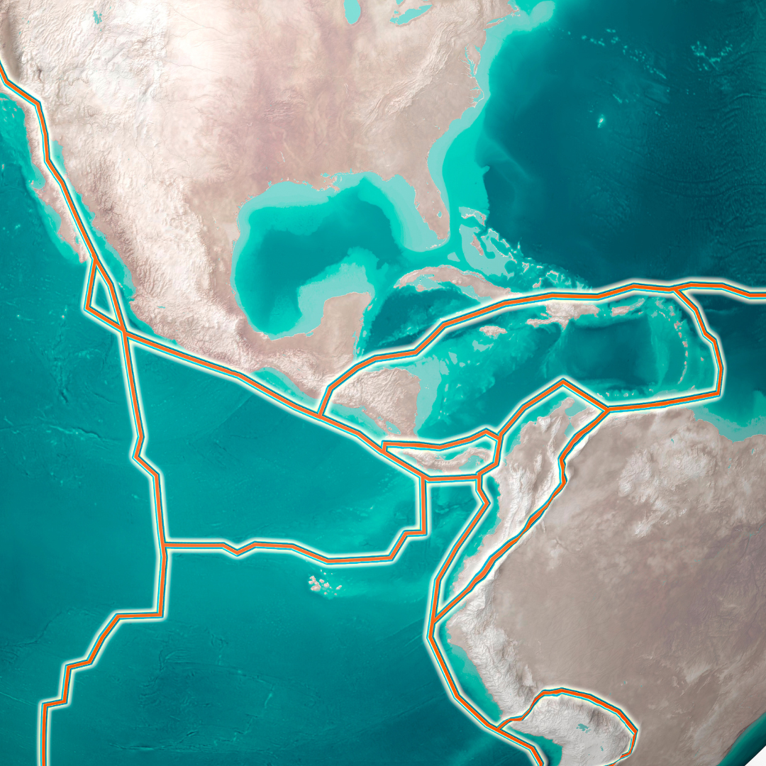
Map of Americas showing maritime boundary lines across Caribbean and Atlantic (active margin)

AActive Margin 

An active margin is a type of continental margin that is tectonically active, typically characterized by the presence of a convergent plate boundary where an oceanic plate is being subducted beneath a continental plate. Active margins are associated with features such as deep ocean trenches, volcanic arcs, and high seismic activity. They contrast with passive margins, which are tectonically inactive. 

Reference: Orme, A. R. “1.10 Tectonism, Climate, and Geomorphology.” Treatise on Geomorphology 1 (2013): 146. 

Share 

Open entry →
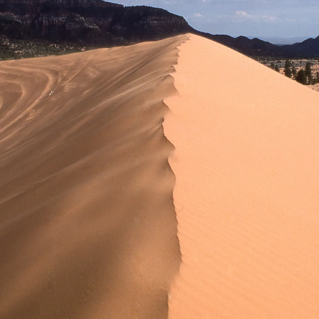
Wind-sculpted sand dune ridge beneath dark mountains (Aeolian Dune)

AAeolian Dune 

Description: Aeolian dunes are hills or ridges of sand formed by the wind in desert or coastal environments. The shape and size of aeolian dunes are influenced by wind direction, sand supply, and vegetation. These dunes are significant in the study of sedimentary processes and desert geomorphology, as well as in understanding past climatic conditions. 

Reference: https://www.nps.gov/subjects/geology/aeolian-landforms.htm

Share 

Open entry →
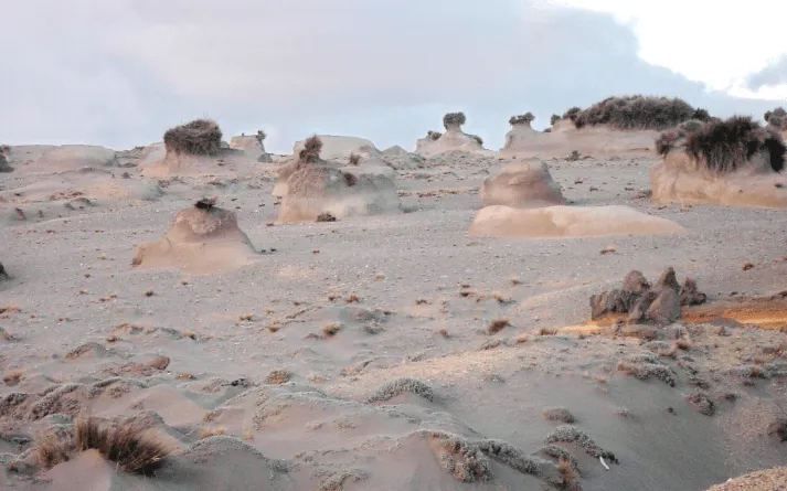
Wind-eroded rock formations in a desert landscape (aeolian processes)

AAeolian Processes 

Aeolian processes involve the erosion, transport, and deposition of sediments by wind. These processes are most effective in arid environments, where vegetation is sparse, and sediment is loose and dry. Aeolian features include dunes, loess deposits, and desert pavements. Understanding aeolian processes is important for interpreting past climate conditions and predicting future landscape changes in desert regions. 

Reference: Lancaster, N. (1995). “Geomorphology of Desert Dunes.” Routledge. 

Share 

Open entry →
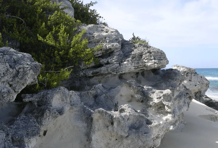
Rocky beach cliffs beside the ocean (aeolianite)

AAeolianite 

Aeolianite is a type of sedimentary rock formed from the lithification of wind-blown (aeolian) sands. These rocks are typically composed of quartz grains and are found in coastal and desert environments. Aeolianites are important indicators of past climatic conditions and wind regimes and are studied to understand sedimentary processes in arid regions. 

Reference: Brooke, B. (2001). “The Distribution and Formation of Coastal Aeolianite.” Earth-Science Reviews, 55(1-2), 135-164. 

Share 

Open entry →
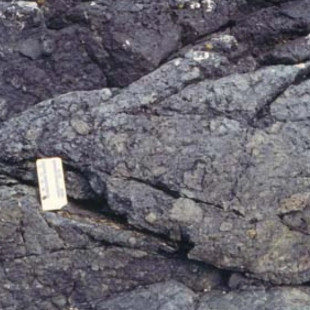
Close-up of layered gray rocks with a small scale marker (Agglomerate)

AAgglomerate 

Agglomerate is a coarse, volcanic rock composed of angular fragments of volcanic material that have been welded or cemented together. It forms from explosive volcanic eruptions and is typically found in volcanic settings, such as around vent areas. Agglomerates are important for understanding the eruptive history and dynamics of volcanoes. 

Reference: Williams, H., & McBirney, A. R. (1979). Volcanology. Freeman, Cooper & Company. 

Share 

Open entry →
Sun rising over Earth’s curved horizon from space (albedo)

AAlbedo 

Albedo is a measure of the reflectivity of a surface, expressed as the ratio of reflected radiation from the surface to the incident radiation upon it. In geology, albedo is important in studying Earth’s climate, as surfaces with high albedo (such as ice and snow) reflect most of the solar energy, while those with low albedo (such as forests and oceans) absorb more energy. Albedo effects are crucial in understanding climate change and energy balance on Earth. 

Reference: Trenberth, K. E., & Fasullo, J. T. (2010). “Earth’s Global Energy Budget.” Bulletin of the American Meteorological Society, 91(3), 311-324. 

Share 

Open entry →
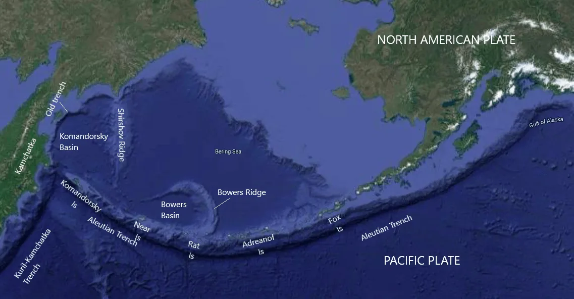
Map showing Aleutian Trench and tectonic plates (aleutian arc)

AAleutian Arc 

The Aleutian Arc is a volcanic arc located in the northern Pacific Ocean, extending from Alaska to Russia. It is formed by the subduction of the Pacific Plate beneath the North American Plate, creating a chain of active volcanoes. The Aleutian Arc is a prime example of an island arc system and is significant for studying subduction-related volcanic activity, plate tectonics, and associated seismic hazards. 

Reference: https://www.usgs.gov/publications/geologic-framework-aleutian-arc-alaska.

Share 

Open entry →
Brown and black granite stone texture (alkaline igneous rock)

AAlkaline Igneous Rock 

Alkaline igneous rocks are a category of igneous rocks that contain higher concentrations of alkali metals (sodium and potassium) relative to silica. These rocks often form in tectonic settings such as continental rifts or hotspots. Examples include nepheline syenite and phonolite. Alkaline rocks are important for understanding mantle processes and the evolution of magmas in extensional tectonic environments. 

Reference: https://www.sciencedirect.com/topics/earth-and-planetary-sciences/alkaline-rock

Share 

Open entry →
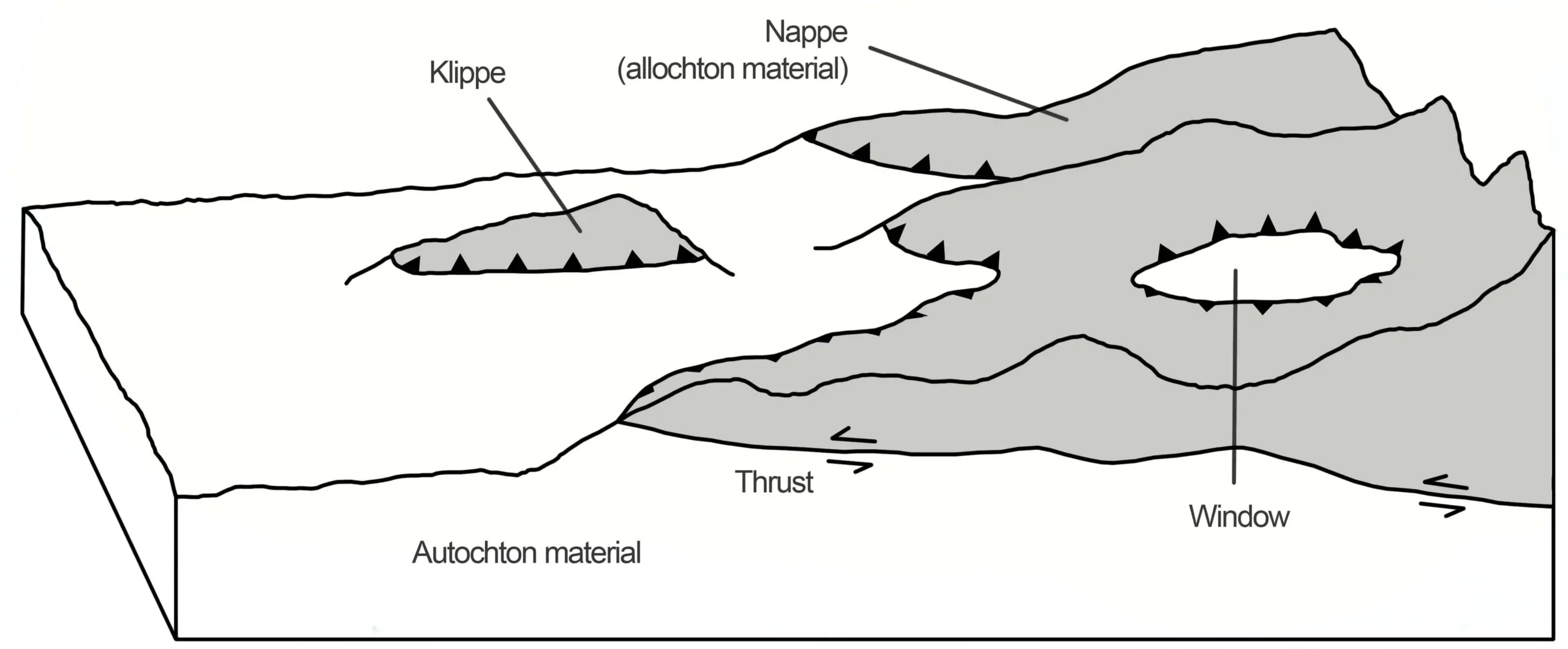
Geological diagram showing nappes, klippe, and thrust faults (allochthonous)

AAllochthonous 

The term allochthonous refers to rocks or sediments that have been transported from their place of origin and deposited in a different location, typically by tectonic forces. In geology, allochthonous units are often contrasted with autochthonous units, which have remained in their place of formation. Allochthonous materials provide insights into the dynamics of tectonic processes, such as thrust faulting and subduction. 

Reference: Davis, G. H., & Reynolds, S. J. (1996). Structural Geology of Rocks and Regions. John Wiley & Sons. 

Share 

Open entry →
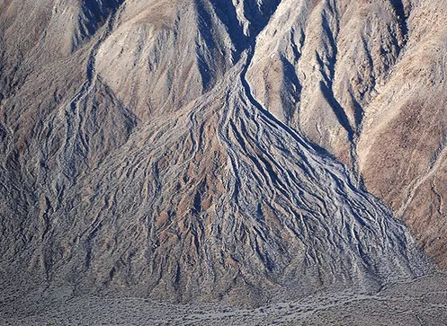
Alluvial fan formation in desert mountain landscape (alluvial fan)

AAlluvial Fan 

An alluvial fan is a triangular or fan-shaped deposit of gravel, sand, and smaller materials, created where a fast-flowing stream flattens out. Typically found at the base of mountain ranges, alluvial fans form when a stream’s gradient decreases, leading to sediment deposition. They are common in arid and semi-arid regions and are significant in interpreting past climatic and geological conditions, as well as in groundwater studies due to their porous nature. 

Reference: Blair, T. C., & McPherson, J. G. (1994). “Alluvial Fans and Their Natural Distinction from Rivers Based on Morphology, Hydraulic Processes, Sedimentary Processes, and Facies Assemblages.” Journal of Sedimentary Research, 64(3), 450-489. 

Share 

Open entry →
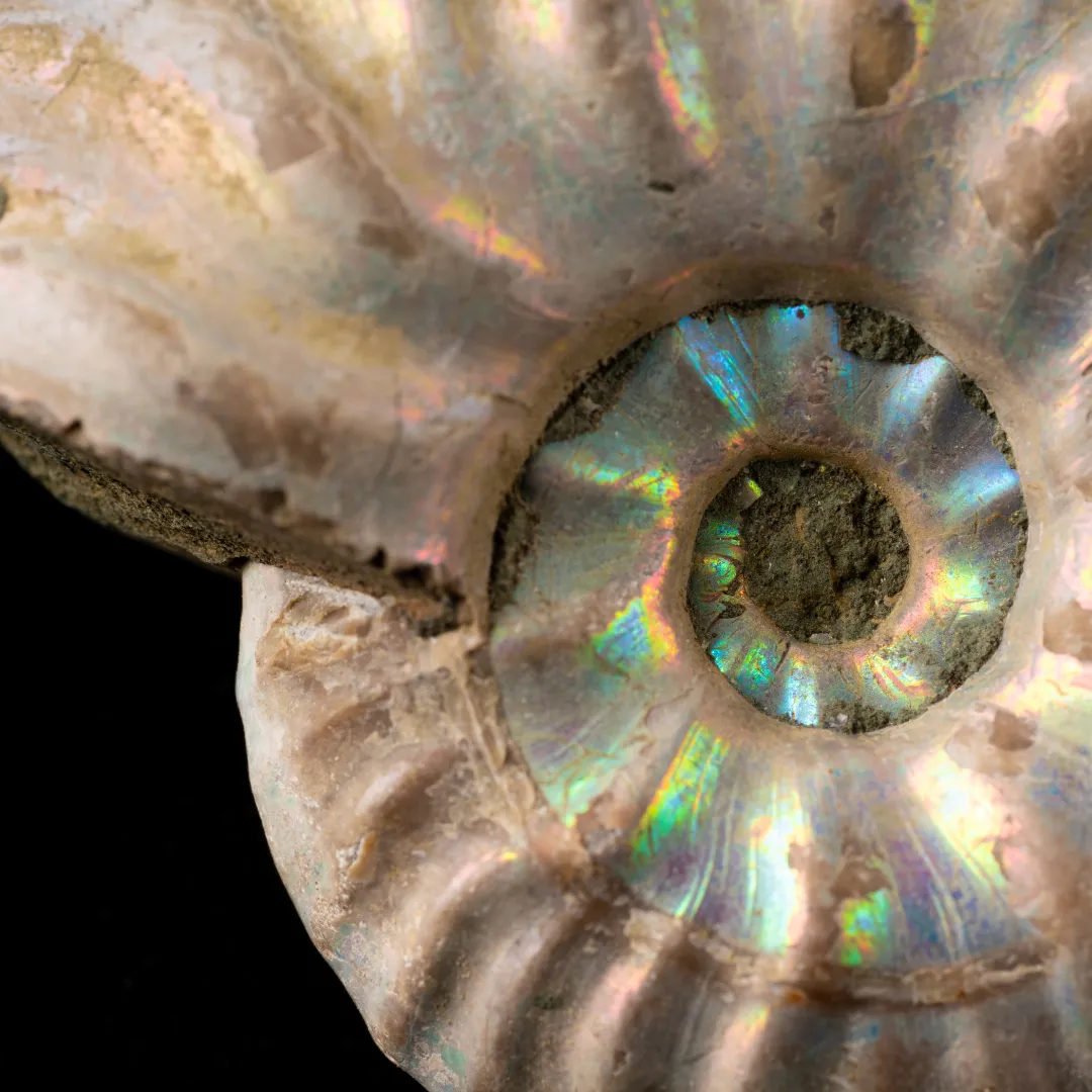
Close-up of iridescent fossil ammonite spiral shell

AAmmonite 

Ammonites are an extinct group of marine mollusk animals that existed from the Devonian to the Cretaceous period. Their spiral shells are commonly found as fossils and are used as index fossils to date the age of the rock layers in which they are found. Ammonites are important in paleontology for understanding the evolution of marine life and the environmental conditions of ancient oceans. 

Reference: Monks, N., & Palmer, P. (2002). Ammonites. Smithsonian Books. 

Share 

Open entry →
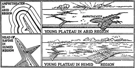
Geological erosion diagrams of arid and humid plateaus (amphitheater valley)

AAmphitheater Valley 

An amphitheater valley is a steep-walled, U-shaped valley that resembles an amphitheater in shape, often formed by the headward erosion of streams or glaciers. These valleys are common in mountainous regions and provide important insights into the processes of erosion, weathering, and the geomorphological evolution of landscapes. 

Reference: Thornbury, W. D. (1965). Regional Geomorphology of the United States. John Wiley & Sons. 

Share 

Open entry →
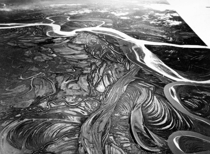
Aerial view of winding river and patterned landscape (anabranch)

AAnabranch 

An anabranch is a section of a river or stream that diverts from the main channel and rejoins it downstream. Anabranches are common in river systems with low gradients and are often associated with braided rivers. The formation and evolution of anabranches are important for understanding river dynamics, sediment transport, and floodplain development. 

Reference: Brierley, G. J., & Fryirs, K. A. (2005). Geomorphology and River Management: Applications of the River Styles Framework. Blackwell Publishing. 

Share 

Open entry →
Test tubes showing different bacterial growth patterns (anaerobic environment)

AAnaerobic Environment 

An anaerobic environment is one that lacks oxygen, which can significantly affect the types of chemical reactions that occur, as well as the types of organisms that can survive. In geology, anaerobic conditions are often found in deep sediments, swamps, and some groundwater systems. These environments are important in the study of biogeochemical cycles, particularly the formation of organic-rich sediments and fossil fuels. 

Reference: Berner, R. A. (1981). “A New Geochemical Classification of Sedimentary Environments.” Journal of Sedimentary Research, 51(2), 359-365. 

Share 

Open entry →
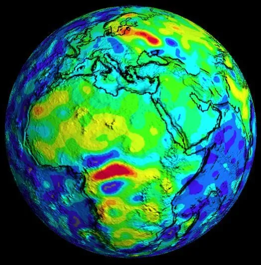
Colorful topographic map of Earth showing Africa and Europe (anomalous magnetic field)

AAnomalous Magnetic Field 

An anomalous magnetic field refers to deviations in Earth’s magnetic field from the expected normal pattern. These anomalies can be caused by variations in the Earth’s crust, such as the presence of different types of rocks, or by external factors like solar wind. Studying these anomalies helps geophysicists understand the structure of the Earth’s crust and mantle, as well as past movements of tectonic plates. 

Reference: Dyment, J., & Arkani-Hamed, J. (1998). “Geophysical Interpretation of Anomalous Magnetic Fields.” Geophysical Journal International, 133(2), 435-456. 

Share 

Open entry →
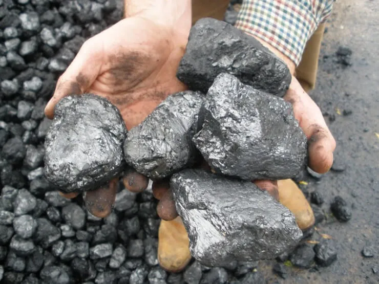
Person holding large black coal pieces (anthracite)

AAnthracite 

Anthracite is the highest grade of coal, known for its high carbon content, low impurities, and high energy density. It is formed under conditions of high temperature and pressure, typically in geologically older formations. Anthracite is an important fuel source and has been extensively mined for its energy-rich properties, particularly in regions with significant industrial history. 

Reference: Speight, J. G. (2012). The Chemistry and Technology of Coal. CRC Press. 

Share 

Open entry →
Industrial power plant smokestacks emitting white smoke under blue sky (Anthropocene)

AAnthropocene 

The Anthropocene is a proposed geological epoch that denotes the current period in Earth’s history, characterized by the significant impact of human activities on the planet’s geology and ecosystems. The term emphasizes the pervasive influence of humans on climate, biodiversity, and natural processes, potentially leaving a distinct stratigraphic signature in the rock record. The formal recognition of the Anthropocene is still under scientific debate. 

Reference: Crutzen, P. J. (2006). “The Anthropocene.” In Earth System Science in the Anthropocene (pp. 13-18). Springer. 

Share 

Open entry →
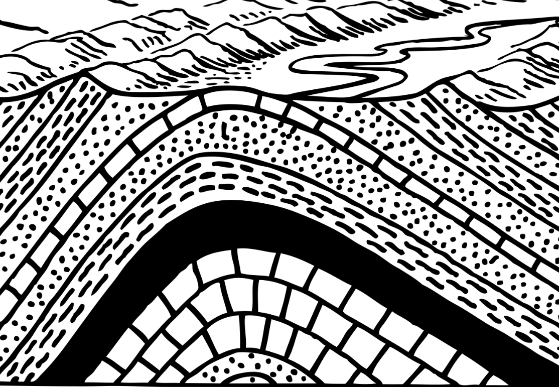
Black-and-white illustration of layered mountains and winding river (Anticline)
A bold black-and-white illustration of layered mountain ridges and a winding river flowing through the valley.

AAnticline 

An anticline is a type of fold in sedimentary strata that is arch-like in shape, with its oldest rocks located at the core of the fold. The limbs of an anticline dip away from the center, creating a convex-upward structure. Anticlines are important in petroleum geology because they can serve as traps for oil and natural gas, accumulating hydrocarbons in the crest of the fold. 

Reference: Twiss, R. J., & Moores, E. M. (2007). Structural Geology. W.H. Freeman and Company. 

Share 

Open entry →
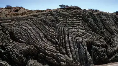
Folded rock layers in eroded hillside formation (anticlinorium)
Dramatic folded rock layers ripple across this rugged coastal cliff, revealing millions of years of geological forces.

AAnticlinorium 

An anticlinorium is a large-scale anticline or a series of anticlinal folds that together form a complex, mountainous structure. These structures are common in regions that have undergone significant compressional tectonic forces, such as during the formation of mountain ranges. The study of anticlinoria is important in understanding the large-scale tectonic evolution of orogenic belts. 

Reference: Davis, G. H., & Reynolds, S. J. (1996). Structural Geology of Rocks and Regions. John Wiley & Sons. 

Share 

Open entry →
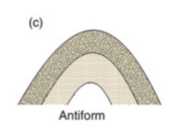
Diagram of a layered arch-shaped antiform structure
An antiform shown as upward-curving, nested rock layers.

AAntiform 

An antiform is a fold that has the shape of an arch, but unlike an anticline, it does not necessarily have the oldest rocks at its core. The term is used when the age relationships between the strata are unknown or irrelevant. Antiforms are important in the study of fold structures and tectonic deformation, providing information on the stresses and forces that have shaped a region’s geology. 

Reference: Ramsay, J. G. (1967). Folding and Fracturing of Rocks. McGraw-Hill. 

Share 

Open entry →
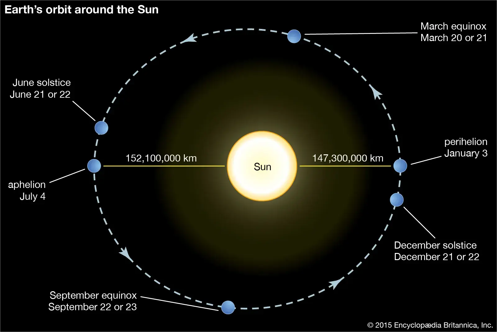
Earth’s orbit around the Sun with solstices and equinoxes (aphelion)

AAphelion 

Aphelion is the point in the orbit of a planet, asteroid, or comet where it is farthest from the Sun. For Earth, this occurs in early July. The concept of aphelion is important in understanding the variations in solar energy received by a planet, which can influence seasonal climate patterns. The difference in distance between aphelion and perihelion (the closest point) contributes to the Earth’s elliptical orbit. 

Reference: Laskar, J., Robutel, P., Joutel, F., Gastineau, M., Correia, A. C. M., & Levrard, B. (2004). “A Long-Term Numerical Solution for the Insolation Quantities of the Earth.” Astronomy & Astrophysics, 428(1), 261-285. 

Share 

Open entry →

join.me

Geology made clear, in your inbox.

Get clear, visual explainers on rocks, minerals, deep time, and the most fascinating parts of Earth science from Geoscopy.
Geological diagram illustrating nappe thrust formation (Nappe Fold Structure)

NArchives: Glossary

Nappe fold structure refers to the large-scale folds associated with the formation of nappes during compressional tectonics. These structures are key features in understanding the deformation processes involved in orogeny and the tectonic evolution of mountain belts.

Reference: Ramsay, J. G., & Huber, M. I. (1987). “The Techniques of Modern Structural Geology, Volume 2: Folds and Fractures.” Academic Press. 

Share 

Open entry →