Opens in a new tab
Geoscopy
Geology, explained.
Generic selectors
Exact matches only
Search in title
Search in content
Post Type Selectors

Rocks

An atlas of rocks and minerals: each one a record of the conditions that made it.

Glossary

Filter - Radio

Sort by

W

Wave-Cut Cliff

A wave-cut cliff is a steep, vertical or near-vertical rock face formed.. more →
W

Wave-Dominated Delta

A wave-dominated delta is a type of delta where wave action is.. more →
W

Weathering

Weathering is the process by which rocks and minerals are broken down.. more →
W

Well Graded Sediment

Well-graded sediment refers to a sediment deposit that contains a wide range.. more →
W

Well Logging

Well logging is the process of recording and analyzing the physical, chemical,.. more →
W

Well Sorted Sediment

Well-sorted sediment is a deposit in which the particles are of relatively.. more →
W

Wellhead Protection

Wellhead protection involves managing and protecting the land area surrounding a wellhead.. more →
W

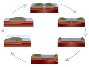
Wilsonian Cycle

The Wilsonian cycle describes the cyclical opening and closing of ocean basins.. more →
W

Wind Abrasion

Wind abrasion is the process by which wind-driven particles, such as sand,.. more →
W

Wind Gap

A wind gap is a dry pass or notch in a ridge.. more →
W

Winnowing 

Winnowing is the process by which fine particles are removed from a.. more →
W

Worm Burrow 

Worm burrows are trace fossils left by the burrowing activity of worms.. more →
X

X-ray Absorption Coefficient 

The X-ray absorption coefficient is a measure of how easily a material.. more →
X

X-ray Absorption Spectroscopy (XAS) 

X-ray absorption spectroscopy (XAS) is a technique used to study the electronic.. more →
X

X-ray Crystallography

X-ray crystallography is a technique used to determine the atomic and molecular.. more →
X

X-ray Diffraction (XRD) 

X-ray diffraction (XRD) is a technique used to determine the crystallographic structure.. more →
X

X-ray Spectroscopy 

X-ray spectroscopy is a technique used to analyze the composition and electronic.. more →
X

Xenocryst 

A xenocryst is a crystal that is not formed from the magma.. more →
X

Xenogenic 

Xenogenic refers to something that originates outside the host rock or organism,.. more →
X

Xenolith

A xenolith is a fragment of rock that is enclosed within a.. more →
Y

Yakutat Block

The Yakutat Block is a fragment of oceanic crust and overlying sedimentary.. more →
Y

Yali Caldera 

The Yali Caldera is a volcanic caldera located in the Aegean Sea,.. more →
Y

Yamato Basin 

The Yamato Basin is a submarine basin in the Sea of Japan,.. more →
Y

Yardang

A yardang is a streamlined, wind-eroded ridge typically found in arid environments,.. more →
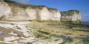
White chalk cliffs by the sea shore (wave cut cliff)

WWave-Cut Cliff

A wave-cut cliff is a steep, vertical or near-vertical rock face formed by the erosive action of waves at the base of a coastal landform. Wave-cut cliffs are significant in coastal geomorphology for understanding the processes of marine erosion, the retreat of coastlines, and the formation of coastal features such as wave-cut platforms. 

Reference: Trenhaile, A. S. (1987). “The Geomorphology of Rock Coasts.” Clarendon Press.
Share 

Open entry →
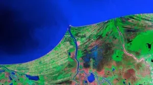
Satellite view of coastlines and river delta (wave dominated delta)

WWave-Dominated Delta

A wave-dominated delta is a type of delta where wave action is the dominant force shaping the deltaic deposits, resulting in a smooth, arcuate shoreline and the redistribution of sediments along the coast. Wave-dominated deltas are significant in coastal geomorphology for understanding the interplay between fluvial and marine processes in delta formation. 

Reference: Galloway, W. E. (1975). “Process Framework for Describing the Morphologic and Stratigraphic Evolution of Deltaic Depositional Systems.” Deltas: Models for Exploration, 87-98. 

Share 

Open entry →
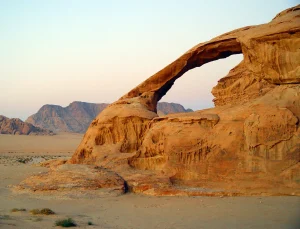
Natural rock arch in desert landscape at sunset (weathering)

WWeathering

Weathering is the process by which rocks and minerals are broken down into smaller particles by physical, chemical, and biological processes. Weathering is significant in geology for understanding the formation of soil, the breakdown of rocks, and the role of weathering in landscape evolution and the rock cycle. 

Reference: White, A. F., & Brantley, S. L. (1995). “Chemical Weathering Rates of Silicate Minerals.” Reviews in Mineralogy and Geochemistry, 31(1), 1-22. 

Share 

Open entry →
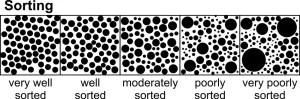
Diagram showing sediment grain sorting levels (very well sorted, well sorted, moderately sorted, poorly sorted, very poorly sorted)

WWell Graded Sediment

Well-graded sediment refers to a sediment deposit that contains a wide range of particle sizes, often resulting in a dense, tightly packed structure. Well-graded sediments are significant in engineering geology and sedimentology for understanding the stability of sediments, the processes of sediment transport, and the design of foundations and embankments. 

Reference: Holtz, R. D., Kovacs, W. D., & Sheahan, T. C. (2011). “An Introduction to Geotechnical Engineering.” Prentice Hall. 

Share 

Open entry →
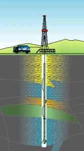
Diagram of oil drilling rig and underground layers (well logging)

WWell Logging

Well logging is the process of recording and analyzing the physical, chemical, and structural properties of rocks and fluids encountered in a borehole. Well logs are significant in petroleum geology, hydrogeology, and engineering for assessing the subsurface geology, evaluating potential resources, and guiding drilling operations. 

Reference: Rider, M. H. (1996). “The Geological Interpretation of Well Logs.” Whittles Publishing. 

Share 

Open entry →
Diagram showing sediment grain sorting levels (very well sorted, well sorted, moderately sorted, poorly sorted, very poorly sorted)

WWell Sorted Sediment

Well-sorted sediment is a deposit in which the particles are of relatively uniform size, often resulting from the action of wind or water that selectively transports and deposits particles of similar size. Well-sorted sediments are significant in sedimentology for understanding the energy conditions of depositional environments, the processes of sediment transport, and the formation of sedimentary structures. 

Reference: Boggs, S. (2009). “Petrology of Sedimentary Rocks.” Cambridge University Press. 

Share 

Open entry →
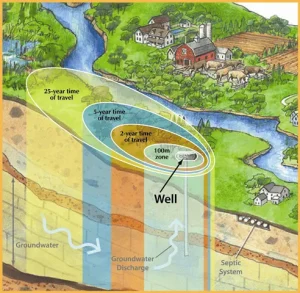
Groundwater flow and well contamination zones illustration (wellhead protection)

WWellhead Protection

Wellhead protection involves managing and protecting the land area surrounding a wellhead to prevent contamination of the groundwater source. This concept is significant in environmental science and hydrogeology for ensuring the safety of drinking water supplies, preventing groundwater pollution, and managing land use near wells. 

Reference: Todd, D. K., & Mays, L. W. (2005). “Groundwater Hydrology.” John Wiley & Sons. 

Share 

Open entry →
Diagram showing volcano formation and erosion cycle (Wilson Cycle)

WWilsonian Cycle

The Wilsonian cycle describes the cyclical opening and closing of ocean basins caused by plate tectonics, leading to the formation and breakup of supercontinents. This concept is significant in tectonics for understanding the long-term evolution of the Earth’s lithosphere, continental drift, and the processes driving the assembly and fragmentation of supercontinents. 

Reference: Wilson, J. T. (1966). “Did the Atlantic Close and Then Re-Open?” Nature, 211(5050), 676-681. 

Share 

Open entry →
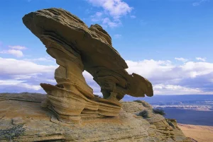
Wind-carved sandstone rock formation under blue sky (wind abrasion)

WWind Abrasion

Wind abrasion is the process by which wind-driven particles, such as sand, erode and polish the surfaces of rocks and other materials. This process is significant in desert geomorphology for understanding the formation of ventifacts, yardangs, and other wind-eroded features, as well as the long-term impact of wind on landscapes. 

Reference: Greeley, R., & Iversen, J. D. (1987). “Wind as a Geological Process: On Earth, Mars, Venus and Titan.” Cambridge University Press. 

Share 

Open entry →
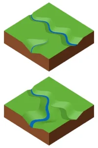
River erosion and valley formation illustration (Wind Gap)

WWind Gap

A wind gap is a dry pass or notch in a ridge or mountain range, formed by the erosion of a river or stream that has since been diverted or captured. Wind gaps are significant in geomorphology for understanding the history of river drainage systems, stream capture, and landscape evolution. 

Reference: Bishop, P. (1995). “Drainage Rearrangement by River Capture, Beheading and Diversion.” Progress in Physical Geography, 19(4), 449-473. 

Share 

Open entry →
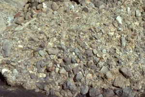
Close-up of mixed gravel and rock surface (debris flow, Winnowing)

WWinnowing 

Winnowing is the process by which fine particles are removed from a sedimentary deposit by wind or water, leaving behind coarser material. Winnowing is significant in sedimentology for understanding the sorting of sediments, the formation of certain sedimentary structures, and the interpretation of past depositional environments. 

Reference: Boggs, S. (2009). “Petrology of Sedimentary Rocks.” Cambridge University Press. 

Share 

Open entry →
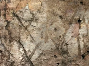
Close-up of weathered rock surface with cracks and mineral patches (Worm Burrow)

WWorm Burrow 

Worm burrows are trace fossils left by the burrowing activity of worms in soft sediments, often preserved in sedimentary rocks. These burrows are significant in ichnology and paleoenvironmental studies for understanding the behavior of ancient organisms, the conditions of sediment deposition, and the interpretation of past environments. 

Reference: Seilacher, A. (2007). “Trace Fossil Analysis.” Springer. 

Share 

Open entry →

XX-ray Absorption Coefficient 

The X-ray absorption coefficient is a measure of how easily a material absorbs X-rays, which is used to determine the composition and density of materials in X-ray imaging techniques. This coefficient is significant in geophysics, mineralogy, and materials science for understanding the properties of rocks, minerals, and other materials in non-destructive testing and imaging. 

Reference: Jenkins, R. (1999). “X-ray Fluorescence Spectrometry.” Wiley-Interscience. 

Share 

Open entry →
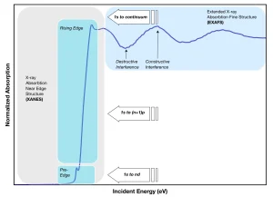
X-ray absorption spectrum showing XANES and EXAFS regions

XX-ray Absorption Spectroscopy (XAS) 

X-ray absorption spectroscopy (XAS) is a technique used to study the electronic structure and local atomic environment of materials by measuring the absorption of X-rays as a function of energy. XAS is significant in mineralogy and geochemistry for understanding the oxidation states, coordination chemistry, and bonding environments of elements in minerals and other materials. 

Reference: Koningsberger, D. C., & Prins, R. (1988). “X-ray Absorption: Principles, Applications, Techniques of EXAFS, SEXAFS, and XANES.” Wiley. 

Share 

Open entry →
Advanced X-ray diffraction analysis machine in laboratory (X Ray Crystallography, freezed XRD)

XX-ray Crystallography

X-ray crystallography is a technique used to determine the atomic and molecular structure of a crystal by measuring the diffraction patterns of X-rays passing through it. This method is significant in mineralogy and chemistry for understanding the detailed structure of minerals, the arrangement of atoms within a crystal, and the properties of materials. 

Reference: Girolami, G. S. (1994). “X-ray Crystallography.” University Science Books. 

Share 

Open entry →
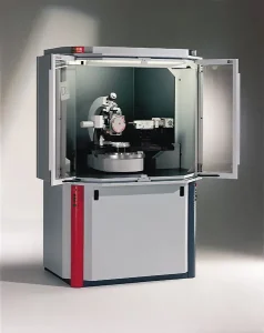
Advanced X-ray diffraction (XRD) analysis machine in laboratory

XX-ray Diffraction (XRD) 

X-ray diffraction (XRD) is a technique used to determine the crystallographic structure of minerals and other crystalline materials by measuring the angles and intensities of diffracted X-rays. XRD is significant in mineralogy and materials science for identifying minerals, analyzing crystal structures, and studying phase transitions in materials. 

Reference: Cullity, B. D., & Stock, S. R. (2001). “Elements of X-ray Diffraction.” Prentice Hall. 

Share 

Open entry →
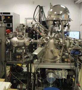
Advanced scientific laboratory equipment with metal components (X ray Spectroscopy)

XX-ray Spectroscopy 

X-ray spectroscopy is a technique used to analyze the composition and electronic structure of materials by measuring the characteristic X-rays emitted by elements when they are excited by an X-ray source. This method is significant in geochemistry and material science for identifying elements, studying chemical bonding, and understanding the properties of minerals and rocks. 

Reference: Jenkins, R. (1999). “X-ray Fluorescence Spectrometry.” Wiley-Interscience. 

Share 

Open entry →
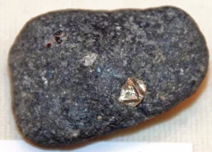
Rough diamond embedded in kimberlite rock

XXenocryst 

A xenocryst is a crystal that is not formed from the magma in which it is found but has been incorporated into the magma from surrounding rocks. Xenocrysts are significant in petrology for understanding magma contamination, the processes of magma assimilation, and the interactions between different rock types during magmatic activity. 

Reference: Smith, D. (1992). “Xenocrysts in Kimberlites and Other Volcanic Rocks.” Journal of Volcanology and Geothermal Research, 50(1-2), 83-98. 

Share 

Open entry →

XXenogenic 

Xenogenic refers to something that originates outside the host rock or organism, often used to describe minerals, crystals, or rock fragments that have been introduced into a host rock from an external source. This concept is significant in petrology and mineralogy for understanding the processes of rock formation, contamination, and the history of geological materials. 

Reference: Nesse, W. D. (2012). “Introduction to Mineralogy.” Oxford University Press. 

Share 

Open entry →
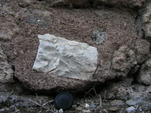
Weathered carved stone fragment embedded in ancient wall (Xenolith rock example)

XXenolith

A xenolith is a fragment of rock that is enclosed within a larger body of igneous rock, typically carried to the surface by volcanic eruptions. Xenoliths are significant in petrology for providing information about the composition and conditions of the Earth’s mantle and lower crust, offering insights into deep geological processes. 

Reference: Gillet, P., McMillan, P., & Guyot, F. (1992). “Thermodynamic Properties and Geophysical Applications of Xenoliths.” Nature, 357(6374), 164-168.

Share 

Open entry →
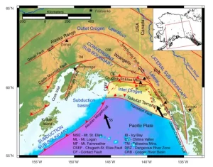
Tectonic map of southern Alaska showing fault boundaries (Yakutat Block)

YYakutat Block

The Yakutat Block is a fragment of oceanic crust and overlying sedimentary rocks that has been accreted onto the southern margin of Alaska. This block is significant in tectonics and seismology for its role in the active deformation and seismicity of southern Alaska, the uplift of the St. Elias Mountains, and the ongoing collision between the Pacific Plate and North America. 

Reference: Plafker, G., & Berg, H. C. (1994). “The Geology of Alaska.” Geological Society of America. 

Share 

Open entry →
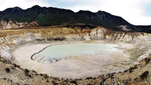
Yali Caldera with shallow water and rocky slopes

YYali Caldera 

The Yali Caldera is a volcanic caldera located in the Aegean Sea, Greece, formed by a series of explosive eruptions during the Quaternary period. The caldera is significant in volcanology and geothermal studies for its active geothermal fields, its potential for future volcanic activity, and its role in shaping the geology of the region. 

Reference: Fytikas, M., & Innocenti, F. (1998). “The South Aegean Active Volcanic Arc: Present Knowledge and Future Perspectives.” Memorie della Società Geologica Italiana, 53, 69-80. 

Share 

Open entry →
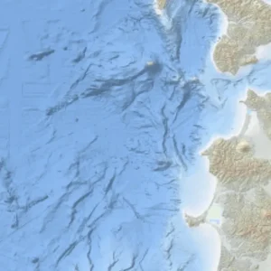
Topographic map of Iberian Peninsula and Atlantic Ocean (Yamato Basin)

YYamato Basin 

The Yamato Basin is a submarine basin in the Sea of Japan, bordered by the Yamato Rise and the Japan Basin. This basin is significant in marine geology and plate tectonics for understanding the processes of back-arc basin formation, the tectonic evolution of the Sea of Japan, and the sedimentary processes that have shaped the basin. 

Reference: Tamaki, K. (1988). “Geometric Model of Back-Arc Spreading.” Tectonophysics, 146(1-4), 155-165. 

Share 

Open entry →
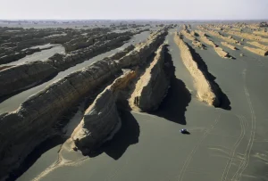
Car driving through rocky desert formations (Yardang)

YYardang

A yardang is a streamlined, wind-eroded ridge typically found in arid environments, formed by the abrasive action of windblown sand. Yardangs are significant in geomorphology for understanding wind erosion processes, the dynamics of desert landscapes, and the geological history of arid regions. 

Reference: Greeley, R., & Iversen, J. D. (1987). “Wind as a Geological Process: On Earth, Mars, Venus, and Titan.” Cambridge University Press. 

Share 

Open entry →

join.me

Geology made clear, in your inbox.

Get clear, visual explainers on rocks, minerals, deep time, and the most fascinating parts of Earth science from Geoscopy.
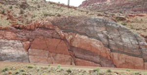
Layered red and gray rock formation in desert (elasticity)

EArchives: Glossary

Elasticity in geology refers to the property of rocks to deform under stress and return to their original shape when the stress is removed, as long as the stress does not exceed the material’s elastic limit. This concept is fundamental in understanding the behavior of rocks under tectonic forces, the propagation of seismic waves, and the mechanics of earthquakes. 

Reference: Jaeger, J. C., Cook, N. G. W., & Zimmerman, R. W. (2007). “Fundamentals of Rock Mechanics.” Wiley-Blackwell.

Share 

Open entry →