Opens in a new tab
Geoscopy
Geology, explained.
Generic selectors
Exact matches only
Search in title
Search in content
Post Type Selectors

Rocks

An atlas of rocks and minerals: each one a record of the conditions that made it.

Glossary

Filter - Radio

Sort by

T

Tephra

Tephra is a general term for fragments of volcanic rock and ash.. more →
T

Tephra Layer

A tephra layer is a deposit of volcanic ash, pumice, and other.. more →
T

Tephrochronology

Tephrochronology is the study and dating of volcanic ash layers (tephra) to.. more →
T

Tephrostratigraphy

Tephrostratigraphy is the study of volcanic ash layers (tephra) within the stratigraphic.. more →
T

Terrane

A terrane is a fragment of crustal material formed on, or broken.. more →
T

Terrigenous Sediment

Terrigenous sediment is sediment derived from the erosion of continental rocks, transported.. more →
T

Thalweg

The thalweg is the line of lowest elevation within a river or.. more →
T

Thermal Metamorphism

Thermal metamorphism, also known as contact metamorphism, occurs when rocks are heated.. more →
T

Thermokarst

Thermokarst refers to the land surface that forms as ice-rich permafrost thaws.. more →
T

Tholeiitic Basalt

Tholeiitic basalt is a type of basaltic rock characterized by low alkali.. more →
T

Tholeiitic Series

The tholeiitic series is a sequence of igneous rocks that range from.. more →
T

Thrust Belt

A thrust belt is a region of the Earth's crust where compressional.. more →
T

Thrust Fault

A thrust fault is a type of reverse fault where the angle.. more →
T

Thrust Nappe

A thrust nappe is a large sheet of rock that has been.. more →
T

Tidal Bore

A tidal bore is a strong surge of water that travels upstream.. more →
T

Tidal Flat

A tidal flat is a flat, often muddy area that is exposed.. more →
T

Tidal Range

Tidal range is the vertical difference between the high tide and the.. more →
T

Tombolo

A tombolo is a coastal landform where an island is connected to.. more →
T

Topography

Topography refers to the arrangement of natural and artificial features on the.. more →
T

Topset Bed

Topset beds are horizontal layers of sediment deposited on top of a.. more →
T

Trace Fossil

A trace fossil, also known as an ichnofossil, is a geological record.. more →
T

Trachyte

Trachyte is a fine-grained, alkali-rich volcanic rock composed predominantly of alkali feldspar,.. more →
T

Transcurrent Fault

A transcurrent fault is a type of strike-slip fault where the motion.. more →
T

Transform Boundary

A transform boundary is a type of plate boundary where two tectonic.. more →
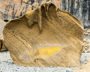
Large weathered tephra with yellow markings

TTephra

Tephra is a general term for fragments of volcanic rock and ash ejected during an explosive volcanic eruption. Tephra deposits are significant in volcanology for understanding eruption dynamics, dating geological events, and reconstructing past volcanic activity. 

Reference: Thorarinsson, S. (1981). “Tephra Studies and Tephrochronology: A Historical Review with Special Reference to Iceland.” Journal of Quaternary Science, 20(1), 3-21.
Share 

Open entry →
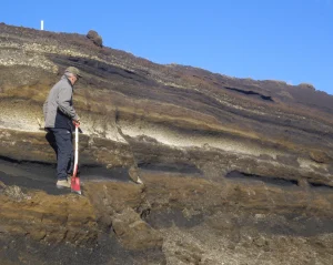
Geologist examining tephra layer

TTephra Layer

A tephra layer is a deposit of volcanic ash, pumice, and other pyroclastic materials that settles out of the air following an explosive volcanic eruption. These layers are significant in stratigraphy and geochronology for dating geological and archaeological events, correlating deposits across regions, and studying past volcanic activity. 

Reference: Thorarinsson, S. (1981). “Tephra Studies and Tephrochronology: A Historical Review with Special Reference to Iceland.” Journal of Quaternary Science, 20(1), 3-21.
Share 

Open entry →
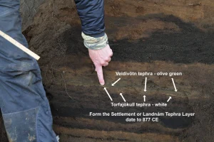
Finger pointing at Icelandic tephra soil layers (tephrochronology)

TTephrochronology

Tephrochronology is the study and dating of volcanic ash layers (tephra) to create a chronological framework for geological and archaeological events. This method is significant in stratigraphy and archaeology for correlating and dating deposits across wide geographic areas. 

Reference: Lowe, D. J. (2011). “Tephrochronology and Its Application: A Review.” Quaternary Geochronology, 6(2), 107-153.

Share 

Open entry →

TTephrostratigraphy

Tephrostratigraphy is the study of volcanic ash layers (tephra) within the stratigraphic record, used to correlate and date sedimentary sequences. This method is significant in geology and archaeology for constructing precise chronological frameworks, correlating events across regions, and studying volcanic activity. 

Reference: Lowe, D. J. (2011). “Tephrochronology and Its Application: A Review.” Quaternary Geochronology, 6(2), 107-153.

Share 

Open entry →
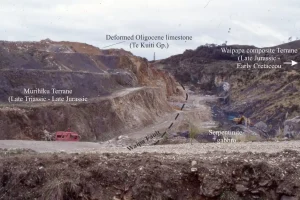
Geological fault line with labeled rock formations (terrane)

TTerrane

A terrane is a fragment of crustal material formed on, or broken off from, one tectonic plate and accreted or sutured onto the crust lying on another plate. Terranes are significant in geology for understanding the growth and evolution of continental crust, as well as the processes of tectonic accretion. 

Reference: Howell, D. G. (1995). “Principles of Terrane Analysis: New Applications for Global Tectonics.” Elsevier.

Share 

Open entry →
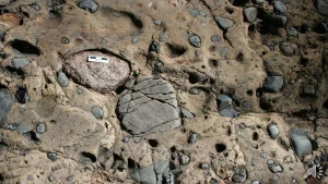
Conglomerate rock with embedded pebbles and sand (terrigenous sediment)

TTerrigenous Sediment

Terrigenous sediment is sediment derived from the erosion of continental rocks, transported to the ocean by rivers, wind, or glaciers. This type of sediment is significant in sedimentology for understanding the sources and transport mechanisms of sedimentary materials, as well as the processes of sedimentation in marine environments. 

Reference: Pettijohn, F. J., Potter, P. E., & Siever, R. (1987). “Sand and Sandstone.” Springer.

Share 

Open entry →
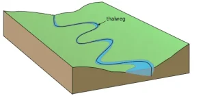
Diagram showing a river thalweg in a valley

TThalweg

The thalweg is the line of lowest elevation within a river or stream channel, often representing the path of fastest flow. It is significant in fluvial geomorphology for understanding river dynamics, channel formation, and the management of waterways. 

Reference: Leopold, L. B., Wolman, M. G., & Miller, J. P. (1964). “Fluvial Processes in Geomorphology.” Dover Publications.

Share 

Open entry →
Diagram showing magma chamber and thermal, contact metamorphism.

TThermal Metamorphism

Thermal metamorphism, also known as contact metamorphism, occurs when rocks are heated by the intrusion of hot magma without significant deformation. This process is significant in petrology for understanding the effects of heat on mineral stability, the formation of metamorphic rocks, and the thermal history of magmatic intrusions. 

Reference: Philpotts, A. R., & Ague, J. J. (2009). “Principles of Igneous and Metamorphic Petrology.” Cambridge University Press.

Share 

Open entry →
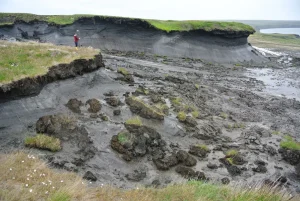
Eroding permafrost landscape with muddy terrain (thermokarst)

TThermokarst

Thermokarst refers to the land surface that forms as ice-rich permafrost thaws and collapses, creating features like sinkholes, ponds, and uneven terrain. This process is significant in periglacial geomorphology for understanding the impacts of climate change on permafrost regions and the associated risks of land subsidence. 

Reference: French, H. M. (2007). “The Periglacial Environment.” John Wiley & Sons.

Share 

Open entry →
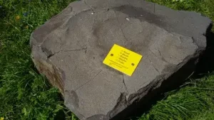
Large gray rock with yellow plaque on grass (tholeiitic basalt)

TTholeiitic Basalt

Tholeiitic basalt is a type of basaltic rock characterized by low alkali content and high iron content, commonly found at mid-ocean ridges and volcanic islands. This rock type is significant for understanding magma differentiation, mid-ocean ridge processes, and the geochemistry of basaltic magmas. 

Reference: Carmichael, I. S. E. (1964). “The Petrology of Thingmuli, a Tertiary Volcano in Eastern Iceland.” Journal of Petrology, 5(3), 435-460.

Share 

Open entry →

TTholeiitic Series

The tholeiitic series is a sequence of igneous rocks that range from basalt to rhyolite, characterized by low potassium content and a specific pattern of mineral crystallization. This series is significant in petrology for understanding the evolution of basaltic magmas, mid-ocean ridge processes, and the geochemistry of volcanic arcs. 

Reference: Winter, J. D. (2010). “Principles of Igneous and Metamorphic Petrology.” Pearson.

Share 

Open entry →
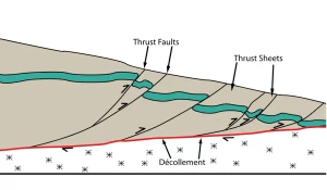
Diagram showing thrust faults and décollement layers (thrust belt)

TThrust Belt

A thrust belt is a region of the Earth’s crust where compressional tectonic forces have created a series of thrust faults, leading to the stacking of crustal blocks and the formation of mountain ranges. Thrust belts are significant in structural geology for understanding mountain-building processes and the mechanics of crustal deformation. 

Reference: Suppe, J. (1985). “Principles of Structural Geology.” Prentice Hall. 

Share 

Open entry →

TThrust Fault

A thrust fault is a type of reverse fault where the angle of the fault plane is shallow, causing the hanging wall to move up relative to the footwall. Thrust faults are significant in structural geology for understanding compressional forces that lead to the shortening of the Earth’s crust, often associated with mountain building. 

Reference: Boyer, S. E., & Elliott, D. (1982). “Thrust Systems.” American Association of Petroleum Geologists Bulletin, 66(9), 1196-1230.

Share 

Open entry →

TThrust Nappe

A thrust nappe is a large sheet of rock that has been displaced horizontally over a considerable distance along a thrust fault, often forming part of a mountain range. Thrust nappes are significant in structural geology for understanding the mechanics of large-scale crustal deformation and the formation of orogenic belts. 

Reference: Price, N. J., & Cosgrove, J. W. (1990). “Analysis of Geological Structures.” Cambridge University Press. 

Share 

Open entry →
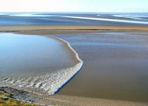
Waves forming patterns on a sandy beach (tidal bore)

TTidal Bore

A tidal bore is a strong surge of water that travels upstream against the current in a river or estuary during a rising tide. Tidal bores are significant in hydrology for understanding the dynamics of tidal waves, riverine processes, and the impact of tides on estuarine ecosystems. 

Reference: Chanson, H. (2011). “Tidal Bores, Aegir, Eagre, Mascaret, Pororoca: Theory and Observations.” World Scientific.

Share 

Open entry →
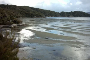
Coastal bay with low tide and forested hills (tidal flat)

TTidal Flat

A tidal flat is a flat, often muddy area that is exposed at low tide and submerged at high tide, typically found in coastal regions. Tidal flats are significant in sedimentology for understanding the deposition of fine-grained sediments, the dynamics of coastal environments, and the development of ecosystems adapted to fluctuating water levels. 

Reference: Ginsburg, R. N. (1953). “Intertidal Sedimentation in the Colorado River Delta.” Journal of Sedimentary Petrology, 23(4), 182-198.

Share 

Open entry →
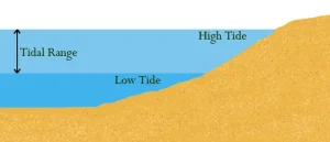
Diagram showing tidal range between high and low tide (tidal range)

TTidal Range

Tidal range is the vertical difference between the high tide and the low tide, which can vary significantly depending on the location and the phase of the moon. Tidal range is significant in oceanography and coastal geology for understanding the dynamics of tides, the formation of tidal currents, and the impact of tides on coastal environments. 

Reference: Pugh, D. T. (1987). “Tides, Surges and Mean Sea-Level: A Handbook for Engineers and Scientists.” Wiley.

Share 

Open entry →
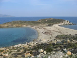
Rocky beach with clear blue sea and peninsula (tombolo)

TTombolo

A tombolo is a coastal landform where an island is connected to the mainland or another island by a narrow strip of sand or gravel, formed by the deposition of sediments in the wave shadow of the island. Tombolos are significant in coastal geomorphology for understanding sediment transport, wave dynamics, and the formation of coastal features. 

Reference: Masselink, G., & Hughes, M. G. (2003). “Introduction to Coastal Processes and Geomorphology.” Hodder Arnold.

Share 

Open entry →
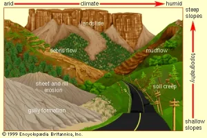
Erosion types across arid to humid landscapes diagram (topography)

TTopography

Topography refers to the arrangement of natural and artificial features on the Earth’s surface, including the study of relief, elevation, and landforms. It is significant in geography, geology, and environmental science for understanding landscape evolution, land use planning, and the interaction between natural processes and human activities. 

Reference: Strahler, A. H. (1969). “Physical Geography.” Wiley. 

Share 

Open entry →
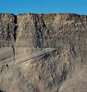
Eroded sedimentary rock cliff under clear blue sky (topset bed)

TTopset Bed

Topset beds are horizontal layers of sediment deposited on top of a delta, often representing the most recent phase of deltaic deposition. These beds are significant in sedimentology for understanding the dynamics of delta formation, sediment transport, and the stratigraphic record of deltaic environments. 

Reference: Reading, H. G., & Collinson, J. D. (1996). “Clastic Coasts.” Sedimentary Environments: Processes, Facies and Stratigraphy, 154-231. 

Share 

Open entry →
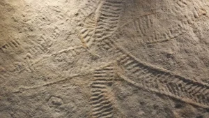
Ancient cave carvings with intricate patterns on rock surface (trace fossils)

TTrace Fossil

A trace fossil, also known as an ichnofossil, is a geological record of biological activity, such as footprints, burrows, or feeding marks, rather than the remains of the organism itself. Trace fossils are significant in paleontology for understanding the behavior of ancient organisms, their interactions with the environment, and the interpretation of sedimentary environments. 

Reference: Bromley, R. G. (1996). “Trace Fossils: Biology, Taphonomy, and Applications.” Chapman & Hall.

Share 

Open entry →
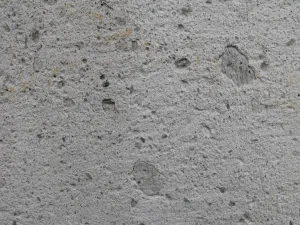
Rough trachyte texture surface

TTrachyte

Trachyte is a fine-grained, alkali-rich volcanic rock composed predominantly of alkali feldspar, with lesser amounts of mafic minerals. It is significant in petrology for understanding the evolution of alkaline magmas, the processes of magmatic differentiation, and the geochemistry of volcanic rocks. 

Reference: Le Maitre, R. W. (2002). “Igneous Rocks: A Classification and Glossary of Terms.” Cambridge University Press. 

Share 

Open entry →

TTranscurrent Fault

A transcurrent fault is a type of strike-slip fault where the motion is predominantly horizontal, with little vertical displacement. These faults are significant in tectonics for understanding lateral movements of the Earth’s crust, the formation of fault zones, and the seismic activity associated with these faults. 

Reference: Sylvester, A. G. (1988). “Strike-Slip Faults.” Geological Society of America Bulletin, 100(11), 1666-1703.

Share 

Open entry →
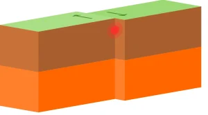
Diagram of a transform fault boundary

TTransform Boundary

A transform boundary is a type of plate boundary where two tectonic plates slide past each other horizontally. Transform boundaries are significant in plate tectonics for understanding the movement and interaction of tectonic plates, as well as the formation of earthquakes along these boundaries. 

Reference: Gordon, R. G., & Stein, S. (1992). “Global Tectonics and the Wilson Cycle.” Geological Society of America Bulletin, 104(8), 1073-1083.

Share 

Open entry →

join.me

Geology made clear, in your inbox.

Get clear, visual explainers on rocks, minerals, deep time, and the most fascinating parts of Earth science from Geoscopy.
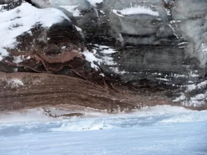
Layered ice and rock formation with snow (glacial abrasion)

GArchives: Glossary

Glacial abrasion is the process by which a glacier grinds down bedrock surfaces, using debris embedded in the ice as abrasive tools. This process creates striations, grooves, and polished surfaces, and plays a significant role in shaping glaciated landscapes. Studying glacial abrasion helps geologists understand past ice flow dynamics and erosion rates. 

Reference: Boulton, G. S. (1974). Processes and Patterns of Glacial Erosion. Progress in Physical Geography.

Share 

Open entry →