Opens in a new tab
Geoscopy
Geology, explained.
Generic selectors
Exact matches only
Search in title
Search in content
Post Type Selectors

Rocks

An atlas of rocks and minerals: each one a record of the conditions that made it.

Glossary

Filter - Radio

Sort by

R

Rhyolitic Lava

Rhyolitic lava is a highly viscous, silica-rich lava that typically forms steep-sided.. more →
R

Rift Flank

A rift flank is the elevated region that forms on either side.. more →
R

Rift Valley

A rift valley is a large, elongated depression formed by the extension.. more →
R

Rift Zone

A rift zone is a region of the Earth's crust where tectonic.. more →
R

Ripple Marks

The rock cycle is a conceptual model describing the transformation of rocks.. more →
R

Ripple Marks

Ripple marks are small, wave-like structures formed on the surface of sedimentary.. more →
R

Rock Glacier

A rock glacier is a mass of rock, ice, and debris that.. more →
R

Rodinia

Rodinia was a supercontinent that existed during the Neoproterozoic era, approximately 1.3.. more →
S

Salt Dome

A salt dome is a type of structural dome formed when a.. more →
S

Saprolite

Saprolite is a deeply weathered rock that retains the original rock's structure.. more →
S

Sargasso Sea

The Sargasso Sea is a region of the North Atlantic Ocean characterized.. more →
S

Schistosity

Schistosity is a type of foliation characteristic of schist, where the rock.. more →
S

Seafloor Spreading

Seafloor spreading is the process by which new oceanic crust is formed.. more →
S

Sedimentary Basin

A sedimentary basin is a low-lying area where sediments accumulate over time,.. more →
S

Sedimentary Rock

Sedimentary rock is formed by the accumulation and lithification of sediments, which.. more →
S

Seismic Hazard

Seismic hazard refers to the potential for earthquake-related ground shaking and damage.. more →
S

Seismic Refraction

Seismic refraction is a geophysical method used to measure the velocities of.. more →
S

Seismic Wave

Seismic waves are waves of energy that travel through the Earth, typically.. more →
S

Serpentinization

Serpentinization is the process of altering ultramafic rocks, particularly peridotite, into serpentine.. more →
S

Sill

A sill is a tabular sheet of igneous rock that intrudes parallel.. more →
S

Siltstone

Siltstone is a fine-grained sedimentary rock composed primarily of silt-sized particles. It.. more →
S

Sinkhole

A sinkhole is a depression or hole in the ground caused by.. more →
S

Solifluction

Solifluction is a type of mass wasting that occurs in periglacial environments,.. more →
S

Sphagnum Moss

Sphagnum moss is a type of peat-forming moss commonly found in wetlands,.. more →
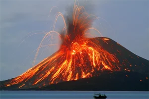
Active volcano erupting with lava and ash (Rhyolitic Lava)

RRhyolitic Lava

Rhyolitic lava is a highly viscous, silica-rich lava that typically forms steep-sided domes or flows. It is significant in volcanology for understanding the explosive nature of rhyolitic eruptions, the formation of volcanic domes, and the processes that lead to the buildup of pressure in magma chambers. 

Reference: Macdonald, G. A. (1972). “Volcanoes.” Prentice Hall. 
Share 

Open entry →
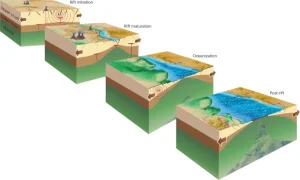
Stages of continental rifting and ocean formation diagram (rift flank)

RRift Flank

A rift flank is the elevated region that forms on either side of a rift valley due to the extensional forces that create the rift. Rift flanks are significant for understanding the tectonic processes that lead to continental breakup, the development of rift basins, and the uplift and erosion of the Earth’s crust. 

Reference: Ebinger, C. J. (2005). “Continental Breakup: The East African Perspective.” Geophysical Monograph Series, 148, 305-324. 

Share 

Open entry →
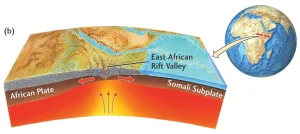
East African Rift Valley tectonic plate movement diagram

RRift Valley

A rift valley is a large, elongated depression formed by the extension and pulling apart of the Earth’s crust. These valleys are significant for understanding tectonic processes, particularly the early stages of continental breakup, the formation of new ocean basins, and the development of volcanic and seismic activity along rift zones. 

Reference: Rosendahl, B. R. (1987). “Architecture of Continental Rifts with Special Reference to East Africa.” Annual Review of Earth and Planetary Sciences, 15, 445-503. 

Share 

Open entry →
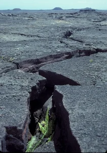
Fern growing through cracked volcanic lava field (rift zone at Kilaeuea)

RRift Zone

A rift zone is a region of the Earth’s crust where tectonic plates are diverging, leading to the formation of rifts and the potential development of new ocean basins. Rift zones are significant for understanding the processes of continental breakup, seafloor spreading, and the formation of volcanic and geothermal features. 

Reference: Ebinger, C. J., & Casey, M. (2001). “Continental Breakup in Magma-Rich and Magma-Poor Rifts: Evolution of the East African Rift System.” Journal of African Earth Sciences, 30(4), 815-834.

Share 

Open entry →
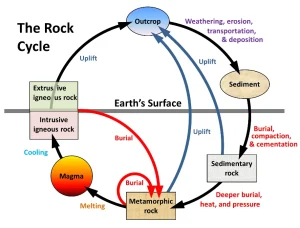
Diagram showing processes of the rock cycle

RRipple Marks

The rock cycle is a conceptual model describing the transformation of rocks through various geological processes, including the formation of igneous, sedimentary, and metamorphic rocks. This cycle is crucial for understanding the dynamic nature of Earth’s crust and the processes that recycle materials over geological time scales. 

Reference: Skinner, B. J., & Porter, S. C. (2004). “The Dynamic Earth: An Introduction to Physical Geology.” Wiley. 

Share 

Open entry →
Ripple marks on layered sedimentary rock surface

RRipple Marks

Ripple marks are small, wave-like structures formed on the surface of sedimentary rocks by the action of water or wind. They are significant in sedimentology for interpreting past environments, including the direction of water flow or wind, and for understanding the conditions under which sediments were deposited. 

Reference: Reineck, H.-E., & Singh, I. B. (1980). “Depositional Sedimentary Environments.” Springer-Verlag. 

Share 

Open entry →
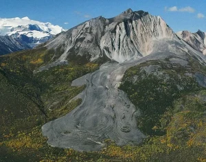
Mountain with rocky slopes and green forest base (rock glacier)

RRock Glacier

A rock glacier is a mass of rock, ice, and debris that moves slowly downhill, similar to a glacier. Rock glaciers are significant for understanding periglacial environments, the movement of ice and debris in cold climates, and the geomorphic processes shaping mountainous regions. 

Reference: Barsch, D. (1996). “Rock Glaciers: Indicators for the Present and Former Geoecology in High Mountain Environments.” Springer. 

Share 

Open entry →
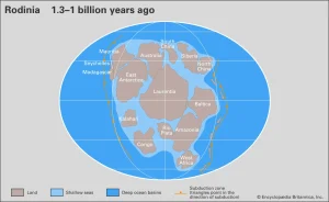
Map of Rodinia supercontinent 1.3 billion years ago

RRodinia

Rodinia was a supercontinent that existed during the Neoproterozoic era, approximately 1.3 billion to 750 million years ago. The study of Rodinia is significant for understanding the assembly and breakup of supercontinents, the evolution of Earth’s tectonic plates, and the environmental changes that led to the Snowball Earth events. 

Reference: Dalziel, I. W. D. (1997). “Neoproterozoic-Paleozoic Geography and Tectonics: Review, Hypothesis, Environmental Speculation.” Geological Society of America Bulletin, 109(1), 16-42.

Share 

Open entry →
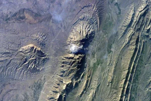
Aerial view of rugged mountain terrain (salt dome)

SSalt Dome

A salt dome is a type of structural dome formed when a thick bed of evaporite minerals, mainly salt, intrudes vertically through overlying rock layers. Salt domes are significant in petroleum geology for trapping hydrocarbons and as targets for oil and gas exploration. 

Reference: Jackson, M. P. A., & Talbot, C. J. (1986). “External Shapes, Strains, and Deformations of Salt Structures.” Geological Society of America Bulletin, 97(3), 305-323. 

Share 

Open entry →
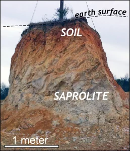
Soil and saprolite layers beneath earth surface.

SSaprolite

Saprolite is a deeply weathered rock that retains the original rock’s structure but has been chemically altered to form a soft, friable material. It is significant in understanding weathering processes, soil formation, and the potential for mineral resource exploration. 

Reference: Eggleton, R. A. (2001). “The Regolith Glossary: Surficial Geology, Soils, and Landscapes.” CRC LEME. 

Share 

Open entry →
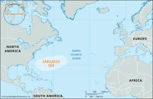
Map showing the Sargasso Sea in the Atlantic Ocean

SSargasso Sea

The Sargasso Sea is a region of the North Atlantic Ocean characterized by its deep blue water and floating seaweed, primarily Sargassum. It is significant in oceanography for understanding ocean currents, marine ecosystems, and the impacts of climate change on marine environments. 

Reference: Nixon, S. W., & Buckley, B. A. (2008). “Sargassum: A Floating Ecological Oasis.” Marine Ecology Progress Series, 364, 279-284. 

Share 

Open entry →
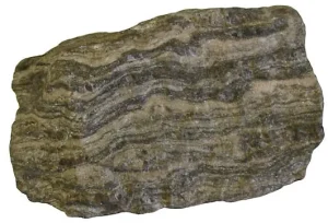
Gray gneiss rock with wavy banded layers (Schistosity)

SSchistosity

Schistosity is a type of foliation characteristic of schist, where the rock exhibits a planar or layered structure due to the alignment of platy minerals like mica. It is significant in metamorphic petrology for understanding the conditions and processes of regional metamorphism. 

Reference: Yardley, B. W. D. (1989). “An Introduction to Metamorphic Petrology.” Longman. 

Share 

Open entry →
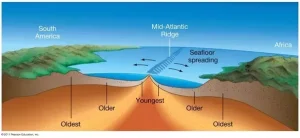
Seafloor spreading at Mid-Atlantic Ridge diagram

SSeafloor Spreading

Seafloor spreading is the process by which new oceanic crust is formed at mid-ocean ridges and gradually moves away from the ridge axis. This process is central to the theory of plate tectonics and is important for understanding the dynamics of the Earth’s lithosphere. 

Reference: Macdonald, K. C. (1982). “Mid-Ocean Ridges: Fine Scale Tectonic, Volcanic and Hydrothermal Processes within the Plate Boundary Zone.” Annual Review of Earth and Planetary Sciences, 10(1), 155-190. 

Share 

Open entry →
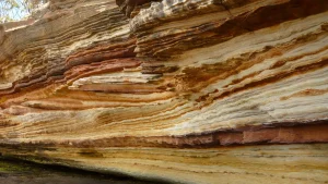
Layered sandstone rock formation with colorful strata (sedimentary basin)

SSedimentary Basin

A sedimentary basin is a low-lying area where sediments accumulate over time, often leading to the formation of sedimentary rocks. These basins are significant for understanding geological processes, the history of sedimentation, and the potential for hydrocarbon reservoirs. 

Reference: Miall, A. D. (1996). “The Geology of Fluvial Deposits.” Springer. 

Share 

Open entry →
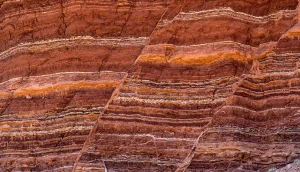
Layered red and orange sedimentary rock formation

SSedimentary Rock

Sedimentary rock is formed by the accumulation and lithification of sediments, which can be derived from the weathering and erosion of pre-existing rocks or from the precipitation of minerals from water. These rocks are significant in geology for preserving fossils, recording past environments, and understanding Earth’s history. 

Reference: Boggs, S. (2009). “Petrology of Sedimentary Rocks.” Cambridge University Press. 

Share 

Open entry →
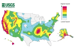
US earthquake seismic hazard map by USGS

SSeismic Hazard

Seismic hazard refers to the potential for earthquake-related ground shaking and damage in a specific area. Assessing seismic hazards is crucial for urban planning, construction practices, and risk management in seismically active regions. 

Reference: US Geological Survey (2003). “Earthquake Hazards Reduction Program.” USGS Publications. 

Share 

Open entry →
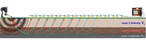
Seismic refraction layers with wave velocity illustration

SSeismic Refraction

Seismic refraction is a geophysical method used to measure the velocities of seismic waves traveling through the Earth’s subsurface. This method is important in exploration geophysics for mapping subsurface structures, determining the depth of bedrock, and exploring for natural resources. 

Reference: Telford, W. M., Geldart, L. P., & Sheriff, R. E. (1990). “Applied Geophysics.” Cambridge University Press. 

Share 

Open entry →
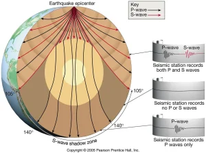
Diagram showing P and S wave shadow zones (seismic wave)

SSeismic Wave

Seismic waves are waves of energy that travel through the Earth, typically generated by earthquakes, volcanic activity, or artificial explosions. They are important in geophysics for understanding the Earth’s internal structure, locating earthquakes, and exploring for natural resources. 

Reference: Lay, T., & Wallace, T. C. (1995). “Modern Global Seismology.” Academic Press. 

Share 

Open entry →
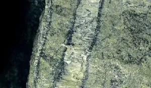
Close-up of rock with dark mineral layers (Serpentinization)

SSerpentinization

Serpentinization is the process of altering ultramafic rocks, particularly peridotite, into serpentine minerals through hydrothermal activity. This process is significant for understanding plate tectonics, the formation of ophiolites, and the geochemistry of Earth’s mantle. 

Reference: Wicks, F. J., & Whittaker, E. J. W. (1977). “Serpentine Textures and Serpentinization.” Canadian Mineralogist, 15(1), 459-488. 

Share 

Open entry →
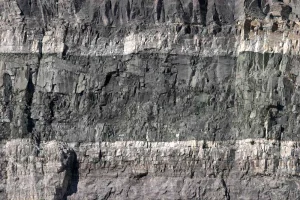
Layered rock cliff with visible sedimentary strata (sill)

SSill

A sill is a tabular sheet of igneous rock that intrudes parallel to the layering of pre-existing rocks. Sills are significant in understanding the processes of magma emplacement, the thermal effects of intrusions on surrounding rocks, and the structural geology of intrusions. 

Reference: Pollard, D. D., & Johnson, A. M. (1973). “Mechanics of Growth of Some Laccolithic Intrusions in the Henry Mountains, Utah, I: Field Observations, Gilbert’s Model, Physical Properties and Flow of the Magma.” Tectonophysics, 18(3-4), 311-354. 

Share 

Open entry →
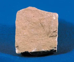
Brown sandstone rock sample on blue background (Siltstone)

SSiltstone

Siltstone is a fine-grained sedimentary rock composed primarily of silt-sized particles. It is important for understanding sedimentary processes, depositional environments, and the history of sediment transport and accumulation in marine and continental settings. 

Reference: Tucker, M. E. (2001). “Sedimentary Petrology: An Introduction to the Origin of Sedimentary Rocks.” Blackwell Science. 

Share 

Open entry →
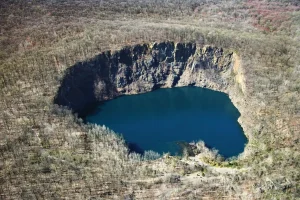
Aerial view of a deep blue sinkhole

SSinkhole

A sinkhole is a depression or hole in the ground caused by the collapse of a surface layer, often due to the dissolution of underlying carbonate rocks such as limestone. Sinkholes are significant in karst geology for understanding subsurface erosion, groundwater flow, and the hazards associated with land subsidence. 

Reference: Ford, D. C., & Williams, P. W. (2007). “Karst Hydrogeology and Geomorphology.” John Wiley & Sons. 

Share 

Open entry →
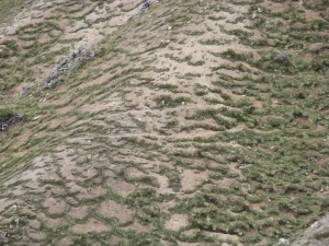
Patterned ground with patches of grass and soil (Solifluction)

SSolifluction

Solifluction is a type of mass wasting that occurs in periglacial environments, where the slow, downslope flow of water-saturated soil and sediment is driven by freeze-thaw cycles. This process is significant in geomorphology for understanding the dynamics of permafrost regions and the formation of periglacial landscapes. 

Reference: French, H. M. (2007). “The Periglacial Environment.” John Wiley & Sons. 

Share 

Open entry →
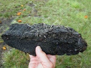
Hand holding a piece of peat soil (Sphagnum Moss)

SSphagnum Moss

Sphagnum moss is a type of peat-forming moss commonly found in wetlands, bogs, and fens. This plant is significant for understanding carbon cycling, wetland ecology, and the formation of peat deposits, which play a role in climate regulation. 

Reference: Gunnarsson, U. (2005). “Sphagnum and the Ecology of Peatlands.” Ecological Indicators, 5(1), 89-100. 

Share 

Open entry →

join.me

Geology made clear, in your inbox.

Get clear, visual explainers on rocks, minerals, deep time, and the most fascinating parts of Earth science from Geoscopy.
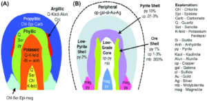
Hydrothermal alteration and ore shell zonation diagram

HArchives: Glossary

Hydrothermal alteration refers to the chemical alteration of minerals in rocks by hot, mineral-rich fluids, typically associated with volcanic activity or deep-seated geothermal systems. This process can lead to the formation of economically important ore deposits, such as gold, copper, and silver. Hydrothermal alteration is key in understanding mineralization processes and the evolution of hydrothermal systems. 

Reference: Guilbert, J. M., & Park, C. F. (1986). The Geology of Ore Deposits. Waveland Press.

Share 

Open entry →