Opens in a new tab
Geoscopy
Geology, explained.
Generic selectors
Exact matches only
Search in title
Search in content
Post Type Selectors

Rocks

An atlas of rocks and minerals: each one a record of the conditions that made it.

Glossary

Filter - Radio

Sort by

J

Jura Mountains

The Jura Mountains are a sub-alpine mountain range located on the border.. more →
J

Jura-Cretaceous Boundary

The Jura-Cretaceous boundary marks the transition between the Jurassic and Cretaceous periods,.. more →
J

Jurassic Carbonate Platforms 

Jurassic carbonate platforms are extensive, shallow marine environments where carbonate sediments, primarily.. more →
J

Jurassic Coast

The Jurassic Coast is a World Heritage Site on the southern coast.. more →
J

Juvenile Water

Juvenile water refers to water that is released from magma during volcanic.. more →
K

K-T Boundary (Cretaceous-Paleogene Boundary)

The K-T boundary, now referred to as the Cretaceous-Paleogene (K-Pg) boundary, marks.. more →
K

Kaapvaal Craton

The Kaapvaal Craton is an ancient geological formation in southern Africa, one.. more →
K

Kame

A kame is a mound or hill of sand and gravel deposited.. more →
K

Karakoram Range

The Karakoram Range is a major mountain range spanning the borders between.. more →
K

Karoo Basin

The Karoo Basin is a large sedimentary basin in South Africa, known.. more →
K

Karst

Karst is a type of landscape formed by the dissolution of soluble.. more →
K

Karstification

Karstification is the process of chemical weathering and dissolution of soluble rocks,.. more →
K

Kata Tjuta

Kata Tjuta, also known as the Olgas, is a group of large,.. more →
K

Katabatic Wind

A katabatic wind is a gravity-driven wind that carries high-density air from.. more →
K

Katmaï Volcanic Complex

The Katmaï Volcanic Complex is a volcanic group in Alaska that includes.. more →
K

Kettle Hole

A kettle hole is a depression in a glacial outwash plain formed.. more →
K

Kettle Lake

A kettle lake is a shallow, sediment-filled body of water formed in.. more →
K

Kettle Moraine

Kettle moraine refers to a glacial landform consisting of a series of.. more →
K

Keystone Thrust 

The Keystone Thrust is a major geological fault located in the Spring.. more →
K

Kinematic Analysis (Geology)

Kinematic analysis in geology involves the study of movement and deformation within.. more →
K

Kinematic Chain

In structural geology, a kinematic chain refers to a sequence of geological.. more →
K

Kinematics (Geology)

Kinematics in geology is the study of the motion and deformation of.. more →
K

Kinetic Metamorphism

Kinetic metamorphism refers to the changes in mineralogy and texture of rocks.. more →
K

Knickpoint

A knickpoint is a sudden change in the gradient of a river,.. more →
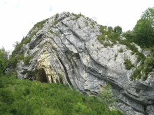
Rocky cave entrance surrounded by green vegetation (Jura Mountains)

JJura Mountains

The Jura Mountains are a sub-alpine mountain range located on the border between France and Switzerland, known for their folded limestone formations. The Jura Mountains are significant in studying the tectonic processes of mountain building, the stratigraphy of the Mesozoic era, and the development of karst landscapes. 

Reference: Becker, A. (2000). “The Jura Mountains—An Active Fold-and-Thrust Belt?” Tectonophysics, 321(1), 381-406. 
Share 

Open entry →

JJura-Cretaceous Boundary

The Jura-Cretaceous boundary marks the transition between the Jurassic and Cretaceous periods, approximately 145 million years ago. This boundary is characterized by significant changes in faunal assemblages and global climate. Understanding this boundary is important for studying the evolution of life, paleoclimate, and the geological history of the Mesozoic era. 

Reference: Ogg, J. G., & Hinnov, L. A. (2012). “Jurassic.” In: Gradstein, F. M., Ogg, J. G., Schmitz, M., & Ogg, G. (Eds.), The Geologic Time Scale 2012. Elsevier, pp. 731-791.

Share 

Open entry →
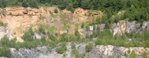
Rocky cliffside with trees and vegetation (Jurassic Carbonate Platforms)

JJurassic Carbonate Platforms 

Jurassic carbonate platforms are extensive, shallow marine environments where carbonate sediments, primarily composed of calcium carbonate, were deposited during the Jurassic period. These platforms are significant for understanding ancient marine ecosystems, sedimentary processes, and the evolution of reef-building organisms. 

Reference: Leinfelder, R. R., et al. (1994). “Jurassic Reef and Platform Facies and their Global Correlation.” In: International Symposium on Fossil Cnidaria including Archaeocyatha and Porifera. 

Share 

Open entry →
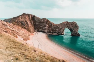
Rock arch on coastal cliff by turquoise sea (Jurassic Coast)

JJurassic Coast

The Jurassic Coast is a World Heritage Site on the southern coast of England, famous for its geological formations that span the Triassic, Jurassic, and Cretaceous periods. It provides an exceptional record of Earth’s history, particularly the fossil record of marine life from the Jurassic period. The site is important for understanding the geological history of the Earth and the processes of coastal erosion. 

Reference: West, I. M. (2014). Geology of the Jurassic Coast. Geological Conservation Review Series, Natural England. 

Share 

Open entry →
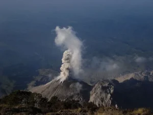
Volcano erupting with smoke rising into sky (juvenile water)

JJuvenile Water

Juvenile water refers to water that is released from magma during volcanic activity and is not part of the existing hydrological cycle. This water originates from the Earth’s mantle and is considered “new” to the Earth’s surface environment. Juvenile water is important in volcanology, hydrogeology, and the study of the Earth’s deep water cycle. 

Reference: Fyfe, W. S., Price, N. J., & Thompson, A. B. (1978). Fluids in the Earth’s Crust: Their Significance in Metamorphic, Tectonic and Chemical Transport Processes. Elsevier. 

Share 

Open entry →
K-T-Boundary-Cretaceous–Paleogene-Boundary

KK-T Boundary (Cretaceous-Paleogene Boundary)

The K-T boundary, now referred to as the Cretaceous-Paleogene (K-Pg) boundary, marks the transition between the Cretaceous and Paleogene periods around 66 million years ago. It is associated with a mass extinction event that wiped out approximately 75% of Earth’s species, including the dinosaurs. The boundary is often identified by a layer of iridium-rich clay. 

Reference: Schulte, P., et al. (2010). “The Chicxulub Asteroid Impact and Mass Extinction at the Cretaceous-Paleogene Boundary.” Science, 327(5970), 1214-1218.

Share 

Open entry →
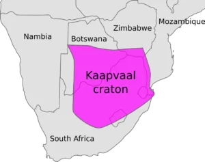
Map showing Kaapvaal craton in southern Africa

KKaapvaal Craton

The Kaapvaal Craton is an ancient geological formation in southern Africa, one of the Earth’s oldest and most stable continental cratons, dating back over 3 billion years. It is significant in studying the formation and stabilization of continental crust, as well as in understanding the early history of the Earth’s lithosphere. 

Reference: De Wit, M. J., & Ashwal, L. D. (1997). “Greenstone Belts: Ancient Crustal Analogues.” Oxford University Press. 

Share 

Open entry →
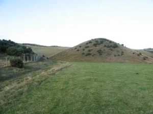
Grass-covered hill in rural countryside landscape (Kame)

KKame

A kame is a mound or hill of sand and gravel deposited by meltwater streams in glacial environments. Kames form in depressions or cavities on or within glaciers and are often found in clusters called kame fields. They are important in reconstructing past glacial environments and understanding sediment transport by meltwater. 

Reference: Easterbrook, D. J. (1999). “Surface Processes and Landforms.” Prentice Hall. 

Share 

Open entry →
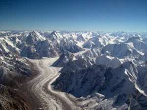
Snow-covered mountains with winding glacier valley (Karakoram Range)

KKarakoram Range

The Karakoram Range is a major mountain range spanning the borders between Pakistan, India, and China, and includes some of the world’s highest peaks, such as K2. The range is significant for its complex geology, including active tectonics, glaciation, and unique biodiversity. It is a key area for studying mountain building processes and the impacts of climate change on glaciers. 

Reference: Searle, M. P. (1991). “Geology and Tectonics of the Karakoram Mountains.” Wiley.

Share 

Open entry →
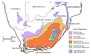
Geological map of South Africa showing Karoo Supergroup formations

KKaroo Basin

The Karoo Basin is a large sedimentary basin in South Africa, known for its extensive Permian to Jurassic sedimentary rocks and rich fossil record, including early dinosaurs and synapsids. The basin is important in studying the Permian-Triassic extinction event, the evolution of early terrestrial ecosystems, and the development of large continental basins. 

Reference: Catuneanu, O., et al. (2005). “The Karoo Basins of South-Central Africa.” Journal of African Earth Sciences, 43(1-3), 211-253. 

Share 

Open entry →
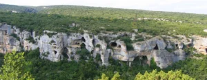
Limestone cliffs with caves and dense green forest (Karst)

KKarst

Karst is a type of landscape formed by the dissolution of soluble rocks such as limestone, dolomite, and gypsum. It is characterized by features such as sinkholes, caves, and underground drainage systems. Karst landscapes are significant in hydrogeology for understanding groundwater flow, the formation of aquifers, and the unique ecosystems that develop in such environments. 

Reference: Ford, D., & Williams, P. (2007). “Karst Hydrogeology and Geomorphology.” Wiley.

Share 

Open entry →
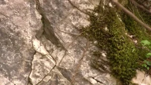
Moss growing on cracked rock surface (Karstification)

KKarstification

Karstification is the process of chemical weathering and dissolution of soluble rocks, such as limestone, that leads to the development of karst landscapes, including caves, sinkholes, and underground rivers. This process is significant in studying groundwater flow, landscape evolution, and the formation of karst aquifers. 

Reference: Ford, D., & Williams, P. (2007). “Karst Hydrogeology and Geomorphology.” Wiley.

Share 

Open entry →
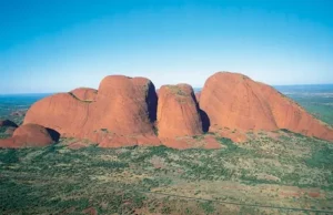
Aerial view of red rock formations in desert (Kata Tjuta)

KKata Tjuta

Kata Tjuta, also known as the Olgas, is a group of large, domed rock formations located in the Northern Territory of Australia. Composed primarily of conglomerate, Kata Tjuta is geologically significant for understanding the processes of erosion, sedimentation, and the tectonic history of central Australia. 

Reference: Wells, A. T., & Forman, D. J. (1987). “Geology of the Northern Territory.” Bureau of Mineral Resources, Geology and Geophysics, Australia.

Share 

Open entry →
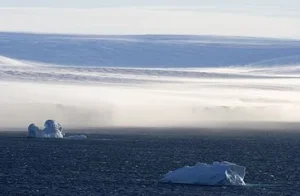
Icebergs floating in cold Arctic ocean waters (Katabatic Wind)

KKatabatic Wind

A katabatic wind is a gravity-driven wind that carries high-density air from a higher elevation down a slope under the force of gravity. Katabatic winds are common in polar regions, where they can influence local climate, ice dynamics, and the formation of ice shelves. They are significant in meteorology and polar research. 

Reference: Parish, T. R., & Cassano, J. J. (2003). “The Role of Katabatic Winds on the Antarctic Surface Wind Regime.” Monthly Weather Review, 131(2), 317-333.

Share 

Open entry →
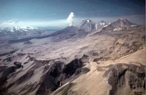
Aerial view of volcanic mountain landscape (Katmaï Volcanic Complex)

KKatmaï Volcanic Complex

The Katmaï Volcanic Complex is a volcanic group in Alaska that includes Mount Katmaï and the Valley of Ten Thousand Smokes. The complex is known for the 1912 eruption of Novarupta, one of the largest volcanic eruptions of the 20th century. This area is significant for studying volcanic activity, pyroclastic flows, and the impact of large eruptions on the environment. 

Reference: Hildreth, W., & Fierstein, J. (2000). “Katmai Volcanic Cluster and the Great Eruption of 1912.” Geological Society of America Bulletin, 112(10), 1594-1620.

Share 

Open entry →
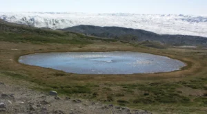
Small glacial lake surrounded by tundra landscape (Kettle Hole)

KKettle Hole

A kettle hole is a depression in a glacial outwash plain formed by the melting of a detached block of ice buried in the sediment. These features often become ponds or small lakes. Kettle holes are important in understanding glacial processes and post-glacial landscapes. 

Reference: Johnson, W. H., & Clayton, L. (2003). “Formation of Kettles by Subglacial Meltwater.” Geological Society of America Bulletin, 115(5), 645-654. 

Share 

Open entry →
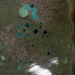
Aerial view of tundra with blue lakes (Kettle Lake)

KKettle Lake

A kettle lake is a shallow, sediment-filled body of water formed in a kettle hole, which is created by the melting of a buried block of glacial ice. These lakes are important in studying post-glacial environments, sedimentary processes, and the ecological development of freshwater systems. 

Reference: Johnson, W. H., & Clayton, L. (2003). “Formation of Kettles by Subglacial Meltwater.” Geological Society of America Bulletin, 115(5), 645-654.

Share 

Open entry →
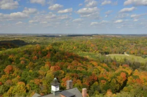
Colorful autumn forest under partly cloudy sky (Kettle Moraine)

KKettle Moraine

Kettle moraine refers to a glacial landform consisting of a series of small hills and depressions formed by the deposition of till around stagnant blocks of ice. As the ice melts, kettle holes form, creating a hummocky landscape. Kettle moraines are important in understanding glacial deposition and post-glacial landscape development. 

Reference: Easterbrook, D. J. (1999). “Surface Processes and Landforms.” Prentice Hall.

Share 

Open entry →
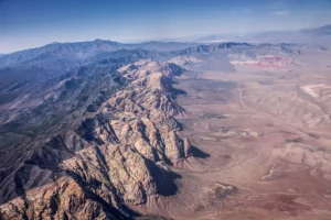
Aerial view of desert mountain range landscape (Keystone Thrust)

KKeystone Thrust 

The Keystone Thrust is a major geological fault located in the Spring Mountains of Nevada, where older Paleozoic rocks have been thrust over younger Mesozoic rocks. It is a classic example of a low-angle thrust fault and is important for understanding the tectonic history and structural geology of the region. 

Reference: Burchfiel, B. C., & Royden, L. H. (1985). “North-South Extension within the Eastern Basin and Range Province: The Keystone Thrust Fault System.” Geology, 13(5), 419-422. 

Share 

Open entry →
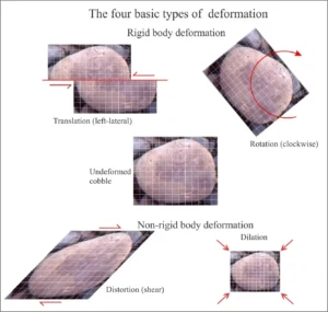
Diagram showing four basic types of deformation (Kinematic Analysis (Geology))

KKinematic Analysis (Geology)

Kinematic analysis in geology involves the study of movement and deformation within the Earth’s crust, often through the analysis of fault and fold systems. This analysis helps geologists understand the history of tectonic events, the direction of stress and strain, and the development of geological structures. 

Reference: Fossen, H. (2010). “Structural Geology.” Cambridge University Press. 

Share 

Open entry →

KKinematic Chain

In structural geology, a kinematic chain refers to a sequence of geological structures that are related by their movement history, such as a series of linked faults or folds. Analyzing kinematic chains helps geologists understand the progressive deformation of the Earth’s crust and the relationships between different structural features. 

Reference: Passchier, C. W., & Trouw, R. A. J. (2005). “Microtectonics.” Springer.

Share 

Open entry →
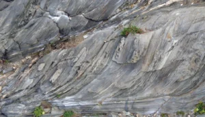
Folded metamorphic rock layers with visible striations (Kinematics, geology)

KKinematics (Geology)

Kinematics in geology is the study of the motion and deformation of rocks and geological structures without considering the forces that cause them. It focuses on describing and interpreting the displacement, rotation, and strain within the Earth’s crust, which is essential for understanding tectonic processes. 

Reference: Fossen, H. (2010). “Structural Geology.” Cambridge University Press.

Share 

Open entry →

KKinetic Metamorphism

Kinetic metamorphism refers to the changes in mineralogy and texture of rocks due to dynamic processes such as shearing and deformation, rather than solely from changes in temperature and pressure. It is important in understanding the formation of mylonites, tectonites, and other deformed rocks in shear zones. 

Reference: Passchier, C. W., & Trouw, R. A. J. (2005). “Microtectonics.” Springer.

Share 

Open entry →
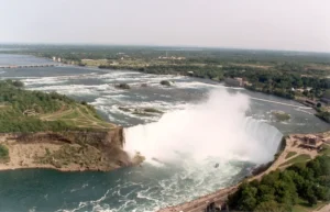
Aerial view of Niagara Falls waterfall (Knickpoint)

KKnickpoint

A knickpoint is a sudden change in the gradient of a river, often seen as a waterfall or a sharp increase in slope. Knickpoints are significant in fluvial geomorphology as indicators of changes in base level, tectonic activity, or variations in lithology. They play a role in river incision and landscape evolution. 

Reference: Crosby, B. T., & Whipple, K. X. (2006). “Knickpoint Initiation and Distribution within Fluvial Networks: 236 Waterfalls in the Waipaoa River, North Island, New Zealand.” Geological Society of America Bulletin, 118(7-8), 1051-1066.

Share 

Open entry →

join.me

Geology made clear, in your inbox.

Get clear, visual explainers on rocks, minerals, deep time, and the most fascinating parts of Earth science from Geoscopy.
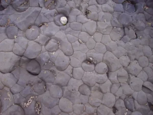
Smooth dark shoreline rocks scattered with barnacles (mudstone formation)

MArchives: Glossary

Mudstone is a fine-grained sedimentary rock composed primarily of clay and silt-sized particles. It is often formed in low-energy environments such as deep marine basins, lakes, and floodplains. Mudstone is significant in understanding depositional environments, the preservation of fossils, and the geochemical cycles of elements. 

Reference: Potter, P. E., Maynard, J. B., & Depetris, P. J. (2005). “Mud and Mudstones: Introduction and Overview.” Springer. 

Share 

Open entry →