Opens in a new tab
Geoscopy
Geology, explained.
Generic selectors
Exact matches only
Search in title
Search in content
Post Type Selectors

Rocks

An atlas of rocks and minerals: each one a record of the conditions that made it.

Glossary

Filter - Radio

Sort by

H

Hypabyssal Intrusion

A hypabyssal intrusion refers to a shallow-level igneous intrusion, typically occurring at.. more →
H

Hypabyssal Rock

Hypabyssal rocks are igneous rocks that form at medium depths, typically within.. more →
H

Hypersaline Environment

A hypersaline environment is characterized by water with extremely high salinity levels,.. more →
H

Hypocenter

The hypocenter is the point within the Earth where an earthquake rupture.. more →
H

Hypogene

Hypogene processes refer to geological processes that occur deep within the Earth's.. more →
I

Igneous Intrusion

An igneous intrusion is a body of magma that has forced its.. more →
I

Igneous Province

An igneous province is a region of extensive igneous rock formations, often.. more →
I

Igneous Rock

Igneous rock is formed through the cooling and solidification of magma or.. more →
I

Imbricate Structure

An imbricate structure is a geological feature where layers or slices of.. more →
I

Incised Valley

An incised valley is a river valley that has been deeply cut.. more →
I

Inclusion (Geology)

An inclusion is a fragment of one rock type enclosed within another,.. more →
I

Index Fossil

An index fossil is a fossil that is used to define and.. more →
I

Infiltration 

Infiltration is the process by which water on the ground surface enters.. more →
J

Jacket (Oil Platform)

A jacket is the steel framework supporting offshore oil platforms, designed to.. more →
J

Jade Belt

A jade belt refers to a region or zone rich in jade.. more →
J

Jet (Lignite)

Jet is a compact form of lignite, a type of brown coal,.. more →
J

Jetty

A jetty is a structure built from the shore into a body.. more →
J

Jig (Mining)

A jig is a mining device used to separate minerals from ore.. more →
J

Joint (Geology)

A joint is a fracture or crack in a rock along which.. more →
J

Jökulhlaup

A jökulhlaup is a type of glacial outburst flood that occurs when.. more →
J

Jökulsárgljúfur

Jökulsárgljúfur is a canyon in Iceland formed by the Jökulsá á Fjöllum.. more →
J

Jominy End-Quench Test

The Jominy end-quench test is a method used to determine the hardenability.. more →
J

Jovian Planets

Jovian planets, also known as gas giants, are large planets primarily composed.. more →
J

Jura Limestone

Jura Limestone is a type of limestone that forms part of the.. more →
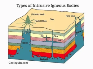
Diagram showing types of intrusive igneous bodies (hypabyssal intrusion)

HHypabyssal Intrusion

A hypabyssal intrusion refers to a shallow-level igneous intrusion, typically occurring at depths of less than a few kilometers below the Earth’s surface. These intrusions are often associated with dikes, sills, and laccoliths and are important in understanding the processes of magma emplacement and the formation of fine-grained igneous rocks. 

Reference: Johannsen, A. (1931). A Descriptive Petrography of the Igneous Rocks. University of Chicago Press. 
Share 

Open entry →
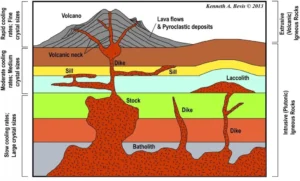
Diagram of igneous rock formations and cooling rates (hypabyssal rock)

HHypabyssal Rock

Hypabyssal rocks are igneous rocks that form at medium depths, typically within the Earth’s crust, between volcanic (extrusive) and plutonic (intrusive) environments. These rocks are often fine-grained due to their intermediate cooling rates and are important in studying the processes of magma intrusion and solidification within the crust. 

Reference: Johannsen, A. (1931). A Descriptive Petrography of the Igneous Rocks. University of Chicago Press. 
Share 

Open entry →
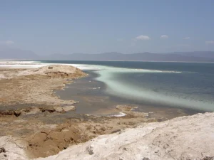
Salty shoreline and blue lake under clear sky (hypersaline environment)

HHypersaline Environment

A hypersaline environment is characterized by water with extremely high salinity levels, often found in evaporative basins, salt flats, and certain coastal lagoons. These environments are significant in studying extreme ecological conditions, evaporite mineral formation, and the geochemistry of saline waters. 

Reference: Warren, J. K. (2006). Evaporites: Sediments, Resources, and Hydrocarbons. Springer. 

Share 

Open entry →
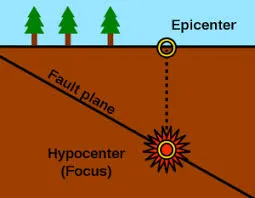
Diagram showing earthquake epicenter and hypocenter locations.

HHypocenter

The hypocenter is the point within the Earth where an earthquake rupture begins, located directly beneath the epicenter on the Earth’s surface. Understanding the hypocenter is crucial in seismology for determining the depth, location, and magnitude of earthquakes and for assessing seismic hazards. 

Reference: Stein, S., & Wysession, M. (2003). An Introduction to Seismology, Earthquakes, and Earth Structure. Wiley-Blackwell. 

Share 

Open entry →
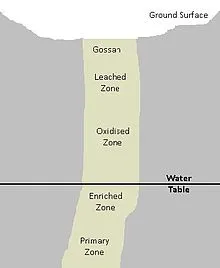
Diagram showing ore deposit zones underground (hypogene)

HHypogene

Hypogene processes refer to geological processes that occur deep within the Earth’s crust, typically involving the formation of minerals and rocks through high temperatures and pressures, often in association with magmatic activity. Hypogene mineralization is crucial in the formation of primary ore deposits, distinguishing it from supergene processes that occur closer to the Earth’s surface. 

Reference: Guilbert, J. M., & Park, C. F. (1986). The Geology of Ore Deposits. Waveland Press.

Share 

Open entry →
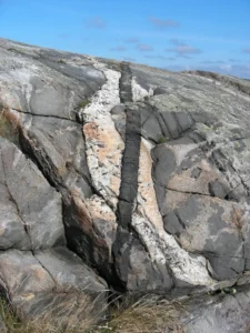
Rock formation with quartz and basalt veins (igneous intrusion)

IIgneous Intrusion

An igneous intrusion is a body of magma that has forced its way into pre-existing rocks and solidified beneath the Earth’s surface. Types of intrusions include dikes, sills, laccoliths, and plutons. These features are important in understanding the structure of the Earth’s crust, the formation of mineral deposits, and the processes of magmatic emplacement. 

Reference: Pitcher, W. S. (1997). The Nature and Origin of Granite. Springer. 

Share 

Open entry →
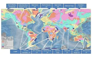
World map showing major large igneous provinces

IIgneous Province

An igneous province is a region of extensive igneous rock formations, often associated with large-scale volcanic activity and the emplacement of large volumes of magma. These provinces, such as the Deccan Traps or the Siberian Traps, are crucial in understanding the processes of mantle plume activity, continental break-up, and mass extinction events. 

Reference: Courtillot, V. E., & Renne, P. R. (2003). “On the Ages of Flood Basalt Events.” Comptes Rendus Geoscience, 335(1), 113-140.

Share 

Open entry →
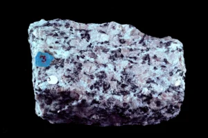
Close-up of granite rock sample with crystals (igneous rock)

IIgneous Rock

Igneous rock is formed through the cooling and solidification of magma or lava. It is classified into two main types: intrusive (plutonic), which cools slowly beneath the Earth’s surface, and extrusive (volcanic), which cools rapidly at the surface. Igneous rocks are significant in understanding the processes of magmatism, the formation of the Earth’s crust, and tectonic activity. 

Reference: Best, M. G. (2003). Igneous and Metamorphic Petrology. Wiley-Blackwell.

Share 

Open entry →
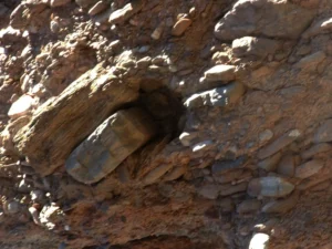
Petrified log embedded in rocky hillside (imbricate structure)

IImbricate Structure

An imbricate structure is a geological feature where layers or slices of rock are stacked on top of each other, typically due to compressional forces. These structures are common in thrust fault systems and accretionary prisms. Understanding imbricate structures is important in studying mountain building processes, tectonics, and the deformation of the Earth’s crust. 

Reference: Davis, G. H., & Reynolds, S. J. (1996). Structural Geology of Rocks and Regions. Wiley. 

Share 

Open entry →
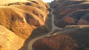
Winding dirt road through dry golden hills

IIncised Valley

An incised valley is a river valley that has been deeply cut into the landscape, often due to a drop in sea level or tectonic uplift. These valleys are important in studying the response of river systems to environmental changes, the development of sedimentary basins, and the preservation of ancient river systems in the geological record. 

Reference: Dalrymple, R. W., Boyd, R., & Zaitlin, B. A. (1994). Incised Valley Systems: Origin and Sedimentary Sequences. SEPM Special Publication No. 51. 

Share 

Open entry →
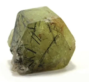
Green quartz crystal with black tourmaline inclusions (inclusion)

IInclusion (Geology)

An inclusion is a fragment of one rock type enclosed within another, typically occurring when magma incorporates pieces of surrounding rock as it intrudes. Inclusions provide valuable information about the conditions of magma formation, the history of the host rock, and the processes of magmatic differentiation. 

Reference: Gill, R. (2010). Igneous Rocks and Processes: A Practical Guide. Wiley-Blackwell.

Share 

Open entry →
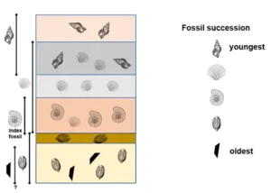
Diagram showing fossil succession from oldest to youngest layers (index fossil)

IIndex Fossil

An index fossil is a fossil that is used to define and identify geological periods or faunal stages. These fossils are typically widespread, abundant, and limited to a short range of geological time. Index fossils are crucial in biostratigraphy, helping to correlate rock layers across large distances and establish the relative ages of strata. 

Reference: Benton, M. J., & Harper, D. A. T. (2009). Introduction to Paleobiology and the Fossil Record. Wiley-Blackwell. 

Share 

Open entry →
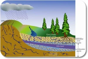
Diagram showing groundwater flow and soil water absorption (infiltration)

IInfiltration 

Infiltration is the process by which water on the ground surface enters the soil. It is a critical component of the hydrological cycle, influencing groundwater recharge, soil moisture, and surface runoff. Understanding infiltration is essential for water resource management, agriculture, and erosion control. 

Reference: Hillel, D. (1998). Environmental Soil Physics. Academic Press. 

Share 

Open entry →
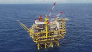
Offshore oil platform in the middle of ocean Jacket (Oil Platform)

JJacket (Oil Platform)

A jacket is the steel framework supporting offshore oil platforms, designed to withstand harsh marine environments. The jacket is driven into the seabed to provide stability for the platform. Understanding the design and function of jackets is crucial in offshore engineering, the development of oil and gas resources, and the safety of marine structures. 

Reference: Palmer, A. C., & King, R. A. (2008). “Subsea Pipeline Engineering.” PennWell Books.

Share 

Open entry →
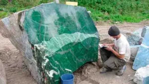
Person examining large green jade stone outdoors (Jade Belt)

JJade Belt

A jade belt refers to a region or zone rich in jade deposits, often associated with tectonic settings where high-pressure, low-temperature metamorphism occurs. These belts are significant in economic geology for jade mining and in studying the geological conditions that lead to jade formation. 

Reference: Harlow, G. E., & Sorensen, S. S. (2005). “Jade (Jadeitite and Nephrite) and Serpentinite: Metasomatic Connections.” International Geology Review, 47(2), 113-146. 

Share 

Open entry →
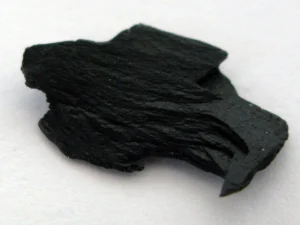
Black piece of shungite mineral rock Jet (Lignite)

JJet (Lignite)

Jet is a compact form of lignite, a type of brown coal, which can be polished and used as a gemstone. It forms from the decomposition of wood under extreme pressure and is known for its deep black color. Jet has been used since prehistoric times for jewelry and ornamental objects and is significant in understanding the early use of coal and organic material in geology. 

Reference: Scott, A. C., & Glasspool, I. J. (2007). “Observations and Experiments on the Origin and Formation of Inertinite Group Macerals.” International Journal of Coal Geology, 70(1-3), 53-66. 

Share 

Open entry →
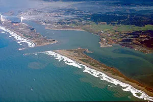
Aerial view of coastal bay and shoreline (Jetty)

JJetty

A jetty is a structure built from the shore into a body of water to influence currents or protect a harbor. Jetties are significant in coastal engineering, sediment transport studies, and the management of coastal erosion. They can also impact local ecosystems by altering water flow and sediment deposition patterns. 

Reference: Dean, R. G. (2003). Beach Nourishment: Theory and Practice. World Scientific.

Share 

Open entry →
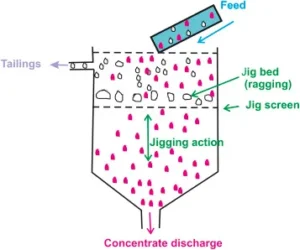
Diagram of jigging process separating minerals by density (Jig (Mining))

JJig (Mining)

A jig is a mining device used to separate minerals from ore based on differences in density. The jigging process involves pulsating water that causes the heavier minerals to settle and the lighter waste material to rise. Jigs are important in mineral processing for recovering valuable minerals and improving ore grades. 

Reference: Wills, B. A., & Finch, J. (2015). Wills’ Mineral Processing Technology: An Introduction to the Practical Aspects of Ore Treatment and Mineral Recovery. Butterworth-Heinemann. 

Share 

Open entry →
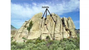
Rock formation showing visible joints in stone.

JJoint (Geology)

A joint is a fracture or crack in a rock along which there has been no significant movement parallel to the plane of the fracture. Joints are common in many rock types and often occur in sets or systems. They are important in studying the mechanical behavior of rocks, the movement of groundwater, and the formation of geological structures. 

Reference: Pollard, D. D., & Aydin, A. (1988). “Progress in Understanding Jointing Over the Past Century.” Geological Society of America Bulletin, 100(8), 1181-1204. 

Share 

Open entry →
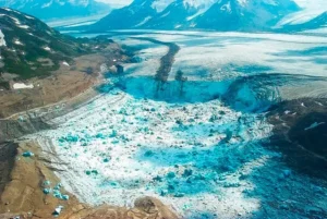
Melting glacier surrounded by snow-covered mountains (Jökulhlaup)

JJökulhlaup

A jökulhlaup is a type of glacial outburst flood that occurs when water trapped by a glacier or within a glacial lake is suddenly released. These floods can cause significant erosion, transport large amounts of sediment, and have major impacts on landscapes. Jökulhlaups are important in understanding glacial processes, flood dynamics, and landscape evolution. 

Reference: Björnsson, H. (2002). “Subglacial Lakes and Jökulhlaups in Iceland.” Global and Planetary Change, 35(3-4), 255-271.

Share 

Open entry →
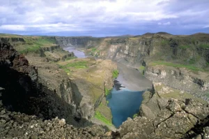
Scenic canyon landscape with river and cliffs (Jökulsárgljúfur)

JJökulsárgljúfur

Jökulsárgljúfur is a canyon in Iceland formed by the Jökulsá á Fjöllum river, known for its dramatic landscapes, including waterfalls, cliffs, and basalt formations. The canyon was shaped by a combination of glacial meltwater floods and volcanic activity, making it significant for studying geomorphology, glacial processes, and volcanic landscapes. 

Reference: Tómasson, H. (1993). “Jökulsárgljúfur—A Canyon Formed by a Series of Catastrophic Floods.” Geografiska Annaler: Series A, Physical Geography, 75(1-2), 101-113. 

Share 

Open entry →
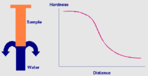
Water hardness decreases with distance in sample (Jominy End-Quench Test)

JJominy End-Quench Test

The Jominy end-quench test is a method used to determine the hardenability of steel by observing the hardness gradient along a sample after it has been heated and quenched at one end. This test is important in materials science and metallurgical engineering for understanding the properties of different steel compositions and their suitability for various applications. 

Reference: Grossmann, M. A., & Bain, E. C. (1938). “Principles of Heat Treatment.” American Society for Metals. 

Share 

Open entry →
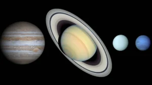
Gas giant planets of the solar system (Jovian Planets)

JJovian Planets

Jovian planets, also known as gas giants, are large planets primarily composed of hydrogen and helium, with thick atmospheres and no well-defined solid surface. The Jovian planets in our solar system are Jupiter, Saturn, Uranus, and Neptune. Studying Jovian planets is important in planetary science for understanding the formation and evolution of planetary systems. 

Reference: Guillot, T. (2005). “The Interiors of Giant Planets: Models and Outstanding Questions.” Annual Review of Earth and Planetary Sciences, 33, 493-530.

Share 

Open entry →
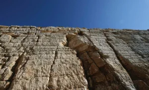
Ancient stone wall under clear blue sky (Jura Limestone)

JJura Limestone

Jura Limestone is a type of limestone that forms part of the Jura Mountains, which extend along the border between France and Switzerland. This limestone is known for its high fossil content, particularly of marine organisms from the Jurassic period. Jura Limestone is important in paleontology, stratigraphy, and as a building material. 

Reference: Hofmann, H. J., & Riding, R. (1978). “Fossil Stromatolites from the Jurassic of the Canadian Cordillera.” Geological Society of America Bulletin, 89(2), 321-329. 

Share 

Open entry →

join.me

Geology made clear, in your inbox.

Get clear, visual explainers on rocks, minerals, deep time, and the most fascinating parts of Earth science from Geoscopy.
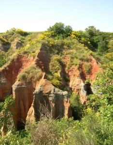
Eroded red cliffs with green vegetation (paleosol)

PArchives: Glossary

A paleosol is a fossil soil, preserved in the geological record, that formed on a landscape surface in the past. Paleosols are important for reconstructing past climates, vegetation, and landscapes, as well as for understanding soil development and diagenetic processes over geological time scales. 

Reference: Retallack, G. J. (2001). “Soils of the Past: An Introduction to Paleopedology.” Wiley-Blackwell.

Share 

Open entry →