Opens in a new tab
Geoscopy
Geology, explained.
Generic selectors
Exact matches only
Search in title
Search in content
Post Type Selectors

Rocks

An atlas of rocks and minerals: each one a record of the conditions that made it.

Glossary

Filter - Radio

Sort by

K

Knickzone

A knickzone is a section of a river or stream where there.. more →
K

Kobuk River

The Kobuk River is a major river in northwestern Alaska, flowing through.. more →
K

Kola Superdeep Borehole

The Kola Superdeep Borehole is the deepest man-made hole on Earth, reaching.. more →
K

Krakatoa

Krakatoa is a volcanic island in Indonesia known for its catastrophic eruption.. more →
K

Kuroshio Current

The Kuroshio Current is a warm ocean current that flows northward along.. more →
L

Laccolith

A laccolith is a dome-shaped intrusive igneous body that forms when magma.. more →
L

Lacustrine Basin

A lacustrine basin is a depression or low-lying area that collects water,.. more →
L

Lahar

A lahar is a type of volcanic mudflow or debris flow that.. more →
L

Lahontan Trough

The Lahontan Trough refers to the remnants of Lake Lahontan, a large.. more →
L

Landslide

A landslide is the movement of rock, soil, or debris down a.. more →
L

Laterite

Laterite is a highly weathered soil rich in iron and aluminum oxides,.. more →
L

Lava Dome

A lava dome is a rounded, steep-sided mound that forms when viscous.. more →
L

Lava Flow

A lava flow is a mass of molten rock that moves across.. more →
L

Lava Plateau

A lava plateau is a large, flat expanse of land formed by.. more →
L

Lava Tube

A lava tube is a natural tunnel formed by flowing lava beneath.. more →
L

Levee

A levee is a natural or artificial embankment that parallels a river,.. more →
L

Lichenometry

Lichenometry is a geochronological technique that uses the size of lichen colonies.. more →
L

Lignite

Lignite is a low-grade, brownish-black coal that represents an intermediate stage between.. more →
L

Limestone

Limestone is a sedimentary rock composed primarily of calcium carbonate (CaCO3), typically.. more →
L

Lithification

Lithification is the process by which sediments are compacted and cemented to.. more →
L

Lithologic Discontinuity

Lithologic discontinuity refers to a boundary within a rock sequence where there.. more →
L

Lithologic Facies

Lithologic facies are distinct rock units that form under specific conditions of.. more →
L

Lithologic Logging

Lithologic logging is the process of systematically recording the lithology, or rock.. more →
L

Lithosphere

The lithosphere is the rigid outer layer of the Earth, consisting of.. more →

KKnickzone

A knickzone is a section of a river or stream where there is a sharp change in slope, often leading to increased erosion and sediment transport. Knickzones can be caused by tectonic uplift, changes in base level, or variations in rock resistance. They are significant in the study of river dynamics and landscape evolution. 

Reference: Whipple, K. X. (2001). “Fluvial Landscape Response Time: How Plausible Is Steady-State Denudation?” American Journal of Science, 301(4-5), 313-325.
Share 

Open entry →
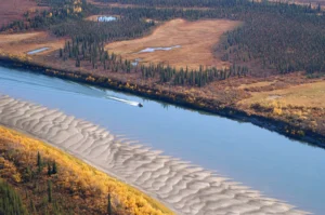
Boat traveling on river through autumn forest (Kobuk River)

KKobuk River

The Kobuk River is a major river in northwestern Alaska, flowing through the Arctic region and playing a significant role in the region’s ecology and hydrology. The river’s geological importance includes its influence on sediment transport, permafrost dynamics, and the formation of river terraces and floodplains. 

Reference: Carter, L. D. (1988). “Kobuk River Area, Alaska: A Guide to Landforms and Surface Features.” USGS Professional Paper 1386. 

Share 

Open entry →
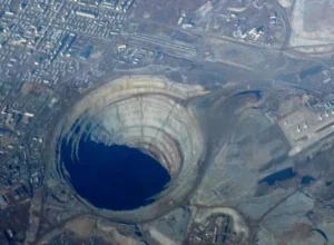
Aerial view of large open pit mine (Kola Superdeep Borehole).

KKola Superdeep Borehole

The Kola Superdeep Borehole is the deepest man-made hole on Earth, reaching a depth of 12,262 meters (40,230 feet) in the Kola Peninsula, Russia. It was drilled for scientific research to study the deep continental crust. The borehole provides valuable information on the composition, temperature, and pressure conditions of the Earth’s crust at great depths. 

Reference: Peive, A. A., & Krylov, D. P. (1988). “Results of Deep Continental Drilling at the Kola Peninsula, U.S.S.R.” Tectonophysics, 148(3-4), 241-246. 

Share 

Open entry →
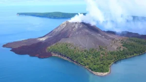
Smoking volcano island surrounded by blue ocean (Krakatoa)

KKrakatoa

Krakatoa is a volcanic island in Indonesia known for its catastrophic eruption in 1883, one of the most violent volcanic events in recorded history. The eruption caused massive tsunamis and led to global climate anomalies. Krakatoa is significant in volcanology, the study of natural disasters, and the impact of volcanic eruptions on global climate. 

Reference: Simkin, T., & Fiske, R. S. (1983). “Krakatau 1883: The Volcanic Eruption and Its Effects.” Smithsonian Institution Press. 

Share 

Open entry →
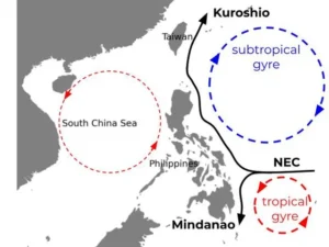
Ocean currents and gyres around the Philippines map (Kuroshio Current)

KKuroshio Current

The Kuroshio Current is a warm ocean current that flows northward along the western Pacific Ocean, off the coast of Japan. It is one of the strongest currents in the world and plays a crucial role in the climate and marine ecosystems of the region. The Kuroshio Current is significant in oceanography, climate studies, and the understanding of oceanic circulation patterns. 

Reference: Yasuda, I. (2003). “Hydrographic Structure and Variability in the Kuroshio-Oyashio Transition Area.” Journal of Oceanography, 59(4), 389-402. 

Share 

Open entry →
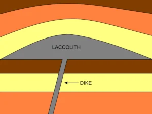
Diagram showing laccolith and dike formation

LLaccolith

A laccolith is a dome-shaped intrusive igneous body that forms when magma is injected between two layers of sedimentary rock, causing the overlying strata to bulge upwards. Laccoliths are significant in understanding the processes of magma emplacement and the formation of igneous rock structures within the Earth’s crust. 

Reference: Pollard, D. D., & Johnson, A. M. (1973). “Mechanics of Growth of Some Laccolithic Intrusions in the Henry Mountains, Utah, II: Bending and Failure of Overburden Layers and Sill Formation.” Tectonophysics, 18(3-4), 311-354.

Share 

Open entry →
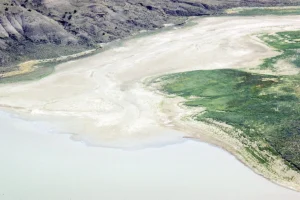
Aerial view of lake shore and vegetation (Lacustrine Basin)

LLacustrine Basin

A lacustrine basin is a depression or low-lying area that collects water, leading to the formation of a lake. These basins can be formed by tectonic activity, glacial processes, or volcanic activity. Lacustrine basins are significant in studying sedimentary environments, paleoclimate, and the hydrology of lake systems. 

Reference: Last, W. M., & Smol, J. P. (2001). “Tracking Environmental Change Using Lake Sediments.” Kluwer Academic Publishers. 

Share 

Open entry →
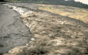
Volcanic mudflow spreading across barren landscape (lahar)

LLahar

A lahar is a type of volcanic mudflow or debris flow that occurs when volcanic ash, pyroclastic material, and water mix, typically due to heavy rainfall, the melting of ice or snow, or the disruption of a crater lake. Lahars can be highly destructive, flowing rapidly down valleys and causing significant damage to communities and infrastructure. 

Reference: Vallance, J. W. (2000). “Lahars.” In: Sigurdsson, H. (Ed.), Encyclopedia of Volcanoes. Academic Press, pp. 601-616.

Share 

Open entry →

LLahontan Trough

The Lahontan Trough refers to the remnants of Lake Lahontan, a large Pleistocene lake that once covered much of present-day Nevada. The trough contains significant lacustrine deposits that provide insights into the climatic and hydrological history of the Great Basin during the Ice Age. 

Reference: Benson, L. V., & Thompson, R. S. (1987). “Lake-Level Variation in the Lahontan Basin for the Past 50,000 Years.” Quaternary Research, 28(1), 69-85.

Share 

Open entry →
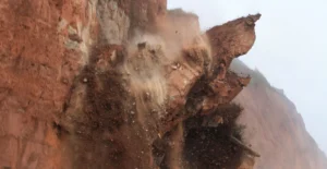
Large cliff collapsing during landslide

LLandslide

A landslide is the movement of rock, soil, or debris down a slope due to gravity. Landslides can be triggered by factors such as heavy rainfall, earthquakes, volcanic activity, or human activities. They are significant in understanding slope stability, erosion, and the risks associated with mountainous regions. 

Reference: Cruden, D. M., & Varnes, D. J. (1996). “Landslide Types and Processes.” In: Turner, A. K., & Schuster, R. L. (Eds.), Landslides: Investigation and Mitigation. Transportation Research Board Special Report 247. 

Share 

Open entry →
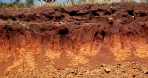
Red and orange soil layers in tropical terrain (laterite)

LLaterite

Laterite is a highly weathered soil rich in iron and aluminum oxides, typically found in tropical regions with high rainfall. Laterites are often used as a source of iron ore and as a building material. They are significant in soil science and the study of tropical weathering processes. 

Reference: Tardy, Y. (1997). “Petrology of Laterites and Tropical Soils.” CRC Press.

Share 

Open entry →
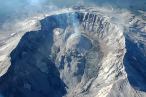
Aerial view of an active volcanic lava dome

LLava Dome

A lava dome is a rounded, steep-sided mound that forms when viscous lava extrudes slowly from a volcanic vent. Lava domes are significant in studying volcanic hazards, as they can produce pyroclastic flows, lava flows, and explosive eruptions when they collapse or are disrupted. 

Reference: Fink, J. H. (1983). “Structure and Evolution of a Rhyolitic Obsidian Flow: Little Glass Mountain, Medicine Lake Highland, Northern California.” Geological Society of America Bulletin, 94(4), 362-380. 

Share 

Open entry →
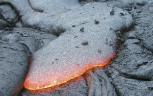
Hot molten lava flowing over solidified rock (lava flow)

LLava Flow

A lava flow is a mass of molten rock that moves across the Earth’s surface during a volcanic eruption. Lava flows can vary in composition, viscosity, and temperature, influencing their behavior and impact on the landscape. Studying lava flows is important for understanding volcanic processes, hazards, and the formation of volcanic landforms. 

Reference: Kilburn, C. R. J., & Luongo, G. (1993). “Active Lava Flows: Monitoring and Modelling.” UCL Press.

Share 

Open entry →
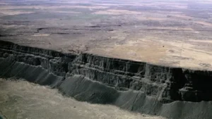
Massive basalt cliffs in desert canyon landscape (lava plateau)

LLava Plateau

A lava plateau is a large, flat expanse of land formed by the eruption of large volumes of low-viscosity basaltic lava that spreads over a vast area. These plateaus are significant in understanding volcanic processes, flood basalt events, and the formation of large igneous provinces. 

Reference: Thordarson, T., & Self, S. (1998). “The Roza Member, Columbia River Basalt Group: A Giant Flood Basalt Eruption.” Journal of Geophysical Research: Solid Earth, 103(B11), 27411-27445.

Share 

Open entry →
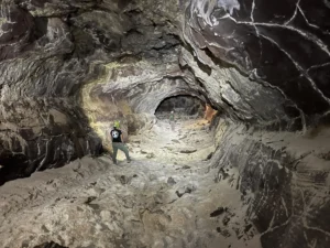
People exploring a rocky cave tunnel (lava tube)

LLava Tube

A lava tube is a natural tunnel formed by flowing lava beneath the surface of a solidified lava flow. Lava tubes are significant in understanding volcanic processes, the movement of lava flows, and the formation of volcanic landforms. They can also serve as habitats for unique ecosystems. 

Reference: Peterson, D. W., & Swanson, D. A. (1974). “Observations of Lava Tubes, Kilauea Volcano, Hawaii.” Bulletin Volcanologique, 38(1), 144-156.

Share 

Open entry →
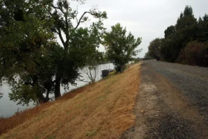
Gravel road beside river with green trees (levee)

LLevee

A levee is a natural or artificial embankment that parallels a river, preventing the river from flooding the adjacent land. Natural levees form during flood events when sediment is deposited along the river’s edges, while artificial levees are constructed to protect against flooding. Levees are significant in flood management and the study of fluvial processes. 

Reference: Smith, N. D. (1986). “River Levees.” In: Richards, K. S. (Ed.), River Channels: Environment and Process. Blackwell, pp. 391-433.

Share 

Open entry →
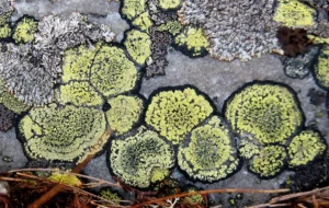
Yellow and green lichens growing on rock surface (Lithification)

LLichenometry

Lichenometry is a geochronological technique that uses the size of lichen colonies to estimate the age of exposed rock surfaces, particularly in glacial and periglacial environments. This method is valuable in studying the timing of glacial retreat, rockfall events, and other geomorphological processes. 

Reference: Innes, J. L. (1985). “Lichenometry.” Progress in Physical Geography, 9(2), 187-254.

Share 

Open entry →
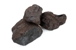
Three dark brown coal rocks isolated white background (lignite)

LLignite

Lignite is a low-grade, brownish-black coal that represents an intermediate stage between peat and bituminous coal. It has a relatively low carbon content and high moisture content, making it less efficient as a fuel. Lignite is significant in studying the formation of coal, paleoenvironments, and the carbon cycle. 

Reference: Taylor, G. H., Teichmüller, M., Davis, A., Diessel, C. F. K., Littke, R., & Robert, P. (1998). “Organic Petrology: A New Handbook Incorporating Advances in the Understanding of Organic Matter and Fossil Fuels.” Gebrüder Borntraeger. 

Share 

Open entry →
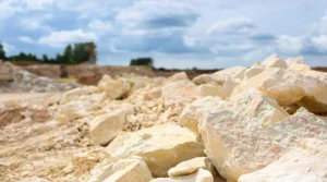
Limestone rocks at a quarry under cloudy sky

LLimestone

Limestone is a sedimentary rock composed primarily of calcium carbonate (CaCO3), typically formed in marine environments from the accumulation of shell, coral, algal, and fecal debris. It is a key rock in the carbon cycle and is widely used in construction, agriculture, and industry. Limestone is important in understanding sedimentary environments and the geological history of carbonates. 

Reference: Tucker, M. E., & Wright, V. P. (1990). “Carbonate Sedimentology.” Blackwell Science. 

Share 

Open entry →
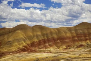
Colorful layered hills under a partly cloudy sky (lithification)

LLithification

Lithification is the process by which sediments are compacted and cemented to form solid sedimentary rock. This process involves the reduction of pore space and the precipitation of minerals that bind the sediment grains together. Lithification is crucial in the formation of sedimentary rocks and the preservation of fossils. 

Reference: Boggs, S. (2009). “Petrology of Sedimentary Rocks.” Cambridge University Press.

Share 

Open entry →

LLithologic Discontinuity

Lithologic discontinuity refers to a boundary within a rock sequence where there is a significant change in rock type, such as between sandstone and shale. These discontinuities are important in stratigraphy for interpreting depositional environments, correlating rock layers, and understanding the geological history of an area. 

Reference: Miall, A. D. (1997). “The Geology of Stratigraphic Sequences.” Springer. 

Share 

Open entry →

LLithologic Facies

Lithologic facies are distinct rock units that form under specific conditions of deposition, reflecting particular environments such as a delta, reef, or desert. Identifying and interpreting facies is essential for reconstructing past environments, understanding sedimentary processes, and exploring natural resources. 

Reference: Reading, H. G. (1996). “Sedimentary Environments: Processes, Facies and Stratigraphy.” Blackwell Science. 

Share 

Open entry →

LLithologic Logging

Lithologic logging is the process of systematically recording the lithology, or rock types, encountered in a borehole or outcrop. This information is critical in geological exploration, resource assessment, and understanding subsurface geology, including the identification of potential hydrocarbon reservoirs. 

Reference: Rider, M. H., & Kennedy, M. (2011). “The Geological Interpretation of Well Logs.” Rider-French Consulting Ltd. 

Share 

Open entry →
Diagram showing tectonic plate boundaries and subduction zones (Lithosphere)

LLithosphere

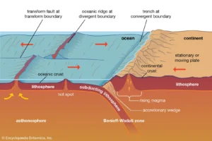
The lithosphere is the rigid outer layer of the Earth, consisting of the crust and the uppermost part of the mantle. It is divided into tectonic plates that move and interact at their boundaries, driving geological processes such as earthquakes, volcanism, and mountain building. The lithosphere is crucial in understanding plate tectonics and Earth’s dynamic processes. 

Reference: Turcotte, D. L., & Schubert, G. (2002). “Geodynamics.” Cambridge University Press. 

Share 

Open entry →

join.me

Geology made clear, in your inbox.

Get clear, visual explainers on rocks, minerals, deep time, and the most fascinating parts of Earth science from Geoscopy.
Dinosaur skeleton in a burning desert landscape (mass extinction)

MArchives: Glossary

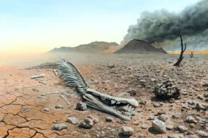
A mass extinction is an event in which a significant percentage of all life on Earth becomes extinct over a relatively short geological time period. Mass extinctions are critical for understanding the history of life on Earth, the factors that can lead to widespread species loss, and the subsequent recovery and evolution of ecosystems. 

Reference: Raup, D. M., & Sepkoski, J. J. (1982). “Mass Extinctions in the Marine Fossil Record.” Science, 215(4539), 1501-1503. 

Share 

Open entry →