Opens in a new tab
Geoscopy
Geology, explained.
Generic selectors
Exact matches only
Search in title
Search in content
Post Type Selectors

Rocks

An atlas of rocks and minerals: each one a record of the conditions that made it.

Glossary

Filter - Radio

Sort by

P

Paleochannel

A paleochannel is an ancient, inactive river or stream channel that has.. more →
P

Paleoclimatology

Paleoclimatology is the study of past climates using evidence found in tree.. more →
P

Paleocurrent Analysis

Paleocurrent analysis is the study of the direction of ancient water or.. more →
P

Paleogene Period

The Paleogene Period is a division of the geological timescale that lasted.. more →
P

Paleomagnetism

Paleomagnetism is the study of the record of the Earth's magnetic field.. more →
P

Paleosol

A paleosol is a fossil soil, preserved in the geological record, that.. more →
P

Paleotemperature

Paleotemperature refers to the temperature conditions in past geological periods, reconstructed from.. more →
P

Pegmatite

Pegmatite is an exceptionally coarse-grained igneous rock, typically composed of quartz, feldspar,.. more →
P

Peneplain

A peneplain is a low-relief land surface that results from prolonged erosion.. more →
P

Permafrost

Permafrost is permanently frozen ground that remains at or below 0°C for.. more →
P

Phreatic Eruption

A phreatic eruption, also known as a steam-blast eruption, occurs when groundwater.. more →
Q

Quasi-Geoid 

The quasi-geoid is a reference surface similar to the geoid but used.. more →
Q

Quicksand 

Quicksand is a colloid hydrogel consisting of fine granular material (such as.. more →
Q

Quicksilver

Quicksilver is another name for mercury, a heavy, silvery metal that is.. more →
Q

Quiescent Volcano

A quiescent volcano is one that is currently inactive but has the.. more →
R

Radial Drainage Pattern

A radial drainage pattern is a network of streams that radiate outward.. more →
R

Radiocarbon Dating 

Radiocarbon dating is a method for determining the age of organic materials.. more →
R

Radiolarian Chert

Radiolarian chert is a sedimentary rock composed predominantly of silica, formed from.. more →
R

Radiometric Dating

Radiometric dating is a method used to determine the age of rocks,.. more →
R

Redox Potential

Redox potential (Eh) is a measure of the tendency of a chemical.. more →
R

Reservoir Rock

Reservoir rock is a porous and permeable rock that can contain and.. more →
R

Residual Soil

Residual soil is soil that forms in place from the weathering of.. more →
R

Resistivity Survey

A resistivity survey is a geophysical method used to measure the electrical.. more →
R

Reverse Fault

A reverse fault is a type of fault where the hanging wall.. more →
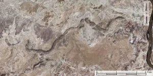
Satellite view of desert canyon landscape (paleochannel)

PPaleochannel

A paleochannel is an ancient, inactive river or stream channel that has been filled or buried by younger sediments. These channels are important for reconstructing past drainage patterns, sedimentary environments, and the history of fluvial systems, as well as for locating potential reservoirs of groundwater or hydrocarbons. 

Reference: Bridge, J. S. (2003). “Rivers and Floodplains: Forms, Processes, and Sedimentary Record.” Blackwell Science.
Share 

Open entry →
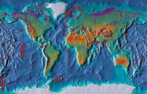
World topographic map with red markers along tectonic boundaries (Paleoclimatology map)

PPaleoclimatology

Paleoclimatology is the study of past climates using evidence found in tree rings, ice cores, sediment layers, and other geological and biological records. This field is critical for understanding the natural variability of Earth’s climate, the causes of past climate changes, and their impacts on the environment and human societies. 
Reference: Bradley, R. S. (1999). “Paleoclimatology: Reconstructing Climates of the Quaternary.” Academic Press.

Share 

Open entry →
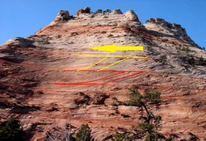
Layered sandstone mountain with colored geological markings (paleocurrent analysis)

PPaleocurrent Analysis

Paleocurrent analysis is the study of the direction of ancient water or wind currents based on the orientation of sedimentary structures such as cross-bedding, ripple marks, and flute casts. This analysis is important for reconstructing paleoenvironments, sediment transport pathways, and the depositional history of sedimentary basins. 

Reference: Potter, P. E., & Pettijohn, F. J. (1977). “Paleocurrents and Basin Analysis.” Springer-Verlag.

Share 

Open entry →
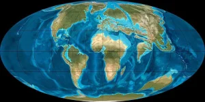
World map showing continents and oceans (Paleogene Period)

PPaleogene Period

The Paleogene Period is a division of the geological timescale that lasted from about 66 to 23 million years ago, following the extinction of the dinosaurs. This period is significant for the diversification of mammals, the development of modern plant species, and the establishment of many of the Earth’s current ecosystems. 

Reference: Berggren, W. A., & Pearson, P. N. (2005). “A Revised Tropical to Subtropical Paleogene Planktonic Foraminiferal Zonation.” Journal of Foraminiferal Research, 35(4), 279-298. 

Share 

Open entry →
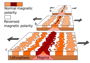
Volcanic island formation and paleomagnetism diagram

PPaleomagnetism

Paleomagnetism is the study of the record of the Earth’s magnetic field preserved in rocks, sediments, and archaeological materials. This field of study is important for understanding plate tectonics, the movement of continents, and the history of the Earth’s magnetic field, including geomagnetic reversals. 

Reference: Butler, R. F. (1992). “Paleomagnetism: Magnetic Domains to Geologic Terranes.” Blackwell Science.
Share 

Open entry →
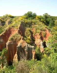
Eroded red cliffs with green vegetation (paleosol)

PPaleosol

A paleosol is a fossil soil, preserved in the geological record, that formed on a landscape surface in the past. Paleosols are important for reconstructing past climates, vegetation, and landscapes, as well as for understanding soil development and diagenetic processes over geological time scales. 

Reference: Retallack, G. J. (2001). “Soils of the Past: An Introduction to Paleopedology.” Wiley-Blackwell.

Share 

Open entry →
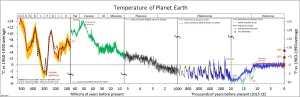
Graph showing Earth's temperature changes over geological time (paleotemperature)

PPaleotemperature

Paleotemperature refers to the temperature conditions in past geological periods, reconstructed from various proxies such as ice cores, tree rings, and isotopic compositions in sediments. This information is crucial for understanding past climate variability, the Earth’s thermal history, and the factors influencing global temperatures over geological time. 

Reference: Bradley, R. S. (1999). “Paleoclimatology: Reconstructing Climates of the Quaternary.” Academic Press.

Share 

Open entry →
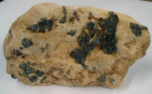
Dark crystals in light brown rock matrix (pegmatite)

PPegmatite

Pegmatite is an exceptionally coarse-grained igneous rock, typically composed of quartz, feldspar, and mica. These rocks form during the final stages of magma crystallization and often contain rare minerals, making them important for studying the late-stage processes of magma evolution and for the extraction of rare elements like lithium and tantalum. 

Reference: London, D. (2008). “Pegmatites.” Canadian Mineralogist Special Publication 10. 

Share 

Open entry →
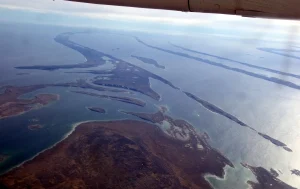
Aerial view of Arctic islands and coastline (peneplain)

PPeneplain

A peneplain is a low-relief land surface that results from prolonged erosion and denudation, representing the final stage of landscape evolution before uplift or rejuvenation. Peneplains are significant for understanding long-term geomorphic processes, landscape evolution, and the history of continental surfaces. 

Reference: Penck, W., & King, L. C. (1953). “Geomorphology.” Macmillan.

Share 

Open entry →
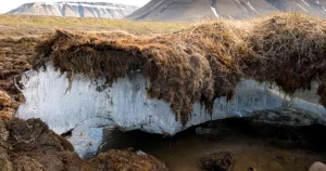
Exposed permafrost layer in arctic landscape

PPermafrost

Permafrost is permanently frozen ground that remains at or below 0°C for at least two consecutive years. It is found in polar regions and high-altitude areas and plays a critical role in the Earth’s climate system, particularly in the carbon cycle, as it stores large amounts of organic carbon that can be released as greenhouse gases when thawed. 

Reference: Brown, J., et al. (1998). “Circumpolar Active Layer Monitoring (CALM) Program: Description and Data.” CD-ROM. National Snow and Ice Data Center.

Share 

Open entry →
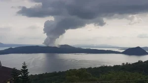
Volcano erupting with smoke over lake and mountains (phreatic eruption)

PPhreatic Eruption

A phreatic eruption, also known as a steam-blast eruption, occurs when groundwater comes into contact with hot magma or lava, causing it to rapidly vaporize and explode. These eruptions are important for understanding volcanic hazards, particularly in areas with abundant groundwater or near hydrothermal systems. 

Reference: Mastin, L. G. (1995). “Thermohydraulic Modeling of the Surface Eruptions at Mount St. Helens, 1980-1984.” Bulletin of Volcanology, 57(6), 509-516.

Share 

Open entry →
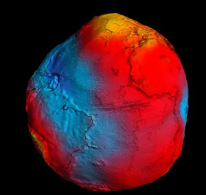
Earth geoid model showing gravitational variations (quasi-geoid)

QQuasi-Geoid 

The quasi-geoid is a reference surface similar to the geoid but used in some geodetic calculations. It approximates the Earth’s mean sea level and is significant for precise geodetic measurements, mapping, and understanding the Earth’s gravitational field. 

Reference: Hofmann-Wellenhof, B., & Moritz, H. (2006). “Physical Geodesy.” Springer. 

Share 

Open entry →
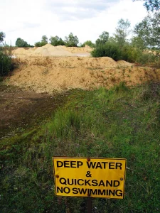
Warning sign for deep water and quicksand

QQuicksand 

Quicksand is a colloid hydrogel consisting of fine granular material (such as sand), clay, and water. It behaves like a liquid when agitated but can trap objects due to its inability to support weight. Quicksand is significant in sedimentology and soil mechanics for understanding fluidized sedimentary layers and their impact on construction and land stability. 

Reference: Dunn, I. S., Anderson, L. R., & Kiefer, F. W. (1980). “Fundamentals of Geotechnical Analysis.” Wiley. 

Share 

Open entry →
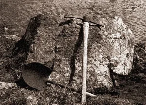
Pickaxe and shovel leaning against large rock (Quicksilver)

QQuicksilver

Quicksilver is another name for mercury, a heavy, silvery metal that is liquid at room temperature. It is significant in the study of mineral deposits, particularly cinnabar (mercury sulfide), which is the primary ore for mercury extraction, as well as for understanding its environmental and health impacts. 

Reference: Hylander, L. D., & Meili, M. (2003). “500 Years of Mercury Production: Global Annual Inventory by Region Until 2000 and Associated Emissions.” Science of the Total Environment, 304(1-3), 13-27. 

Share 

Open entry →
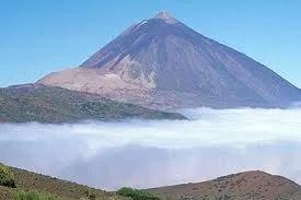
Mountain peak rising above clouds and green hills (Quiescent Volcano)

QQuiescent Volcano

A quiescent volcano is one that is currently inactive but has the potential to erupt again. These volcanoes are significant for volcanic hazard assessment, as they can remain dormant for long periods before erupting, posing risks to nearby populations. 

Reference: Simkin, T., & Siebert, L. (1994). “Volcanoes of the World.” Smithsonian Institution. 

Share 

Open entry →
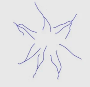
Abstract star shape with wavy blue lines (radial drainage pattern)

RRadial Drainage Pattern

A radial drainage pattern is a network of streams that radiate outward from a central point, typically associated with volcanic cones or domes. This pattern is significant in geomorphology for understanding the influence of topography on drainage development and the geological history of volcanic regions. 

Reference: Chorley, R. J., Schumm, S. A., & Sugden, D. E. (1984). “Geomorphology.” Methuen.

Share 

Open entry →
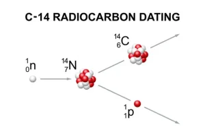
Carbon-14 radiocarbon dating atomic decay diagram

RRadiocarbon Dating 

Radiocarbon dating is a method for determining the age of organic materials by measuring the decay of carbon-14. This technique is essential in archaeology, paleontology, and geology for dating relatively recent events up to about 50,000 years ago. 

Reference: Taylor, R. E. (1987). “Radiocarbon Dating: An Archaeological Perspective.” Academic Press. 

Share 

Open entry →
Close-up of rough tree bark texture (Radiolarian Chert)

RRadiolarian Chert

Radiolarian chert is a sedimentary rock composed predominantly of silica, formed from the accumulation of radiolarian skeletons. These rocks are significant in paleontology and stratigraphy for understanding deep-sea environments, the global carbon cycle, and the age dating of oceanic crust. 

Reference: Moore, T. C. (1973). “Radiolarian Stratigraphy and the Cenozoic History of the Equatorial Pacific.” Geological Society of America Bulletin, 84(5), 1803-1828. 

Share 

Open entry →
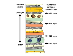
Geologic layers showing relative and numerical dating timeline (radiometric dating)

RRadiometric Dating

Radiometric dating is a method used to determine the age of rocks, minerals, and fossils by measuring the relative proportions of radioactive isotopes and their decay products. This technique is crucial for establishing the absolute ages of geological formations and the timing of events in Earth’s history, such as the age of the Earth, volcanic eruptions, and fossils. 

Reference: Faure, G. (1986). “Principles of Isotope Geology.” Wiley. 

Share 

Open entry →
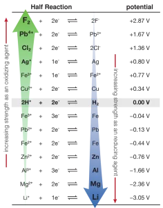
Electrochemical series showing standard redox potentials

RRedox Potential

Redox potential (Eh) is a measure of the tendency of a chemical environment to either gain or lose electrons, influencing the oxidation-reduction reactions that occur in it. In geology, redox potential is significant for understanding the formation of minerals, the mobility of metals, and the geochemistry of natural waters. 

Reference: Langmuir, D. (1997). “Aqueous Environmental Geochemistry.” Prentice Hall. 

Share 

Open entry →
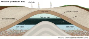
Diagram showing anticline petroleum trap structure (reservoir rock)

RReservoir Rock

Reservoir rock is a porous and permeable rock that can contain and transmit fluids, typically oil or gas, making it a key component in hydrocarbon exploration and production. These rocks are crucial in petroleum geology for understanding the accumulation and extraction of oil and gas. 

Reference: Schlumberger (1989). “Reservoir Characterization.” Elsevier. 

Share 

Open entry →
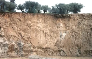
Eroded soil cliff with exposed tree roots (residual soil)

RResidual Soil

Residual soil is soil that forms in place from the weathering of the underlying rock, without significant transport. These soils are important for understanding weathering processes, soil formation, and landscape development, particularly in regions with stable tectonic conditions. 

Reference: Retallack, G. J. (2001). “Soils of the Past: An Introduction to Paleopedology.” Wiley-Blackwell. 

Share 

Open entry →
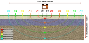
Electrical resistivity tomography measurement setup diagram (Resistivity Survey)

RResistivity Survey

A resistivity survey is a geophysical method used to measure the electrical resistance of subsurface materials, helping to identify variations in rock types, groundwater, and mineral deposits. This method is important for exploration geophysics, environmental studies, and engineering applications. 

Reference: Telford, W. M., Geldart, L. P., & Sheriff, R. E. (1990). “Applied Geophysics.” Cambridge University Press. 

Share 

Open entry →
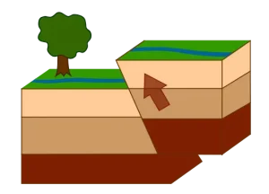
Diagram showing reverse fault geological movement

RReverse Fault

A reverse fault is a type of fault where the hanging wall moves upward relative to the footwall, typically due to compressional forces. These faults are significant for understanding the processes of crustal shortening and the formation of mountain ranges, as they are commonly found in convergent tectonic settings. 

Reference: Twiss, R. J., & Moores, E. M. (2007). “Structural Geology.” W. H. Freeman.

Share 

Open entry →

join.me

Geology made clear, in your inbox.

Get clear, visual explainers on rocks, minerals, deep time, and the most fascinating parts of Earth science from Geoscopy.
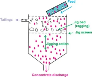
Diagram of jigging process separating minerals by density (Jig (Mining))

JArchives: Glossary

A jig is a mining device used to separate minerals from ore based on differences in density. The jigging process involves pulsating water that causes the heavier minerals to settle and the lighter waste material to rise. Jigs are important in mineral processing for recovering valuable minerals and improving ore grades. 

Reference: Wills, B. A., & Finch, J. (2015). Wills’ Mineral Processing Technology: An Introduction to the Practical Aspects of Ore Treatment and Mineral Recovery. Butterworth-Heinemann. 

Share 

Open entry →