Opens in a new tab
Geoscopy
Geology, explained.
Generic selectors
Exact matches only
Search in title
Search in content
Post Type Selectors

Rocks

An atlas of rocks and minerals: each one a record of the conditions that made it.

Glossary

Filter - Radio

Sort by

N

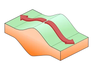
Nappe Fold Structure

Nappe fold structure refers to the large-scale folds associated with the formation.. more →
N

Neotectonics

Neotectonics refers to the study of recent and ongoing movements and deformations.. more →
N

Neptunism

Neptunism is an obsolete geological theory that proposed all rocks, including igneous.. more →
N

Neritic Zone

The neritic zone is the shallow part of the ocean that extends.. more →
N

Nonconformity

A nonconformity is a type of unconformity in which sedimentary rocks lie.. more →
N

Nonconformity 

A nonconformity is a type of unconformity in which sedimentary rocks lie.. more →
N

Normal Fault

A normal fault is a type of fault where the hanging wall.. more →
N

Normal Polarity

Normal polarity refers to the orientation of the Earth's magnetic field in.. more →
N

Nunatak

A nunatak is a mountain peak or rocky ridge that protrudes above.. more →
O

Oblate Spheroid

An oblate spheroid is a shape that is flattened at the poles.. more →
O

Ocean Trench

An ocean trench is a deep, elongated depression in the ocean floor,.. more →
O

Oceanic Crust

The oceanic crust is the outermost layer of the Earth's lithosphere that.. more →
O

Oceanic Plateau 

An oceanic plateau is a large, relatively flat region of the ocean.. more →
O

Offshore Bar

An offshore bar is a submerged or partly exposed ridge of sand,.. more →
O

Offshore Drilling

Offshore drilling is the process of extracting oil and natural gas from.. more →
O

Onlap

Onlap refers to the progressive covering of older strata by younger sedimentary.. more →
O

Oolite

Oolite is a sedimentary rock formed from ooids, which are small, spherical.. more →
O

Ophiolite

Ophiolites are sections of the Earth's oceanic crust and upper mantle that.. more →
O

Orogenic Belt 

An orogenic belt is a region of the Earth's crust that has.. more →
O

Orogenic Collapse

Orogenic collapse refers to the process by which mountain ranges formed during.. more →
O

Orogenic Gold

Orogenic gold deposits are formed during orogeny, typically within metamorphic belts where.. more →
O

Orogenic Plateau 

An orogenic plateau is a high-elevation, relatively flat region formed during orogeny,.. more →
O

Orogeny

Orogeny refers to the process of mountain building through tectonic forces, including.. more →
P

Pahoehoe

Pahoehoe is a type of basaltic lava with a smooth, ropy surface,.. more →
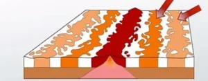
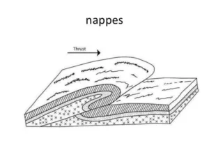
Geological diagram illustrating nappe thrust formation (Nappe Fold Structure)

NNappe Fold Structure

Nappe fold structure refers to the large-scale folds associated with the formation of nappes during compressional tectonics. These structures are key features in understanding the deformation processes involved in orogeny and the tectonic evolution of mountain belts.

Reference: Ramsay, J. G., & Huber, M. I. (1987). “The Techniques of Modern Structural Geology, Volume 2: Folds and Fractures.” Academic Press. 
Share 

Open entry →
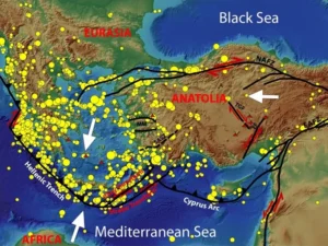
Tectonic map of Anatolia and surrounding earthquake zones (Neotectonics)

NNeotectonics

Neotectonics refers to the study of recent and ongoing movements and deformations of the Earth’s crust, typically occurring in the late Cenozoic era. This field is important for understanding current tectonic activity, the formation of landforms, and assessing seismic hazards.

Reference: Stewart, I. S., & Hancock, P. L. (1994). “Neotectonics.” In: Hancock, P. L. (Ed.), Continental Deformation. Pergamon, pp. 370-409. 

Share 

Open entry →
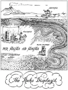
Illustration of geological rock formation and magma processes (Neptunism)

NNeptunism

Neptunism is an obsolete geological theory that proposed all rocks, including igneous rocks, were formed by the crystallization of minerals in the early Earth’s oceans. Although discredited by modern geology, Neptunism played a role in the development of geological thought and the understanding of rock formation processes.

Reference: Pancaldi, G. (1983). “Neptunism and the Neptunists: A Controversy in Eighteenth-Century German Geology.” History of Science, 21(2), 155-189. 

Share 

Open entry →
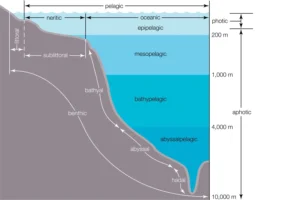
Diagram of ocean zones by depth and light levels (Neritic Zone)

NNeritic Zone

The neritic zone is the shallow part of the ocean that extends from the low tide mark to the edge of the continental shelf. It is characterized by abundant sunlight, relatively stable temperatures, and high biological productivity. This zone is significant for marine ecology, sedimentation, and the study of coastal processes.

Reference: Thurman, H. V., & Trujillo, A. P. (2010). “Essentials of Oceanography.” Prentice Hall.

Share 

Open entry →
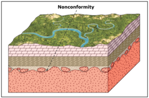
Geologic diagram illustrating a nonconformity layer.

NNonconformity

A nonconformity is a type of unconformity in which sedimentary rocks lie on top of older, eroded igneous or metamorphic rocks. This feature indicates a significant gap in the geological record and is important for understanding the history of erosion, deposition, and tectonic events in a region.

Reference: Press, F., & Siever, R. (2001). “Understanding Earth.” W. H. Freeman.

Share 

Open entry →

NNonconformity 

A nonconformity is a type of unconformity in which sedimentary rocks lie on top of older, eroded igneous or metamorphic rocks. This feature indicates a significant gap in the geological record and is important for understanding the history of erosion, deposition, and tectonic events in a region.

Reference: Press, F., & Siever, R. (2001). “Understanding Earth.” W. H. Freeman. 

Share 

Open entry →
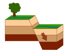
Diagram showing normal fault block movement

NNormal Fault

A normal fault is a type of fault where the hanging wall moves downward relative to the footwall, typically associated with extensional tectonic regimes. Normal faults are significant in understanding the processes of crustal extension, the formation of rift valleys, and the development of sedimentary basins.

Reference: Twiss, R. J., & Moores, E. M. (2007). “Structural Geology.” W. H. Freeman.

Share 

Open entry →
Laser cutting metal sheet diagram illustration (Normal Polarity)

NNormal Polarity

Normal polarity refers to the orientation of the Earth’s magnetic field in the same direction as the present magnetic field, where the magnetic north pole is near the geographic north pole. This concept is important in paleomagnetism for understanding the history of Earth’s magnetic field and the process of geomagnetic reversals.

Reference: Butler, R. F. (1992). “Paleomagnetism: Magnetic Domains to Geologic Terranes.” Blackwell Science.

Share 

Open entry →
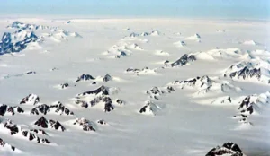
Snow-covered mountains and icy landscape aerial view (Nunatak)

NNunatak

A nunatak is a mountain peak or rocky ridge that protrudes above a glacier or ice sheet. Nunataks are significant as they provide evidence of past glaciation, serve as refuges for plant and animal species during glacial periods, and are important markers in studying glacial dynamics.

Reference: Sugden, D. E., & John, B. S. (1976). “Glaciers and Landscape: A Geomorphological Approach.” Edward Arnold.

Share 

Open entry →
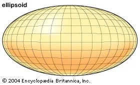
Three-dimensional illustration of an ellipsoid shape (Oblate Spheroid)

OOblate Spheroid

An oblate spheroid is a shape that is flattened at the poles and bulging at the equator, describing the approximate shape of the Earth due to its rotation. This concept is important in geodesy, the study of Earth’s shape, gravity field, and rotational dynamics. 

Reference: Heiskanen, W. A., & Moritz, H. (1967). “Physical Geodesy.” Freeman. 

Share 

Open entry →
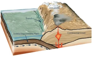
Subduction zone forming volcano near ocean trench

OOcean Trench

An ocean trench is a deep, elongated depression in the ocean floor, typically formed at convergent plate boundaries where one tectonic plate is subducted beneath another. Ocean trenches are the deepest parts of the ocean and are significant for studying subduction zones, the recycling of oceanic crust, and the dynamics of plate tectonics. 

Reference: Stern, R. J. (2002). “Subduction Zones.” Reviews of Geophysics, 40(4), 3-1-3-38.

Share 

Open entry →
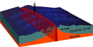
Diagram showing oceanic crust and mantle layers (oceanic crust)

OOceanic Crust

The oceanic crust is the outermost layer of the Earth’s lithosphere that underlies the ocean basins. It is composed primarily of basalt, gabbro, and other mafic rocks, and is thinner but denser than continental crust. The study of oceanic crust is essential for understanding plate tectonics, seafloor spreading, and the geodynamic processes of the Earth’s mantle. 

Reference: White, R. S., & McKenzie, D. (1989). “Magmatism at Rift Zones: The Generation of Volcanic Continental Margins and Flood Basalts.” Journal of Geophysical Research, 94(B6), 7685-7729. 

Share 

Open entry →
Map of oceanic plateaus near Australia and Pacific islands

OOceanic Plateau 

An oceanic plateau is a large, relatively flat region of the ocean floor that is elevated above the surrounding seafloor, often formed by large-scale volcanic activity. These plateaus are significant for understanding the processes of mantle plumes, hotspot volcanism, and the formation of large igneous provinces. 

Reference: Coffin, M. F., & Eldholm, O. (1994). “Large Igneous Provinces: Crustal Structure, Dimensions, and External Consequences.” Reviews of Geophysics, 32(1), 1-36. 

Share 

Open entry →
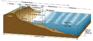
Diagram of coastal zones and beach features (offshore bar)

OOffshore Bar

An offshore bar is a submerged or partly exposed ridge of sand, gravel, or other sediment that lies parallel to the shore and is formed by the action of waves and currents. Offshore bars are important for understanding coastal processes, sediment transport, and the dynamics of beach and shoreline systems. 

Reference: Komar, P. D. (1998). “Beach Processes and Sedimentation.” Prentice Hall. 

Share 

Open entry →
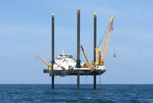
Offshore drilling jack-up platform with cranes in the sea

OOffshore Drilling

Offshore drilling is the process of extracting oil and natural gas from beneath the ocean floor using specialized drilling rigs and platforms. This technique is significant for the global energy industry, the exploration of marine hydrocarbon reserves, and the environmental challenges associated with drilling in marine environments. 

Reference: Holland, P. (2014). “Offshore Oil and Gas Exploration: Background, Challenges, and Future Development.” Springer. 

Share 

Open entry →
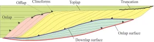
Diagram showing sedimentary clinoforms and lap surfaces.

OOnlap

Onlap refers to the progressive covering of older strata by younger sedimentary layers that lap onto an inclined surface or structure. This process is important in sequence stratigraphy for interpreting changes in sea level, sediment supply, and the depositional environment over time. 

Reference: Catuneanu, O. (2006). “Principles of Sequence Stratigraphy.” Elsevier. 

Share 

Open entry →
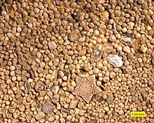
Close-up of oolitic limestone grains with shell fragments (oolite)

OOolite

Oolite is a sedimentary rock formed from ooids, which are small, spherical grains composed of concentric layers of calcium carbonate or other minerals. Oolites are typically found in warm, shallow marine environments and are significant in the study of carbonate sedimentation and paleoenvironmental reconstruction. 

Reference: Tucker, M. E., & Wright, V. P. (1990). “Carbonate Sedimentology.” Blackwell Science. 

Share 

Open entry →
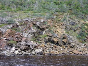
Rocky hillside beside calm water (ophiolite rocks)

OOphiolite

Ophiolites are sections of the Earth’s oceanic crust and upper mantle that have been uplifted and exposed above sea level, typically as a result of tectonic processes such as obduction. These rock complexes provide valuable insights into the composition and structure of the oceanic crust, as well as the processes of seafloor spreading and subduction. 

Reference: Moores, E. M., & Vine, F. J. (1971). “The Troodos Massif, Cyprus, and Other Ophiolites as Oceanic Crust: Evaluation and Implications.” Philosophical Transactions of the Royal Society of London. Series A, Mathematical and Physical Sciences, 268(1192), 443-466. 

Share 

Open entry →
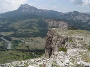
Mountain cliff overlooking river valley and peaks (orogenic belt)

OOrogenic Belt 

An orogenic belt is a region of the Earth’s crust that has been deformed and uplifted during an orogeny, resulting in the formation of mountain ranges. These belts are characterized by complex geological structures, including folds, faults, and metamorphic rocks, and are important for understanding the tectonic evolution of continents. 

Reference: Hatcher, R. D. (1989). “Tectonics of the Southern and Central Appalachian Internides.” Annual Review of Earth and Planetary Sciences, 17, 251-283. 

Share 

Open entry →
Diagram of transform plate boundary movement (orogenic collapse)

OOrogenic Collapse

Orogenic collapse refers to the process by which mountain ranges formed during orogeny are subsequently thinned and lowered by extensional tectonics and gravitational forces. This process is significant for understanding the post-orogenic evolution of mountain belts, crustal thinning, and the formation of extensional basins. 

Reference: Dewey, J. F. (1988). “Extensional Collapse of Orogens.” Tectonics, 7(6), 1123-1139. 

Share 

Open entry →
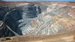
Large open pit mine with terraced rock layers (orogenic gold)

OOrogenic Gold

Orogenic gold deposits are formed during orogeny, typically within metamorphic belts where gold is concentrated by hydrothermal fluids. These deposits are significant for gold exploration and understanding the processes of mineralization associated with tectonic activity. 

Reference: Groves, D. I., Goldfarb, R. J., Robert, F., & Hart, C. J. R. (2003). “Gold Deposits in Metamorphic Belts: Overview of Current Understanding, Outstanding Problems, Future Research, and Exploration Significance.” Economic Geology, 98(1), 1-29. 

Share 

Open entry →

OOrogenic Plateau 

An orogenic plateau is a high-elevation, relatively flat region formed during orogeny, typically associated with large-scale tectonic uplift and crustal thickening. Examples include the Tibetan Plateau, which is the result of the collision between the Indian and Eurasian plates. These plateaus are important for understanding the processes of mountain building, climate interactions, and the evolution of large orogenic systems. 

Reference: Tapponnier, P., et al. (2001). “Oblique Stepwise Rise and Growth of the Tibet Plateau.” Science, 294(5547), 1671-1677. 

Share 

Open entry →
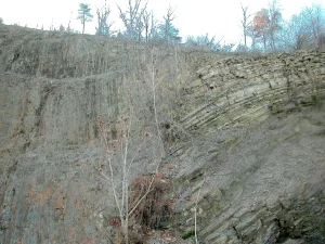
Exposed layered rock formation on hillside (orogeny)

OOrogeny

Orogeny refers to the process of mountain building through tectonic forces, including the folding, faulting, and uplift of the Earth’s crust. Orogenies result from the collision of tectonic plates and are significant in the formation of mountain ranges, such as the Himalayas and the Andes. Understanding orogeny is crucial for studying the Earth’s tectonic history and the structural evolution of continents. 

Reference: Dewey, J. F., & Bird, J. M. (1970). “Mountain Belts and the New Global Tectonics.” Journal of Geophysical Research, 75(14), 2625-2647. 

Share 

Open entry →
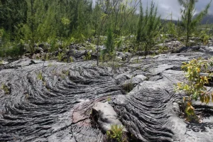
Hardened lava field with new vegetation growth (pahoehoe)

PPahoehoe

Pahoehoe is a type of basaltic lava with a smooth, ropy surface, formed by the slow cooling and movement of fluid lava. This type of lava flow is significant for understanding volcanic processes, particularly the behavior of low-viscosity basaltic lavas during effusive eruptions. 

Reference: Macdonald, G. A. (1972). “Volcanoes.” Prentice Hall.

Share 

Open entry →

join.me

Geology made clear, in your inbox.

Get clear, visual explainers on rocks, minerals, deep time, and the most fascinating parts of Earth science from Geoscopy.
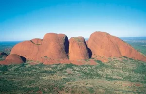
Aerial view of red rock formations in desert (Kata Tjuta)

KArchives: Glossary

Kata Tjuta, also known as the Olgas, is a group of large, domed rock formations located in the Northern Territory of Australia. Composed primarily of conglomerate, Kata Tjuta is geologically significant for understanding the processes of erosion, sedimentation, and the tectonic history of central Australia. 

Reference: Wells, A. T., & Forman, D. J. (1987). “Geology of the Northern Territory.” Bureau of Mineral Resources, Geology and Geophysics, Australia.

Share 

Open entry →