Opens in a new tab
Geoscopy
Geology, explained.
Generic selectors
Exact matches only
Search in title
Search in content
Post Type Selectors

Rocks

An atlas of rocks and minerals: each one a record of the conditions that made it.

Glossary

Filter - Radio

Sort by

E

Endorheic Basin

An endorheic basin is a closed drainage basin where water does not.. more →
E

Enstatite

Enstatite is a common mineral in the pyroxene group, typically found in.. more →
E

Eolian Processes

Eolian processes involve the transportation, deposition, and erosion of sediments by wind... more →
E

Epeiric Sea

An epeiric sea, also known as an epicontinental sea, is a shallow.. more →
E

Epeirogenic Movement

Epeirogenic movement refers to broad, relatively slow, vertical movements of the Earth's.. more →
E

Epeirogeny

Epeirogeny refers to broad, gentle uplifts or subsidence of large areas of.. more →
E

Ephemeral Gully

An ephemeral gully is a small, temporary channel formed by the concentration.. more →
E

Ephemeral Lake

An ephemeral lake is a temporary body of water that forms in.. more →
E

Epicenter

The epicenter is the point on the Earth's surface directly above the.. more →
E

Epiclastic

Epiclastic rocks are sedimentary rocks composed of clastic fragments derived from the.. more →
E

Epigenesis

Epigenesis in geology refers to the process by which mineral deposits are.. more →
E

Erosion

Erosion is the process by which soil, rock, and other surface materials.. more →
E

Erratic (Glacial)

A glacial erratic is a large boulder or rock fragment that has.. more →
E

Esker 

An esker is a long, winding ridge of stratified sand and gravel.. more →
E

Eustasy

Eustasy refers to global changes in sea level caused by variations in.. more →
E

Eustatic Change

Eustatic change refers to global variations in sea level caused by changes.. more →
E

Evaporite

Evaporites are sedimentary rocks formed by the precipitation of minerals from evaporating.. more →
E

Evapotranspiration

Evapotranspiration is the combined process of evaporation of water from the Earth's.. more →
E

Exfoliation 

Exfoliation is a physical weathering process where rock layers peel away in.. more →
E

Exhalative Deposits

Exhalative deposits are mineral deposits formed from the precipitation of minerals from.. more →
E

Exhumation (Geology)

Exhumation in geology refers to the process by which rocks that were.. more →
E

Exotic Terrane

An exotic terrane is a fragment of crustal material that has been.. more →
E

Exsolution

Exsolution is the process by which a solid solution separates into two.. more →
E

Extrusion (Geology)

Extrusion refers to the process by which magma reaches the Earth's surface.. more →
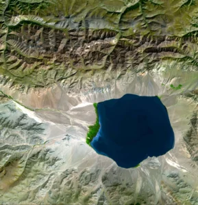
Satellite image of a deep blue mountain lake (endorheic basin)

EEndorheic Basin

An endorheic basin is a closed drainage basin where water does not drain into the ocean but instead accumulates in a central lake or evaporates. These basins are often found in arid regions and are characterized by high salinity levels in their lakes due to evaporation. Endorheic basins are significant in hydrology, geology, and environmental studies of arid regions. 

Reference: Deocampo, D. M. (2015). “Endorheic Basins.” In: Reference Module in Earth Systems and Environmental Sciences. Elsevier.
Share 

Open entry →
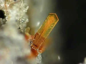
Close-up of an orange crystal formation (enstatite)

EEnstatite

Enstatite is a common mineral in the pyroxene group, typically found in mafic and ultramafic igneous rocks, as well as in some metamorphic rocks. It is composed of magnesium silicate (MgSiO3) and is important in understanding the mineralogical composition of the Earth’s mantle and the petrogenesis of igneous rocks. 

Reference: Deer, W. A., Howie, R. A., & Zussman, J. (2013). “An Introduction to the Rock-Forming Minerals.” The Mineralogical Society.

Share 

Open entry →
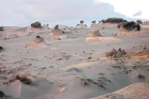
Wind-eroded rock formations in desert landscape (eolian processes)

EEolian Processes

Eolian processes involve the transportation, deposition, and erosion of sediments by wind. These processes are most active in arid and semi-arid environments, leading to the formation of dunes, loess deposits, and desert pavements. Eolian processes are critical in understanding desert landscapes, sediment transport mechanisms, and past climatic conditions. 

Reference: Pye, K., & Tsoar, H. (2009). “Aeolian Sand and Sand Dunes.” Springer.

Share 

Open entry →
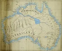
Historical map of Australia with early regional names (epeiric sea)

EEpeiric Sea

An epeiric sea, also known as an epicontinental sea, is a shallow sea that extends over a large part of a continent, typically during periods of high sea levels. These seas are significant in paleogeography and sedimentology, as they are often associated with extensive sedimentary deposits and fossil-rich layers. 

Reference: Johnson, M. E., & Boucot, A. J. (1996). “Paleogeography and Paleobiogeography: Biodiversity in Shallow Seas.” Geological Society of America Special Paper 306.

Share 

Open entry →
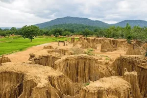
Eroded sandstone formations with green hills background (epeirogenic movement)

EEpeirogenic Movement

Epeirogenic movement refers to broad, relatively slow, vertical movements of the Earth’s crust that result in the formation of large-scale features such as plateaus, basins, and continental interiors. Unlike orogenic movements, which are associated with mountain building, epeirogenic movements are typically not associated with significant folding or faulting. 

Reference: Levandowski, W., & Jones, C. H. (2015). “Epeirogeny or Eustasy? Gauging Sea Level with Paleozoic Epeirogeny in the Central United States.” Geology, 43(2), 171-174. 

Share 

Open entry →
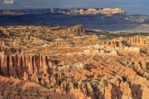
Scenic view of Bryce Canyon rock formations (epeirogeny)

EEpeirogeny

Epeirogeny refers to broad, gentle uplifts or subsidence of large areas of the Earth’s crust, typically not associated with volcanic or seismic activity. These vertical movements can create plateaus, basins, and other large-scale landforms. Epeirogeny is important in understanding long-term landscape evolution, tectonics, and sedimentary basin development. 

Reference: Bond, G. C. (1978). “Evidence for Continental Subsidence in North America During the Late Cretaceous Global Tectonics.” Geology, 6(11), 713-718.

Share 

Open entry →
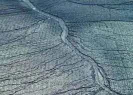
Aerial view of cracked glacier ice surface (ephemeral gully)

EEphemeral Gully

An ephemeral gully is a small, temporary channel formed by the concentration of runoff during heavy rainfall or snowmelt. These gullies can quickly erode and transport significant amounts of soil, contributing to landscape change and soil degradation. The study of ephemeral gullies is important in soil conservation, hydrology, and erosion control. 

Reference: Poesen, J., Nachtergaele, J., Verstraeten, G., & Valentin, C. (2003). “Gully Erosion and Environmental Change: Importance and Research Needs.” Catena, 50(2-4), 91-133.

Share 

Open entry →
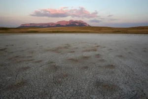
Dry cracked landscape with mountains at sunset (ephemeral lake)

EEphemeral Lake

An ephemeral lake is a temporary body of water that forms in arid or semi-arid regions, usually after heavy rainfall. These lakes exist for a short period before evaporating or draining away. Ephemeral lakes are significant in studying desert hydrology, sedimentation patterns, and the response of ecosystems to fluctuating water availability. 

Reference: Yechieli, Y., & Wood, W. W. (2002). “Hydrology and Evolution of Saline Lakes in the Dead Sea Rift Valley.” Earth-Science Reviews, 58(3-4), 297-314. 

Share 

Open entry →
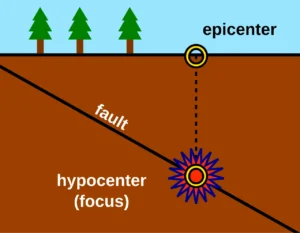
Diagram showing earthquake epicenter, hypocenter, and fault line.

EEpicenter

The epicenter is the point on the Earth’s surface directly above the focus of an earthquake, where seismic waves are first generated. It is the location that typically experiences the strongest shaking during an earthquake. Understanding the epicenter is crucial in seismology for assessing the impact of earthquakes and for emergency response planning. 

Reference: Lay, T., & Wallace, T. C. (1995). “Modern Global Seismology.” Academic Press. 

Share 

Open entry →
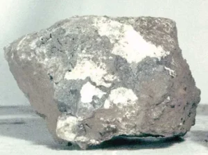
Gray bauxite rock with white patches (epiclastic)

EEpiclastic

Epiclastic rocks are sedimentary rocks composed of clastic fragments derived from the erosion of pre-existing rocks, typically of volcanic origin. These rocks are important in reconstructing past volcanic environments and understanding the processes of erosion, transportation, and deposition in volcanic terrains. 

Reference: Fisher, R. V., & Schmincke, H.-U. (1984). “Pyroclastic Rocks.” Springer. 

Share 

Open entry →
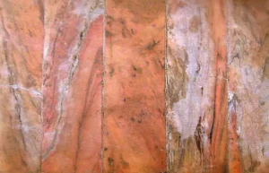
Polished orange and brown marble wall texture (epigenesis)

EEpigenesis

Epigenesis in geology refers to the process by which mineral deposits are formed or altered after the initial formation of the host rock, typically through the action of fluids. This process can lead to the introduction of new minerals or the alteration of existing ones, often resulting in economically valuable ore deposits. Epigenesis is important in economic geology and the exploration of mineral resources. 

Reference: Guilbert, J. M., & Park, C. F. (1986). “The Geology of Ore Deposits.”

Share 

Open entry →
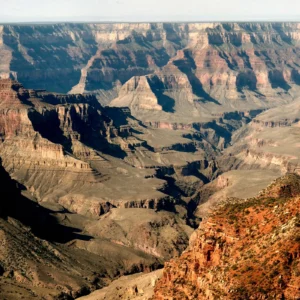
Scenic view of the Grand Canyon cliffs (erosion)

EErosion

Erosion is the process by which soil, rock, and other surface materials are removed from one location and transported to another by natural agents such as water, wind, ice, or gravity. Erosion shapes landscapes, forms sedimentary deposits, and plays a critical role in the rock cycle and the formation of various geological features. 

Reference: Montgomery, D. R. (2007). “Soil Erosion and Agricultural Sustainability.” Proceedings of the National Academy of Sciences, 104(33), 13268-13272. 

Share 

Open entry →
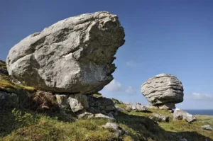
Large balancing rocks on a grassy hillside (glacial erratic)

EErratic (Glacial)

A glacial erratic is a large boulder or rock fragment that has been transported and deposited by a glacier, often far from its original location. These rocks are typically different in composition from the bedrock on which they rest, serving as indicators of past glacial movement and ice sheet dynamics. Erratics are significant in studying the extent and direction of glaciation. 

Reference: Benn, D. I., & Evans, D. J. A. (2010). “Glaciers and Glaciation.” Routledge. 

Share 

Open entry →
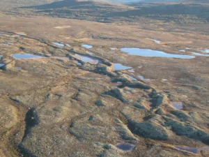
Aerial view of tundra landscape with small ponds (esker)

EEsker 

An esker is a long, winding ridge of stratified sand and gravel deposited by meltwater streams flowing beneath a glacier. Eskers are significant features in glacial geomorphology, providing evidence of past glacial dynamics and meltwater processes. They are also important in hydrogeology as potential aquifers. 

Reference: Shreve, R. L. (1985). “Eskers, Kames, and Subglacial Drainage Channels.” Geological Society of America Bulletin, 96(5), 639-646. 

Share 

Open entry →
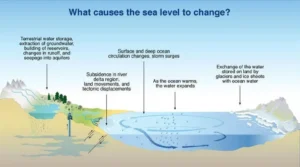
Diagram showing factors that cause sea level changes (eustasy)

EEustasy

Eustasy refers to global changes in sea level caused by variations in the volume of water in the oceans, typically due to the melting or formation of ice sheets and glaciers. Eustatic changes are crucial in understanding past climate change, sedimentary sequences, and the formation of coastal and marine landforms. 

Reference: Miller, K. G., Fairbanks, R. G., & Mountain, G. S. (1987). “Tertiary Oxygen Isotope Synthesis, Sea Level History, and Continental Margin Erosion.” Paleoceanography, 2(1), 1-19. 

Share 

Open entry →

EEustatic Change

Eustatic change refers to global variations in sea level caused by changes in the volume of the world’s oceans, typically driven by the melting or growth of ice sheets and thermal expansion of seawater. Eustatic changes are crucial in understanding past climate changes, sea-level history, and the development of coastal environments. 

Reference: Fairbanks, R. G. (1989). “A 17,000-Year Glacio-Eustatic Sea Level Record: Influence of Glacial Melting Rates on the Younger Dryas Event and Deep-Ocean Circulation.” Nature, 342(6250), 637-642. 

Share 

Open entry →
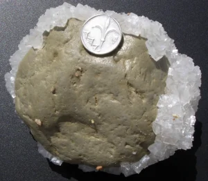
Gray rock with white crystal edges and coin (evaporite)

EEvaporite

Evaporites are sedimentary rocks formed by the precipitation of minerals from evaporating water, typically in closed basins in arid environments. Common evaporite minerals include halite (salt), gypsum, and anhydrite. Evaporites are important in the study of sedimentology, stratigraphy, and the economic extraction of minerals like salt and potash. 

Reference: Warren, J. K. (2006). “Evaporites: Sediments, Resources, and Hydrocarbons.” Springer. 

Share 

Open entry →
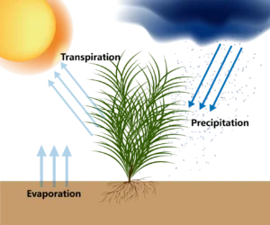
Illustration of plant water cycle processes (evapotranspiration)

EEvapotranspiration

Evapotranspiration is the combined process of evaporation of water from the Earth’s surface and the transpiration of water from plants. It plays a critical role in the hydrological cycle, influencing water availability, soil moisture, and climate. Understanding evapotranspiration is essential for water resource management, agriculture, and climate modeling. 

Reference: Allen, R. G., Pereira, L. S., Raes, D., & Smith, M. (1998). “Crop Evapotranspiration: Guidelines for Computing Crop Water Requirements.” FAO Irrigation and Drainage Paper 56. 

Share 

Open entry →
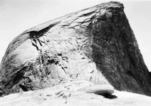
Large rocky cliff with rugged surface (exfoliation)

EExfoliation 

Exfoliation is a physical weathering process where rock layers peel away in sheets or slabs, often due to the release of pressure as overlying materials are removed. This process is common in large, homogeneous rock masses like granite, forming characteristic dome-shaped landforms. Exfoliation is significant in geomorphology and the study of weathering processes. 

Reference: Twidale, C. R. (1982). “Granite Landforms.” Elsevier. 

Share 

Open entry →
Close-up of rock layers and sediment texture (exhalative deposits)

EExhalative Deposits

Exhalative deposits are mineral deposits formed from the precipitation of minerals from hydrothermal fluids that are expelled onto the seafloor, typically associated with volcanic activity. These deposits are important in understanding the formation of massive sulfide deposits and other hydrothermal ore deposits. 

Reference: Franklin, J. M., Gibson, H. L., Jonasson, I. R., & Galley, A. G. (2005). “Volcanogenic Massive Sulfide Deposits.” Economic Geology 100th Anniversary Volume, 523-560. 

Share 

Open entry →
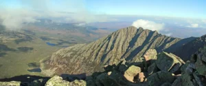
Rocky mountain ridge under blue sky and clouds (exhumation)

EExhumation (Geology)

Exhumation in geology refers to the process by which rocks that were once buried deep within the Earth’s crust are brought to the surface through erosion, tectonic uplift, or other geological processes. This process is crucial for exposing deep-seated rocks, such as those formed under high pressure and temperature conditions, and for understanding the tectonic history of a region. 

Reference: Ring, U., Brandon, M. T., Willett, S. D., & Lister, G. S. (1999). “Exhumation Processes: Normal Faulting, Ductile Flow and Erosion.” Geological Society, London, Special Publications, 154(1), 1-27. 

Share 

Open entry →
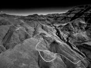
Winding mountain road through rugged terrain (exotic terrane)

EExotic Terrane

An exotic terrane is a fragment of crustal material that has been transported and accreted onto a continent, typically as a result of plate tectonic processes. These terranes often have a different geological history and composition compared to the surrounding crust, providing valuable insights into the processes of continental growth and the tectonic evolution of regions. 

Reference: Coney, P. J., Jones, D. L., & Monger, J. W. H. (1980). “Cordilleran Suspect Terranes.” Nature, 288(5789), 329-333. 

Share 

Open entry →
Large white perthite sample close-up (exsolution)

EExsolution

Exsolution is the process by which a solid solution separates into two or more distinct phases, typically as a result of cooling. This process is common in minerals such as feldspar and pyroxene, where exsolution can lead to the formation of lamellae or other fine-scale structures. Exsolution is important in mineralogy and petrology for understanding the thermal history of rocks and the evolution of mineral compositions. 

Reference: Smith, J. V., & Brown, W. L. (1988). “Feldspar Minerals.” Springer. 

Share 

Open entry →
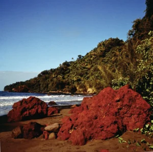
Red rocks on tropical beach shoreline (extrusion)

EExtrusion (Geology)

Extrusion refers to the process by which magma reaches the Earth’s surface and solidifies to form volcanic rocks. The study of extrusion processes is important in understanding volcanic activity, the formation of volcanic landforms, and the petrology of extrusive rocks. 

Reference: Williams, H., Turner, F. J., & Gilbert, C. M. (1982). “Petrography: An Introduction to the Study of Rocks in Thin Sections.” W. H. Freeman. 

Share 

Open entry →

join.me

Geology made clear, in your inbox.

Get clear, visual explainers on rocks, minerals, deep time, and the most fascinating parts of Earth science from Geoscopy.

TArchives: Glossary

A transcurrent fault is a type of strike-slip fault where the motion is predominantly horizontal, with little vertical displacement. These faults are significant in tectonics for understanding lateral movements of the Earth’s crust, the formation of fault zones, and the seismic activity associated with these faults. 

Reference: Sylvester, A. G. (1988). “Strike-Slip Faults.” Geological Society of America Bulletin, 100(11), 1666-1703.

Share 

Open entry →