Opens in a new tab
Geoscopy
Geology, explained.
Generic selectors
Exact matches only
Search in title
Search in content
Post Type Selectors

Rocks

An atlas of rocks and minerals: each one a record of the conditions that made it.

Glossary

Filter - Radio

Sort by

E

Extrusive Rock

Extrusive rock, or volcanic rock, forms from magma that erupts onto the.. more →
F

Facies

A facies refers to a body of rock with specific characteristics that.. more →
F

Facies Model

A facies model is a conceptual framework used to interpret and predict.. more →
F

Fault

A fault is a fracture or zone of fractures in the Earth's.. more →
F

Fault Bend Fold

A fault bend fold is a type of fold that forms as.. more →
F

Fault Block

A fault block is a large section of the Earth's crust that.. more →
F

Fault Breccia

Fault breccia is a type of rock formed within a fault zone,.. more →
F

Fault Gouge

Fault gouge is a fine-grained, unconsolidated material found within a fault zone,.. more →
F

Fault Plane

A fault plane is the flat or gently curved surface along which.. more →
F

Fault Trench

A fault trench is an excavation made across a fault to study.. more →
F

Felsic Rock

Felsic rock is a type of igneous rock that is rich in.. more →
F

Fissile

Fissile refers to a rock's ability to be easily split along closely.. more →
F

Fissure Eruption

A fissure eruption occurs when magma rises through cracks or fissures in.. more →
F

Fjord

A fjord is a long, narrow, deep inlet of the sea between.. more →
F

Flint

Flint is a hard, sedimentary form of the mineral quartz, usually found.. more →
F

Flocculation

Flocculation is the process by which fine particles in suspension aggregate to.. more →
F

Flood (Geological)

In geology, a flood refers to the inundation of land by water,.. more →
F

Flood Basalt

Flood basalts are vast, flat-lying lava flows that cover large areas of.. more →
F

Flood Frequency Analysis

Flood frequency analysis is a statistical method used to estimate the probability.. more →
F

Floodplain

A floodplain is the flat, low-lying area adjacent to a river that.. more →
F

Flow Banding

Flow banding is a textural feature observed in volcanic rocks, characterized by.. more →
F

Flow Regime

Flow regime refers to the pattern of flow behavior in a fluid.. more →
F

Fluid Flow (Geology) 

Fluid flow in geology refers to the movement of fluids, such as.. more →
F

Fluorescence (Geology)

Fluorescence in geology refers to the emission of visible light by minerals.. more →
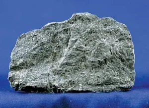
Sample of basalt rock on blue background (extrusive rock)

EExtrusive Rock

Extrusive rock, or volcanic rock, forms from magma that erupts onto the Earth’s surface and cools rapidly, resulting in fine-grained textures. Examples include basalt, andesite, and rhyolite. Extrusive rocks are important in the study of volcanology, plate tectonics, and the interpretation of past volcanic activity. 

Reference: Winter, J. D. (2010). “Principles of Igneous and Metamorphic Petrology.” Pearson. 
Share 

Open entry →
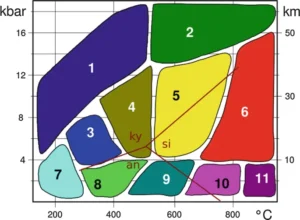
Metamorphic facies diagram showing pressure-temperature zones

FFacies

A facies refers to a body of rock with specific characteristics that distinguish it from adjacent rock units, typically reflecting particular conditions of deposition, such as environment, energy level, and sediment supply. Facies analysis is crucial in sedimentology, stratigraphy, and paleoenvironmental reconstruction, helping geologists interpret past depositional environments and changes over time. 

Reference: Walker, R. G., & James, N. P. (1992). Facies Models: Response to Sea Level Change. Geological Association of Canada. 

Share 

Open entry →
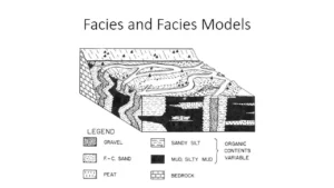
Geological facies and facies models diagram

FFacies Model

A facies model is a conceptual framework used to interpret and predict the distribution of sedimentary facies within a depositional environment. These models help geologists understand the processes that control sediment deposition and the spatial relationships between different sedimentary units. Facies models are crucial in sedimentology, stratigraphy, and petroleum geology. 

Reference: Walker, R. G., & James, N. P. (1992). Facies Models: Response to Sea Level Change. Geological Association of Canada.

Share 

Open entry →
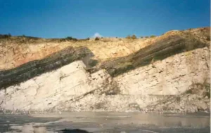
Tilted sedimentary rock layers along a cliff (fault)

FFault

A fault is a fracture or zone of fractures in the Earth’s crust along which movement has occurred. Faults can range in size from a few centimeters to thousands of kilometers and are categorized into types such as normal, reverse, and strike-slip based on the direction of movement. Faults are significant in understanding tectonic processes, earthquake generation, and the structural evolution of the Earth’s crust. 

Reference: Twiss, R. J., & Moores, E. M. (2007). Structural Geology. W. H. Freeman. 

Share 

Open entry →
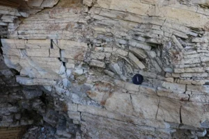
Folded sedimentary rock layers with camera lens cap (Fault Bend Fold)

FFault Bend Fold

A fault bend fold is a type of fold that forms as a layer of rock is deformed by movement along a fault with a bend or step in its trajectory. These folds are important in structural geology, providing insights into the deformation of the Earth’s crust and the mechanics of fault-related structures. 

Reference: Suppe, J. (1983). Geometry and Kinematics of Fault-Bend Folding. American Journal of Science. 

Share 

Open entry →
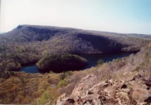
Scenic view of a forested mountain and lake (fault block)

FFault Block

A fault block is a large section of the Earth’s crust that has been displaced and rotated along a fault or set of faults. These blocks can be uplifted or downthrown, leading to the formation of mountain ranges, basins, and other large-scale geological features. Fault blocks are significant in tectonics, structural geology, and the study of crustal deformation. 

Reference: Davis, G. H., & Reynolds, S. J. (1996). Structural Geology of Rocks and Regions. John Wiley & Sons. 

Share 

Open entry →
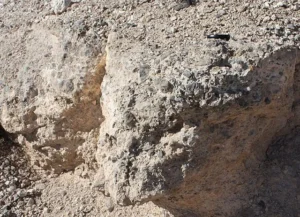
Close-up of rough textured rocky surface (fault breccia)

FFault Breccia

Fault breccia is a type of rock formed within a fault zone, composed of angular fragments of rock that have been crushed and broken by fault movement. These fragments are typically cemented together by finer materials. Fault breccia is significant in the study of fault mechanics, rock deformation, and the interpretation of past seismic activity. 

Reference: Sibson, R. H. (1977). Fault Rocks and Fault Mechanisms. Journal of the Geological Society. 

Share 

Open entry →
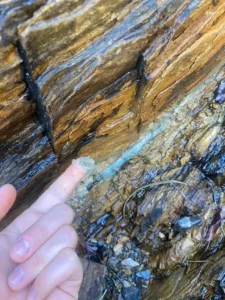
Finger pointing at mineral vein in rock (fault gouge)

FFault Gouge

Fault gouge is a fine-grained, unconsolidated material found within a fault zone, formed by the grinding and crushing of rocks during fault movement. It can affect the mechanical properties of faults, including frictional resistance and permeability. Fault gouge is important in the study of fault mechanics, earthquake behavior, and the evolution of fault zones. 

Reference: Chester, F. M., & Logan, J. M. (1986). Implications for Mechanical Properties of Brittle Faults from Observations of the Punchbowl Fault Zone, California. Pure and Applied Geophysics. 

Share 

Open entry →

FFault Plane

A fault plane is the flat or gently curved surface along which there is slip during an earthquake or faulting event. The orientation and characteristics of the fault plane are critical in understanding the nature of the fault, the movement of the Earth’s crust, and the generation of earthquakes. 

Reference: Scholz, C. H. (2002). The Mechanics of Earthquakes and Faulting. Cambridge University Press. 

Share 

Open entry →
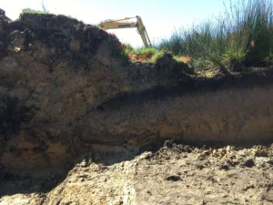
Excavated soil layers with visible sediment strata (fault trench)

FFault Trench

A fault trench is an excavation made across a fault to study its structure, history, and movement. Trenching is commonly used in paleoseismology to identify past earthquake events and assess seismic hazards. Fault trenches reveal the stratigraphy and deformation patterns associated with faulting. 

Reference: McCalpin, J. P. (2009). Paleoseismology. Elsevier. 

Share 

Open entry →
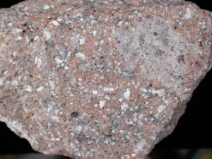
Close-up of pink granite rock texture (felsic rock)

FFelsic Rock

Felsic rock is a type of igneous rock that is rich in silica and light-colored minerals, such as quartz, feldspar, and muscovite. Examples include granite and rhyolite. Felsic rocks are important in understanding the evolution of continental crust and the processes of magmatic differentiation. 

Reference: Best, M. G. (2003). Igneous and Metamorphic Petrology. Wiley-Blackwell. 

Share 

Open entry →
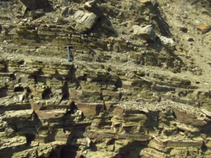
Layered sedimentary rock outcrop with rock hammer (fissile)

FFissile

Fissile refers to a rock’s ability to be easily split along closely spaced planes, typically due to the alignment of platy minerals or the presence of bedding or cleavage. Fissile rocks, such as shale, are important in understanding sedimentary structures, stratigraphy, and the mechanical behavior of rocks under stress. 

Reference: Tucker, M. E. (2003). Sedimentary Rocks in the Field: A Practical Guide. Wiley-Blackwell.

Share 

Open entry →
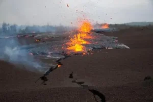
Lava erupting from a volcanic fissure

FFissure Eruption

A fissure eruption occurs when magma rises through cracks or fissures in the Earth’s crust, rather than through a central vent, leading to the formation of long, linear volcanic features. These eruptions can produce extensive lava flows and are often associated with rift zones or large igneous provinces. Fissure eruptions are significant in understanding volcanic processes and the formation of basaltic plateaus. 

Reference: Thordarson, T., & Self, S. (1993). The Laki (Skaftár Fires) and Grímsvötn Eruptions in 1783–1785. Bulletin of Volcanology. 

Share 

Open entry →
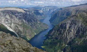
Scenic fjord surrounded by steep rocky mountains

FFjord

A fjord is a long, narrow, deep inlet of the sea between high cliffs or steep slopes, created by the submergence of a glaciated valley. Fjords are significant features in the study of glacial geomorphology, providing insights into past glacial activity, sea level changes, and the interaction between glaciers and coastal environments. 

Reference: Syvitski, J. P. M., & Shaw, J. (1995). Sedimentology and Geomorphology of Fjords. Elsevier. 

Share 

Open entry →
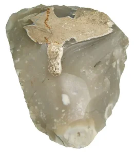
Raw gray flint mineral rock sample

FFlint

Flint is a hard, sedimentary form of the mineral quartz, usually found as nodules in chalk or limestone. Flint has been historically important as a tool-making material, particularly in the Stone Age. Its study provides insights into prehistoric technology, sedimentary environments, and the processes of diagenesis. 

Reference: Pettijohn, F. J. (1975). Sedimentary Rocks. Harper & Row. 

Share 

Open entry →
Four beakers showing water sedimentation experiment (flocculation)

FFlocculation

Flocculation is the process by which fine particles in suspension aggregate to form larger particles or flocs, typically due to the action of chemical agents or changes in water chemistry. This process is important in sedimentation, water treatment, and the study of fine-grained sediment transport in rivers, lakes, and oceans. 

Reference: Van Olphen, H. (1977). An Introduction to Clay Colloid Chemistry. Wiley-Interscience. 

Share 

Open entry →
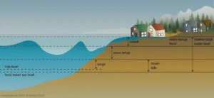
Diagram showing coastal water levels and storm surge (flood)

FFlood (Geological)

In geology, a flood refers to the inundation of land by water, often resulting from excessive rainfall, snowmelt, or the breaching of natural or artificial barriers. Geological floods can lead to the deposition of sediments, the formation of new landforms, and the alteration of landscapes. Understanding floods is essential in geomorphology, sedimentology, and environmental management. 

Reference: Baker, V. R. (1987). Paleoflood Hydrology and Extraordinary Flood Events. Journal of Hydrology.

Share 

Open entry →
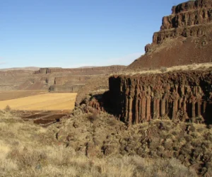
Basalt cliffs overlooking rocky desert valley (flood basalt)

FFlood Basalt

Flood basalts are vast, flat-lying lava flows that cover large areas of the Earth’s surface, formed from highly fluid basaltic magma during periods of intense volcanic activity. These flows are significant in the study of volcanic processes, mass extinctions, and large igneous provinces, as they are associated with some of the most extensive and voluminous eruptions in Earth’s history. 

Reference: Coffin, M. F., & Eldholm, O. (1994). Large Igneous Provinces: Crustal Structure, Dimensions, and External Consequences. Reviews of Geophysics.

Share 

Open entry →
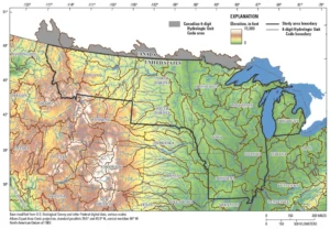
Elevation and hydrologic map of central United States (Flood Frequency Analysis)

FFlood Frequency Analysis

Flood frequency analysis is a statistical method used to estimate the probability of floods of different magnitudes occurring in a given area over a specific period. This analysis is vital for flood risk management, infrastructure design, and understanding the long-term behavior of river systems. 

Reference: Stedinger, J. R., Vogel, R. M., & Foufoula-Georgiou, E. (1993). Frequency Analysis of Extreme Events. Handbook of Hydrology.

Share 

Open entry →
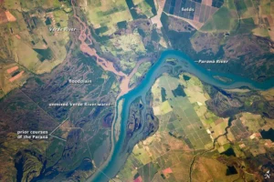
Aerial view of Paraná and Verde Rivers confluence (floodplain)

FFloodplain

A floodplain is the flat, low-lying area adjacent to a river that is subject to periodic flooding. Floodplains are formed by the deposition of sediments during floods and are characterized by fertile soils and dynamic environments. They are important in hydrology, agriculture, and the study of river dynamics and sedimentary processes. 

Reference: Leopold, L. B., Wolman, M. G., & Miller, J. P. (1964). Fluvial Processes in Geomorphology. Dover Publications.

Share 

Open entry →
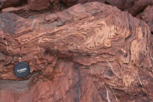
Close-up of folded red layered rock formation (flow banding)

FFlow Banding

Flow banding is a textural feature observed in volcanic rocks, characterized by the alignment of minerals and vesicles in response to the flow of magma. This banding reflects the movement and deformation of the molten material and is important in understanding the dynamics of volcanic eruptions and the cooling history of lava flows. 

Reference: McPhie, J., Doyle, M., & Allen, R. (1993). Volcanic Textures: A Guide to the Interpretation of Textures in Volcanic Rocks. University of Tasmania Centre for Ore Deposit and Exploration Studies. 

Share 

Open entry →
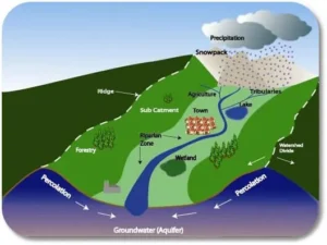
Watershed diagram showing water flow and groundwater process (flow regime)

FFlow Regime

Flow regime refers to the pattern of flow behavior in a fluid system, influenced by factors such as velocity, viscosity, and channel characteristics. In geology, flow regimes are studied in the context of sediment transport, river dynamics, and volcanic eruptions to understand the movement of fluids and the resulting landforms. 

Reference: Middleton, G. V., & Southard, J. B. (1984). Mechanics of Sediment Movement. SEPM Society for Sedimentary Geology. 

Share 

Open entry →
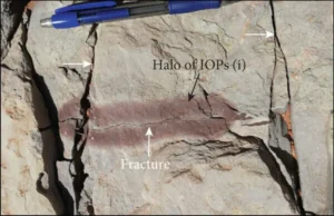
Rock fracture with labeled halo and pen for scale (fluid flow (geology))

FFluid Flow (Geology) 

Fluid flow in geology refers to the movement of fluids, such as water, oil, or gas, through the pores and fractures of rocks. Understanding fluid flow is essential in hydrogeology, petroleum geology, and environmental geology for managing water resources, predicting the movement of contaminants, and optimizing oil and gas extraction. 

Reference: Bear, J. (1972). Dynamics of Fluids in Porous Media. Dover Publications. 

Share 

Open entry →
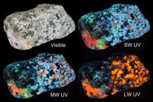
Rock fluorescing under different ultraviolet light wavelengths (fluorescence (Geology))

FFluorescence (Geology)

Fluorescence in geology refers to the emission of visible light by minerals when they are exposed to ultraviolet (UV) light. Certain minerals, such as fluorite and calcite, exhibit fluorescence due to impurities or structural defects. Fluorescence is used in mineral identification and in studying the properties of rocks and minerals. 

Reference: Robbins, M. (1994). Fluorescence: Gems and Minerals Under Ultraviolet Light. Geoscience Press. 

Share 

Open entry →

join.me

Geology made clear, in your inbox.

Get clear, visual explainers on rocks, minerals, deep time, and the most fascinating parts of Earth science from Geoscopy.
Diagram showing magma chamber and thermal, contact metamorphism.

TArchives: Glossary

Thermal metamorphism, also known as contact metamorphism, occurs when rocks are heated by the intrusion of hot magma without significant deformation. This process is significant in petrology for understanding the effects of heat on mineral stability, the formation of metamorphic rocks, and the thermal history of magmatic intrusions. 

Reference: Philpotts, A. R., & Ague, J. J. (2009). “Principles of Igneous and Metamorphic Petrology.” Cambridge University Press.

Share 

Open entry →