Opens in a new tab
Geoscopy
Geology, explained.
Generic selectors
Exact matches only
Search in title
Search in content
Post Type Selectors

Rocks

An atlas of rocks and minerals: each one a record of the conditions that made it.

Glossary

Filter - Radio

Sort by

D

Desert Pavement

Desert pavement is a natural surface covering of closely packed, interlocking angular.. more →
D

Desert Varnish

Desert varnish is a dark, glossy coating found on the surface of.. more →
D

Desertification

Desertification is the process by which fertile land becomes desert, typically as.. more →
D

Detachment Fault

A detachment fault is a low-angle normal fault that typically separates highly.. more →
D

Detritus

Detritus refers to loose fragments of rock and mineral material that have.. more →
D

Diatomite

Diatomite is a soft, siliceous sedimentary rock composed mainly of the fossilized.. more →
D

Diatreme

A diatreme is a volcanic pipe or vent formed by a gas-charged.. more →
D

Differential Erosion

Differential erosion occurs when different types of rocks or sediments erode at.. more →
D

Dike (Geology)

A dike is a sheet-like intrusion of igneous rock that cuts through.. more →
D

Diluvial

The term "diluvial" refers to geological processes or deposits associated with the.. more →
D

Drag Fold

A drag fold is a small-scale fold that forms adjacent to a.. more →
D

Drainage Basin

A drainage basin, also known as a watershed or catchment area, is.. more →
D

Drainage Divide

A drainage divide is a geographical boundary separating neighboring drainage basins, where.. more →
D

Drift (Glacial)

Glacial drift refers to all the materials, including boulders, sand, clay, and.. more →
D

Dripstone

Dripstone refers to calcite deposits formed by the dripping of water in.. more →
D

Dropstone

A dropstone is an isolated fragment of rock that has been transported.. more →
D

Drumlin

A drumlin is an elongated hill formed by glacial action, composed of.. more →
E

Earthflow 

An earthflow is a type of mass wasting where a mass of.. more →
E

Earthquake

An earthquake is the sudden release of energy in the Earth's crust.. more →
E

Eddy Current

An eddy current is a circular movement of fluid, such as air.. more →
E

Elastic Rebound Theory

Elastic rebound theory explains how energy is stored and released during an.. more →
E

Elasticity (Geology)

Elasticity in geology refers to the property of rocks to deform under.. more →
E

En Echelon

"En echelon" refers to a pattern of geological features, such as faults,.. more →
E

End Moraine

An end moraine is a ridge of debris (till) deposited at the.. more →
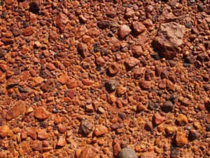
Close-up of reddish gravel and small rocks (desert pavement)

DDesert Pavement

Desert pavement is a natural surface covering of closely packed, interlocking angular or rounded rock fragments found in arid regions. It forms through the gradual removal of fine particles by wind and water, leaving behind a layer of coarser material. Desert pavements play a critical role in protecting underlying soils from erosion and are important indicators of long-term climatic stability in deserts. 

Reference: McFadden, L. D., Wells, S. G., & Dohrenwend, J. C. (1987). “Influences of Quaternary Climatic Changes on Processes of Soil Development on Desert Loess Deposits of the Cima Volcanic Field, California.” Catena, 14(4), 361-389. 
Share 

Open entry →
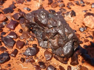
Dark meteorite rock on reddish desert ground (desert varnish)

DDesert Varnish

Desert varnish is a dark, glossy coating found on the surface of rocks in arid environments, composed of clay minerals, oxides of manganese and iron, and organic material. It forms over long periods of time through the action of wind and water, and its study can provide insights into past environmental conditions and the history of the landscape. 

Reference: Dorn, R. I. (1998). “Rock Coatings.” Elsevier. 

Share 

Open entry →
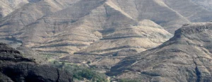
Dry mountain landscape with rugged hills (desertification)

DDesertification

Desertification is the process by which fertile land becomes desert, typically as a result of drought, deforestation, or inappropriate agricultural practices. It leads to the loss of productive land and biodiversity and is a major environmental issue in arid and semi-arid regions. Desertification is significant in environmental science, land management, and global sustainability efforts. 

Reference: UNCCD (1994). “United Nations Convention to Combat Desertification.” United Nations. 

Share 

Open entry →
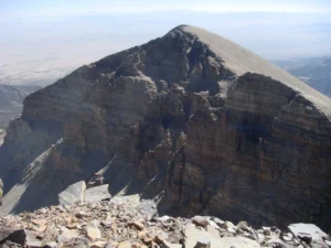
Rocky mountain peak under clear sky (detachment fault)

DDetachment Fault

A detachment fault is a low-angle normal fault that typically separates highly deformed rocks in its hanging wall from less deformed rocks in its footwall. These faults are often associated with large-scale extensional tectonics and can be linked to the formation of metamorphic core complexes. Detachment faults are significant in understanding the tectonic evolution of extensional terrains. 

Reference: Wernicke, B. (1981). “Low-Angle Normal Faults in the Basin and Range Province: Nappe Tectonics in an Extending Orogen.” Nature, 291(5810), 645-648. 

Share 

Open entry →
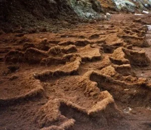
Eroded brown soil with uneven textured surface (detritus)

DDetritus

Detritus refers to loose fragments of rock and mineral material that have been broken down by weathering and erosion. These fragments can range in size from boulders to clay particles and are typically transported by wind, water, or ice before being deposited as sediment. Detritus is a key component of sedimentary processes and plays a crucial role in the formation of sedimentary rocks. 

Reference: Pettijohn, F. J., Potter, P. E., & Siever, R. (1987). “Sand and Sandstone.” Springer.

Share 

Open entry →
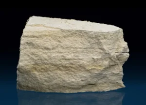
Close-up of a limestone rock sample (diatomite)

DDiatomite

Diatomite is a soft, siliceous sedimentary rock composed mainly of the fossilized remains of diatoms, a type of microscopic algae. It is highly porous and has a wide range of industrial applications, including filtration, insulation, and as a lightweight aggregate. Diatomite is important in paleoenvironmental studies, as it provides a record of past climatic and ecological conditions. 

Reference: Round, F. E., Crawford, R. M., & Mann, D. G. (1990). “The Diatoms: Biology and Morphology of the Genera.” Cambridge University Press. 

Share 

Open entry →
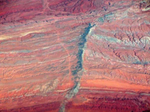
Aerial view of rugged red desert landscape (diatreme)

DDiatreme

A diatreme is a volcanic pipe or vent formed by a gas-charged explosive eruption that blasts through the Earth’s crust, creating a steep-sided, often funnel-shaped, breccia-filled conduit. Diatremes are commonly associated with kimberlite pipes, which can contain diamonds. They are significant in the study of volcanology and economic geology, particularly in diamond exploration. 

Reference: Kjarsgaard, B. A., & Levinson, A. A. (2002). “Diamonds in Canada.” Geoscience Canada, 29(2), 71-84. 

Share 

Open entry →
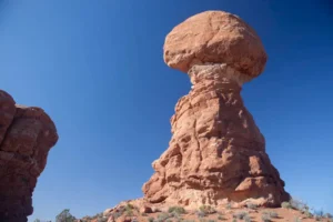
Mushroom-shaped red rock formation under blue sky (differential erosion)

DDifferential Erosion

Differential erosion occurs when different types of rocks or sediments erode at different rates due to variations in hardness, composition, or structure. This process can lead to the formation of distinct landforms, such as mesas, buttes, and valleys. Differential erosion is significant in the study of geomorphology and landscape evolution. 

Reference: Twidale, C. R. (1982). “Granite Landforms.” Elsevier. 

Share 

Open entry →
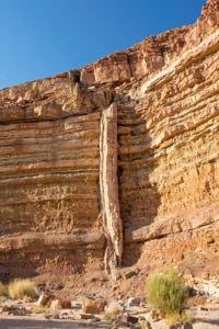
Vertical rock formation in desert canyon (dike)

DDike (Geology)

A dike is a sheet-like intrusion of igneous rock that cuts through pre-existing rock layers, typically formed when magma intrudes into cracks and solidifies. Dikes can vary in width and length, and they often form in regions of tectonic activity. They are important for understanding the plumbing systems of volcanoes, the direction of past tectonic stresses, and the emplacement of magma within the Earth’s crust. 

Reference: Pollard, D. D., & Johnson, A. M. (1973). “Mechanics of Growth of Some Laccolithic Intrusions in the Henry Mountains, Utah, II: Bending and Failure of Overburden Layers and Sill Formation.” Tectonophysics, 18(3-4), 311-354.

Share 

Open entry →
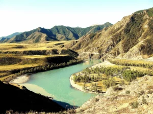
Turquoise river flowing through mountain valley landscape (diluvial)

DDiluvial

The term “diluvial” refers to geological processes or deposits associated with the action of large-scale floods or the runoff from melting glaciers, particularly those related to past glacial periods. Diluvial deposits can include large-scale gravel and sand beds, indicating ancient flood events. Understanding diluvial processes is important in reconstructing past climate events and landscape changes. 

Reference: Baker, V. R. (1978). “The Spokane Flood Controversy and the Martian Outflow Channels.” Science, 202(4374), 1249-1256. 

Share 

Open entry →
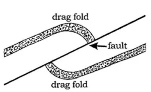
Diagram showing drag fold and fault in rock layers

DDrag Fold

A drag fold is a small-scale fold that forms adjacent to a fault, where the movement along the fault causes the rock layers to bend. Drag folds are typically asymmetrical and provide valuable insights into the direction and sense of fault movement. They are important structures in structural geology for interpreting the kinematics of fault zones. 

Reference: Ramsay, J. G., & Huber, M. I. (1987). “The Techniques of Modern Structural Geology, Volume 2: Folds and Fractures.” Academic Press.

Share 

Open entry →
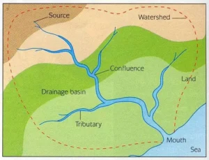
Diagram showing river drainage basin and watershed

DDrainage Basin

A drainage basin, also known as a watershed or catchment area, is the geographic area that contributes water to a particular stream, river, or lake. It is defined by topographic divides, where all precipitation within the basin eventually drains into a common outlet. Drainage basins are critical in hydrology, water resource management, and environmental studies, as they influence water flow, sediment transport, and ecosystem health. 

Reference: Chorley, R. J., Schumm, S. A., & Sugden, D. E. (1984). “Geomorphology.” Methuen.

Share 

Open entry →
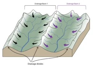
Diagram showing two drainage basins and divides (drainage divide)

DDrainage Divide

A drainage divide is a geographical boundary separating neighboring drainage basins, where precipitation on either side of the divide flows into different bodies of water. Drainage divides can range from sharp ridges, such as mountain crests, to subtle topographic boundaries. They are crucial in hydrology, determining the direction of water flow and influencing river systems. 

Reference: Twidale, C. R. (2004). “River Patterns and Their Meaning.” Earth-Science Reviews, 67(3-4), 159-218.

Share 

Open entry →
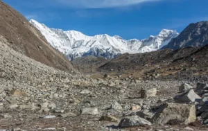
Rocky valley with snow-covered mountain peaks (glacial drift)

DDrift (Glacial)

Glacial drift refers to all the materials, including boulders, sand, clay, and silt, deposited directly or indirectly by glaciers. It includes both till, which is deposited directly by the ice, and outwash, which is deposited by meltwater. Glacial drift is important for understanding past glacial movements, the history of glaciation, and the shaping of landscapes in glaciated regions. 

Reference: Easterbrook, D. J. (1993). “Surface Processes and Landforms.” Prentice Hall. 

Share 

Open entry →
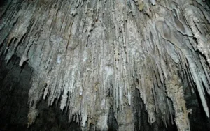
Stalactites hanging from cave ceiling (dripstone)

DDripstone

Dripstone refers to calcite deposits formed by the dripping of water in caves, commonly seen as stalactites hanging from the ceiling and stalagmites growing from the floor. Dripstones are formed from the precipitation of calcium carbonate as water loses carbon dioxide. They are important in the study of speleology, paleoclimate, and karst environments. 

Reference: Ford, D. C., & Williams, P. (2007). “Karst Hydrogeology and Geomorphology.” Wiley. 

Share 

Open entry →
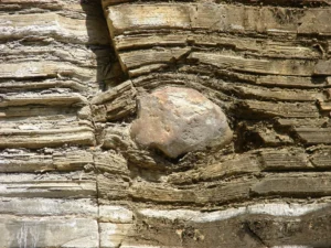
Rock layers with embedded stone formation (dropstone)

DDropstone

A dropstone is an isolated fragment of rock that has been transported by floating ice, such as an iceberg, and deposited in marine or lacustrine sediments. The presence of dropstones in sedimentary layers is an indicator of glacial activity and is important in paleoclimatology and the study of ancient ice ages. 

Reference: Andrews, J. T. (2000). “Icebergs and the Greenland Ice Sheet: The Evidence from Radiocarbon Dating.” Quaternary Science Reviews, 19(10), 983-1014. 

Share 

Open entry →
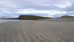
Sandy beach with grassy hill and cloudy sky (drumlin)

DDrumlin

A drumlin is an elongated hill formed by glacial action, composed of till, and shaped like an inverted spoon or half-buried egg, with its long axis parallel to the direction of ice movement. Drumlins are often found in clusters called drumlin fields. Their study provides valuable insights into glacial dynamics, ice flow directions, and the behavior of past ice sheets. 

Reference: Benn, D. I., & Evans, D. J. A. (2010). “Glaciers and Glaciation.” Routledge. 

Share 

Open entry →
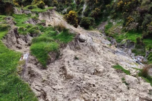
Soil erosion on hillside with small stream (earthflow)

EEarthflow 

An earthflow is a type of mass wasting where a mass of earth or fine-grained soil moves downslope under the influence of gravity, often triggered by saturation from rainfall. Earthflows can vary in speed from slow to rapid and are significant in shaping landscapes, especially in hilly or mountainous regions. They are also important in understanding soil stability and landslide hazards. 

Reference: Varnes, D. J. (1978). “Slope Movement Types and Processes.” Landslides: Analysis and Control, Transportation Research Board Special Report 176. 

Share 

Open entry →
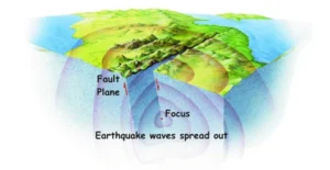
Earthquake fault diagram showing focus and wave spread

EEarthquake

An earthquake is the sudden release of energy in the Earth’s crust that creates seismic waves, often due to the movement along a fault line. Earthquakes can cause significant ground shaking, leading to structural damage, landslides, tsunamis, and other hazards. Understanding earthquakes is essential in seismology, disaster preparedness, and the study of plate tectonics. 

Reference: Scholz, C. H. (2002). “The Mechanics of Earthquakes and Faulting.” Cambridge University Press.

Share 

Open entry →
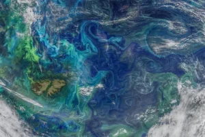
Satellite view of colorful ocean phytoplankton swirls (eddy current)

EEddy Current

An eddy current is a circular movement of fluid, such as air or water, that flows in a direction contrary to the main current. Eddy currents are common in rivers, oceans, and the atmosphere, and they play a significant role in the transport of sediments, nutrients, and pollutants. Understanding eddy currents is important in oceanography, atmospheric science, and sedimentology. 

Reference: Mann, J., & Ott, S. (1994). “Horizontal Coherence of Eddies in the Surface Layer.” Boundary-Layer Meteorology, 70(1-2), 183-205. 

Share 

Open entry →
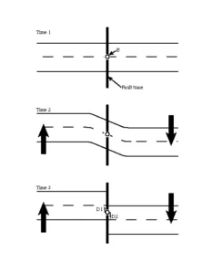
Normal fault diagram showing rock layer displacement (Elastic Rebound Theory)

EElastic Rebound Theory

Elastic rebound theory explains how energy is stored and released during an earthquake. According to this theory, stress builds up in the Earth’s crust as tectonic plates move, causing deformation. When the stress exceeds the strength of the rocks, they rupture, and the stored energy is released as seismic waves. This theory is fundamental in understanding the mechanics of earthquakes. 

Reference: Reid, H. F. (1910). “The California Earthquake of April 18, 1906: Report of the State Earthquake Investigation Commission.” Carnegie Institution of Washington. 

Share 

Open entry →
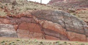
Layered red and gray rock formation in desert (elasticity)

EElasticity (Geology)

Elasticity in geology refers to the property of rocks to deform under stress and return to their original shape when the stress is removed, as long as the stress does not exceed the material’s elastic limit. This concept is fundamental in understanding the behavior of rocks under tectonic forces, the propagation of seismic waves, and the mechanics of earthquakes. 

Reference: Jaeger, J. C., Cook, N. G. W., & Zimmerman, R. W. (2007). “Fundamentals of Rock Mechanics.” Wiley-Blackwell.

Share 

Open entry →
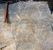
Rock surface with geological hammer for scale (en echelon)

EEn Echelon

“En echelon” refers to a pattern of geological features, such as faults, folds, or veins, that are arranged in a staggered or overlapping configuration. This pattern is often indicative of shear stress and is important in structural geology for understanding the deformation of the Earth’s crust and the orientation of stress fields. 

Reference: Cowan, D. S. (1999). “Structural Styles in Mylonitic Rocks of the Mecca Hills, Southern California.” Journal of Structural Geology, 21(9), 1285-1302. 

Share 

Open entry →
Snow-covered mountains beside vast glacier valley (end moraine)

EEnd Moraine

An end moraine is a ridge of debris (till) deposited at the edge or terminus of a glacier. It forms when the glacier is stationary for a period, allowing the accumulation of sediments carried by the glacier. End moraines are key indicators of the past extent and dynamics of glaciers, and they provide valuable information about glacial advance and retreat cycles. 

Reference: Benn, D. I., & Evans, D. J. A. (2010). “Glaciers and Glaciation.” Routledge.

Share 

Open entry →

join.me

Geology made clear, in your inbox.

Get clear, visual explainers on rocks, minerals, deep time, and the most fascinating parts of Earth science from Geoscopy.
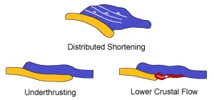
Tectonic deformation processes: shortening, underthrusting, crustal flow diagram

UArchives: Glossary

Underthrusting occurs when one tectonic plate is forced beneath another, a process often associated with subduction zones. This geological phenomenon is significant for understanding plate tectonics, the formation of mountain ranges, and seismic activity related to convergent plate boundaries. 

Reference: Suppe, J. (1985). “Principles of Structural Geology.” Prentice Hall.

Share 

Open entry →