
Introduction
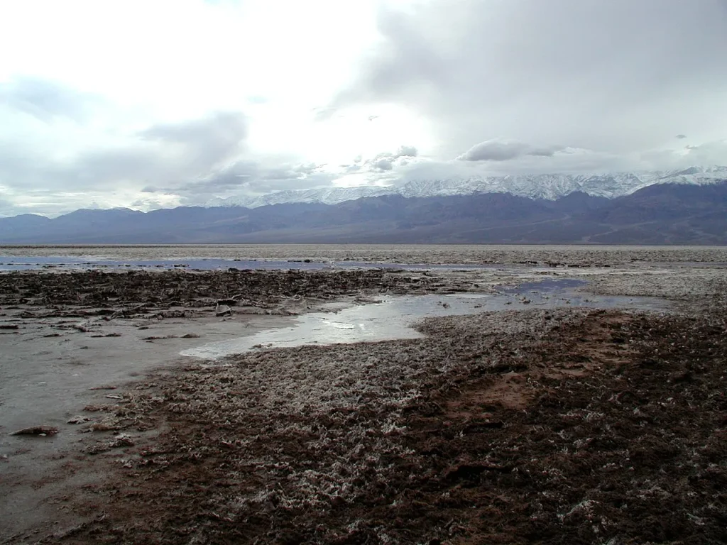
On 10 July 1913, the caretaker at Greenland Ranch, a lonely outpost on the floor of Death Valley in California, walked out to a wooden weather shelter and read the thermometer. It said 134 degrees Fahrenheit. That is 56.7°C, and it remains the highest air temperature ever officially recorded on Earth, though meteorologists have argued about the reading ever since. In dry desert air a healthy adult with shade and water can survive that for a while. Without either, it kills. But it was an afternoon. Night came, the desert radiated its warmth into a clear sky, and by dawn Death Valley was merely hot.
Now imagine a world where that afternoon never ends. The ground between the tropics bakes at 40 to 50°C for months at a stretch. The coasts are wrapped in air so humid that sweat cannot evaporate. The nearest ocean, the only thing capable of cooling the interior, lies thousands of kilometres away across a desert the size of a hemisphere. That is Pangaea Ultima. A study published in Nature Geoscience on 25 September 2023 argues it may be the world that ends the reign of the mammals, roughly 250 million years from now.
The paper was led by Alexander Farnsworth, a climate modeller at the University of Bristol. What is new is not the map but the machinery: an ocean–atmosphere general circulation model run on a future supercontinent and coupled to a long-term carbon cycle model, so that the CO₂ level is calculated rather than assumed. Fuse today’s continents into one tropical landmass, add a Sun that is a little brighter and an atmosphere with a little more carbon dioxide, and the warm-blooded animals that have dominated the land for the last 66 million years run out of places to live. In the worst case, only about 8% of the land surface stays survivable for them. Today, the figure is around 66%.
These are projections, built on physics that is well understood and geography that is not. That distinction runs through everything below.
What Is Pangaea Ultima? The Next Supercontinent, Explained
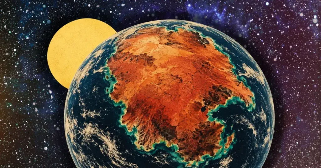
Pangaea Ultima is the name geologists use for a hypothetical future supercontinent that forms when Earth’s present-day continents drift back together, roughly 250 million years from now. The idea belongs to Christopher Scotese, an American geologist who has spent his career reconstructing ancient world maps through the PALEOMAP Project. The origin is more casual than the idea’s afterlife suggests. In 1982, as a graduate student, Scotese was commissioned by Discover magazine to draw a set of maps showing where the plates were headed. What he produced was a future Earth in which the Atlantic closes, the Americas swing back toward Africa and Europe, and the continents pile into a single mass across the tropics, a rerun of Pangaea, the supercontinent of the dinosaurs’ early days. He called it Pangaea Ultima, “the last Pangaea”.
The name turned out to be a mistake, and Scotese was the first to say so. “Ultima” implied a final act, but the supercontinent cycle does not end; Earth will keep assembling and dismantling continents for as long as its interior holds enough heat to drive plate tectonics. So he renamed it Pangaea Proxima, “the next Pangaea”. Both names describe the same object. The 2023 climate study used the old name, so “Pangaea Ultima” dominates the headlines; the paleogeographers who draw the maps prefer Pangaea Proxima. You will also see Neopangaea and Pangaea II. Treat them all as synonyms.
Scotese’s scenario runs in stages. Within about 50 million years, Africa finishes its slow northward drive into Europe, closing the Mediterranean and throwing up a range of mountains from Iberia to the Caspian. Australia pushes into South-East Asia. The Atlantic, meanwhile, keeps widening, but only for a while. In Scotese’s model, the small subduction zones that already chew at the Atlantic’s margins in the Caribbean and the Scotia Sea grow, spread and eventually begin to consume the Atlantic floor faster than the Mid-Atlantic Ridge can make it. Somewhere beyond 100 million years from now, the Atlantic reverses. By 250 million years, the Americas have rejoined Afro-Eurasia, Antarctica has drifted north to help plug the gap, and a single supercontinent sits astride the equator, wrapped by one global ocean. A remnant of the Indian Ocean survives as an inland sea in the middle.
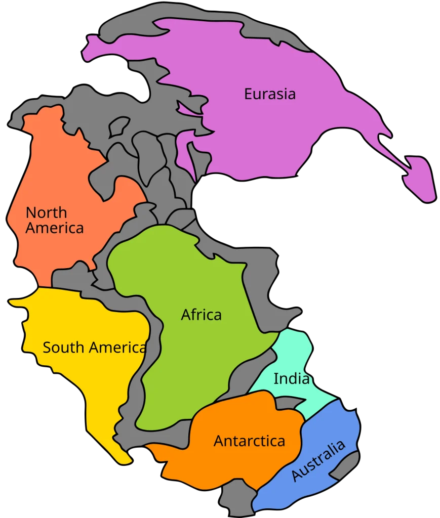
Plate motions can be projected forward with some confidence for tens of millions of years, because we can measure them today with satellite positioning to the millimetre. Beyond that, the forecast depends on assumptions about how the mantle will behave, where new subduction zones will form and which ocean will die first. Scotese himself has described his far-future maps as “pretty much fantasy” at the outset: a starting point for thinking about how the machinery works. That honesty matters, because the climate study inherits the map’s uncertainties along with its geometry.
The Supercontinent Cycle: Earth’s Slowest Rhythm
To see why anyone would take a 250-million-year map seriously, you need the supercontinent cycle, the pattern of assembly and break-up that has shaped Earth’s surface for at least two billion years.
Continents ride on tectonic plates, rigid slabs of the outer Earth that glide over the hot, slowly convecting mantle at a few centimetres a year, about the pace at which fingernails grow. Fingernail speed sounds trivial until you multiply it by geological time. Two centimetres a year is 20 kilometres in a million years and 5,000 kilometres in 250 million years, which is roughly the width of the Atlantic. Over such spans, continents wander across the globe, collide, weld together, and eventually split apart again.
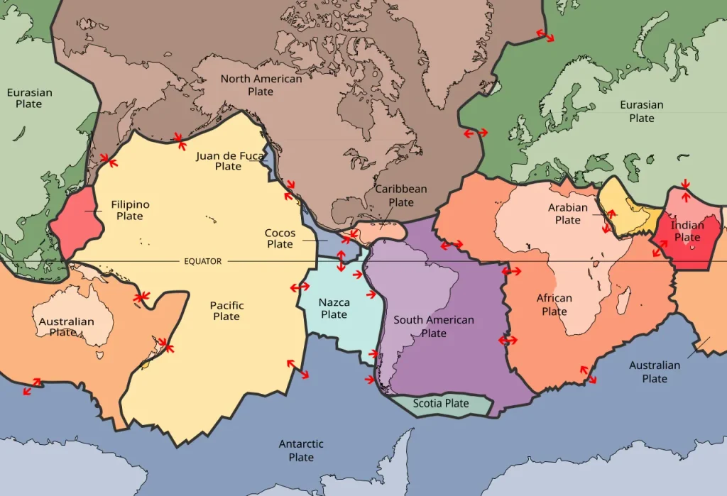
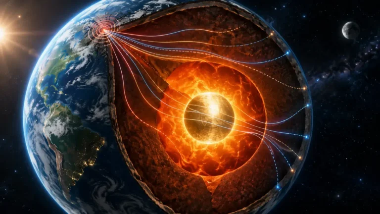
The engine behind all this is heat. Earth’s interior is still cooling from its formation 4.5 billion years ago, and it is warmed from within by the decay of uranium, thorium and potassium. That heat escapes by convection: hot rock rises, cools near the surface, then sinks again over hundreds of millions of years. Plates are the cold, stiff upper skin of this circulation. Where they pull apart, new crust forms at mid-ocean ridges; where they converge, one slab bends down into the mantle at a subduction zone. The US Geological Survey’s primer This Dynamic Earth remains the clearest plain-language introduction to the machinery.
A supercontinent adds a twist to the cycle. Continental crust is thick and insulating, so a giant landmass acts like a blanket over the mantle beneath it. Heat pools under the blanket, the mantle warms, upwellings develop, and eventually the supercontinent is stretched, thinned and torn apart along new rifts. Meanwhile the cold slabs that sank at subduction zones during assembly settle toward the base of the mantle and help organise the next generation of rising plumes. Assembly sets up break-up; break-up sets up the next assembly. Geologists estimate that a full cycle takes something like 400 to 600 million years, though it has never been perfectly regular.
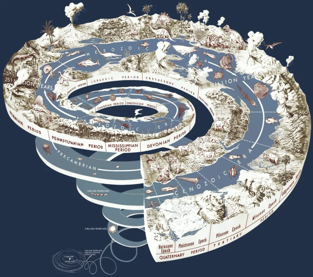
If you want the deeper story of how geologists read these enormous spans of time out of layered rock and radioactive clocks, Geoscopy’s explainer on how Earth’s rocks reveal deep time covers the tools. For now, the key number is this: the last supercontinent began breaking up about 180 million years ago, which puts Earth somewhere near the middle of the current cycle. The next gathering is due.
From Vaalbara to Nuna
How many supercontinents have there been? At least five. Probably more. And the oldest ones are arguments as much as they are objects. Reconstructing them relies on paleomagnetism, the faint compass directions frozen into rocks as they cooled, plus matching mountain belts and rock ages across continents that are now oceans apart. The further back you go, the fewer rocks survive and the fuzzier the picture becomes.
The oldest candidate, Vaalbara, is proposed to have linked the Kaapvaal craton of southern Africa with the Pilbara craton of Western Australia more than three billion years ago; its very existence is debated. Kenorland, around 2.7 to 2.5 billion years ago, has better support. Then comes Columbia, also called Nuna, which assembled around 1.8 billion years ago and held together for several hundred million years. The Farnsworth team notes an intriguing detail about Nuna: unlike some later supercontinents, it appears to have stayed warm throughout its life. Size alone, in other words, does not fix a supercontinent’s climate. Where it sits on the globe and what the atmosphere is doing matter just as much, a point that becomes central later.
Rodinia and the Snowball
Rodinia, which assembled around 1.1 billion years ago with the ancient core of North America, Laurentia, at its heart, is the first supercontinent we can draw with any confidence. Its break-up, beginning around 750 million years ago, coincided with the most extreme climate swings in the geological record: the Snowball Earth glaciations, when ice sheets may have reached sea level at the equator. The leading explanation ties the two together. As Rodinia fragmented, vast new stretches of continental margin sat in the wet tropics, where the chemical weathering of silicate rock draws carbon dioxide out of the air. CO₂ fell, the planet cooled, ice spread, and because ice reflects sunlight it cooled further, until volcanic CO₂ accumulated for millions of years beneath the frozen lid and finally thawed the planet into a hothouse. Rodinia’s break-up, in other words, may have nearly frozen the planet solid. Geography moves the thermostat.
Pangaea, the Template
And then Pangaea. It assembled by about 335 million years ago, as Gondwana in the south collided with Laurussia in the north along a suture that now runs through the Appalachians, the Variscan mountains of Europe and the Atlas. Rifting began in the Late Triassic and the central Atlantic opened between North America and Africa through the Early Jurassic, roughly 200 to 175 million years ago. The US Geological Survey’s classic sequence of maps shows the rest: the South Atlantic unzipping in the Cretaceous, India racing north, Australia parting from Antarctica, and the familiar modern map emerging only in the last few tens of millions of years, all described in the historical-perspective chapter of This Dynamic Earth.
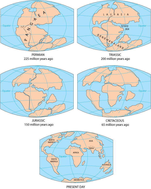
Pangaea’s climate is the reason its name gets reused for the future. With one landmass stretching from pole to pole and one ocean, Panthalassa, covering the rest of the globe, the interior lay thousands of kilometres from moisture. Geologists call the result a “megamonsoon”: savage seasonal swings, with the interior baking in summer and freezing in winter, and rain confined to the coasts. The Permian and Triassic red beds, oxidised, dune-crossed sandstones found from Utah to central Europe, are the fossilised interior of that desert.
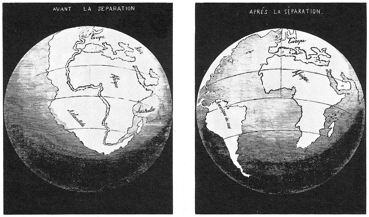
When Alfred Wegener matched the coastlines, fossils and rock formations of South America and Africa and proposed continental drift in 1912, Pangaea was the world he was reconstructing. He could not explain how continents moved, and the geological establishment dismissed him for decades. Seafloor spreading, confirmed in the early 1960s, finally supplied the mechanism he lacked; the USGS tells that story well. Wegener died on the Greenland ice sheet in 1930, thirty years before the vindication.
How the Next Supercontinent Assembles: Subduction and the Death of Oceans
Every supercontinent is built by subduction, and every subduction zone begins with a bend. Oceanic crust is born hot and buoyant at a mid-ocean ridge, but as it cools and thickens over tens of millions of years it becomes denser than the mantle beneath it. Eventually it wants to sink. Where it does, along a deep ocean trench, the slab dives into the mantle at an angle that can range from a shallow slide to a near-vertical plunge. Water carried down in the slab’s minerals lowers the melting point of the overlying mantle, generating the magma that builds volcanic arcs: the Andes, Japan, the Cascades, the whole Pacific Ring of Fire, as the USGS explains. The same descending slabs produce the planet’s largest earthquakes. Subduction is also, ultimately, the muscle that drags continents together. Once an ocean basin has a subduction zone on its edge, the basin is destined to shrink.
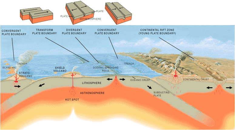
The Canadian geophysicist J. Tuzo Wilson described the full life cycle of an ocean in 1966, in a paper that asked a modest-sounding question: did the Atlantic close and then reopen? His answer became the Wilson cycle, the six-act play of every ocean basin. A continent rifts (act one: the East African Rift today). A narrow sea opens (act two: the Red Sea). The ocean widens over a spreading ridge for a hundred million years or more (act three: the Atlantic). Subduction begins along one margin and the basin starts to shrink (act four: the Pacific). The ocean narrows to a strait (act five: the Mediterranean). Finally the continents on either side collide, crumpling the crust into a mountain belt and leaving a suture as the only trace of the vanished ocean (act six: the Himalayas). Wilson realised that the Appalachians and the Caledonian mountains of Scotland and Norway were the suture of an earlier Atlantic, the Iapetus Ocean, which had closed some 400 million years ago, as the continents began gathering into Pangaea, and that today’s Atlantic had reopened almost along the same seam.
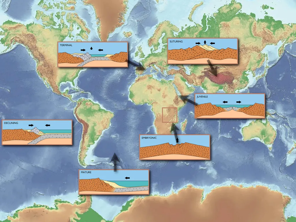
Water runs through all of this. It is water in the descending slab that makes subduction-zone volcanoes erupt, water that keeps the mantle above the slab weak enough to flow, and water stored deep in the mantle that helps keep plate tectonics running at all. Geoscopy looked at that hidden reservoir in The Ocean Inside the Earth: Water in the Mantle. A dry planet would struggle to subduct anything. Venus has a surface nearly as large as Earth’s and no plate tectonics.
The Atlantic Problem
Pangaea Ultima has one serious scientific objection, and it is geometric. For the Atlantic to close, it needs subduction zones that eat its floor, and at the moment it has almost none. The Atlantic is ringed largely by passive margins, quiet continental edges with no trench, no volcanic arc and few earthquakes. Two small subduction zones do exist: the Lesser Antilles arc in the Caribbean and the Scotia arc near the tip of South America, both of which are Pacific-style systems that have leaked into the Atlantic through gaps between the continents. A third, the Gibraltar arc beneath the western Mediterranean, may be on its way. João Duarte’s group at the University of Lisbon, working with geodynamicists at Mainz, published models in Geology in 2024 arguing that the Gibraltar arc is not dead but in a slow phase. Their model has it creeping on for roughly another 20 million years, nearly stalling, before the rate of migration picks up and the zone spreads out into the Atlantic in a semicircle over the following 30 million years. A new Atlantic subduction system is running by about 50 million years from now. If that happens, it would be the first act of a closing Atlantic, the “introversion” scenario that leads to Pangaea Ultima.
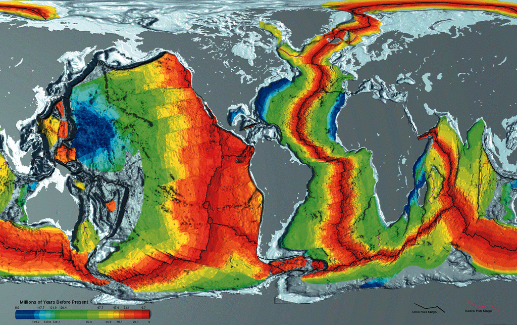
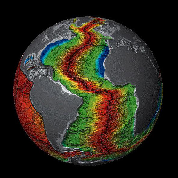
But starting a subduction zone from scratch is one of the hardest problems in geodynamics. A slab has to be forced to bend and sink against the resistance of its own strength, which is why most new subduction zones nucleate at pre-existing weaknesses such as transform faults or old arcs, and why geologists have no unambiguous example of one igniting spontaneously in the middle of a passive margin. The Atlantic’s oldest crust, off the coasts of North America and West Africa, is around 180 million years old, roughly the age at which oceanic lithosphere becomes dense enough that it “ought” to sink. Whether it will, and when, is precisely the sort of question a 250-million-year forecast cannot settle.
Amasia, Novopangea, Aurica: The Rival Models for the Next Supercontinent
Pangaea Ultima is the best-known scenario for the next supercontinent, but it is not the only one, and the alternatives disagree about the single most important variable in the climate story: where on the globe the landmass ends up. In 2018 Hannah Davies, Mattias Green and João Duarte set four competing scenarios side by side, rebuilding each from the same starting point with the plate-reconstruction software GPlates, in a paper titled “Back to the future”. The four are worth meeting individually, because the differences between them are the differences between a lethal world and a survivable one.
Pangaea Proxima: the Atlantic closes
Scotese’s scenario, already described above. The young Atlantic reverses and closes, the Americas return to the Old World, and the supercontinent forms roughly where Pangaea did, straddling the equator. Geologists call this “introversion”: the ocean that opened during the last break-up is the one that dies. It is the scenario the 2023 climate study modelled, and the one with the hottest outcome.
Novopangea: the Pacific closes
The simplest extrapolation of today’s plate motions. The Atlantic keeps widening, the Pacific keeps shrinking, and the westward-drifting Americas eventually collide with Asia and Australia on the far side of the globe. This is “extroversion”, the closure of the older exterior ocean, and it is the pattern that has produced most supercontinents in the geological record. The scenario was developed by the British geophysicist Roy Livermore and popularised in Ted Nield’s 2007 book Supercontinent. Novopangea would sit largely at low to middle latitudes, a good deal of it in the tropics.
Aurica: both oceans close
Proposed by Duarte and colleagues in 2018, Aurica imagines subduction taking hold in the Atlantic and continuing in the Pacific, so that both great oceans close at once. To balance the books, a new ocean must open somewhere, and in this scenario it tears through Asia along a rift that runs roughly from the Indian Ocean north toward the Arctic. The continents converge on the equator from both sides, forming a supercontinent centred in the tropics with a single new ocean wrapped around it. Aurica and Pangaea Ultima disagree about geometry but agree about the one thing that matters most for the climate: the land ends up where the Sun is strongest.
Amasia: the polar supercontinent
Amasia is the outlier, and it comes with two very different intellectual pedigrees. The first is a 2012 Nature paper by Ross Mitchell, Taylor Kilian and David Evans at Yale, who argued from paleomagnetic data that each supercontinent tends to form about 90 degrees away from the centre of its predecessor, a pattern they named “orthoversion”. By that rule, the next supercontinent should assemble over the Arctic, as the Americas and Eurasia close the Arctic Ocean and Caribbean between them. The name fuses America and Asia.
The second pedigree is computational, and it comes from the 2022 study by Chuan Huang, Zheng-Xiang Li and Nan Zhang at Curtin University and Peking University, published in National Science Review. Using a supercomputer to model the whole plate–mantle system forward in time, they concluded that the Pacific, not the Atlantic, is the ocean most likely to close. Earth has been cooling for billions of years, and a cooler mantle makes oceanic plates thinner and weaker. Young, thin oceans like the Atlantic and the Indian are therefore harder to force shut than they would have been in the deep past, while the old, wide Pacific is already ringed by subduction zones and is the path of least resistance. In their model the Americas drift west, Australia collides with Asia, and the continents gather in the northern hemisphere as Amasia within 200 to 300 million years. The Curtin University announcement notes that the motions are already measurable: Australia is heading north toward Asia at about seven centimetres a year, two to three times the typical plate speed.
Why latitude decides everything
Three of the four scenarios put the future supercontinent in or near the tropics. Only Amasia parks it over a pole. That distinction is the pivot on which the extinction question turns. A landmass at the equator receives the most intense sunlight on the planet all year round; a landmass at the pole receives the least, and it spends months in darkness. In 2021, Michael Way at NASA’s Goddard Institute for Space Studies, working with Hannah Davies and João Duarte in Lisbon and Mattias Green at Bangor, ran both Aurica and Amasia through a climate model. The two worlds came out several degrees apart in mean surface temperature. But the decisive variable was not latitude on its own. It was the height of the high-latitude landmass: raise Amasia’s topography and snow accumulates, albedo climbs, and the planet cools further. Their low-topography Amasia was far less extreme. The Farnsworth team makes the same point in its own paper: a polar supercontinent would likely spare large areas from lethal heat stress, though it would trade that for cold stress and for the risk that spreading ice reflects enough sunlight to tip the planet into a frozen state.
So the headline “the next supercontinent will kill the mammals” carries a hidden premise: that the next supercontinent is a tropical one. Most models say it will be. The most computationally ambitious recent model says it won’t.
Inside the 2023 Study: Modelling a World 250 Million Years Away
The paper at the centre of this story is “Climate extremes likely to drive land mammal extinction during next supercontinent assembly”, published in Nature Geoscience (volume 16, pages 901–908) on 25 September 2023, with the DOI 10.1038/s41561-023-01259-3. Alexander Farnsworth of the University of Bristol led a team of eight: the climate scientists Eunice Lo and Paul Valdes, the biogeochemist Benjamin Mills of the University of Leeds, the physiological-climate modeller Jonathan Buzan, the tectonic reconstruction specialist Andrew Merdith, the exoplanet astronomer Hannah Wakeford, and Christopher Scotese himself, the man who drew the map in 1982.
The map itself was decades old, Scotese’s 1982 sketch, revised in 2001 and turned into the digital elevation model the climate modellers actually fed the computer. What was new was the machinery pointed at it. Climate modellers have spent decades simulating Earth’s past, from the Cretaceous greenhouse to the ice ages, and the Bristol group is among the best-known practitioners. Bristol’s press release called this the first supercomputer climate modelling of the distant future. That overstates it. Michael Way’s team at NASA Goddard had already put Aurica and Amasia through a general circulation model in 2021, and Farnsworth’s paper cites that work. What is new is the coupling: an ocean–atmosphere model feeding a long-term carbon cycle model, with mammalian physiology applied on top of the output.
The model was HadCM3L, a version of the UK Met Office Hadley Centre’s coupled atmosphere–ocean general circulation model, in the Bristol-tuned configuration known as HadCM3LB-M2.1aD. It is not the newest or the highest-resolution model in existence; its atmosphere works on grid cells 3.75 degrees of longitude by 2.5 degrees of latitude, coarse enough that a single cell covers an area larger than Switzerland. Its strengths are different. It couples the atmosphere, the ocean, sea ice and a dynamic vegetation scheme; it has been tested against modern observations and against the geological record of past greenhouse worlds; and it is fast enough to run for thousands of simulated years, which is what a wholly new geography demands. The deep ocean takes millennia to adjust to a rearranged map, and the team ran each simulation for around 5,000 model years to let it settle.
Into that model went Scotese’s reconstruction: the outline of Pangaea Ultima, its topography, including a great mountain belt raised by the collisions that build it, and the single surrounding ocean. Two other inputs had to be estimated rather than measured. One was the brightness of the Sun 250 million years from now, which comes from stellar physics. The other was the concentration of carbon dioxide, which comes from the long-term carbon cycle, and which is by far the hardest number in the paper.
For that, the team coupled the climate runs to SCION, a biogeochemical model developed by Mills that simulates the slow exchange of carbon between the solid Earth, the oceans and the atmosphere. Volcanoes and metamorphism add CO₂; the chemical weathering of silicate rocks, followed by the burial of carbonate and organic carbon in the sea, removes it. To drive SCION the researchers reconstructed the likely plate boundaries of Pangaea Ultima and estimated how much volcanic degassing they would produce, arriving at a rate roughly 1.3 to 1.9 times today’s. The model then found the CO₂ level at which supply and removal balance. Rather than trust a single answer, the team ran the climate model across a sweep of CO₂ concentrations from zero up to 1,120 parts per million, and under both today’s solar output and the brighter future Sun, so that no single assumption carried the whole result.
Finally, they needed a definition of “habitable for mammals”, and they built it from physiology rather than guesswork. The test is three conditions applied to monthly means in every land grid cell. The cold month mean has to stay above 0°C for at least three consecutive months: below freezing, surface freshwater becomes biologically unavailable, and plants have already gone dormant by 5°C. Wet-bulb temperature has to stay under 34.5°C. Humidex, the index Canadian meteorologists use, where 45 means stop all activity and 54 means heat stroke, has to stay under 45. On top of that, any cell the model’s vegetation scheme turned into bare desert was ruled out entirely, on the grounds that there would be nothing to eat or drink.
Run the same test on a pre-industrial control and it returns 66% of the land, which matches a reconstruction of where mammals actually lived before humans reshaped their ranges. That agreement is how the team checked the method had skill.
The Triple Whammy: Three Heat Sources Stacked on One World
Farnsworth’s phrase for the result was a “triple whammy”: three independent sources of heat arriving on the same planet at the same time, each amplifying the others. Understanding them one at a time is the key to understanding why the numbers come out the way they do.
Continentality: the cruelty of distance from the sea
The first and largest effect is pure geography. Water has an enormous capacity to store heat: it takes about four times as much energy to warm a kilogram of seawater by one degree as it does to warm a kilogram of dry rock. The oceans therefore act as a planetary flywheel, absorbing heat in summer and releasing it in winter, and their evaporation feeds the clouds and rain that keep coastal and maritime climates mild. Move inland and that buffer fades. Winnipeg and Novosibirsk, deep inside North America and Asia, swing through roughly 90°C between their record high and record low. Now imagine a continent with an interior three or four thousand kilometres from the nearest coast. Nothing moderates its summers, nothing waters its plains, and the air arriving from the sea has dropped every gram of moisture long before it gets there.
Pangaea Ultima concentrates that effect where it hurts most, across the tropics. In the model, geography alone, before any change in the Sun or in CO₂, already warms and dries the interior enough to remove a large fraction of the land from the habitable range. The geological analogue is the megamonsoon of the original Pangaea: an interior that alternates between furnace and freezer, and rains that stop at the coast. Pangaea Ultima’s interior would be the same machine, running under a brighter Sun.
A brighter Sun: the one certainty
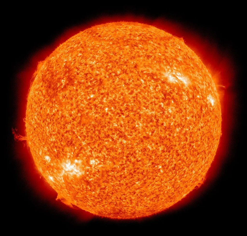
The second effect is astronomical, and it is the only ingredient in the whole projection that nobody disputes. Stars like the Sun grow steadily brighter as they age. As hydrogen in the core fuses into helium, the core contracts and heats, fusion runs faster, and the star’s output rises. When Earth formed, the Sun was roughly 30% fainter than it is now, a fact that creates the well-known “faint young Sun” puzzle of how the early oceans avoided freezing. The brightening continues at about 1% every 110 million years, which means that by the time Pangaea Ultima assembles, the Sun will be delivering around 2.5% more energy than it does today.
Two and a half percent does not sound like much. In the currency of climate science it is enormous. Earth currently absorbs roughly 240 watts of sunlight per square metre averaged over its surface. The paper puts the extra forcing from a 2.5% brighter Sun at 5.55 watts per square metre, more than the roughly 3.7 watts produced by doubling atmospheric CO₂. A brighter Sun on its own would push the planet several degrees warmer even if the continents stayed where they are. Combined with a tropical supercontinent, it removes the cold-stress problem at high latitudes, which sounds like good news until you realise that it also removes the cool refuges.
Volcanic carbon dioxide: the thermostat jammed on high
The third effect is the carbon cycle, and it is where geology and chemistry combine. Over millions of years, Earth’s temperature is set by a tug of war. Volcanoes and the metamorphic cooking of buried carbonate rocks release CO₂ into the air. Rain, slightly acidified by that CO₂, dissolves silicate minerals in exposed rock and carries the products to the sea, where they are locked into limestone and shells. Warmer, wetter conditions speed the weathering and draw CO₂ down; cold, dry conditions slow it and let CO₂ build up. This weathering thermostat is why Earth has stayed within a liveable range for billions of years despite a brightening Sun.
Supercontinent assembly jams the thermostat. Collisions and the reorganisation of subduction raise the rate of volcanic outgassing; SCION estimates Pangaea Ultima’s degassing at 1.3 to 1.9 times today’s. At the same time, the drying of the vast interior slows the chemical weathering that would normally scrub CO₂ back out, because weathering needs rain. More supply, less removal, and the balance point shifts upward. SCION’s answer was an ensemble mean of 621 ppm, within a range of 410 to 816 ppm, roughly 1.5 to 3 times pre-industrial. That came from running the whole system a thousand times across the plausible spread of future degassing rates and silicate rock reactivities. For comparison, the pre-industrial atmosphere held about 280 ppm. The Mauna Loa annual mean was about 427 ppm in 2025, and the May 2026 seasonal peak reached 432.0 ppm at Scripps, 432.3 at NOAA. The long-run climb is two to three ppm a year. Which points to something the paper does not spell out: we are already inside the range SCION projects for Pangaea Ultima. The bottom of it, 410 ppm, went past us around 2019.
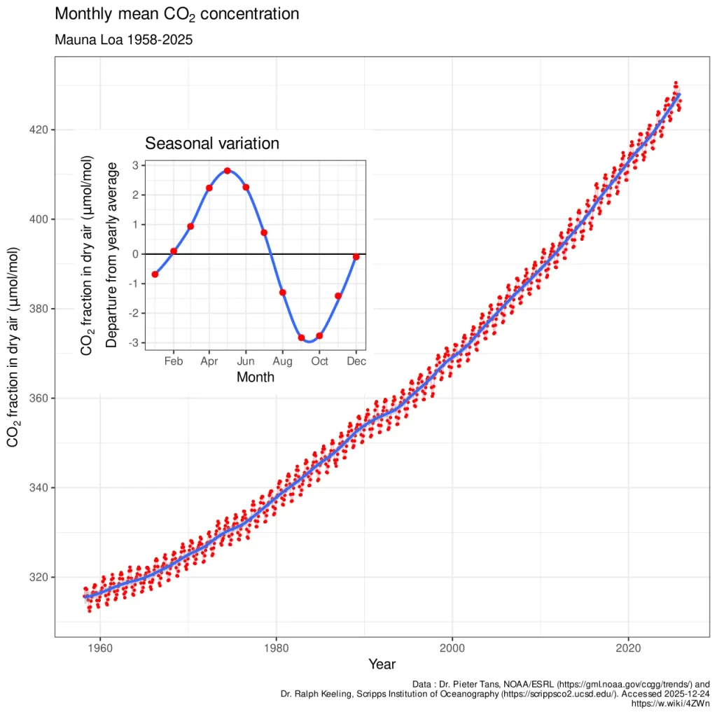
Mills, who led the carbon calculations, spelled out the implication in the Bristol announcement: the model suggests CO₂ could climb from around 400 ppm today to more than 600 ppm over these vast timescales, but that projection assumes humanity stops burning fossil fuels long before then. Keep burning them, and the same concentrations arrive not in hundreds of millions of years but within a few human lifetimes. That aside is the hinge on which the whole paper turns from deep-time curiosity into present-day warning, and we will come back to it.
The three effects do not simply add. They multiply through feedbacks. A brighter Sun melts snow and ice, darkening the surface and absorbing more sunlight. Higher CO₂ warms the air, which holds more water vapour, itself a powerful greenhouse gas. A dry continental interior sends less moisture skyward, thinning the clouds that would otherwise reflect sunlight, and its bare, dark soils absorb more of it. Each turn of the screw tightens the next. The three effects together produce a planet several times more sensitive to CO₂ than geography alone would predict.
The Numbers: How Much of Pangaea Ultima Would Be Habitable?
On the modern, pre-industrial Earth, about 66% of the land surface passes the study’s habitability test. On Pangaea Ultima, depending on the CO₂ scenario, the figure collapses to somewhere between 8% and 25%. In the most optimistic case, CO₂ held at the pre-industrial 280 ppm under the brighter Sun, the results section and Table 1 report 54% of the land still habitable. That is below today’s 66%, but not catastrophically so. At 560 ppm, double the pre-industrial level and well inside SCION’s own projected range, the figure falls to 16%. At 1,120 ppm, the worst case, only 8% remains, a few strips along the coasts and toward the poles.
The paper is inconsistent with itself on that best case. Its discussion of aestivation gives 25% for the same 280 ppm scenario, not 54%, and never reconciles the two. Bristol’s press release quoted the range as 8% to 16%, sidestepping the question by leaving the 280 ppm run out entirely. What is not in dispute is the part that matters. At the CO₂ level the paper’s own carbon cycle modelling predicts, 410 to 816 ppm, Pangaea Ultima loses somewhere between three-quarters and nine-tenths of today’s mammal-habitable land.
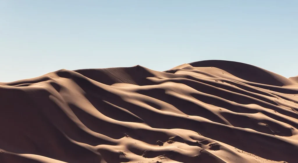
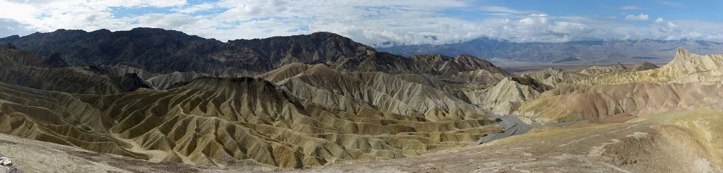
The temperatures behind those percentages are hard to picture. Averaged over the whole year and the whole land surface, Pangaea Ultima runs somewhere in the mid-20s to mid-30s Celsius depending on CO₂, against the pre-industrial control run, which the paper puts anywhere from 12 to 30°C cooler over land depending on the scenario. Averages hide the danger. Across broad swathes of the interior, temperatures would routinely run between 40 and 50°C, with daily peaks higher still, and in the worst scenarios daytime maxima across much of the continent would exceed 50 to 60°C. In Bristol’s press release, Farnsworth said that with the brighter Sun and the landmass sitting in the hot, humid tropics, much of the planet could be facing temperatures between 40 and 70°C. The interior becomes a parched wasteland; the coasts become a sauna.
The team tried several ways of rescuing the result, and none worked well. Mountains are cooler than lowlands, so they doubled the height of the whole land surface to manufacture highland refuges. At 560 ppm the habitable fraction rose from 16% to 19%. They allowed every mammal species to hibernate for nine months of the year – the paper notes that only one known mammal manages seasonal hibernation on anything like that scale, and it goes to eleven months – and extended summer dormancy, or aestivation, from one month to three. The gain was small: 25%, 16% and 8% became 32%, 21% and 13% at 280, 560 and 1,120 ppm, because the months on either side of the dormant period were already past the physiological limit. Whatever they tried, the fundamental problem remained. A tropical supercontinent under a brighter Sun does not have a cool season to wait for.
Water compounds the problem. Between roughly 50 degrees north and 50 degrees south, the model produces vast arid zones, and in the highest-CO₂ scenario the drying power of the tropical air, its vapour pressure deficit, runs three to four times higher between 50°N and 50°S than in the modern Gobi Desert. Deserts of that size and severity do more than deny animals a drink. They act as barriers. A mammal population squeezed out of one shrinking refuge could not simply migrate to another across thousands of kilometres of waterless ground. The refuges themselves would be islands. And islands are where lineages go to become small, then rare, then absent.
Why Heat Kills Mammals: Sweat, Wet-Bulb Temperature and an Evolutionary Ceiling
Why single out mammals? Because the thing that makes us successful is the thing that makes this particular future lethal. Mammals are endotherms: we burn food to generate our own body heat and we hold our core temperature within a narrow band, around 37°C in humans. In the cold that is a superpower. It is why there are seals under Antarctic ice and musk oxen on the tundra, and why mammals have repeatedly evolved their way into colder and colder habitats over the last 200 million years. In extreme heat it is a liability, because an animal that generates heat continuously must also shed it continuously, and it can only do that if the environment lets it.
Two temperatures define the danger. The first is the ordinary air temperature, the dry-bulb reading on a thermometer. Once it climbs past body temperature, the air can no longer carry heat away from the skin; the body gains heat from its surroundings instead of losing it, and the only remaining escape is evaporation. Sustained exposure above about 40°C begins to cause deaths even among healthy adults, and the study uses that figure as one of its thresholds.
The second is the wet-bulb temperature, the reading a thermometer gives when its bulb is wrapped in wet cloth, which folds humidity into the measurement. Wet-bulb temperature is the number that governs sweating, and it is the more insidious of the two. In dry air, sweat evaporates readily and cools the skin, which is why a healthy person can survive 45°C in a desert with enough water. In saturated air, sweat simply drips. In a landmark 2010 paper, Steven Sherwood and Matthew Huber calculated that once the wet-bulb temperature exceeds about 35°C for several hours, a resting human in the shade with unlimited water can no longer lose metabolic heat at all, and core temperature climbs toward death. More recent laboratory work at Penn State put real people in environmental chambers with core-temperature telemetry and found the limit for young, healthy adults at everyday activity levels is lower still: a mean critical wet-bulb temperature of 30.55 ± 0.98°C in humid air, and lower again in hot, dry air. No subject reached 35°C. The threshold turns out not to be a single number at all. It moves with vapour pressure. And a 2020 analysis of weather-station records found that brief episodes at or beyond the 35°C wet-bulb threshold have already occurred in the Persian Gulf and the Indus valley, decades earlier than models had expected.
The Farnsworth study applies these limits, together with the Humidex index used by Canadian meteorologists, to every mammal, not just to us. Larger animals have more trouble shedding heat than small ones, because they have less surface area per kilogram of heat-producing tissue. Animals that cool by panting rather than sweating hit similar walls. The physiology varies in the details, but the wall is in roughly the same place for everyone.
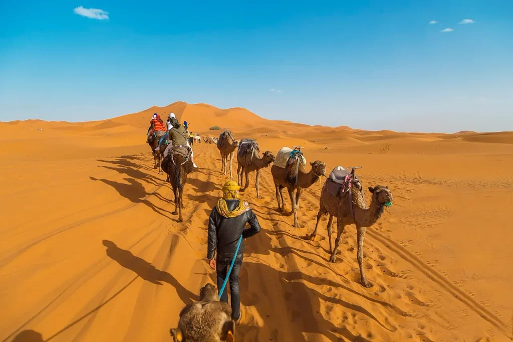
Could mammals simply evolve a higher tolerance over 250 million years? This is the obvious objection, and the paper meets it with a finding from evolutionary ecology that deserves to be better known. In 2013 Miguel Araújo and colleagues assembled thermal tolerance data for 697 terrestrial ectotherms, 227 endotherms and 1,816 plants. They found a consistent asymmetry. Cold tolerance varies widely, both between species and within them, and tracks local temperature. Heat tolerance barely varies at all. They called the paper “Heat freezes niche evolution”.
The study is not beyond challenge. The authors issued a correction in 2016: some endotherm upper limits had been taken from work that never measured metabolic rate above the reported threshold, a problem worse in the bird data than the mammal data. Later analyses have argued that what the study really showed was lower variance in upper limits, not a slower rate of evolution. The direction of the finding has held up. Its strength is still argued over. Farnsworth’s team leans on it alongside a 2021 survey by Bennett and colleagues, which reached the same conclusion from a different dataset. Upper thermal limits seem to be pinned by the basic chemistry of proteins and membranes, which begin to fail at similar temperatures in almost every animal. Lineages have found endless ways to survive cold. Almost none have pushed the hot ceiling higher.
That is why the study concludes mammals cannot adapt their way out. The ceiling is not a trait that natural selection can easily raise; it is closer to a law of biochemistry. Pangaea Ultima would exceed it not for hours, as in today’s worst heatwaves, but for weeks and months at a stretch, across most of the land, year after year. In the same release, Farnsworth put the human version plainly: widespread temperatures of 40 to 50°C, greater daily extremes and high humidity would leave people unable to shed heat by sweating.
The refuges that remain
The picture is not quite absolute. The study identifies a few places and strategies that might allow some mammals to persist. The high latitudes above about 50 degrees offer relief from heat, though under high CO₂ even those shrink and the barriers between them widen. Burrows and caves, insulated from the daily extremes, could shelter small animals, provided they could find food and water outside at night. Nocturnality helps. So does small body size, which sheds heat efficiently. The paper itself only goes as far as “small burrowing rodents”. The obvious modern analogues are the animals already living in the world’s harshest deserts, the fennec fox, the kangaroo rat, the jerboa. Farnsworth has speculated that any surviving humans would have to adopt the same playbook, retreating underground and coming out after dark, or, as he put it in interviews, leave the planet for somewhere more hospitable.

A biosphere reduced to scattered pockets of small, nocturnal desert specialists is a biosphere that has already lost the elephants, the big cats, the primates and nearly everything else that makes the Cenozoic the Age of Mammals. Even in the study’s most generous accounting, the class of animals that has dominated the land since the dinosaurs fell would be reduced to a remnant.
Why Supercontinents Cause Mass Extinctions
The Pangaea Ultima result does not come out of nowhere. It fits a pattern in the fossil record that geologists have noticed for decades. What the paper describes is, in effect, a supercontinent mass extinction, and the record of the last half-billion years contains several of them. Farnsworth told Live Science that supercontinent formation “has coincided with four of the last five mass extinctions”, and that assembling one seems to create conditions in which mass extinction comes more easily.
The mechanism is the triple whammy, played out in the past. When continents pile together, volcanism rises, CO₂ climbs, the weathering thermostat sticks, and the interior turns to desert. Life is squeezed from both ends: too hot and dry on land, and in the oceans, which absorb the excess CO₂ and heat, too acidic and too starved of oxygen. Add the one-off catastrophes that supercontinent-era volcanism seems to produce, and the pattern becomes a mechanism.
The worst catastrophe in Earth’s history is the clearest example. Around 252 million years ago, at the end of the Permian period and while Pangaea stood assembled, an estimated 81% of marine species and around 70% of terrestrial vertebrate species disappeared in the event nicknamed the Great Dying. The trigger was the Siberian Traps, a large igneous province in which basalt lava and intrusions flooded an area comparable to western Europe, with a total volume measured in millions of cubic kilometres. A 2017 study led by Seth Burgess pinned the onset of the extinction to the moment when magma began intruding as sills into carbon-rich sediments beneath Siberia, cooking out enormous quantities of CO₂ and methane. The result was rapid warming, ocean acidification, the spread of oxygen-free water, and a world that took millions of years to recover.
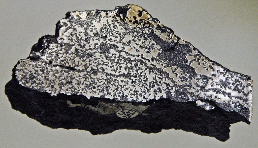
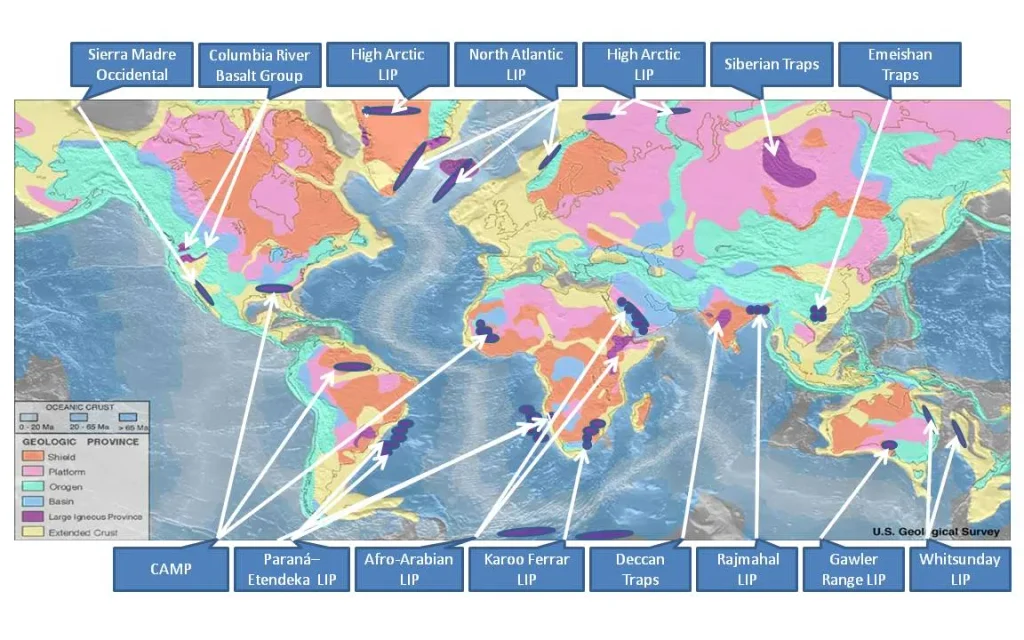
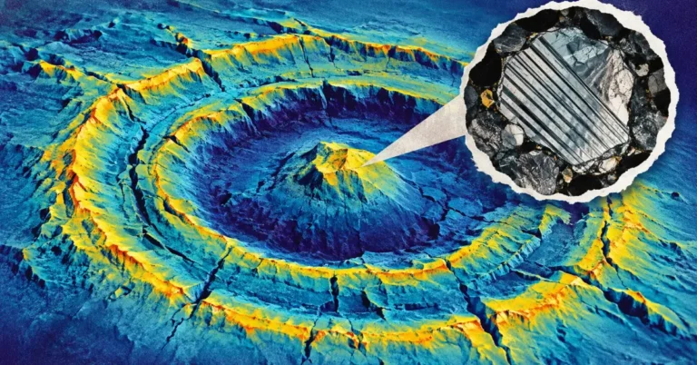
The end-Triassic extinction, around 201 million years ago, follows the same script from the other end of the cycle. As Pangaea began to rift, the Central Atlantic Magmatic Province erupted across what is now four continents, the largest flood-basalt province by area in the record, and as much as three-quarters of species vanished. The end-Ordovician extinction around 445 million years ago struck as the supercontinent Gondwana drifted over the South Pole and glaciated. The Late Devonian crisis around 372 million years ago is more contested but sits amid the collisions that would build Pangaea. Only the end-Cretaceous extinction 66 million years ago, the one that removed the non-avian dinosaurs, has a clearly external cause, the Chicxulub impact, though even there the Deccan Traps were erupting in India at the same time.
That last event is the reason we are here. Mammals as a lineage go back more than 200 million years, and their synapsid ancestors well over 300 million, but for the whole of the Mesozoic they lived small and mostly nocturnal in a world run by reptiles. The impact cleared the stage. In the 66 million years since, mammals have radiated into whales and bats and elephants and us. The Farnsworth study’s closing move is to point out that the same planetary forces which opened the door may, in the very deep future, close it.
The paper flags one threshold in particular, and it deserves emphasis because it is not a far-future number at all. The team notes that if CO₂ on the future supercontinent were to reach 560 ppm or more, even briefly – the paper’s window is a century to a millennium – the heat would be enough to trigger an extinction on the scale of the Big Five. Five hundred and sixty parts per million is double the pre-industrial concentration. Under a high-emissions pathway, human industry could reach it before the end of this century. The far-future Earth and the near-future Earth are not as far apart as the timescales suggest.
The volcanic wildcard
Volcanism is also where the projection’s error bars are widest. SCION’s CO₂ estimate is a long-term average, and long-term averages say nothing about the sudden pulses that large igneous provinces deliver. A single Siberian Traps-scale eruption superimposed on an already overheated Pangaea Ultima could, the authors note, add several degrees of warming on top of the baseline within a few thousand years, which is instantaneous by geological standards and far too fast for any ecosystem to adjust. Nor is such an event unlikely: the record suggests that supercontinent assembly and break-up are exactly when such provinces tend to form, as mantle plumes rise beneath the insulating lid of continental crust.
Our understanding of how magma is stored and how gas escapes from it is still evolving even at the best-studied volcanoes on Earth. Geoscopy reported recently on the discovery of a gas-rich cap sitting atop the magma system beneath Yellowstone, at a depth of just 3.8 kilometres, a finding that changed the picture of how that system vents. Multiply the unknowns of one volcano across the plumbing of an entire assembling supercontinent and you have a fair sense of why nobody can say precisely how much CO₂ Pangaea Ultima’s volcanoes will release. The answer is a range, and SCION’s range is wide for a reason.
Where You Can Watch the Future Beginning Today
The opening scenes of a 250-million-year forecast are already playing. The motions that will build the next supercontinent, whichever one it turns out to be, are happening now, at fingernail speed, in places you can visit.
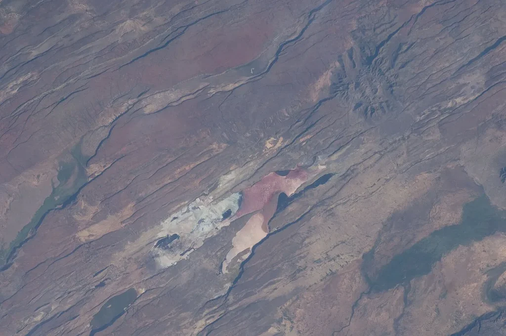
In East Africa, a continent is tearing itself in two. Along the East African Rift, the Somalian plate is pulling away from the rest of Africa at a few millimetres a year, and the crust between them has sagged into a valley floored with lakes and volcanoes. Astronauts on the International Space Station have photographed its parallel fault scarps throwing long shadows in the afternoon sun. Give it tens of millions of years and the Horn of Africa may be an island with a young ocean behind it, the way Arabia is today across the Red Sea. This is act one of the Wilson cycle, live.
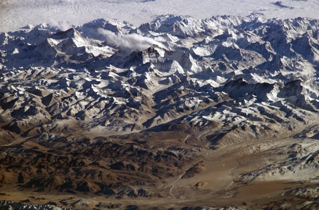
In the Himalayas, you can see the final act. India broke away from Gondwana, crossed an ocean called the Tethys at some of the fastest speeds any continent has managed, and rammed into Asia beginning around 50 million years ago. The Tethys is gone; its floor was subducted and its sediments, full of marine fossils, now sit near the summit of Everest. The range is still rising by several millimetres a year, as NASA’s astronaut photographs of the region show in oblique views that make the scale of the crumpling obvious. When Pangaea Ultima assembles, collisions like this would happen along thousands of kilometres of suture at once, raising the great tropical mountain belt that the climate model includes, a belt that matters because mountains catch rain and because fresh rock weathers CO₂ out of the air.
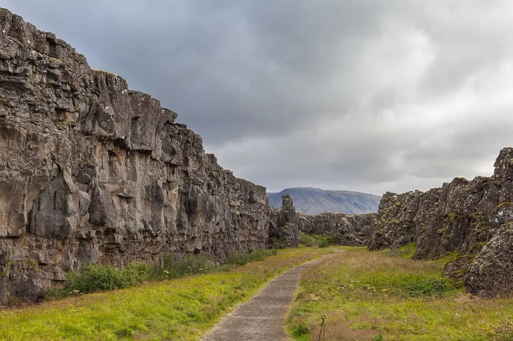
And in Iceland, you can stand on the seam of an ocean being born. The Mid-Atlantic Ridge, which runs the length of the Atlantic on the seafloor, surfaces on the island, and at Þingvellir National Park the rift is a walk-through canyon. The North American plate rises on one side, the Eurasian plate on the other, and the ground between them is being stretched at about two centimetres a year, with fresh basalt filling the gap. This is the process that opened the Atlantic. It is the process that, if Scotese is right, must one day go into reverse.
Elsewhere the signs are quieter. The Mediterranean is shrinking as Africa drives north into Europe, a few millimetres each year; the earthquakes of Italy, Greece and Turkey are the sound of that closure. Australia is racing north toward Indonesia faster than any other continent. Baja California is sliding away from Mexico along the San Andreas system. Every one of them is decisive on a geological timescale.
Dune, Westeros and the Art of Modelling Imaginary Worlds
The Bristol group had been rehearsing on fictional planets.
In December 2017 Dan Lunt at Bristol, with colleagues at Cardiff and Southampton, published a tongue-in-cheek climate model of the world of Game of Thrones under the byline of Samwell Tarly, a novice studying to become a maester at the Citadel in Oldtown. Their explanation for winters that last years: an axis that tumbles as the planet orbits, so the same hemisphere keeps facing the Sun. In 2021 Farnsworth went further, working with Sebastian Steinig at Bristol and Michael Farnsworth at the University of Sheffield to simulate Arrakis, the desert planet of Frank Herbert’s Dune, using the same family of models later pointed at Pangaea Ultima. They fed the model the planet’s topography, orbit and atmosphere as described in the novels and their appendices, kept the physics identical to Earth’s, and asked whether such a world could exist. Their verdict: Arrakis is harsh but broadly plausible, a striking result for a book written in 1965, when general-circulation modelling was barely a decade old and no one had yet simulated a planet other than this one. One detail came out the opposite way round. In their simulation the polar latitudes, where Herbert placed his cities, swung to the most brutal extremes, while the tropics were comparatively mild.
This was more than play. Fictional worlds stress-test a model against geographies that never existed, which is precisely what the deep future demands, and they give the public a way into climate science through stories they already care about. When the time came to model a real but equally alien future Earth, the tools and the habits of mind were ready. When Farnsworth describes how humans might survive on Pangaea Ultima, the picture is recognisably Arrakis: desert specialists, nocturnal, underground.
How Much Should We Trust a 250-Million-Year Forecast?
It is a projection, and the scientists who made it say so at every opportunity. Several distinct layers of uncertainty stack up, and intellectual honesty demands naming each of them.
First, the map. Will Pangaea Ultima form as drawn? Competing models place the next supercontinent over the pole rather than the equator, a difference that could turn a lethal world into a merely difficult one. Plate-motion forecasts are reasonably reliable for a few tens of millions of years and become extrapolation beyond that. Scotese’s own description of his far-future maps as fantasy at the outset is the right baseline.
Second, the carbon dioxide. The 410 to 816 ppm range rests on estimates of volcanic outgassing and rock weathering that are hard to pin down, and a single large igneous province at the wrong moment could overwhelm them in either direction. The authors handled this by running a wide sweep of CO₂ values rather than trusting one, which is the right approach, but it means the headline percentages are conditional on a number nobody can measure.
Third, the model. HadCM3L is well tested but coarse, and it is one model. Modern climate projections rest on ensembles of dozens of models precisely because each has its quirks; a single model of a single geography, however carefully run, cannot capture that spread. Details such as future vegetation, ocean chemistry and the planet’s orbital cycles all had to be simplified or held fixed.
Fourth, evolution. The argument that mammals cannot raise their heat ceiling is well grounded in the fossil and physiological record, but 250 million years is longer than the entire history of mammals to date. What “mammal” even means by then, or whether some lineage stumbles on a biochemical trick nobody has yet imagined, is unknowable.
The geoscientists asked to comment on the paper accepted its physics and pushed back on its geography. Davies, who has modelled the alternatives herself, pointed out that Amasia would be a different world entirely, and that extinction of all mammals is one outcome the model permits, not the only one. What survives the scrutiny is narrower and more interesting than “mammals are doomed”. It is that the arrangement of a planet’s continents, combined with the slow brightening of its star and the state of its carbon cycle, can render a world hostile to complex land life long before the star’s eventual runaway greenhouse, and that this has consequences well beyond Earth.
The Exoplanet Twist: Why a Habitable Zone Is Not Enough
That last point explains why an exoplanet astronomer, Hannah Wakeford, sits on the author list.
When astronomers judge whether a distant planet might host life, the first question is whether it orbits within its star’s habitable zone, the band of distances at which liquid water can exist on the surface. Earth sits comfortably inside the Sun’s. Pangaea Ultima would too; the planet does not move. Yet when the team ran their future Earth through the standard astronomical habitability indices, it failed. Under every scenario with CO₂ at or above pre-industrial levels, a planet with Earth’s mass, orbit and star scored as uninhabitable, purely because of where its land was and what its air contained.
Turn that around and the implication for the search for life is uncomfortable. A rocky world in the habitable zone with a single equatorial supercontinent might be a furnace; the same world with its land broken into dispersed, ocean-buffered continents might be paradise. Tectonic configuration, which we currently have no way of measuring across light-years, may matter as much as orbital distance. As the James Webb Space Telescope and its successors begin to read the atmospheres of Earth-sized planets, that is a lesson worth carrying with us. Distance from the star is where the search starts. It is nowhere near enough on its own.
Who Inherits the Earth?
If mammals fall, what takes their place? Nobody knows, and the uncertainty is part of the point. The study is careful to say that mammals are not the only ones under threat. Between roughly 40 and 60°C, the molecular machinery of photosynthesis, in particular the protein complex called photosystem II, starts to fail in most plants, cutting electron transport rates until photosynthesis stops. A continent where daytime temperatures routinely exceed that range is a continent where the base of the food chain is failing. Whatever survives on land would have to cope with less to eat, not just more heat.
Reptiles and other ectotherms, which take their heat from the environment rather than making it, hit the same biochemical ceiling as mammals but do not have to shed a constant internal furnace, and some, like the desert tortoises and lizards of today, tolerate body temperatures that would kill a mammal outright. Birds run hotter than mammals and pant rather than sweat; their prospects are unclear. Insects and other small invertebrates have survived every extinction so far. And the oceans, though warmer, more acidic and lower in oxygen, are a vastly larger and more buffered habitat than the land. Life in some form would go on. The record is unambiguous about that, and about the corollary: every mass extinction has been followed, after a few million years of impoverished recovery, by a burst of new forms filling the emptied world. Hannah Davies, the same geologist who set the four scenarios side by side in 2018 and co-authored the NASA runs of Aurica and Amasia, now at GFZ Potsdam, told Nature News that total extinction is one outcome among several rather than the only one, and that she finds the picture “a bit depressing”.
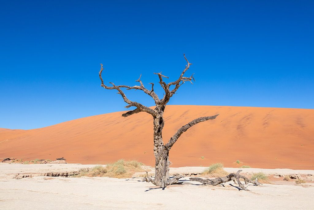
It is also worth keeping the timescale in view. Even in the worst case, this is a crisis a quarter of a billion years away, a span longer than the whole tenure of the dinosaurs. Any descendants of humanity that exist then would be as different from us as we are from the first shrew-sized mammals of the Triassic. Pangaea Ultima is not a deadline for our species. Nor is it the end of the story: the Sun will keep brightening, and in roughly a billion years it will be bright enough to boil the oceans away regardless of where the continents sit. The supercontinent is a chapter, not the final page.
The Warning Hidden in Deep Time
For all its far-future strangeness, the study circles back to the present with real force, and its authors made sure of that. Eunice Lo, whose research focuses on climate and health, used the Bristol announcement to draw the line explicitly: the deep-future scenario must not distract from the climate crisis already under way, which is driven by human greenhouse-gas emissions and is already producing heat that harms and kills people. Mills’s point about carbon dioxide sharpens it. The 600-plus ppm that Pangaea Ultima would reach naturally over hundreds of millions of years is a concentration that fossil-fuel burning could deliver within a century or two.
The physics that would make Pangaea Ultima lethal is the physics of today’s worst heatwaves. On 29 June 2021, the village of Lytton in British Columbia, at nearly 50 degrees north, recorded 49.6°C and burned to the ground the following day. In the spring of 2022, a heatwave that lasted for weeks pushed temperatures across northern India and Pakistan to 49°C and beyond. Weather stations on the shores of the Persian Gulf and in the Indus valley have already logged brief brushes with the 35°C wet-bulb limit that no human can survive for long. These are single afternoons and single seasons in a world with 66% of its land habitable. Pangaea Ultima would make them the climate. The deep-time story, in the end, is a mirror.
Mammals inherited the Earth because a catastrophe cleared the field. For 66 million years the class has flourished in nearly every land habitat, riding out ice ages and warm spells. The projection suggests that the same slow planetary rhythms that handed mammals the world will, on a long enough timeline, take it back, not with a sudden blow but through the patient grinding-together of continents and the steady brightening of a star.
Frequently Asked Questions About Pangaea Ultima
What is Pangaea Ultima?
Pangaea Ultima is the leading model for Earth’s next supercontinent, expected to form in roughly 250 million years as today’s continents drift back together. Proposed by geologist Christopher Scotese in 1982, it would sit mostly across the tropics with a vast desert interior. A 2023 climate study found it could be lethally hot for mammals.
Scotese built the scenario by extrapolating past supercontinent cycles rather than by physical prediction, and he is candid that such deep-future maps are speculative. In his version the Atlantic closes, the Americas rejoin Africa and Eurasia, and a single landmass forms inside one global ocean, with a remnant of the Indian Ocean surviving as an inland sea.
When will the next supercontinent form?
Most models place the next supercontinent between 200 and 300 million years from now, with 250 million years the figure most often cited for Pangaea Ultima. That timing follows the supercontinent cycle, in which Earth’s continents assemble and disperse roughly every 400 to 600 million years. Pangaea, the last supercontinent, began breaking up about 180 million years ago.
Plate motions are measured precisely today and can be projected with reasonable confidence for tens of millions of years. Beyond that the timing depends on when new subduction zones form and which ocean closes first, which is why competing models such as Amasia give a range rather than a date.
Will humans survive the next supercontinent?
Almost certainly not in any form we would recognise, though the timescale makes the question abstract. Pangaea Ultima is about 250 million years away, longer than the entire age of the dinosaurs. The 2023 study concludes the heat would be unsurvivable for mammals in general. Any descendants would need to live underground, emerge at night, or leave Earth.
The researchers stress that the pressing danger for humans is not the supercontinent but present-day climate change, which is pushing parts of the world toward the same physiological heat limits within decades rather than aeons.
What will Earth look like in 250 million years?
If Pangaea Ultima forms as modelled, Earth will have one supercontinent straddling the equator inside a single global ocean. Its interior would be a hyper-arid desert with temperatures of 40 to 50°C and higher; its coasts would be dangerously hot and humid. The Sun would be about 2.5% brighter, and CO₂ likely between 410 and 816 ppm.
At the CO₂ levels the study’s own carbon-cycle modelling predicts, somewhere between 8% and 16% of the land would be habitable for mammals, against roughly 66% today. Competing scenarios differ: a polar supercontinent such as Amasia would be far colder, and might face glaciation rather than heat, so the answer depends on which model turns out to be right.
Why do supercontinents cause mass extinctions?
Farnsworth told Live Science that supercontinent formation has coincided with four of the last five mass extinctions. When continents fuse, volcanic outgassing rises and pumps CO₂ into the air, while the drying interior slows the rock weathering that normally removes it, so the planet overheats. The vast desert interior destroys habitat, and the oceans lose oxygen and turn acidic.
The end-Permian Great Dying 252 million years ago, which wiped out more than 80% of marine species during Pangaea’s tenure, was triggered by the Siberian Traps eruptions. Large igneous provinces like it tend to form when mantle plumes rise beneath the insulating lid of a supercontinent, which is why the risk climbs during assembly and break-up.
Is Pangaea Ultima the same as Pangaea Proxima?
Yes. They are two names for the same projected supercontinent. Christopher Scotese first called it Pangaea Ultima, meaning “last Pangaea”, then renamed it Pangaea Proxima, “next Pangaea”, because the supercontinent cycle will continue after it. The 2023 climate study used the older name, which is why “Pangaea Ultima” remains the more familiar term.
You may also encounter Neopangaea and Pangaea II. All refer to the same idea. Amasia, Novopangea and Aurica, by contrast, are different scenarios with different geographies, not alternative names for the same one.
The Bottom Line on Pangaea Ultima and the Next Supercontinent
Pangaea Ultima is a rigorous thought experiment about the deep future, built from real tectonics, real stellar physics and the same climate models used to study the greenhouse worlds of Earth’s past. The central finding: a tropical supercontinent, a Sun 2.5% brighter and a carbon cycle jammed toward higher CO₂ could, together, push all but a small fraction of Earth’s land past the survivable limits of mammals in roughly 250 million years. Its central uncertainty is just as real: whether the next supercontinent assembles as Pangaea Ultima at all, or as a colder, polar Amasia, and how much carbon its volcanoes release.
What is not in doubt is the deeper lesson. Where a planet’s continents sit, and what its atmosphere holds, govern whether it is liveable, a rule that applies to distant exoplanets and, far more urgently, to the only inhabited planet we know. The supercontinent cycle will do what it does on its own schedule. The atmosphere is the part we are writing now.

.jpg)


_2_(17338266745).jpg)


