Opens in a new tab
Geoscopy
Geology, explained.
Generic selectors
Exact matches only
Search in title
Search in content
Post Type Selectors

Rocks

An atlas of rocks and minerals: each one a record of the conditions that made it.

Glossary

Filter - Radio

Sort by

G

Geosyncline

A geosyncline is a large-scale depression in the Earth's crust that fills.. more →
G

Geothermal Energy

Geothermal energy is the heat derived from the Earth's internal heat sources,.. more →
G

Geothermal Gradient

The geothermal gradient is the rate at which the Earth's temperature increases.. more →
G

Geothermal Reservoir

A geothermal reservoir is a natural system that stores heat from the.. more →
G

Geyser

A geyser is a hot spring that intermittently erupts jets of steam.. more →
G

Glacial Abrasion

Glacial abrasion is the process by which a glacier grinds down bedrock.. more →
G

Glacial Lake

A glacial lake is a body of water formed by the melting.. more →
G

Glacial Maximum

The glacial maximum refers to the period during an ice age when.. more →
G

Glacial Moraine

A glacial moraine is an accumulation of unsorted glacial debris (till) that.. more →
G

Glacial Outwash

Glacial outwash is a deposit of sand and gravel carried by meltwater.. more →
G

Glacial Plucking

Glacial plucking is the process by which a glacier removes large chunks.. more →
G

Glacial Rebound

Glacial rebound, also known as isostatic rebound, is the rise of the.. more →
G

Glacial Striation

Glacial striations are grooves or scratches carved into bedrock by rocks embedded.. more →
G

Glacial Till

Glacial till is an unsorted, unstratified mixture of sediments ranging from clay.. more →
G

Gossan

A gossan is an iron-rich, weathered, oxidized zone found at the surface.. more →
G

Graben

A graben is a depressed block of the Earth's crust bordered by.. more →
G

Grain Flow

Grain flow is a type of sedimentary process where loose, granular material.. more →
G

Granitic Magma

Granitic magma is a type of felsic magma rich in silica and.. more →
G

Gravitational Collapse (Geology)

Gravitational collapse in geology refers to the process where a mountain range.. more →
G

Greenstone Belt

A greenstone belt is a region of ancient, metamorphosed volcanic and sedimentary.. more →
G

Groundwater

Groundwater is the water found beneath the Earth's surface in soil pore.. more →
G

Guyot

A guyot, also known as a tablemount, is an underwater volcanic mountain.. more →
G

Gyre

A gyre is a large system of circulating ocean currents, driven by.. more →
H

Habitat Fragmentation 

Habitat fragmentation refers to the process by which large, contiguous habitats are.. more →
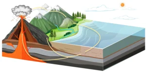
Volcanic eruption and mountain water cycle diagram (geosyncline)

GGeosyncline

A geosyncline is a large-scale depression in the Earth’s crust that fills with thick sequences of sedimentary and volcanic rocks, often associated with the early stages of mountain building. Geosynclines were once a central concept in geology, but they have been largely replaced by the modern theory of plate tectonics. However, they remain important in the historical study of tectonic processes and sedimentary basin evolution. 
Reference: Dewey, J. F., & Bird, J. M. (1970). Mountain Belts and the New Global Tectonics. Journal of Geophysical Research.

Share 

Open entry →
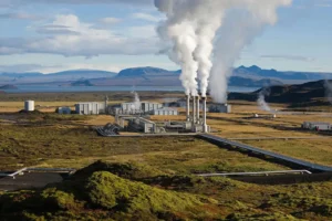
Geothermal power plant with steam and mountains (geothermal energy)

GGeothermal Energy

Geothermal energy is the heat derived from the Earth’s internal heat sources, which can be harnessed for electricity generation, direct heating, and other uses. It is a renewable energy resource that is particularly important in volcanic regions where geothermal gradients are high. The study of geothermal energy involves understanding the Earth’s heat flow, reservoir engineering, and the environmental impact of geothermal development. 

Reference: Dickson, M. H., & Fanelli, M. (2004). Geothermal Energy: Utilization and Technology. Routledge.

Share 

Open entry →
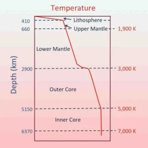
Earth temperature gradient by depth and layers diagram (geothermal gradient)

GGeothermal Gradient

The geothermal gradient is the rate at which the Earth’s temperature increases with depth, typically measured in degrees Celsius per kilometer. This gradient is a critical factor in the study of geothermal energy, the formation of magmas, and the thermal evolution of the Earth’s crust. It varies widely depending on tectonic setting, crustal composition, and heat flow. 

Reference: Turcotte, D. L., & Schubert, G. (2002). Geodynamics. Cambridge University Press. 

Share 

Open entry →
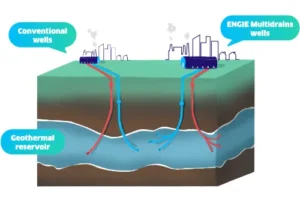
Comparison of conventional and multidrain geothermal wells (geothermal reservoir)

GGeothermal Reservoir

A geothermal reservoir is a natural system that stores heat from the Earth’s interior, which can be tapped for geothermal energy production. These reservoirs typically consist of hot water or steam trapped in porous rocks. Understanding geothermal reservoirs is crucial for sustainable energy production, reservoir management, and environmental impact assessment. 

Reference: Axelsson, G., & Gunnlaugsson, E. (2000). Long-Term Monitoring of High- and Low-Temperature Fields Under Exploitation. Proceedings World Geothermal Congress.

Share 

Open entry →
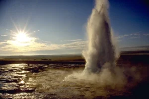
Geyser erupting under bright sunlight in open landscape

GGeyser

A geyser is a hot spring that intermittently erupts jets of steam and hot water into the air. Geysers are powered by the geothermal heat from the Earth’s interior and are typically found in volcanic regions. They are significant in studying geothermal activity, volcanic processes, and the dynamics of hydrothermal systems. 
Reference: Hurwitz, S., & Manga, M. (2017). The Fascinating and Complex Dynamics of Geyser Eruptions. Annual Review of Earth and Planetary Sciences.

Share 

Open entry →
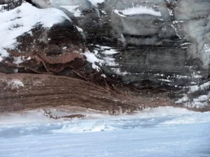
Layered ice and rock formation with snow (glacial abrasion)

GGlacial Abrasion

Glacial abrasion is the process by which a glacier grinds down bedrock surfaces, using debris embedded in the ice as abrasive tools. This process creates striations, grooves, and polished surfaces, and plays a significant role in shaping glaciated landscapes. Studying glacial abrasion helps geologists understand past ice flow dynamics and erosion rates. 

Reference: Boulton, G. S. (1974). Processes and Patterns of Glacial Erosion. Progress in Physical Geography.

Share 

Open entry →
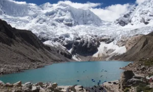
Snowy mountains above turquoise glacial lake

GGlacial Lake

A glacial lake is a body of water formed by the melting of glacial ice, often dammed by moraines, ice, or bedrock. These lakes are important indicators of past glacial activity, climate change, and the dynamics of glacial meltwater. Studying glacial lakes helps in understanding the processes of deglaciation, sedimentation, and landscape evolution. 

Reference: Benn, D. I., & Evans, D. J. A. (2010). Glaciers and Glaciation. Routledge.

Share 

Open entry →
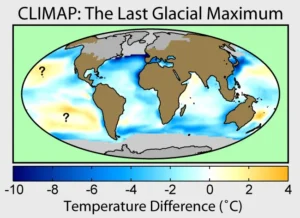
Global temperature changes during the Last Glacial Maximum map

GGlacial Maximum

The glacial maximum refers to the period during an ice age when ice sheets reached their greatest extent, covering significant portions of the Earth’s surface. The most recent glacial maximum occurred about 20,000 years ago during the Last Glacial Period. Studying glacial maxima is crucial for understanding the Earth’s climatic history, ice sheet dynamics, and sea-level changes. 

Reference: Clark, P. U., & Mix, A. C. (2002). Ice Sheets and Sea Level of the Last Glacial Maximum. Quaternary Science Reviews.

Share 

Open entry →
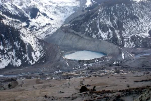
Frozen lake surrounded by snowy mountain peaks (glacial moraine)

GGlacial Moraine

A glacial moraine is an accumulation of unsorted glacial debris (till) that has been transported and deposited by a glacier. Moraines can form at the edges, terminus, or beneath the glacier, and are key indicators of past glacial activity, ice movement, and climatic conditions. Types of moraines include terminal, lateral, and medial moraines. 

Reference: Benn, D. I., & Evans, D. J. A. (2010). Glaciers and Glaciation. Routledge.

Share 

Open entry →
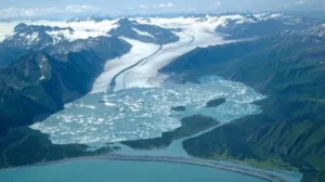
Aerial view of glacier melting into mountain lake (glacial outwash)

GGlacial Outwash

Glacial outwash is a deposit of sand and gravel carried by meltwater from a glacier and laid down in stratified layers. Outwash plains, composed of these deposits, form in front of melting glaciers and are characterized by braided stream patterns. Studying glacial outwash provides insights into past glacial environments, sediment transport processes, and the interaction between glaciers and rivers. 

Reference: Miall, A. D. (1970). A Review of the Geology of Glacial Outwash Plains. Bulletin of Canadian Petroleum Geology.

Share 

Open entry →
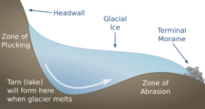
Diagram showing glacier erosion zones and tarn formation (glacial plucking)

GGlacial Plucking

Glacial plucking is the process by which a glacier removes large chunks of bedrock as it moves. This occurs when meltwater infiltrates bedrock fractures, freezes, and then as the glacier moves, it pulls the loosened rock fragments away. Plucking plays a key role in glacial erosion and the formation of jagged mountain landscapes. 

Reference: Benn, D. I., & Evans, D. J. A. (2010). Glaciers and Glaciation. Routledge.

Share 

Open entry →
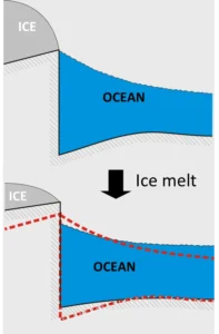
Diagram showing ocean rise from ice melting (glacial rebound)

GGlacial Rebound

Glacial rebound, also known as isostatic rebound, is the rise of the Earth’s crust after the melting of a heavy ice sheet, which had previously caused the crust to depress. This process continues for thousands of years after the ice melts and is significant in studying the effects of glaciation on the Earth’s crust, sea-level changes, and post-glacial landscapes. 

Reference: Peltier, W. R. (2004). Global Glacial Isostasy and the Surface of the Ice-Age Earth: The ICE-5G (VM2) Model and GRACE. Annual Review of Earth and Planetary Sciences.

Share 

Open entry →
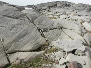
Weathered gray rock formations with cracks and layers (glacial striation)

GGlacial Striation

Glacial striations are grooves or scratches carved into bedrock by rocks embedded in the base of a moving glacier. These striations are aligned with the direction of ice flow and provide important evidence of past glacial movement. Studying glacial striations helps geologists reconstruct ice flow patterns and understand the dynamics of ancient ice sheets. 

Reference: Boulton, G. S. (1974). Processes and Patterns of Glacial Erosion. Progress in Physical Geography.

Share 

Open entry →
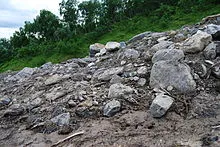
Rocky hillside with scattered stones and greenery (glacial till)

GGlacial Till

Glacial till is an unsorted, unstratified mixture of sediments ranging from clay to boulders, deposited directly by glacial ice. It is significant in understanding past glacial environments, the dynamics of ice movement, and the geological history of glaciated regions. Till forms the basis for many glacial landforms, including moraines and drumlins. 

Reference: Dreimanis, A. (1976). Tills: Their Genetic Terminology and Classification. Geological Society of America Bulletin.

Share 

Open entry →
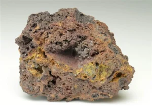
Porous brown and yellow volcanic rock sample (gossan)

GGossan

A gossan is an iron-rich, weathered, oxidized zone found at the surface above a sulfide mineral deposit. Gossans are significant in mineral exploration as indicators of underlying ore deposits, particularly in the search for copper, gold, and other valuable metals. They form through the oxidation of sulfide minerals and the leaching of soluble components. 

Reference: Guilbert, J. M., & Park, C. F. (1986). The Geology of Ore Deposits. Waveland Press. 

Share 

Open entry →
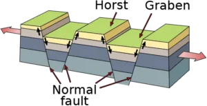
Diagram showing normal faults and block movement (graben)

GGraben

A graben is a depressed block of the Earth’s crust bordered by parallel faults, typically forming a rift valley or basin. Grabens are significant in understanding extensional tectonics, where the Earth’s crust is stretched and thinned. They are often associated with volcanic activity and the formation of basins that may host sedimentary deposits. 

Reference: McClay, K. R. (1990). Extensional Fault Systems in Sedimentary Basins: A Review of the Geometry, Processes, and Evolution. In: Extensional Tectonics and Stratigraphy of the North Atlantic Margins. AAPG Memoir 46.

Share 

Open entry →
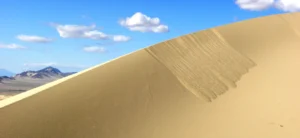
Golden sand dune under blue sky with clouds (grain flow)

GGrain Flow

Grain flow is a type of sedimentary process where loose, granular material moves downslope under the influence of gravity. This process typically occurs in environments such as dunes, beaches, and submarine slopes, forming structures like cross-bedding and graded bedding. Understanding grain flow is important in sedimentology and the interpretation of sedimentary structures. 

Reference: Middleton, G. V., & Southard, J. B. (1984). Mechanics of Sediment Movement. SEPM Society for Sedimentary Geology.

Share 

Open entry →
Granitic magma

GGranitic Magma

Granitic magma is a type of felsic magma rich in silica and aluminum, typically forming granite upon solidification. This magma is often associated with continental crust and forms through processes such as partial melting, fractional crystallization, and magma mixing. Granitic magma is crucial in understanding the formation of continental crust and the processes of magmatic differentiation. 

Reference: Pitcher, W. S. (1993). The Nature and Origin of Granite. Springer. 

Share 

Open entry →
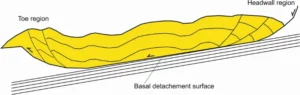
Diagram of landslide showing headwall and toe regions (gravitational collapse (geology))

GGravitational Collapse (Geology)

Gravitational collapse in geology refers to the process where a mountain range or orogen undergoes extension and thinning due to the gravitational potential energy built up during tectonic compression. This process can lead to the formation of extensional faults, metamorphic core complexes, and the redistribution of crustal material. 

Reference: Dewey, J. F. (1988). Extensional Collapse of Orogens. Tectonics.

Share 

Open entry →
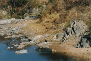
Rocky riverbank with water and dry vegetation (greenstone belt)

GGreenstone Belt

A greenstone belt is a region of ancient, metamorphosed volcanic and sedimentary rocks, typically of Archean to Proterozoic age, often associated with significant mineral deposits such as gold and nickel. Greenstone belts are important in understanding the early Earth’s tectonics, the formation of the continental crust, and the processes of mineralization. 

Reference: de Wit, M. J., & Ashwal, L. D. (1997). Greenstone Belts. Oxford Monographs on Geology and Geophysics.

Share 

Open entry →
Diagram showing groundwater and aquifer layers

GGroundwater

Groundwater is the water found beneath the Earth’s surface in soil pore spaces and fractures of rock formations. It is a crucial component of the hydrological cycle and a vital resource for drinking water, agriculture, and industry. The study of groundwater involves hydrogeology, which focuses on the distribution, movement, and quality of water in the subsurface. 

Reference: Freeze, R. A., & Cherry, J. A. (1979). Groundwater. Prentice Hall.

Share 

Open entry →
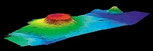
3D topographic map showing underwater seamounts (guyot)

GGuyot

A guyot, also known as a tablemount, is an underwater volcanic mountain with a flat top, usually found in deep ocean basins. Guyots are formed by volcanic activity and are later eroded to sea level, creating the flat summit. They are significant in studying the geological history of ocean basins, plate tectonics, and the evolution of volcanic islands. 

Reference: Menard, H. W. (1984). Origin of Guyots: The Beheaded Volcanoes. Geological Society of America Bulletin.

Share 

Open entry →
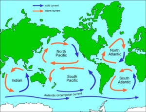
World map showing major ocean currents (gyre)

GGyre

A gyre is a large system of circulating ocean currents, driven by wind patterns and the Earth’s rotation (Coriolis effect). Major oceanic gyres play a crucial role in climate regulation, nutrient distribution, and the movement of marine debris. Understanding gyres is important in oceanography, climate science, and environmental studies. 

Reference: Tomczak, M., & Godfrey, J. S. (1994). Regional Oceanography: An Introduction. Elsevier. 

Share 

Open entry →
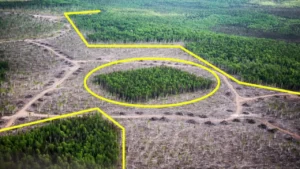
Aerial view of deforestation with remaining green forest patches (habitat fragmentation)

HHabitat Fragmentation 

Habitat fragmentation refers to the process by which large, contiguous habitats are broken into smaller, isolated patches due to human activities or natural events. This phenomenon impacts biodiversity, ecosystem health, and species survival, and is significant in conservation biology and land-use planning. 

Reference: Fahrig, L. (2003). Effects of Habitat Fragmentation on Biodiversity. Annual Review of Ecology, Evolution, and Systematics, 34(1), 487-515. 

Share 

Open entry →

join.me

Geology made clear, in your inbox.

Get clear, visual explainers on rocks, minerals, deep time, and the most fascinating parts of Earth science from Geoscopy.
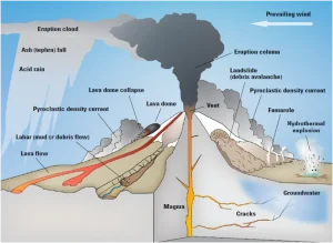
Diagram showing parts and processes of a volcano eruption (Stratovolcano)

SArchives: Glossary

A stratovolcano, also known as a composite volcano, is a large, steep volcano built up of alternating layers of lava, ash, and volcanic debris. These volcanoes are significant in volcanology for understanding explosive eruptions, volcanic hazards, and the formation of volcanic arcs. 

Reference: Davidson, J. P., et al. (2007). “The North Atlantic Igneous Province: Stratigraphy, Tectonics, Volcanism.” Cambridge University Press. 

Share 

Open entry →