Opens in a new tab
Geoscopy
Geology, explained.
Generic selectors
Exact matches only
Search in title
Search in content
Post Type Selectors

Rocks

An atlas of rocks and minerals: each one a record of the conditions that made it.

Glossary

Filter - Radio

Sort by

B

Buried Soil

Buried soils, or paleosols, are ancient soil horizons that have been preserved.. more →
B

Buried Valley

A buried valley is an ancient river valley that has been filled.. more →
B

Butte

A butte is an isolated hill with steep, often vertical sides and.. more →
C

Caldera

A caldera is a large, basin-shaped volcanic depression that forms when a.. more →
C

Caliche

Caliche is a hardened deposit of calcium carbonate that forms in arid.. more →
C

Carbon Sequestration

Carbon sequestration refers to the process of capturing and storing atmospheric carbon.. more →
C

Carbonate Compensation Depth (CCD)

The carbonate compensation depth (CCD) is the depth in the ocean below.. more →
C

Carbonate Platform

A carbonate platform is a sedimentary body that forms in shallow, warm.. more →
C

Cataclasite

Cataclasite is a type of fault rock formed by mechanical fragmentation and.. more →
C

Catastrophism

Catastrophism is the geological doctrine that Earth's history has been shaped primarily.. more →
C

Cementation

Cementation is the process by which minerals precipitate from groundwater and fill.. more →
C

Chatter Marks

Chatter marks are small, curved fractures found on glaciated rock surfaces, formed.. more →
C

Chelation

Chelation in geology refers to the process by which metal ions are.. more →
C

Chert

Chert is a hard, fine-grained sedimentary rock composed primarily of microcrystalline quartz.. more →
C

Cirque

A cirque is a bowl-shaped, amphitheater-like depression eroded into a mountain by.. more →
C

Clastic Rock

Clastic rocks are sedimentary rocks composed of fragments, or clasts, of pre-existing.. more →
C

Clathrate

Clathrates, or gas hydrates, are crystalline structures where gas molecules, typically methane,.. more →
C

Cleavage

Cleavage is a type of foliation in metamorphic rocks, characterized by the.. more →
C

Cliff Retreat

Cliff retreat is the process by which coastal or riverine cliffs erode.. more →
C

Columnar Basalt

Columnar basalt is a type of rock formation characterized by hexagonal columns.. more →
C

Columnar Jointing

Columnar jointing is a geological structure that forms when a thick lava.. more →
C

Conchoidal Fracture

Conchoidal fracture is a type of fracture that occurs in brittle materials,.. more →
C

Continental Divide

A continental divide is a natural boundary or ridge that separates the.. more →
C

Continental Drift

Continental drift is the hypothesis that the continents have moved across the.. more →
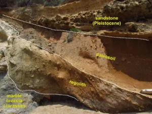
Geological layers showing sandstone, paleosoil, and marble breccia (buried soil)

BBuried Soil

Buried soils, or paleosols, are ancient soil horizons that have been preserved beneath layers of sediment or volcanic deposits. These soils provide valuable information about past climates, vegetation, and environmental conditions, serving as important markers in stratigraphy and the study of Earth’s history. 

Reference: Retallack, G. J. (2001). Soils of the Past: An Introduction to Paleopedology. Wiley-Blackwell. 
Share 

Open entry →
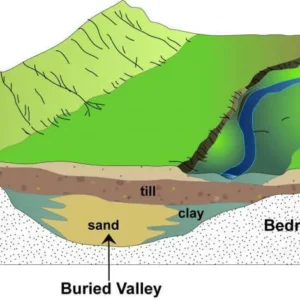
Diagram showing buried valley with sand and clay layers (buried valley)

BBuried Valley

A buried valley is an ancient river valley that has been filled with sediment and buried beneath newer layers of material. These valleys are important in hydrogeology because they often serve as aquifers, providing significant groundwater resources. The study of buried valleys can also reveal information about past river systems and climate conditions. 

Reference: Eyles, N., & Arnott, R. W. C. (1986). The Geological Record of Glaciation.

Share 

Open entry →
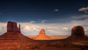
Monument Valley desert rock formations under blue sky (butte)

BButte

A butte is an isolated hill with steep, often vertical sides and a flat top, formed by erosion of the surrounding land. Buttes are remnants of larger rock structures, such as mesas or plateaus, that have been worn away over time. They are common in arid and semi-arid regions and are significant in understanding erosion processes and landscape evolution. 

Reference: Twidale, C. R. (2007). Desert Geomorphology. Cambridge University Press. 

Share 

Open entry →
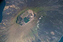
Aerial view of volcanic crater and surrounding landscape (caldera)

CCaldera

A caldera is a large, basin-shaped volcanic depression that forms when a volcano collapses after the emptying of a magma chamber during an explosive eruption. Calderas are much larger than typical volcanic craters, often several kilometers in diameter. They are significant in understanding volcanic processes, the dynamics of magma chambers, and the potential hazards associated with large-scale eruptions. 

Reference: Lipman, P. W. (1997). “Subsidence of Ash-Flow Calderas: Relation to Caldera Size and Magma-Chamber Geometry.” Bulletin of Volcanology, 59(3), 198-218. 

Share 

Open entry →
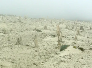
Foggy desert landscape with eroded sand formations (caliche)

CCaliche

Caliche is a hardened deposit of calcium carbonate that forms in arid and semi-arid regions within the soil or at the surface. It can act as a cement, binding together soil particles and forming a hard, impervious layer. Caliche is significant in soil science and desert geomorphology, as it affects soil development, water infiltration, and plant growth. 

Reference: Gile, L. H., Hawley, J. W., & Grossman, R. B. (1966). “Morphological and Genetic Sequences of Caliche Formation in Desert Soils.” Soil Science, 101(5), 347-360. 

Share 

Open entry →
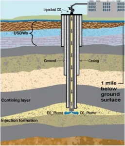
Diagram of underground carbon dioxide injection process (carbon sequestration)

CCarbon Sequestration

Carbon sequestration refers to the process of capturing and storing atmospheric carbon dioxide in order to mitigate climate change. This can occur naturally, through processes like photosynthesis and the formation of carbonate minerals, or artificially, through techniques like carbon capture and storage (CCS). Carbon sequestration is significant in efforts to reduce greenhouse gas concentrations and combat global warming. 

Reference: Lal, R. (2008). “Carbon Sequestration.” Philosophical Transactions of the Royal Society B: Biological Sciences, 363(1492), 815-830. 

Share 

Open entry →
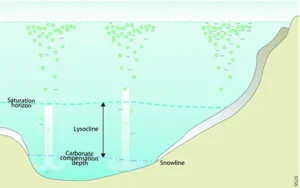
Ocean layers showing lysocline and carbonate compensation depth (CCD)

CCarbonate Compensation Depth (CCD)

The carbonate compensation depth (CCD) is the depth in the ocean below which calcium carbonate (CaCO3) dissolves more rapidly than it accumulates, preventing the formation of carbonate sediments. This depth varies with the acidity, temperature, and pressure of the seawater. The CCD is significant in paleoceanography and sedimentology, as it influences the distribution of carbonate sediments on the ocean floor. 

Reference: Berger, W. H., & Winterer, E. L. (1974). “Plate Stratigraphy and the Fluctuating Carbonate Line.” Pelagic Sediments: On Land and Under the Sea. International Association of Sedimentologists Special Publication No. 1. 

Share 

Open entry →
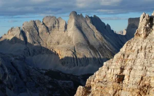
Sunlit rocky mountains under partly cloudy sky (carbonate platform)

CCarbonate Platform

A carbonate platform is a sedimentary body that forms in shallow, warm marine environments and is primarily composed of carbonate minerals such as limestone and dolostone. These platforms are typically associated with coral reefs and other biological activity. Carbonate platforms are crucial in the study of sedimentology, paleoenvironments, and petroleum geology due to their potential as hydrocarbon reservoirs. 

Reference: Schlager, W. (1992). “Sedimentology and Sequence Stratigraphy of Carbonate Platforms.” Marine Geology, 110(1-2), 163-174. 

Share 

Open entry →
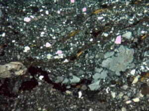
Volcanic breccia rock under microscope view (cataclasite)

CCataclasite

Cataclasite is a type of fault rock formed by mechanical fragmentation and frictional grinding during faulting, without significant recrystallization. It is typically found in fault zones and is characterized by a fine-grained matrix surrounding larger, angular fragments of rock. Cataclasites are important in understanding fault mechanics and the deformation of the Earth’s crust. 

Reference: Sibson, R. H. (1977). “Fault Rocks and Fault Mechanisms.” Journal of the Geological Society, 133(3), 191-213. 

Share 

Open entry →
Fiery meteor entering Earth's atmosphere (catastrophism)

CCatastrophism

Catastrophism is the geological doctrine that Earth’s history has been shaped primarily by sudden, short-lived, and violent events, such as volcanic eruptions, earthquakes, and floods. This contrasts with the principle of uniformitarianism, which emphasizes gradual processes. While modern geology recognizes the importance of both catastrophic events and gradual processes, catastrophism was historically significant in debates about Earth’s history and the development of geological theories. 

Reference: Oreskes, N. (1999). The Rejection of Continental Drift: Theory and Method in American Earth Science. Oxford University Press.

Share 

Open entry →
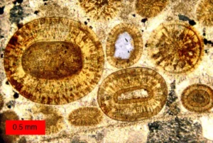
Microscopic view of oolitic limestone grains (cementation)

CCementation

Cementation is the process by which minerals precipitate from groundwater and fill the spaces between sediment grains, binding them together into a solid rock. This process is a key stage in the lithification of sedimentary rocks and is significant in the study of diagenesis and the formation of sedimentary structures. 

Reference: Boggs, S. (2009). Petrology of Sedimentary Rocks. Cambridge University Press. 

Share 

Open entry →
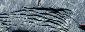
Folded rock layers showing geological deformation (chatter marks)

CChatter Marks

Chatter marks are small, curved fractures found on glaciated rock surfaces, formed by the jerky movement of a glacier over bedrock. These marks are typically crescent-shaped and provide important clues about the direction of glacial movement and the nature of glacial erosion. Chatter marks are studied in the field of glacial geomorphology. 

Reference: Boulton, G. S. (1974). “Processes and Patterns of Subglacial Sedimentation: A Theoretical Approach.” Geological Society of America Bulletin, 85(3), 439-445. 

Share 

Open entry →
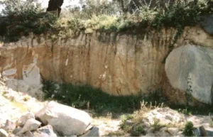
Exposed soil and rock layers on a hillside (chelation)

CChelation

Chelation in geology refers to the process by which metal ions are bound to organic molecules, forming stable, water-soluble complexes. This process plays a critical role in soil chemistry, the mobility of metals in the environment, and the formation of ore deposits. Chelation is important in understanding biogeochemical cycles and the behavior of trace elements in soils and sediments. 

Reference: Sposito, G. (1989). The Chemistry of Soils. Oxford University Press.

Share 

Open entry →
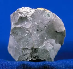
Gray flint rock against blue background (chert)

CChert

Chert is a hard, fine-grained sedimentary rock composed primarily of microcrystalline quartz (silica). It often forms in marine environments as nodules or layers within limestone or chalk and can also be a product of diagenetic processes. Chert is significant in geology for its use in reconstructing past marine environments and as a source of ancient tool-making material. 

Reference: Hein, J. R., & Parrish, J. T. (1987). “Distribution of Siliceous Deposits in Space and Time.” Paleogeography, Paleoclimatology, Paleoecology, 60(1-2), 1-7. 

Share 

Open entry →
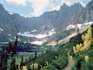
Mountain trail with wildflowers and snow-capped cliffs (cirque)

CCirque

A cirque is a bowl-shaped, amphitheater-like depression eroded into a mountain by a glacier. Cirques are typically found at the head of a glacial valley and are the starting point for glacier formation. The study of cirques is important in understanding glacial processes, alpine geomorphology, and the climatic conditions that lead to glacier formation. 

Reference: Benn, D. I., & Evans, D. J. A. (2010). Glaciers and Glaciation. Routledge. 

Share 

Open entry →
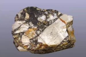
Polished breccia rock with mixed mineral fragments (clastic rock)

CClastic Rock

Clastic rocks are sedimentary rocks composed of fragments, or clasts, of pre-existing minerals and rocks. These fragments are transported by water, wind, or ice and deposited in different environments, where they are lithified into rock. Clastic rocks, such as sandstone, shale, and conglomerate, are key in reconstructing past environments and understanding sedimentary processes. 

Reference: Boggs, S. (2009). Petrology of Sedimentary Rocks. Cambridge University Press. 

Share 

Open entry →
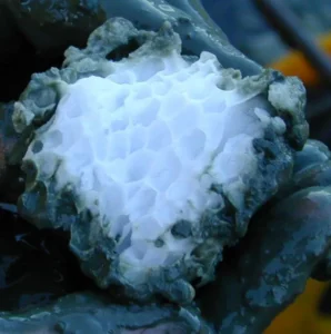
Hand holding a white porous rock (clathrate)

CClathrate

Clathrates, or gas hydrates, are crystalline structures where gas molecules, typically methane, are trapped within a lattice of water ice. They are found in permafrost regions and beneath the ocean floor. Clathrates are significant in studies of climate change, as they represent a potential source of methane, a potent greenhouse gas, which could be released if the clathrates destabilize due to warming temperatures. 

Reference: Sloan, E. D., & Koh, C. A. (2008). Clathrate Hydrates of Natural Gases. CRC Press. 

Share 

Open entry →
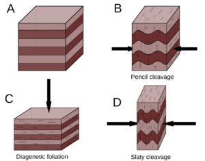
Rock layer deformation showing folding and cleavage formation (Cleavage)

CCleavage

Cleavage is a type of foliation in metamorphic rocks, characterized by the tendency of the rock to split along parallel planes. It is typically associated with low-grade metamorphism and is often found in slate and phyllite. Cleavage planes form as a result of directed pressure during deformation, making them significant in understanding the stress and strain history of a rock. 

Reference: Passchier, C. W., & Trouw, R. A. J. (2005). Microtectonics. Springer. 

Share 

Open entry →
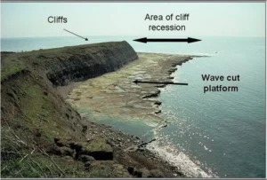
Cliff erosion showing wave cut platform by the sea (cliff retreat)

CCliff Retreat

Cliff retreat is the process by which coastal or riverine cliffs erode and move landward over time. This process can be driven by wave action, weathering, and mass wasting. Cliff retreat is important in understanding coastal dynamics, erosion rates, and the impact of sea-level rise on coastal landscapes. 

Reference: Sunamura, T. (1992). Geomorphology of Rocky Coasts. Wiley. 

Share 

Open entry →
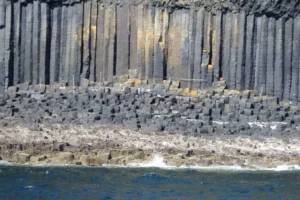
Basalt rock columns by the ocean (columnar basalt)

CColumnar Basalt

Columnar basalt is a type of rock formation characterized by hexagonal columns that result from the cooling and contraction of basaltic lava. These columns typically form in parallel arrays and are often found in volcanic regions. Columnar basalt formations are significant in the study of volcanic processes and the cooling behavior of lava. 

Reference: Goehring, L., Morris, S. W., & Lin, Y. (2006). “Granular-Fluid Behavior in Columnar Basalt Formation.” Physical Review Letters, 97(9), 095503. 

Share 

Open entry →
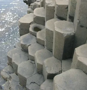
Hexagonal basalt columns by the sea (columnar jointing)

CColumnar Jointing

Columnar jointing is a geological structure that forms when a thick lava flow or shallow intrusive body cools and contracts, creating a pattern of polygonal columns, typically with a hexagonal cross-section. These columns are often vertical and can be seen in basaltic formations, such as the Giant’s Causeway in Northern Ireland. Columnar jointing is important in understanding the cooling and solidification processes of volcanic rocks. 

Reference: De Graff, J. M., & Aydin, A. (1987). “Surface Morphology of Columnar Joints and Its Significance to Mechanism of Jointing.” Geological Society of America Bulletin, 99(5), 605-617. 

Share 

Open entry →
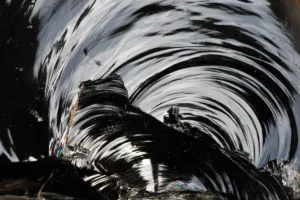
Close-up of shiny black obsidian swirls (conchoidal fracture)

CConchoidal Fracture

Conchoidal fracture is a type of fracture that occurs in brittle materials, such as glass or quartz, where the breakage produces smooth, curved surfaces that resemble the interior of a seashell. This fracture pattern is characteristic of materials that lack natural planes of weakness, making it important in the identification of minerals and the study of material properties. 

Reference: Klein, C., & Hurlbut, C. S. (1999). Manual of Mineralogy. Wiley. 

Share 

Open entry →
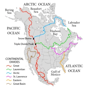
Map of North American continental divides

CContinental Divide

A continental divide is a natural boundary or ridge that separates the watersheds of major river systems on a continent. Water on either side of the divide flows to different oceans or basins. Continental divides are important in hydrology and geography, as they influence the flow of rivers and the distribution of water resources. 

Reference: Hedman, E. R., & Osterkamp, W. R. (1982). “Streamflow Characteristics Related to Channel Geometry of Streams in Western United States.” Geological Survey Water-Supply Paper 2193. 

Share 

Open entry →
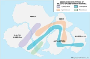
Map showing fossil species ranges in Gondwana (continental drift)

CContinental Drift

Continental drift is the hypothesis that the continents have moved across the Earth’s surface over geological time. Proposed by Alfred Wegener in 1912, this idea laid the groundwork for the modern theory of plate tectonics. Continental drift is critical in understanding the historical distribution of continents, the formation of mountain ranges, and the development of ocean basins. 

Reference: Wegener, A. (1966). The Origin of Continents and Oceans. Dover Publications. 

Share 

Open entry →

join.me

Geology made clear, in your inbox.

Get clear, visual explainers on rocks, minerals, deep time, and the most fascinating parts of Earth science from Geoscopy.
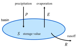
Water balance diagram showing precipitation, evaporation, and runoff (water budget)

WArchives: Glossary

A water budget is a balance sheet of water inflows, outflows, and storage changes within a specific system, such as a watershed, aquifer, or lake. The water budget is significant in hydrology and water resource management for understanding the availability of water resources, managing water supply, and assessing the impacts of land use and climate change on water systems. 

Reference: Viessman, W., & Lewis, G. L. (2003). “Introduction to Hydrology.” Prentice Hall.

Share 

Open entry →