Introduction
If you’re new here, welcome to Geoscopy, a geology science-communication project dedicated to making geology explained clearly, accurately and without unnecessary jargon. This page is a starting point: an introduction to how geologists read rocks, landscapes and deep time to reconstruct Earth’s history. But there’s much more to explore across the site. You’ll find stories about volcanoes, earthquakes, tectonic plates, minerals, fossils, ancient oceans, mass extinctions, strange geological mysteries and the forces that continue to shape our planet today. Whether you’re completely new to geology or already know your schist from your shale, feel free to explore, every article is built around the same idea: helping you read the Earth a little better.
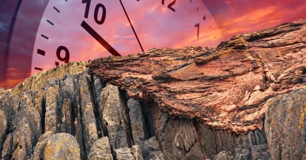
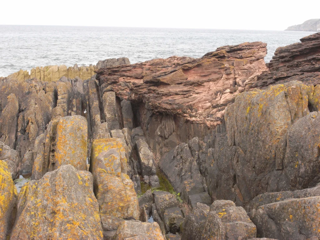
In June 1788 a small boat worked its way along the Berwickshire coast of Scotland and put in at a low rocky headland called Siccar Point. On board were James Hutton, the mathematician John Playfair and Sir James Hall of Dunglass. Hutton wanted his companions to see a particular junction in the rock: a set of grey beds standing almost on end, then a gap, then gently tilted red sandstone lying flat across the top of them. He already had an interpretation in mind, and he wanted his companions to see the evidence. Playfair later wrote that “the mind seemed to grow giddy by looking so far into the abyss of time.” That single afternoon is as good a starting point as any for geology explained, because it captures the whole discipline in one image: the ground is a document, and a trained eye can read it.
The steep grey Silurian sandstones and mudstones began as sediment on an ancient sea floor. They were buried, lithified and deformed, then uplifted and eroded. Devonian rivers later laid red conglomerate and sandstone across that eroded surface, and the whole sequence was uplifted again. That history requires multiple episodes of deposition, deformation and erosion separated by immense spans of time. Hutton read the outcrop and understood that Earth keeps its own history in stone, written in a language of layers, grains, minerals and breaks. Learning that language is what geologists do. Everything that follows is an attempt to teach a little of it.
Geology, explained: definition through method
Geology is the study of the solid Earth: what it is made of, how it is arranged, how it changes, and how old the parts of it are. That definition sounds tidy, but the useful thing about geology is not its subject so much as its method. A geologist starts from something visible in the present, a bed of sandstone, a fault scarp, a chemical trace in a crystal, and reasons backward to the processes and the amount of time that must have produced it. A guiding principle is often called uniformitarianism, or actualism: the same physical laws operate through geological time, so processes observed today help us interpret the past. That does not mean every geological process was slow or every rate constant; impacts, megafloods, eruptions and other catastrophes belong to the same record.
Geology and geography overlap, but they emphasize different questions. Geology focuses on Earth materials, structure, processes and deep history. Geography studies spatial patterns and relationships at Earth’s surface, including both physical environments and human societies. Physical geography overlaps strongly with geology in areas such as geomorphology, hydrology, soils and natural hazards.
The discipline fans out into branches that each read a different part of the record. Mineralogy and petrology deal with the composition of rocks and crystals. Structural geology reads folds and faults to reconstruct the forces that bent them. Stratigraphy and sedimentology read layered rocks like pages. Palaeontology reads the fossils inside them. Geophysics and seismology probe the parts too deep to visit. Geochemistry reads the isotopes locked in minerals as clocks and thermometers. Volcanology, glaciology, hydrogeology and economic geology each take a slice. What unites them is the shared habit of treating the present as a key to the past, and the ground as evidence rather than scenery. Geoscopy’s own guide to field geology covers how that reading is done outdoors, with a hand lens, a hammer and a notebook.
Deep time, and how humans learned to read it
The hardest idea in geology is not a rock type or a force but the amount of time involved. Human intuition is built for seasons and generations, not for the hundreds of millions of years over which mountains rise and vanish. The first person to put the logic of relative time on a firm footing was the Danish anatomist Nicolas Steno, who in 1669 stated the principle of superposition: in an undisturbed stack of sedimentary layers, the ones on the bottom were laid down first. He added that layers start out roughly horizontal and continuous, so anything tilted, cut or interrupted must have been disturbed after it formed. With those simple rules a stack of rock becomes a sequence of events in order.
Steno gave order without duration. He could say which layer was older, not how much older. That second question waited on physics. Around the turn of the twentieth century, the discovery of radioactivity and the recognition that radioactive isotopes decay at predictable rates gave geology a numerical clock. Radiometric dating measures the ratio of a radioactive parent isotope to its stable daughter in a mineral; because the decay rate is constant, the ratio gives an age. Uranium-lead dating in the mineral zircon is the workhorse for deep time, because zircon readily incorporates uranium but strongly excludes lead when it crystallises, so most lead in a well-preserved zircon is radiogenic; geochronologists can also identify or correct for inherited lead and later lead loss.
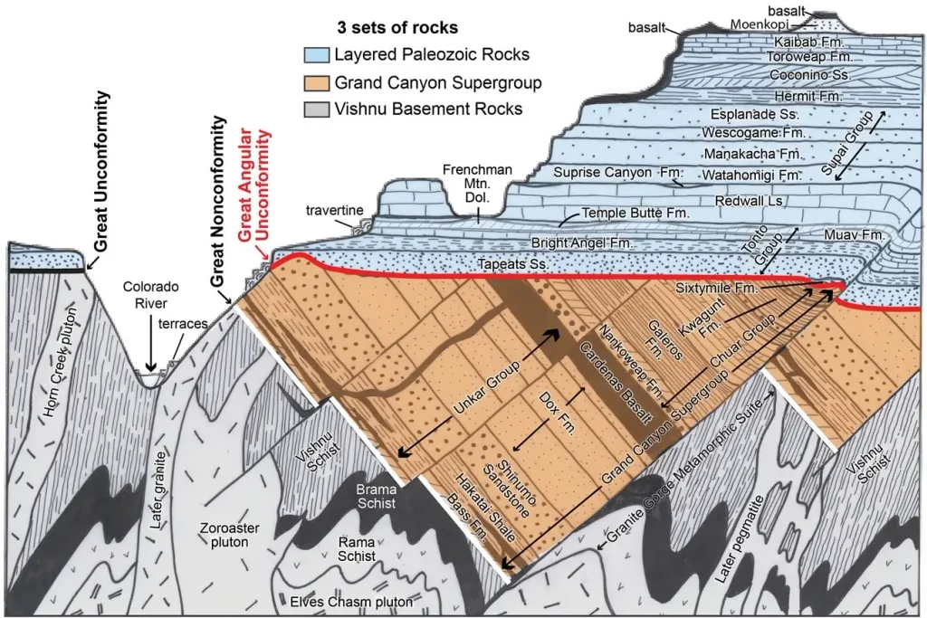
Zircon is exceptionally resistant to weathering, alteration and recycling, which is why the oldest widely accepted terrestrial material yet found is a zircon grain. In a study led by Simon Wilde and published in Nature in 2001, a single detrital zircon from a metaconglomerate on Eranondoo Hill in the Jack Hills of Western Australia yielded a concordant age of 4,404 ± 8 million years. That grain is older than any undisputed intact rock known today; it weathered out of some vanished parent and was recycled into younger sediment, carrying its age with it. It tells us continental crust and liquid water existed within about 150 million years of the planet’s birth. Earth is about 4.54 billion years old. That estimate does not come from simply dating one terrestrial rock; it comes from lead-isotope systematics that treat Earth and primitive meteorites as parts of the same early Solar System, with meteorites preserving primordial lead compositions that terrestrial geology has largely overprinted. The Grand Canyon puts the same principle on display at tourist scale: In parts of the Grand Canyon, Cambrian Tapeats Sandstone rests directly on Precambrian basement rocks more than a billion years older. A gap Geoscopy examines in the Great Unconformity, and the canyon’s own carving is the subject of a 150-year scientific feud over its age.
The engine inside the planet
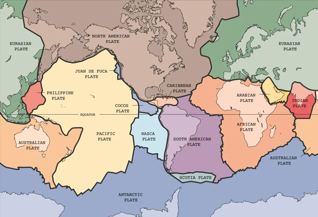
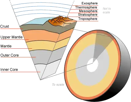
Earth remains geologically active because it still contains enormous internal heat. Some is primordial heat left from the planet’s accretion and differentiation, while radioactive decay, especially of uranium, thorium and potassium, continues to add heat. This energy sustains convection in the solid mantle. Plate motion is coupled to that convecting mantle, while gravity-driven forces, particularly the pull of cold, dense slabs sinking at subduction zones, play a major role in moving the plates.
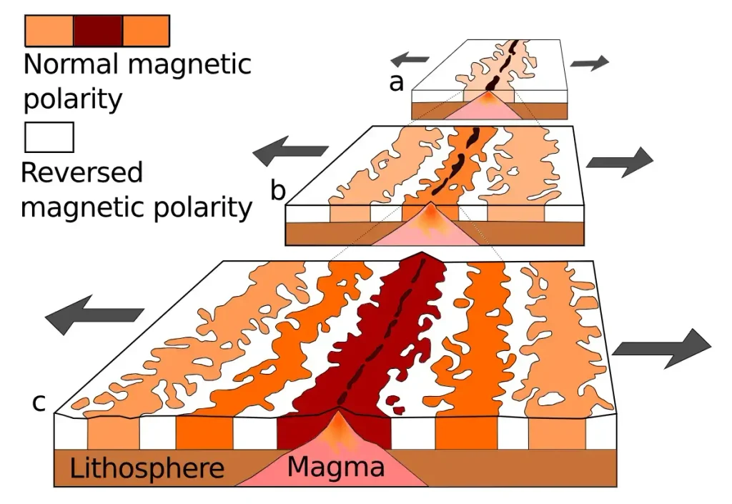
The idea took a long time to win. In 1912 the German meteorologist Alfred Wegener proposed continental drift, pointing to the jigsaw fit of Africa and South America and to matching fossils and rock sequences on opposite Atlantic coasts. He had no mechanism, and geologists rejected the notion for decades. The evidence that turned the argument came from the sea floor. In the early 1950s, Marie Tharp’s North Atlantic profiles revealed a rift valley along the Mid-Atlantic Ridge; Tharp and Bruce Heezen later helped trace the connected mid-ocean-ridge system around the globe. Harry Hess then proposed seafloor spreading: upwelling mantle partially melts beneath ridges, magma forms new oceanic crust, and the lithosphere moves away as plates diverge.
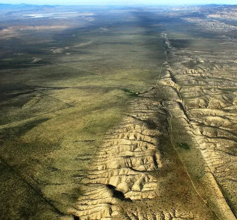
Crucial evidence came from marine magnetism. As new ocean crust cools, iron-bearing minerals lock in the direction of Earth’s magnetic field, which reverses polarity at irregular intervals. Surveys of the ocean floor revealed symmetrical stripes of normal and reversed magnetism running parallel to the ridges, mirror images on either side, a tape recording of spreading. Today the motion is measured directly. Geodetic measurements now track the motion directly: Pacific–North America relative motion in California is several centimetres per year, distributed across the San Andreas fault system and neighbouring faults, roughly the rate at which fingernails grow. Or India driving into Asia to keep the Himalaya rising. Plate tectonics ties the whole surface together: earthquakes, volcanoes, mountain belts and the slow opening and closing of oceans are all its bookkeeping. Geoscopy has followed that bookkeeping into odd corners, from the lost continent of Argoland now sutured into Southeast Asia, to the Turkana Rift, where East Africa is tearing open to make a new ocean.
The rock cycle, read in real landscapes
Every rock on Earth belongs to one of three families, defined by how it formed, and the whole system turns over continuously in what geologists call the rock cycle. Igneous rocks crystallise from molten material. Magma that cools slowly at depth can grow large interlocking crystals, producing coarse-grained rocks such as granite; lava that cools quickly at the surface commonly forms fine-grained rocks such as basalt. Thick lava flows can also fracture into polygonal columns as they cool and contract: slower cooling generally produces broader, more regular columns, whereas faster cooling produces narrower and less regular jointing.
Sedimentary rocks form at the surface from the debris of older rocks or from chemical and biological precipitation. Rivers, wind, ice and waves break older rocks into sand and mud, transport the sediment, and deposit it in basins where burial and cementation can turn it into sandstone and mudstone. Limestone commonly forms instead from carbonate precipitation or from the accumulation of shells and other skeletal material. These are the rocks that keep the clearest historical record, because they preserve layering, fossils and the ripples and mud cracks of ancient surfaces. The seashells that hikers find near the summit of Everest are marine limestone lifted more than eight kilometres by the India-Asia collision, a story told in Geoscopy’s account of fossils on the roof of the world. Erosion is the engine feeding the whole sedimentary side of the cycle, a process examined on its own terms in how erosion shapes Earth’s history.
Metamorphic rocks are older rocks reworked in the solid state by heat and pressure, usually during mountain-building or deep burial. In a common regional metamorphic sequence, shale can become slate, then schist and, at higher metamorphic grade, gneiss; other protoliths can also produce gneiss. Push a metamorphic rock far enough and it melts, becoming magma again, and the cycle closes. A single atom of silicon might pass through all three families many times over billions of years. Reading a rock means asking which loop of the cycle it is currently in, and where it has been before. For readers who want to put a name to a specimen in hand, Geoscopy’s beginner’s guide to rock identification and its visual rock atlas work through the diagnostic features family by family.
How geologists actually know things
Each of the claims in this article, an age of 4.4 billion years, a plate moving at fingernail speed, a mantle that convects, rests on a method. Geology becomes especially powerful when independent methods converge on the same history.
Field mapping is the foundation. A geologist walks the ground, records what rock is where and how it is oriented, and builds a three-dimensional picture from two-dimensional exposures, then tests it by prediction: if the interpretation is right, a certain rock should appear over the next ridge. Stratigraphy applies Steno’s rules to correlate layers between distant sites using distinctive marker beds and fossil assemblages. Radiometric dating pins numerical ages to that framework. Seismology reads the Earth’s interior by timing earthquake waves: pressure waves pass through liquids while shear waves do not, and it was the disappearance of shear waves at depth that revealed the outer core is molten. The same technique, refined, produces tomographic images of the whole mantle.
Isotope geochemistry turns minerals into thermometers and tracers, recording the temperature at which a crystal grew or the source of the water that altered it. Deep drilling samples the crust directly; the Kola Superdeep Borehole in Russia reached 12.26 kilometres and returned direct rock samples and temperature measurements from the continental crust. Remote sensing from satellites maps deformation to the millimetre, so that the ground swelling above a magma chamber or slipping in an earthquake can be watched from orbit. Numerical modelling ties the observations together and tests whether a proposed process can actually produce the measured result. No single line of evidence carries a conclusion on its own. Confidence comes from convergence, and where the methods disagree, that disagreement is where the science is happening.
Earth as one coupled system
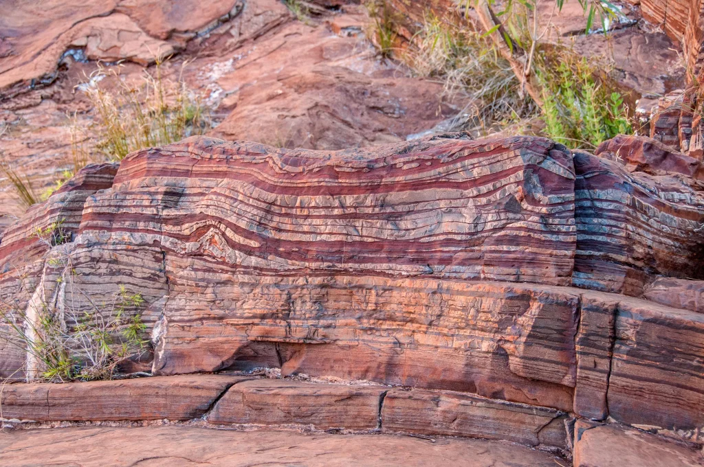
For a long time geology, biology, chemistry and climate were studied as separate subjects. The record shows they are one system, and some of the most important entries in that record are chemical rather than physical. The clearest example is the Great Oxidation Event. For much of Earth’s early history, atmospheric free oxygen remained extremely low. Oxygenic photosynthesis evolved before the Great Oxidation Event, but around 2.4 billion years ago atmospheric oxygen began a sustained rise that left a profound mark in the geological record.
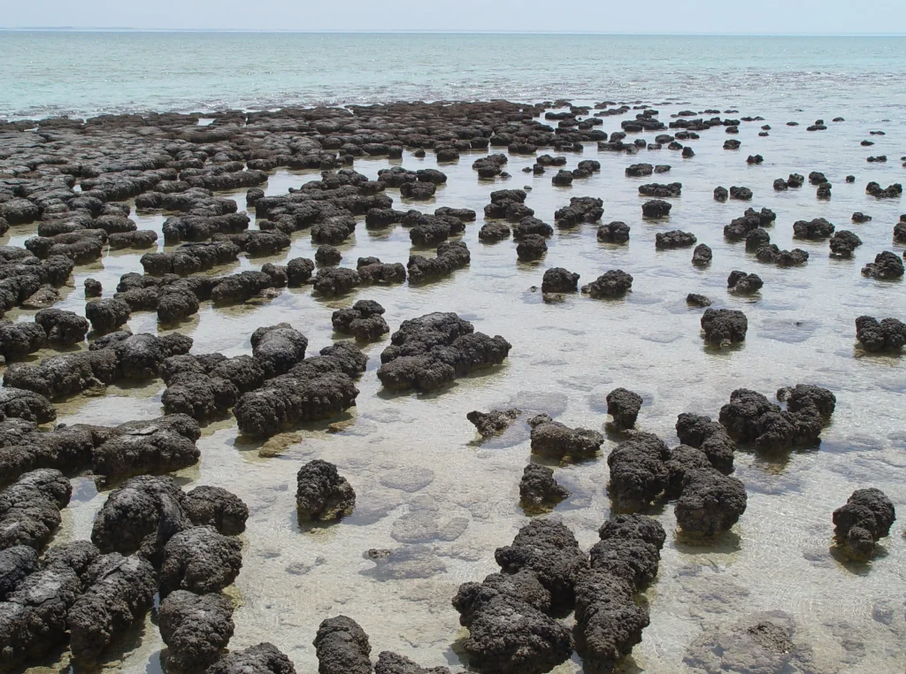
That mark is the banded iron formation: alternating layers of iron oxide and silica, laid down when oxygen produced by early life reacted with iron dissolved in the oceans and precipitated it to the sea floor. These rocks are both the fingerprint of an atmospheric revolution and the source of most of the iron ore that built the industrial world. Geoscopy reads them in detail in banded iron formations as Earth’s oxygen record. Stromatolites still form today in places such as Shark Bay, where microbial mats build laminated structures that provide useful, but imperfect, analogues for some ancient stromatolitic processes.
The coupling can become lethal. The end-Permian mass extinction about 252 million years ago was the largest of the Phanerozoic. In a 2018 Science study, Justin Penn, Curtis Deutsch and colleagues showed that ocean warming and oxygen loss could account for more than half of the observed marine extinction magnitude, including its geographic pattern. Siberian Traps magmatism is the leading trigger, with greenhouse-gas release driving extreme warming and a cascade of ocean deoxygenation and acidification; gases generated where magma intruded carbon-rich and evaporitic sediments may have amplified the disturbance. Geology, atmospheric chemistry, ocean chemistry and life were all coupled in the crisis. That deep record is one of the few ways to test how the Earth system responds to large, rapid carbon perturbations.
Why geology is a matter of life and death
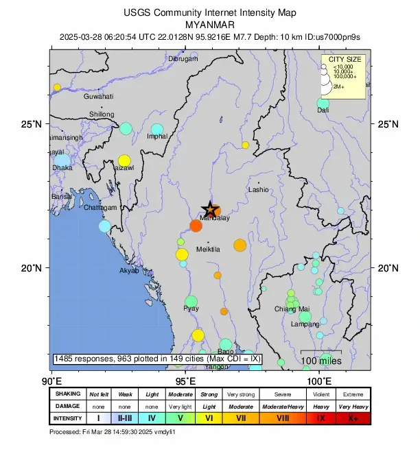
Geology is also a hazard science. On 28 March 2025 a magnitude 7.7 earthquake struck near Mandalay in Myanmar. According to a USGS-led analysis, it ruptured 475 kilometres of the Sagaing Fault, more than twice the length that standard scaling relations predict for that magnitude, and it did so at supershear velocity, greater than 5 kilometres per second, faster than the shear waves it was generating, producing a sonic-boom-like Mach front recorded in Thailand. The USGS PAGER system estimated that more than 55 million people in Myanmar and Thailand were exposed to at least moderate shaking, and about 2.6 million to violent shaking. The event shows that magnitude–rupture-length scaling used in seismic-hazard models can underestimate the footprint of rare, exceptionally long strike-slip ruptures. Geoscopy covers the rupture, apparently captured in what is the first known video of surface fault rupture during a major earthquake, in the first fault rupture caught on camera.
Volcanoes write the same lesson more slowly. The eruptions on Iceland’s Reykjanes Peninsula, dormant for eight centuries and reawakened along the Sundhnúkur fissures, forced the evacuation of the town of Grindavík and are explained in Geoscopy’s piece on why Reykjanes is erupting again. Earthquakes can arrive in near-simultaneous pairs, as they did in the Venezuela doublet of June 2026, and swarms can rattle a caldera for months without erupting, as at Santorini in 2025. Water in the mountains is its own hazard: on 26 August 2026 a collapsing glacier and outburst flood tore down the Bhote Koshi valley below Langtang in Nepal. The largest wave ever measured, more than half a kilometre high, was a landslide-driven surge in Lituya Bay, Alaska. And the greatest hazard on many coasts is one no living person has felt: the Cascadia megathrust that ruptured in 1700, dated to the night of 26 January that year by the tsunami it sent across the Pacific to Japan. Reading the record is how societies find these threats before the threats find them.
Resources, and the civilisations built on them
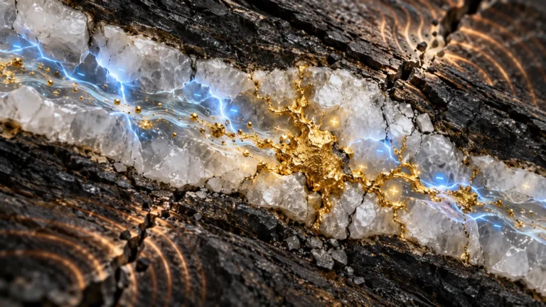
Almost everything a modern society runs on comes out of the ground, and finding it is applied geology. Groundwater, held in porous and fractured rock, supplies a large share of the world’s drinking and irrigation water, and understanding how it moves is the difference between a sustainable aquifer and a depleted one. Energy has been geological for two centuries, from coal and oil trapped in sedimentary basins to the geothermal heat tapped in volcanic regions. A newer prospect is natural, or “white,” hydrogen: molecular H₂ generated and accumulated underground through geological processes, including reactions between water and iron-bearing rocks. In February 2024 a team led by Laurent Truche reported in Science direct measurements of gas venting at 84 percent hydrogen by volume from the Bulqizë chromite mine in Albania, with at least 200 tonnes escaping each year, the case Geoscopy lays out in its feature on the white-hydrogen rush.
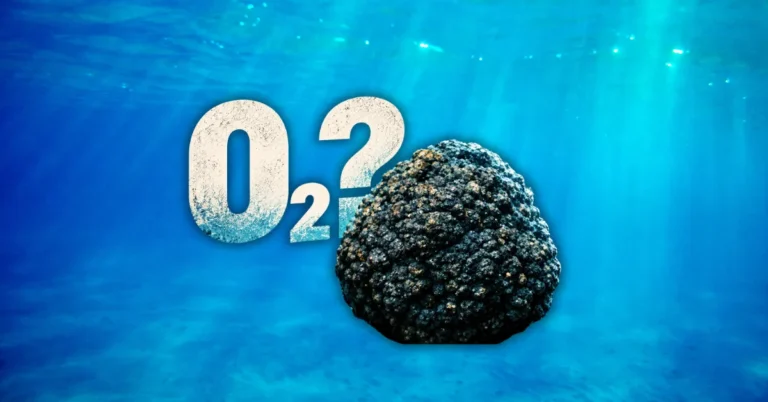
The metals for electrification are geological too. Copper, lithium, cobalt, nickel and the rare-earth elements, the “critical minerals” of energy policy, are concentrated only where specific geological processes put them, and the search for them is reshaping mining and geopolitics. It even reaches the deep sea, where the polymetallic nodules that carpet parts of the abyssal Pacific have become the centre of a scientific and legal fight examined in Geoscopy’s report on dark oxygen. Geology also decides where waste can safely go: the search for stable rock to hold nuclear waste for millennia has a natural precedent in the Oklo natural nuclear reactor in Gabon, where natural fission reactors operated about two billion years ago. Studies at Oklo show that some actinides and fission products remained highly localised while others migrated, making the site a valuable, but not simple, natural analogue for long-term radionuclide behaviour. Even gemstones are a resource question, treated at consumer level in Geoscopy’s guide to alternative engagement-ring stones. Where a city sits, why it grew rich, and what it fears are usually geological answers.
The frontier: what geologists are arguing about now
Textbooks can make a science look finished. Geology is not, and the years from 2023 to 2026 have been unusually busy at its deep-Earth frontier. One long-running argument is about when plate tectonics began. Estimates range from more than four billion years ago to less than one billion, because the early crustal record is so sparse; the Jack Hills zircons are evidence in that debate precisely because so little else survives from the Hadean.
Another argument sits at the bottom of the mantle. Two continent-sized regions where seismic shear waves slow down, one under Africa and one under the Pacific, were first reported by Su, Woodward and Dziewonski in 1994. These large low-shear-velocity provinces, which by one estimate occupy about 8 percent of the mantle by volume (Cottaar and Lekić, 2016), are variously interpreted as graveyards of subducted ocean crust, primordial piles left from a magma ocean, or even fragments of the planet Theia that struck the early Earth. Geoscopy surveys the competing stories in LLSVPs: hidden giants at the core-mantle boundary, and traces how one of them may bend the magnetic field in the Laschamps excursion and the related Indian Ocean gravity hole. The inner core is contested too: work by Yi Yang and Xiaodong Song in Nature Geoscience in 2023 argued that it oscillates relative to the mantle on an approximately 70-year cycle that paused around 2009, a claim other seismologists still dispute.
Not every frontier is thousands of kilometres down. The discovery that manganese nodules on the deep-sea floor may generate oxygen in total darkness, the “dark oxygen” now splitting marine science, would rewrite assumptions about where oxygen can come from if it holds up. Even the mantle’s water budget is unsettled, after ringwoodite trapped in a diamond showed the transition zone can hold an ocean’s worth of water bound in rock, the subject of Geoscopy’s ocean inside the Earth. These are live questions, and the honest version of geology explained says so plainly rather than papering over them.
The most common myths about geology, corrected
Popular geology is full of durable errors, and a few are worth dismantling precisely. The most stubborn is that diamonds are squeezed coal. They are not. Coal is a sedimentary rock made from land plants, which did not exist until roughly 400 million years ago, and it rarely sits more than a couple of kilometres deep. Most natural diamonds are far older and crystallised 140 to 200 kilometres down in the mantle, from carbon that never saw sunlight, before being carried up in violent kimberlite eruptions. Geoscopy takes the myth apart in are diamonds made from coal and explains the real delivery mechanism in how diamonds reach the surface.
A second myth is that the Earth’s layers were sorted out with drills. Almost nothing about the deep interior comes from direct sampling; the deepest hole ever bored, at Kola, barely dented the crust, and most of what we know about the deep interior comes from seismology, gravity, geomagnetism, mineral physics and modelling. A third is that geological change is always slow. Most of it is, but the record is punctuated by catastrophes that obey the same physics at high speed: individual Missoula floods transformed parts of eastern Washington within days, and the floods recurred many times. Many geological processes are slow, but the record is also punctuated by abrupt events that obey the same physics: individual Missoula floods transformed parts of eastern Washington within days. Other examples include the debated hypothesis of catastrophic Mediterranean refilling after the Messinian Salinity Crisis and the 1980 Lake Peigneur disaster, when drilling breached an underground salt mine and the lake rapidly drained into it. Uniformitarianism means that the same physical laws and familiar processes can be used to interpret the past; it does not require geological change to be gentle or slow. A fourth is that quicksand swallows people whole; the physics, worked out in Geoscopy’s piece on whether you can drown in quicksand, says a human body is too buoyant to sink out of sight. For a broader sweep of the errors that circulate online, Geoscopy keeps a running correction in what TikTok gets wrong and right about geology.
How to learn geology, properly
Anyone can start reading the ground, and the good news is that the best material is free and the equipment is cheap. Begin in the field, where geology is a physical skill before it is a body of facts. A hand lens, a notebook and the discipline of describing what you actually see, grain size, colour, layering, hardness, will teach more than any amount of passive reading; Geoscopy’s field geology guide is a practical starting point, and its rock identification guide and A-to-Z glossary give the vocabulary. Geologists sometimes wet a fresh rock surface to make grains and textures easier to see; putting unknown specimens in your mouth is unnecessary and can be unsafe.
For the science behind the specimens, geology is unusually well explained online by institutions that publish for the public and cite their evidence. The U.S. Geological Survey (USGS) and the British Geological Survey (BGS) cover hazards, maps and resources; NASA’s Earth Observatory pairs satellite imagery with clear write-ups; the Geological Society of London publishes accessible primers; and free open textbooks such as OpenGeology and the LibreTexts geosciences library give a full first-year course at no cost. These sit alongside Geoscopy’s own long-form explainers, its video archive and its topic archives in volcanology, geophysics and mineralogy. A workable path is to learn to describe rocks in the field, read a free textbook chapter for the mechanism behind what you saw, and then follow a current discovery through a sourced explainer to see how the method is applied to a real problem. Do that for a season and Siccar Point stops being a curiosity and becomes legible.
Back at the outcrop
Return to the three men on the shore at Siccar Point. What made Playfair giddy was not the rock itself, which is grey and red and unspectacular, but the sudden comprehension of how much had happened to it and how long that had taken. That comprehension is the whole of geology in miniature: a surface observed in the present, reasoned back through processes we can measure, into a past far deeper than intuition allows. Every method in this article, from a hand lens to seismic tomography, is a way of extending that single act of reading a little further into the abyss. The ground is still writing, under Reykjanes and along the Sagaing Fault and beneath the Pacific, and the record is open to anyone willing to learn the language. Read the Earth.
Frequently asked questions
What is geology in simple words?
Geology is the science of the solid Earth: what rocks and minerals are made of, how they form and change, how the planet is structured inside, and how old its features are. Its central method is reading present-day clues in rock to reconstruct past processes and the vast spans of time involved.
What are the three types of rock?
Igneous rocks crystallise from molten magma or lava, such as granite and basalt. Sedimentary rocks form from compacted debris or chemical precipitation, such as sandstone and limestone. Metamorphic rocks are older rocks reworked by heat and pressure without melting, such as slate, schist and gneiss. The rock cycle continuously converts one type into another.
What do geologists actually do?
Geologists map rocks in the field, sample and date them in the lab, and interpret how they formed. They find water, energy and minerals, assess hazards such as earthquakes, volcanoes and landslides, reconstruct past climates, and advise on construction and waste disposal. The work combines outdoor fieldwork with chemistry, physics and increasingly heavy data analysis.
How do geologists know how old a rock is?
They use two approaches. Relative dating orders layers by position, since lower beds are usually older. Numerical dating uses radioactive decay: minerals such as zircon trap radioactive isotopes that decay to stable products at fixed rates, so the parent-to-daughter ratio gives an age in years. Independent isotope systems are cross-checked for agreement.
How old is the Earth, and how do we know?
Earth is about 4.54 billion years old. The figure comes not from any Earth rock but from the lead-isotope composition of meteorites, which formed at the same time as the planets and have remained closed systems since. The oldest known Earth material, a zircon grain from Jack Hills, Australia, is dated to 4,404 ± 8 million years.
What is the difference between geology and geography?
Geology studies the solid Earth and its deep history, the rocks, structures and processes that shaped the planet over billions of years. Geography describes the present-day surface and how humans relate to it, including landforms, climate and settlement. They overlap in the study of landscapes, but geology emphasises the cross-section and the time axis.
Why is geology important?
Geology locates drinking water, energy and the metals modern technology needs, and it identifies the hazards that threaten cities: earthquakes, volcanoes, landslides and tsunamis. It also provides the only long-run record of how Earth’s climate and life respond to change, which is why the deep past informs decisions about the future.
What is plate tectonics in simple terms?
Earth’s rigid outer shell is broken into large plates that move slowly over the hotter, flowing mantle beneath, driven by internal heat. Where plates pull apart, collide or slide past one another, they produce most of the world’s earthquakes, volcanoes and mountain ranges. Plates move at roughly the rate human fingernails grow.
Is geology a hard science, and is it hard to study?
Yes. Geology is a rigorous natural science that draws on physics, chemistry, biology and mathematics. It is not especially harder to begin than any other science: the basics of rocks and time are accessible to any curious adult, while the professional level demands quantitative skill and fieldwork. Its distinctive challenge is reasoning across enormous spans of time.
How can a beginner start learning geology?
Start outdoors by describing rocks you can see, their grain, colour and layering, using a hand lens and notebook. Pair that with free resources from the USGS, BGS, NASA Earth Observatory and open textbooks such as OpenGeology and LibreTexts, plus sourced explainers. Learning to identify local rocks and follow one current discovery builds real understanding quickly.
What is deep time?
Deep time is the geological concept of time on the scale of millions to billions of years, far beyond human experience. It emerged when James Hutton and others recognised that slow, everyday processes, given enough time, could build and destroy mountains. Grasping deep time is what lets geologists read a rock as a record of long past events.
What is the rock cycle?
The rock cycle is the continuous transformation of rock among the three families. Magma cools into igneous rock; weathering and erosion turn it into sediment that hardens into sedimentary rock; heat and pressure convert either into metamorphic rock; and deep melting returns rock to magma. Driven by internal heat and surface erosion, the cycle has run for billions of years.