Introduction
On a low rise of Arctic tundra near the Norwegian border, in the spring of 1970, a drill bit cut into the oldest rock in Europe and began a descent that would last most of a working lifetime. The crew at the Kola Superdeep Borehole did not know it then, but they were starting a project that would outlast the Soviet Union, force a rewrite of parts of the textbook on what lies beneath our feet, and, improbably, give rise to one of the late twentieth century’s most persistent religious hoaxes. When they finally stopped, the hole reached 12,262 metres into the crust. Nothing humans have drilled since has gone deeper.
What follows is an account of why it was dug, what it cost, what surprised the scientists who studied it, and how a sober geological experiment became the “well to hell.”
A race nobody could see
Everyone remembers the Space Race. Far fewer remember that the same Cold War rivalry pointed downward as well as up. While rockets grabbed the headlines, geologists in both superpowers were lobbying for a different kind of frontier: the inside of the planet. We had mapped the Moon’s near side in more detail than the rock a few kilometres beneath any city. The deep crust was inferred almost entirely from the way earthquake waves bent and sped up as they passed through it. Nobody had a sample from more than a few kilometres down.
The Americans moved first. In 1958 a group with the gleefully unserious name of the American Miscellaneous Society (AMSOC) won National Science Foundation backing for Project Mohole, an attempt to drill clean through the thin oceanic crust and pull up a piece of the mantle. The target was the Mohorovičić discontinuity, the boundary between crust and mantle, and the project’s name was a portmanteau of “Moho” and “hole.” In 1961, off Guadalupe Island, Mexico, the converted drilling barge CUSS I drilled five holes, the deepest reaching about 183 metres below the sea floor through roughly 3,500 metres of water. That was a real engineering milestone: it proved a ship could hold position over a single spot in deep water and drill. The science was thinner, and the politics soon soured. Costs ballooned and management splintered. Congress cut the funding in 1966, and the mantle stayed unreached.
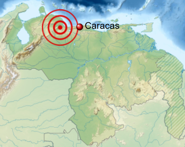
The Soviets took a different route. Rather than chase the thin crust under the ocean, they would drill on land, straight down, as far as a hole could be pushed, and learn whatever the rock had to teach along the way. The choice of the Kola Peninsula was deliberate. The Baltic Shield there exposes some of some of the oldest and most stable continental crust on Earth, and among the coldest, Precambrian basement perhaps 35 kilometres thick. Cold crust meant the temperature would climb more slowly with depth, which engineers assumed would let them drill further before heat became unbearable. Drilling began on 24 May 1970, the centenary year of Lenin’s birth, with the full propaganda weight the date implied.
The borehole was one of a small family of Soviet “superdeep” holes designated SG. Two earlier ones, SG-1 in Kazakhstan and SG-2 in southern Russia, never reached 7 kilometres. SG-3 on Kola was meant to reach about 7,000 metres at first. As confidence grew, the target was pushed to a staggering 15,000 metres, and in 1974 a purpose-built rig, the Uralmash-15000, was installed and named for that ambition.
How you drill a hole 12 kilometres deep
The first thing to understand about the Kola Superdeep Borehole is how thin it is. The deepest hole on Earth is just 23 centimetres across, about nine inches, roughly the width of a dinner plate. A thread of empty space, nearly eight miles long, drilled into solid crystalline rock.
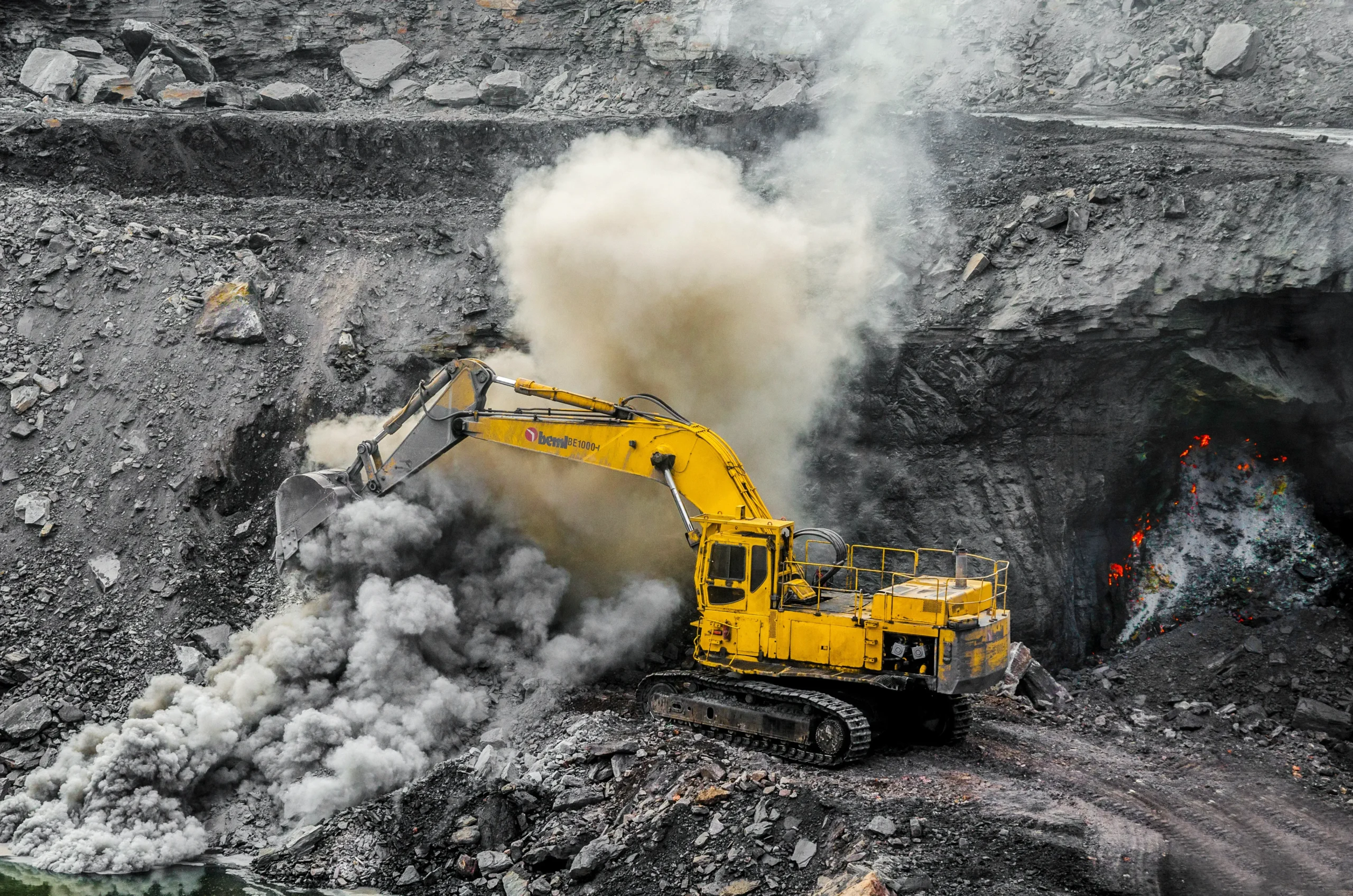
Drilling that deep with conventional methods is impossible, and the reason is simple physics. A normal drilling rig turns the entire string of pipe from the surface so the bit at the bottom spins. Past a certain length the steel pipe stops behaving like a rigid rod. It twists along its length, stores torsional energy like a wound spring, and eventually fails under its own weight and torque. At 12 kilometres the drill string would weigh on the order of a million pounds. You cannot simply rotate it.
The Soviet answer was the turbodrill. Only the bit at the very bottom turned, spun by the pressure of drilling mud forced down the hollow pipe at around 250 atmospheres. The pipe itself, made of a lightweight aluminium alloy to shave weight, slid down without rotating. Sensors were built into the bottom assembly to take readings in place rather than waiting hours to haul a core to the surface. Each time the crew needed to change a worn bit, they had to pull the entire string out of the ground, unscrewing it section by section, and then feed it all back down, a round trip that could swallow most of a day. A single bit might last only a handful of hours of cutting at the bottom.
Progress, by any normal standard, was glacial. On 6 June 1979 the hole passed 9,583 metres and broke the world depth record previously held by the Bertha Rogers gas well in Washita County, Oklahoma. By 1983 the drill had pushed past 12,000 metres, and the Soviet scientific establishment paused to celebrate. The bit lay idle for roughly a year while delegations of scientists and politicians toured the site, admired the rusty record-setting drill head, and posed for photographs. A commemorative postage stamp was issued. Coffee cups bearing the iconic drilling tower were handed to visiting guests.
That long pause may have cost them. When drilling resumed after the long pause, the hole, by then at 12,066 metres, gave way. On 27 September 1984 a five-kilometre section of the drill string twisted off and was abandoned in the hole, unrecoverable. The crew had no choice but to plug back and, in 1986, start a fresh branch from around 7,000 metres. This was not a one-off. The borehole is really a family of holes, several branches forking off a central shaft, the deepest of which is SG-3. The repeated breakdowns and sidetracks gave the well a shape, mapped out over years, that the scientists themselves compared to a crooked tree.
The record depth of 12,262 metres was reached in 1989. There is a minor discrepancy in the literature: the International Continental Scientific Drilling Program and some references cite 12,261 metres, while most sources, including Smithsonian and Guinness World Records, give 12,262 metres. The difference of a single metre sits at the edge of measurement precision and changes nothing about the achievement. The Soviet plan, even at this point, was optimistic to the end, internal projections in 1989 still spoke of reaching 13,500 metres by 1990 and the full 15,000 by 1993.
They never got close. The hole stalled, branched, and stalled again, defeated, in the end, by heat.
The wall they couldn’t drill through
For the first few kilometres, the temperature behaved itself. It rose with depth at roughly the rate the planners expected, tracking their model down to around 3,000 metres. Below that, the rock began to outpace the predictions. By the bottom of the hole the temperature had reached about 180°C, 356°F, when the models had forecast something closer to 100°C at that depth. The crust on Kola was running nearly twice as hot as it was supposed to.
That changes everything about drilling. Hot rock under enormous confining pressure stops behaving like the brittle stuff at the surface. It turns ductile, almost plastic. Soviet scientists described the rock at the bottom as behaving more like plastic than like stone, and the practical consequence was maddening: the moment the bit stopped cutting and was withdrawn, the walls of the hole would slowly squeeze inward, the rock effectively flowing back into the void the drill had made. Drill bits softened and deformed. The mud needed to be denser and more carefully managed. Every metre cost more time and more equipment than the last.
That 180°C reading is also, incidentally, the figure the hoaxers would later inflate into something cinematic. At 180°C the rock was nowhere near hellish, roughly the temperature of a moderate kitchen oven, but it was the practical end of the road. Engineers reckoned that at the rate the temperature was climbing, the rock at the 15,000-metre target would sit around 300°C, far beyond what the available tools could survive.
Drilling on the deepest branch effectively halted in 1992 at a temperature of 180°C, with a final attempt on one branch ending at 11,882 metres. A last, shallower branch was started in 1994 and abandoned at 8,578 metres for lack of money. The Soviet Union itself had dissolved at the end of 1991, and the funding that had sustained a two-decade earth-science marathon simply evaporated.
What did they find in the Kola borehole?
The Kola Superdeep Borehole was never going to reach the mantle; it managed only about a third of the way through the local crust. Measured against the original dream of pulling up a piece of the mantle, it failed. Measured by what it taught us about the continental crust, it delivered a scientific haul that geologists are still working through decades later.
The missing basalt and the case of the vanishing boundary
The single most important scientific result was something the drill failed to find. Seismologists had long noticed that in many continental regions, earthquake waves speed up abruptly somewhere around 15 to 20 kilometres down, a mid-crustal jump named the Conrad discontinuity, after the Austrian seismologist Victor Conrad, who described it in 1925. The standard interpretation, inherited from the early twentieth century, was that this marked a change in rock type: a “granitic” upper crust sitting on top of a denser “basaltic” lower crust. On Kola, the velocity change was expected somewhere around 7 kilometres.
The drill reached that depth and found no basalt. It found more granite, and below that, gneiss, metamorphosed but still unmistakably continental, granitic rock, continuing all the way to the bottom of the hole. The expected granite-to-basalt transition did not exist at 7 kilometres, or at any depth the drill reached. The seismic boundary itself was real; its cause was simply not a change in rock type. It turned out to be a zone where the rock had been fractured and cooked by metamorphism and was saturated with water, which altered how seismic waves moved through it. Textbooks had drawn the boundary as a clean chemical layer cake. What the drill actually hit was a smear of cracked, wet, altered rock.
That single finding forced a quiet rewrite of how geologists read seismic data from the deep crust. A velocity jump no longer automatically meant a change in rock type; it could mean the same rock, broken and saturated with fluid.
“They were also blown away that there was no transition from granite to basalt, a boundary geologists call ‘Conrad discontinuity,’ which was reasoned to exist based on results of seismic-reflection surveys,” noted Dr. Ulrich Harms of the International Continental Scientific Drilling Program at GFZ Potsdam, who has visited Kola, examined its core repository, and worked on the German rival project.
Water where water shouldn’t be
The second surprise was liquid. Free, salty, mineralised water was circulating through cracks in the crystalline rock several kilometres down, pooled and moving roughly between 3 and 6 kilometres, with mineralised fluids reported deeper still. Western geologists, accustomed to thinking of the deep crust as essentially impermeable, found this hard to swallow. The prevailing assumption was that a few kilometres down, the crushing pressure would have squeezed every crack shut, leaving no room for water to move.
Harms has described how unwelcome the news was at the time:
“When the Russians started to drill they claimed they had found free water, and that was simply not believed by most scientists,” he told the BBC. “There used to be common understanding among Western scientists that the crust was so dense 5km down that water could not permeate through it.”
The water appears to have been squeezed out of the minerals themselves. Under heat and pressure, water locked in the crystal structure of the rock is liberated, and on Kola it had collected in fractures rather than escaping upward, trapped beneath a less permeable layer. Harms summarised the significance for HowStuffWorks: “One of the unexpected results was certainly the occurrence of open saline water-filled cracks documenting that the crust is not dense but that pathways exist allowing fluids to flow.” The deep crust, in other words, leaks.
Boiling mud and a whiff of hydrogen
The drilling mud that came back up the hole was, in the words that have followed the project ever since, “boiling” with hydrogen gas. Flows of helium, nitrogen, methane and other hydrocarbons, and carbon dioxide were detected at many levels too. The hydrogen in particular was abundant enough to be startling. The leading modern explanation is serpentinization: hot, mineralised water reacting with iron- and magnesium-rich silicate minerals in the rock, a process that transforms them into serpentine and releases free hydrogen as a byproduct. The same chemistry is now of intense interest at the bottom of the ocean, where it powers some of the strangest ecosystems on the planet and may bear on the origin of life.
Microscopic fossils in two-billion-year-old rock
The discovery that captures most imaginations came from about 6 kilometres down, roughly 6.7 kilometres, or 22,000 feet, in the sources that give a precise figure. There, in rocks around two billion years old, the team recovered microscopic fossils. As the University of Texas Bureau of Economic Geology’s EarthDate program puts it: “At 22,000 ft (6.7 km, 4.2 mi), 24 species of 2-billion-year-old microfossils were found intact, encased within organic carbon and nitrogen compounds that appear to have protected the fossils from the intense heat and pressure at those depths.” These were single-celled marine microplankton, preserved in organic compounds rather than the usual mineralised shells, which shielded their delicate structures, from heat and pressure that should have destroyed them.
It is important to keep two ages separate here, because popular accounts routinely jam them together. The microfossils sit in rock about two billion years old, at around 6 kilometres. The rock at the very bottom of the hole, near 12 kilometres, is older still, Archean basement on the order of 2.7 billion years old. The fossils are not 2.7 billion years old, and the bottom of the hole is not where they were found. Conflating the two produces a tidier sentence and a wrong fact.
The deep rock held other treasures. A 2020 study in Scientific Reports (Prokofiev et al.) reported a gold-bearing zone in the Kola core, where gold-rich fluids were forced into much older Archaean host rock during a later hydrothermal event dated to around 1.7 billion years ago. In the words of the paper: “gold-bearing rocks of Archaean age have been located at depths of 9,500 to 11,000 m,” and within quartz veins in that zone, fluid inclusions held striking amounts of gold nanoparticles, “the highest gold concentrations were found in the type 3 and 4 fluid inclusions with an average concentration of c. 750 ppm and may be as high as 6,000 ppm.” The find matters less for the gold itself than for what it reveals about how orogenic gold deposits form, since fluids that rich could seed an ore body without requiring the enormous volumes of fluid that older models demanded.
The “well to hell”: anatomy of a hoax
Search for the Kola Superdeep Borehole today and the autocomplete will offer you “screams.” The hole has a second life on the internet as the “well to hell,” a place where Soviet scientists supposedly drilled into a vast hot cavern, lowered a microphone, and recorded the screams of the damned before fleeing in terror. It is worth tracing this story carefully, because the way it actually spread is both better documented and more interesting than the lazy version usually told.
The kernel of truth is a real publication. In December 1984, Scientific American published an article titled “The World’s Deepest Well” by the Soviet geologist Ye. A. Kozlovsky, describing the real Kola project at around 12,000 metres, the rare rock formations, the flows of gas and mineralised water, the temperatures up to 180°C. That factual report is the seed from which the legend grew.
The definitive investigation was done by Rich Buhler, a California radio host, who published his findings in Christianity Today on 16 July 1990 after listeners kept calling to ask whether the story was true. His reconstruction, since echoed by Snopes and by the folklorist Jan Harold Brunvand, runs roughly like this.
The English-language story did not start in “a respected Finnish scientific journal,” as it was often billed. Its public launch point that can be pinned down was a 1989 broadcast on the Trinity Broadcasting Network, the “Praise the Lord” program, based in California, which aired a “Scientists Discover Hell” story and located it on the Kola Peninsula. From there the trail loops through the religious press rather than the scientific one. The story had circulated in Finnish Christian and missionary newsletters, including a small Evangelical Lutheran magazine called Ammennusastia, emphatically not a scientific journal. When Buhler contacted that magazine, a staffer admitted the item had been written from memory after reading it somewhere else, and the chain of “somewhere else” led back through unverifiable newsletters until it ran cold.
Snopes is blunt about the futility of finding a single origin: it is “impossible to pinpoint when the news story about a well in Russia transformed into a story about scientists breaking into Hell or who was responsible for that transformation.” The religious-newsletter trail leads back toward California, not to a Finnish newspaper. Anyone who tells you the story simply “started in a Finnish newspaper” is repeating one of the legend’s own talking points.
The hoax then acquired a deliberate embellisher. A Norwegian schoolteacher named Åge Rendalen heard the story on TBN while visiting the United States and was disgusted by the credulity around him. So he decided to feed the machine. He wrote to the network embellishing the tale with a demonic, gaseous apparition rising from the well, and he enclosed a Norwegian newspaper clipping he claimed corroborated it. The clipping was real but mundane, a trivial local item about a building inspector. Rendalen, by his own account, included his real name and contact details, plus those of a pastor friend who was primed to expose the hoax to anyone who bothered to check. Nobody checked. TBN rebroadcast the embellished version as further proof. Rendalen later confessed the whole thing, and the details were laid out publicly.
The famous audio, the seventeen seconds of “screams of the damned” said to have been captured before the microphone melted, is fabricated. It is a looped, layered montage of sound effects, repeatedly traced by skeptics to the soundtrack of a 1972 Italian horror film, often identified as Baron Blood. There is no recording of hell because there was no hell, no cavern, and no melted microphone. The actual hole is nine inches wide, drilled into solid rock that flows shut rather than opening into chambers, and it is on the Kola Peninsula in Russia’s far northwest, nowhere near the “Siberia” of the legend.
The Snopes summary of Buhler’s work closed with a line worth keeping: as one newsletter quipped, “when it comes to rumors, it’s not where they start, it’s where they Finnish.” The joke, in the end, outlasted the hoax it punctured.
Why they sealed it
The end of the Kola Superdeep Borehole was a matter of budgets and bureaucracy. After drilling stopped, the scientific team was folded into a downsized state enterprise tasked with studying the rock that had already been brought up. By the accounts in the record, drilling ceased in the early-to-mid 1990s, the larger project was wound down, and over the following years the operation was dismantled.
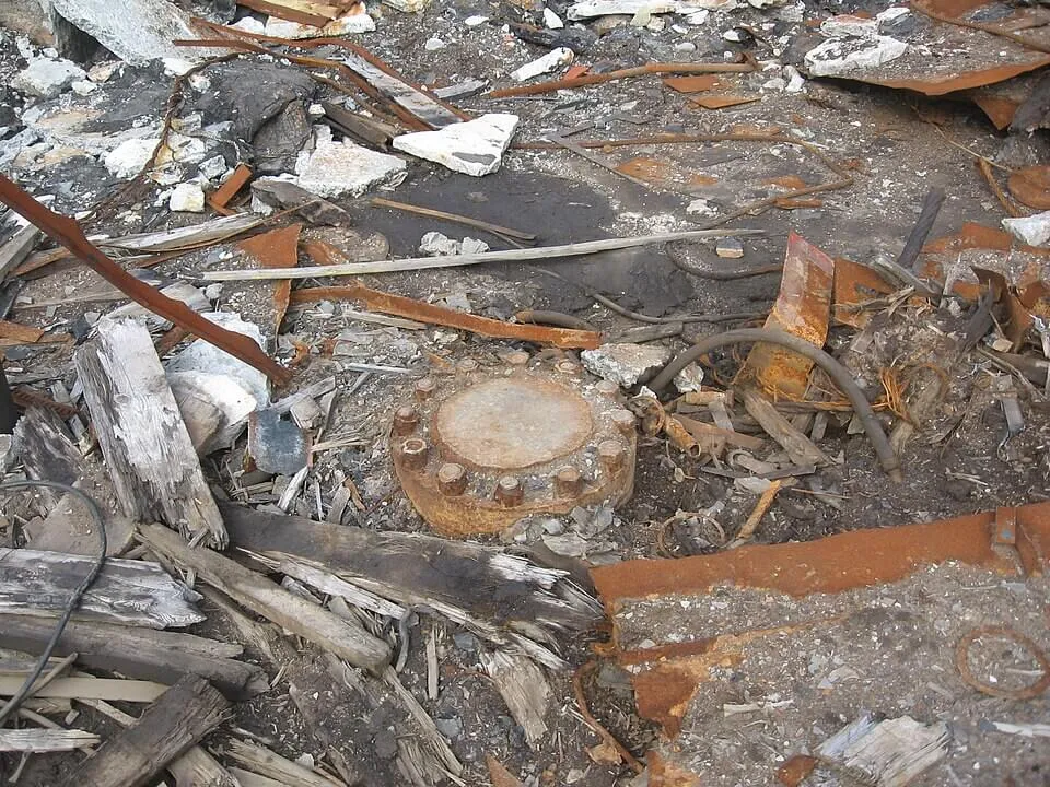
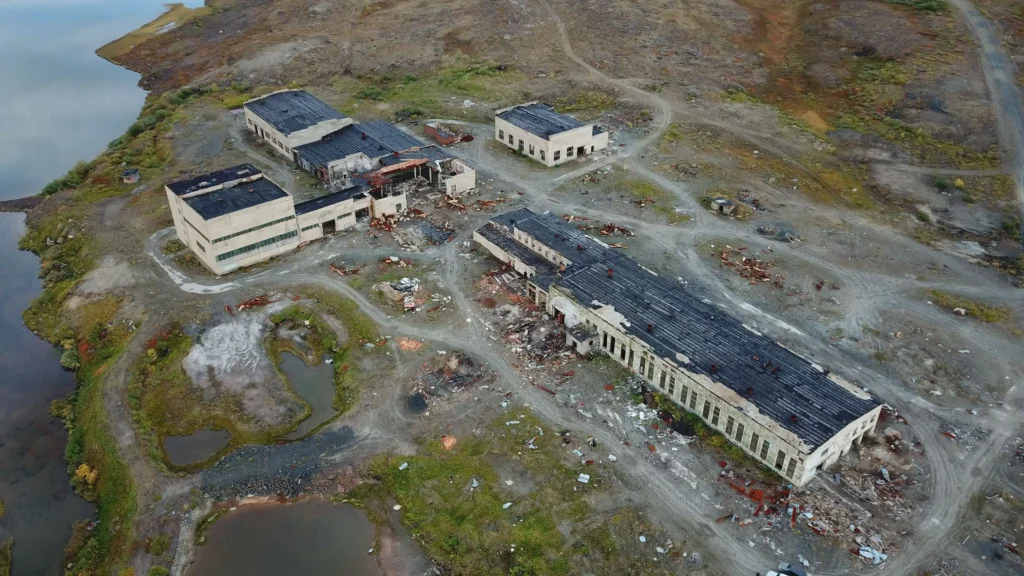
The dates here do conflict across sources, and it is more honest to say so than to pick one. Several widely cited accounts, including Smithsonian-derived summaries and HowStuffWorks, state that the project was formally ended and the hole sealed with a welded steel cap in 2005. Wikipedia’s detailed timeline, drawing on Russian-language sources, instead says drilling ended in 1995, the research enterprise was dissolved in 2007, and the company holding the site was liquidated in 2008, after which the place was abandoned. What is not in dispute: the drilling tower and the buildings are gone or ruined, the borehole itself is capped with a heavy bolted-and-welded metal plate, and sightseers who make the trek find rusting scrap and broken concrete on the tundra. The core samples are archived in the nearby town of Zapolyarny.
The hole was sealed for the dullest of reasons: the money ran out, the science had been logged, and an open 12-kilometre shaft is a hazard best capped.
What came after Kola
Kola did not end the impulse to drill into the deep crust. It redirected the effort, toward the ocean, and toward better-instrumented holes on land.
Germany’s KTB: a deliberate, well-funded sequel
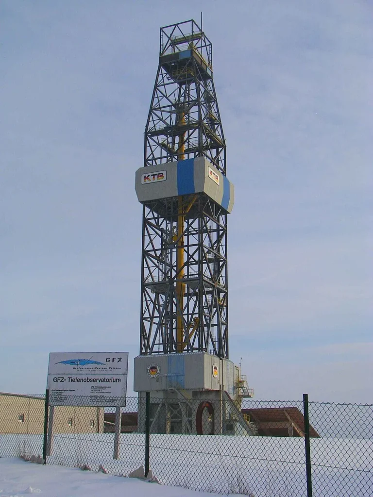
The most direct successor was the German Continental Deep Drilling Programme, known by its German abbreviation KTB (Kontinentales Tiefbohrprogramm der Bundesrepublik Deutschland), drilled near Windischeschenbach in Bavaria between 1987 and 1995. Where Kola was a marathon of improvisation, KTB was a meticulously instrumented science project. A 4,000-metre pilot hole was drilled first to scout conditions. The main hole, started in 1990 about 200 metres away, reached its final depth on a precise and documented date: as GFZ records it, “on 12 October 1994, the deepest borehole in Germany near the Bavarian town of Windischeschenbach reached its final depth of 9101 metres below the surface – after 1468 days of drilling.”
KTB confirmed Kola’s most uncomfortable lessons and added its own. The temperature again climbed faster than hoped; according to the official Emmermann and Lauterjung overview in the Journal of Geophysical Research, the borehole reached “a final depth of 9101 m and a temperature of ∼265 °C,” forcing a halt well short of the original target. The rock entered the brittle-to-ductile transition, deforming the hole. Large amounts of free fluid poured in at mid-crustal depths, echoing Kola’s leaky-crust result. The German engineers, having watched Kola fight friction and crookedness, developed a self-steering vertical drilling system that held the hole far straighter than the Soviet effort managed. KTB’s institutional legacy is large: it helped spur the founding of the German Research Centre for Geosciences (GFZ) in 1992 and the International Continental Scientific Drilling Program in 1996. The 83-metre derrick still stands at Windischeschenbach as a monument and a working facility, and the boreholes are still used for research.
Back to the sea: from Mohole to Chikyū
The other path to the deep Earth went back underwater, where Project Mohole had started. Mohole’s failure was not total, its drilling techniques, especially dynamic positioning, seeded a lineage of scientific ocean drilling: the Deep Sea Drilling Project, the Ocean Drilling Program, the Integrated Ocean Drilling Program, and the International Ocean Discovery Program (IODP). The logic is sound: oceanic crust is far thinner than continental crust, so the mantle is closer to the seafloor than it is beneath any continent, even if you have to drill through several kilometres of water to reach it.
The most capable tool in this lineage is the Japanese drilling vessel Chikyū, operated by JAMSTEC, designed to drill as much as 7 kilometres below the seafloor with a riser system that ordinary scientific drillships lack. In September 2024, during IODP Expedition 405, Chikyū set a record confirmed by Guinness World Records: “The deepest scientific ocean drilling is 7,906m, and was achieved onboard the CHIKYU vessel … on 21 September 2024.” That 7,906 metres is the total length of drill pipe deployed, water column included, not penetration below the seafloor, but it is the deepest a scientific drill string has ever reached. And in 2023, the long-serving American drillship JOIDES Resolution drilled into the Atlantis Massif in the Atlantic and pulled up the longest continuous sequence of mantle-like rock yet recovered, arguably the closest anyone has come to Mohole’s original dream, more than sixty years after it was conceived. The IODP itself concluded in 2024 after decades of work.
Is Kola still the deepest?
In true vertical depth, yes. As of 2026 the Kola Superdeep Borehole remains the deepest artificial point below Earth’s surface, a record it has held since 1979. The common confusion involves length versus depth. Some oil and gas wells are longer along their bore because they bend and run nearly horizontal: the BD-04A well at the Al Shaheen field in Qatar reached a total measured length of 12,289 metres in 2008, surpassing Kola’s length record, and the Sakhalin-I Odoptu OP-11 well off Russia’s Pacific coast went longer still in 2011. But these are extended-reach wells that travel sideways; BD-04A reaches a true vertical depth of only about 1,387 metres. None goes deeper straight down than Kola. China’s Shendi Take-1 borehole in the Tarim Basin passed 10,000 metres in March 2024 and was completed in February 2025 at a final depth of 10,910 metres, the deepest onshore well in the world after Kola, but still short of the Soviet mark in vertical depth.
The legacy of a hole
It is easy to file the Kola Superdeep Borehole under Cold War folly: two decades and an enormous budget for a target missed by a wide margin. That misses what it actually delivered. The crust under our continents is not the layered, dry, predictable structure that pre-Kola textbooks implied. It is wetter and hotter than the pre-Kola picture allowed, and far more chemically active than anyone drew on a cross-section; the seismic boundaries we draw on cross-sections do not always mean what we assumed they meant. Those are not footnotes. They are corrections to the working picture of the planet.
Harms, who has handled the Kola core and worked on its German cousin, is also clear-eyed about why nobody has simply gone back to finish the job. “These expeditions are extremely expensive, and therefore they are difficult to repeat,” he has said, noting that such a project can cost hundreds of millions and that only a fraction of the spending goes to the earth science itself; the rest is swallowed by technology development and the sheer cost of operating at the limit. “In the end, it really is a cost issue.” The same heat and pressure that defeated the Soviet drillers still stand between us and the rock below.
The deepest hole humans have ever dug reaches about a third of the way through the crust at one spot in the Arctic, and not one step into the mantle. The centre of the Earth is more than 6,300 kilometres down. We have scratched roughly the top 0.2 percent of the distance, and we did it once, slowly, decades ago, and have not matched it since. Beneath the welded cap on the Kola tundra the hole is still there, and far stranger in fact than it ever was in legend.
Related reading on Geoscopy: how seismic waves reveal the Earth’s interior, the granite and basalt entries in our rocks atlas, and the geology glossary. Primary authorities for this article include the International Continental Scientific Drilling Program (ICDP / GFZ Potsdam), Scientific American, the USGS, and Snopes.
Frequently asked questions
How deep is the Kola Superdeep Borehole?
The deepest branch, SG-3, reached a true vertical depth of 12,262 metres (40,230 feet) in 1989, about 7.6 miles. A few sources, including the ICDP, cite 12,261 metres; the one-metre difference is within measurement precision. That makes it deeper than the Mariana Trench is deep and deeper than Mount Everest is tall.
What did they find in the Kola Superdeep Borehole?
No granite-to-basalt boundary where one was expected at about 7 kilometres, just more granite and gneiss; free saline water circulating in cracks several kilometres down, where the crust was thought to be impermeable; drilling mud “boiling” with hydrogen gas, now linked to serpentinization; and roughly two dozen species of microscopic plankton fossils about 6 kilometres down in rock around two billion years old. The temperature at the bottom hit about 180°C, nearly double the prediction.
Is it really the deepest hole on Earth?
By true vertical depth, yes, and it has held that record since 1979. Some oil wells, such as Qatar’s Al Shaheen BD-04A and Russia’s Sakhalin-I Odoptu OP-11, are longer along their bores because they run sideways, but none reaches deeper straight down.
Was the “well to hell” real?
No. The story of recorded screams from a Siberian borehole is a hoax built on a real 1984 Scientific American article about Kola. It spread through Christian broadcasting and missionary newsletters beginning with a 1989 California TBN broadcast, was deliberately embellished by a Norwegian teacher who later confessed, and the “screams” audio is looped horror-film sound effects.
Can you visit it?
You can reach the abandoned site on the Kola Peninsula, but there is little to see beyond ruined buildings, rusting scrap, and the bolted, welded metal cap over the hole itself. The drilling tower is gone and the facility is derelict.
Why did they stop drilling?
Heat. At about 12 kilometres the rock was around 180°C instead of the predicted ~100°C, hot enough to make the rock flow back into the hole and to wreck drill bits. Combined with the collapse of the Soviet Union and the loss of funding, the project could not continue.
How long did it take to drill the Kola Superdeep Borehole?
Drilling began on 24 May 1970 and the record depth of 12,262 metres was reached in 1989, with work on the deepest branches continuing into the early 1990s — roughly two decades. The slow pace came from the method: every bit change meant hauling the entire drill string out of the ground section by section and feeding it back down, and a single bit lasted only a few hours of cutting at the bottom.