Introduction
By late January 2025, the residents of Santorini had stopped sleeping well. The ground beneath the white villages of Fira and Oia would not hold still. The shaking came in pulses through the sea between Santorini and the smaller island of Amorgos, and it kept coming.
Schools had already been ordered shut. On 6 February 2025, Greek authorities declared a state of emergency for the Municipality of Thera. By that day, more than 11,000 people had left the island, roughly 7,000 by ferry and 4,000 by air, according to figures reported by the BBC, out of a permanent population of about 15,500. Within days the total of those who fled climbed past 13,000, leaving a near-empty island. On 3 February alone, Aegean Airlines flew 1,294 passengers from Santorini to Athens on nine flights, four scheduled and five extra; the planes arrived nearly empty, carrying mostly government officials, and left full.
For months nobody could say what it meant. Was this the prelude to a major tectonic earthquake, like the magnitude 7.7 Amorgos quake of 1956? Or was magma rising toward an eruption? By late 2025, two international teams had published the answer, first in Nature and then in Science. The swarm was a “rebounding” magmatic dike, a sheet of magma punching sideways through the crust between the Santorini caldera and the Kolumbo submarine volcano, never quite reaching the surface.
What happened between Santorini and Amorgos in early 2025
The unrest did not begin with the headline-grabbing swarm. Gradual inflation of the Santorini caldera began in mid-2024, as magma seeped into a shallow reservoir beneath the island. Before mid-January 2025, the seismicity was sparse and confined mostly to the caldera. Then, from 26 January, dense swarm-like seismicity broke out about 20 kilometers northeast of Santorini. Between 3 and 6 February, the activity expanded rapidly to the northeast. Intense, migrating seismicity from 6 to 19 February pushed more than 30 kilometers further, widening into a fan-shaped cloud over the seafloor.
The strongest earthquake of the swarm struck on 10 February 2025 at magnitude 5.3, in the National Observatory of Athens catalog, following an ML 5.2 event on the evening of 5 February. Hundreds of quakes exceeded magnitude 4.5: large enough to be felt, to crack vulnerable masonry, and to trigger rockfalls along the caldera cliffs. The 5 February tremor was felt in Athens, some 240 kilometers away, as well as in Crete and along Turkey’s western coast.
What made the swarm so alarming was that it did not behave like a normal earthquake sequence. A typical sequence has a mainshock followed by aftershocks that taper off in size and frequency. Here, the rate and the magnitudes climbed over weeks. That pattern, a swarm rather than a mainshock-aftershock sequence, is one of the classic signatures of fluids or magma on the move, but it can also accompany tectonic faulting. In the moment, the ambiguity was the whole problem.
The state of emergency for Santorini ran from 6 February until 3 March 2025. A separate state of emergency was declared for Amorgos on 13 February, and for Anafi the same day; all three were set to run through mid-March.
Why a swarm is not the same as a Santorini volcano eruption
A volcanic eruption requires magma to reach the surface. An earthquake swarm only requires the crust to be breaking somewhere, for some reason. Magma forcing its way through rock breaks that rock and generates earthquakes, but most magma intrusions never erupt. They stall underground, freeze in place, and become part of the crust.
The crucial variables are depth and buoyancy. Magma rises when it is less dense than the surrounding rock and when it has enough pressure behind it. If a body of magma loses that pressure or runs into denser rock, it stops. The 2025 intrusion stopped. The magma “did not have the pressure or buoyancy needed to reach the surface and cause an eruption,” the study’s authors concluded. As Isobel Yeo, a submarine volcanologist at the UK’s National Oceanography Centre who was not part of the study, put it: “There probably wasn’t enough magma in it, and it wasn’t buoyant enough, to hit the surface.”
This is the distinction that mattered most for the people of Santorini, and it is the one that took months of analysis to nail down. A swarm driven by magma at depth is a different animal from magma about to erupt.
The detective story: ruling out a fault
The first job for scientists was to separate two very different hazards. If a fault was slipping, the swarm could be the foreshocks of a large tectonic earthquake. If magma was intruding, the hazard was a possible eruption. The two scenarios call for different responses, and in early February no one could tell them apart.
Rémy Bossu of the European-Mediterranean Seismological Centre told CNN at the time that the activity was “very unusual”: instead of a large earthquake followed by decreasing aftershocks, “the magnitude has been increasing with time and the rate has been increasing.” Kostas Papazachos, a seismologist at Aristotle University of Thessaloniki, cautioned that the likelihood of a magnitude 6 had diminished but could not be ruled out. “We will have to be a little patient and see,” he told Greek broadcaster ERT.
The resolution came from two complementary studies, published months apart, that approached the problem from different angles and reached the same core conclusion.
The “virtual stress meter” method that explains the Santorini earthquake swarm
The Science study, led by Anthony Lomax of ALomax Scientific with Vasilis Anagnostou and Vasileios Karakostas at Aristotle University of Thessaloniki, Stephen P. Hicks at UCL, and Eleftheria Papadimitriou at Aristotle University, took the swarm itself and turned it into an instrument.
The team used machine learning to detect and precisely relocate about 25,000 earthquakes over the eight-week crisis, far more than conventional catalogs captured, including episodic tremor bursts lasting just a few hours. The trick was what they did with that catalog. Each earthquake marks a spot where the crust failed, and the way the crust fails encodes the stress acting on it. By treating all 25,000 quakes as measurements of stress change at depth, the team could map how stress evolved across the region in space and time, using a three-dimensional Coulomb-stress imaging technique.
“We used a new method to work out the cause of a swarm of earthquakes, treating each of the 25,000 precisely located quakes as ‘virtual stress meters’, clues as to how stress was changing underground. This gave us a robust and higher-resolution picture of what was happening, allowing us to rule out fault slippage as the earthquakes’ main cause.”Dr Stephen Hicks, UCL Department of Earth Sciences
The stress pattern matched a propagating dike, not a slipping fault. The Science study placed the intrusion about 12 kilometers below the seafloor and traced its horizontal propagation across roughly 30 kilometers, with magma pumping into newly opened dikes.
What stood out was the rhythm of the movement. “Most striking was that the intrusion did not move smoothly,” Lomax said. “Instead, it rebounded in waves, opening new fractures, closing others, and pumping magma forward in pulses. These pulses of magma pressure created a vast, dynamic and cascading pattern of stress and triggered earthquakes in the surrounding crust.” In the paper’s language, the dike advanced as “multiscale rebounding waves of dike opening, magma pressure, and breaking of barriers.” The intruded magma, the researchers estimated, could have filled some 200,000 Olympic-sized swimming pools.
Papadimitriou argued the implications run far beyond Greece: “This rebounding, wave-like process of magma intrusion may not be unique to Santorini but may be a fundamental mechanism by which magma is transported beneath volcanoes worldwide.”
The coupled system: how Santorini caldera and Kolumbo volcano are connected
The second study, published in Nature in September 2025 and led by Marius P. Isken of GFZ Helmholtz Centre for Geosciences and Jens Karstens of GEOMAR Helmholtz Centre for Ocean Research, used a different toolkit: onshore and ocean-bottom seismometers, satellite radar (InSAR), GPS, and seafloor pressure sensors. Its machine-learning catalog detected more than 28,000 events.
The Nature team modeled the intrusion as roughly 0.313 cubic kilometers of magma, about 300 million cubic meters, filling a dike around 13 kilometers long that arrested 3 to 5 kilometers below the seafloor. The magma came from a mid-crustal reservoir beneath Kolumbo, the submarine volcano 7 kilometers northeast of Santorini, and the pre-crisis inflation under the caldera was traced to an inflating magma body at a median depth of 3.8 kilometers.
The unexpected result was the link between the two volcanoes. As the dike pushed northeast, the magma chamber beneath Kolumbo deflated, and the seafloor above it sank by up to 30 centimeters. Santorini, which had been inflating, began to subside. “They are communicating,” Karstens said of the two centers, long treated as separate plumbing systems. The authors interpret this as evidence of a previously unknown hydraulic connection at depth.
“The seismic activity was typical of magma ascending through the Earth’s crust. The migrating magma breaks the rock and forms pathways, which causes intense earthquake activity. Our analysis enabled us to trace the path and dynamics of the magma ascent with a high degree of accuracy.”Dr Marius Isken, GFZ Helmholtz Centre for Geosciences
The timing was extraordinary. Just weeks before the crisis, researchers with the German-Greek MULTI-MAREX project had installed fresh seafloor sensors inside Kolumbo’s crater. When the swarm began, Karstens happened to be on Santorini, receiving AI-processed earthquake updates every six hours from Isken in Potsdam, data that far surpassed the public catalogs. “There were days when I looked toward the horizon, thinking, ‘OK, I’m going to see something there,'” Karstens admitted. The fear was concrete: “There was a probability that the magma would come to the surface offshore Santorini,” Isken said. A UK research cruise retrieved the seafloor gear in March 2025, releasing a trove of data that had not been available in real time.
Reconciling the two studies: 25,000 versus 28,000 earthquakes
The two papers report different earthquake counts, about 25,000 in Science, more than 28,000 in Nature, and somewhat different stall depths, with the Science dike imaged near 12 kilometers below the seafloor and the Nature model arresting at 3 to 5 kilometers. These are not contradictions. The counts come from different machine-learning catalogs with different detection thresholds and time windows, so the totals differ. Both teams agree on the essentials: this was magma, not a fault; it propagated horizontally; it stalled in the crust; and it never erupted. The Science study emphasizes the rebounding-wave dynamics of the dike. The Nature study emphasizes the coupled Santorini–Kolumbo system and the magma volume budget. Read together, they describe the same event from two vantage points.
Deep time: why this coastline shakes
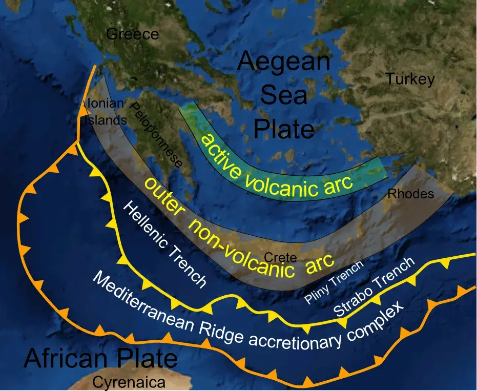
Santorini sits above the Hellenic subduction zone, part of the broad collision between the African and Eurasian plates. The African (Nubian) plate subducts northward beneath the Aegean microplate; geodetic measurements put convergence across the Hellenic subduction zone at roughly 35 millimeters per year, far faster than the few millimeters per year of underlying Africa–Eurasia convergence, because the descending slab is rolling back and the Aegean is stretching. That rollback and extension drive both intense seismicity and a chain of volcanoes, the South Aegean Volcanic Arc, running from the Saronic Gulf to Nisyros. Santorini and Kolumbo are two centers on that arc.
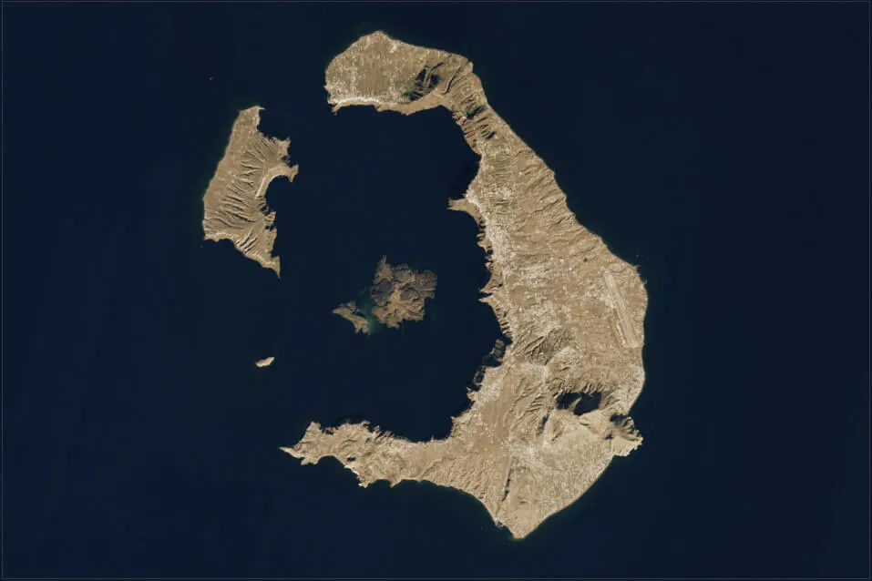
The region’s geological memory is violent. In the Late Bronze Age, the Minoan eruption blew the heart out of the island, forming the caldera that draws millions of visitors today. The exact date is genuinely disputed. Friedrich and colleagues, writing in Science in 2006, used radiocarbon wiggle-matching on an olive branch buried alive by the eruption “to constrain the eruption date to the range 1627–1600 B.C. with 95.4% probability”, about a century earlier than the date derived from traditional Egyptian chronologies. Archaeological chronologies and some later work argue for a mid-16th-century BCE date; a 2023 study in Scientific Reports of an olive shrub on Therasia, for instance, “supports a mid-16th century BCE date for the Thera eruption.” Estimates commonly cited fall across roughly 1627 to 1600 BCE, with later proposals in the 1500s BCE. The disagreement is real and unresolved, which is why a single definitive year should be treated with suspicion.
That eruption buried the Bronze Age town of Akrotiri under tens of meters of ash, preserving multi-story buildings, frescoes, and an elaborate drainage system, the “Pompeii of the Aegean.” Unlike Pompeii, Akrotiri has yielded essentially no human remains in eruption context across nearly six decades of excavation. The most natural reading is that its inhabitants read the warning signs and evacuated before the catastrophe, taking their valuables with them. Where they went is still unknown.
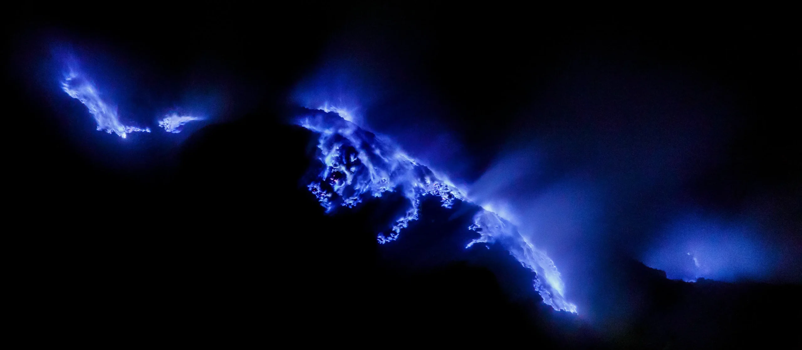
Kolumbo’s history is more recent and more directly cautionary. In 1650 CE, the submarine volcano erupted explosively, breached the sea surface, and generated a tsunami. As Vougioukalakis and colleagues summarized in the Bulletin of Volcanology in 2025, “the 1650 CE eruption caused 50 deaths in Santorini and exhibited multiple hazards, including tsunamis, tephra fall, and lethal gas clouds.” (Some sources, including the Smithsonian’s Global Volcanism Program and contemporary accounts, put the toll higher, at around 70.) Most of the deaths came from toxic gas clouds drifting onto Santorini. Researchers regard Kolumbo as the greatest volcanic hazard in the region, which is exactly why the discovery of its hydraulic link to Santorini matters.
And the tectonic hazard is not hypothetical. The 1956 Amorgos earthquake, magnitude 7.7 and followed 13 minutes later by a magnitude 7.2 shock, was the largest in Greece in the 20th century. Okal and colleagues measured its seismic moment at 3.9 × 10²⁷ dyn·cm, the biggest recorded in the Mediterranean Basin in the past hundred years. It killed 53 people, injured about 100, and destroyed 529 houses. It triggered a tsunami with run-ups of up to 20 meters on the southern coast of Amorgos in Okal’s eyewitness survey, with earlier reports as high as 25 meters on the island’s eastern coast; it was the most damaging tsunami to strike Greece in the past century. The 2025 swarm unfolded in almost exactly the same patch of sea. That history is why the early ambiguity was so frightening.
What magma dike intrusion means for forecasting eruptions
The lasting significance of 2025 is methodological. The “virtual stress meter” approach turns a dense earthquake catalog into a near-real-time image of what magma is doing underground, distinguishing a dike from a fault while a crisis is still unfolding. “Our technique could be applied to future earthquake swarms almost in real time and could allow us to better forecast the likelihood of volcanic eruptions or larger earthquakes,” Hicks said.
The Santorini crisis became, in effect, a natural laboratory. The combination of pre-installed seafloor sensors, satellite geodesy, GPS, gas detectors, and machine-learning seismology let scientists watch an intrusion advance, stall, and retreat as it happened, the kind of observation that usually takes decades to assemble. The discovery that Santorini and Kolumbo share deep plumbing also reframes the hazard picture: unrest at one center may carry information about the other. The coupled system is now a target for sustained monitoring rather than an afterthought.
Is Santorini safe now?
The seismic activity declined through late February 2025 and returned to background levels in the months after; by early May 2025 the rate had fallen back to normal. The state of emergency expired on 3 March 2025 and was not renewed. Schools reopened on 4 March, and the island’s tourist season resumed, though the disruption left a mark: Santorini’s airport handled about 16 percent fewer passengers in 2025 than in 2024, with the steepest drops in the winter and spring booking window.
Monitoring continues and has expanded. As of September 2025, GFZ was conducting repeated gas and temperature measurements on Santorini, while GEOMAR operated eight seabed sensor platforms around Kolumbo, with findings shared with Greek authorities. In December 2025, the GEOMAR-led M215 expedition set out from Crete to recover instruments that had recorded the entire crisis and to deploy new stations aimed at transmitting seafloor data in real time. Heidrun Kopp of GEOMAR, who leads MULTI-MAREX, has framed the goal plainly: detecting early signals from the seafloor before tremors are felt on land. Paraskevi Nomikou of the National and Kapodistrian University of Athens has stressed, in remarks to the Athens–Macedonian News Agency, that sustained observation also helps ensure reliable public information and prevents misinformation and unnecessary panic.
The magma that caused the 2025 swarm stalled kilometers below the seabed and never threatened to erupt. The same studies that calmed the immediate fear also revealed a coupled plumbing system whose behavior researchers are only beginning to map. The magma stalled. The instruments stayed.
FAQ: Santorini earthquakes and volcano questions
Will Santorini erupt?
Not imminently, based on current evidence. The 2025 magma intrusion stalled 3 to 5 kilometers (Nature) to about 12 kilometers (Science) below the seafloor and lacked the pressure and buoyancy to reach the surface. Santorini and the nearby Kolumbo volcano remain active and are monitored continuously, but no eruption is forecast.
Was anyone hurt in the 2025 Santorini earthquakes?
There were no reported deaths or serious injuries. The largest quake was magnitude 5.3. The main physical damage was rockfalls along the caldera cliffs and minor damage to older buildings. The biggest impacts were the evacuation of more than 13,000 people and the disruption to daily life, schooling, and tourism.
What caused the Santorini earthquake swarm?
A magma-filled dike intruding horizontally through the crust between the Santorini caldera and the Kolumbo submarine volcano. Two 2025 studies, in Science and in Nature, independently concluded it was a magmatic intrusion, not tectonic fault slip, and that it never reached the surface.
Is it safe to travel to Santorini now?
The seismic crisis ended in 2025. The state of emergency was lifted on 3 March 2025, schools reopened the next day, and seismic activity returned to normal levels by spring. Scientific monitoring of both Santorini and Kolumbo continues, with results shared with Greek civil protection authorities.
How many earthquakes hit Santorini in 2025?
Depending on the detection method, machine-learning catalogs recorded roughly 25,000 events (Science) to more than 28,000 (Nature) over the swarm. The difference reflects different detection thresholds and time windows, not a disagreement about what happened.
What is the Kolumbo volcano?
Kolumbo is an active submarine volcano about 7 kilometers northeast of Santorini, the largest of a line of underwater cones. Its last eruption, in 1650 CE, breached the sea surface and killed about 50 people on Santorini, mostly through toxic gas. The 2025 crisis revealed that its magma system is hydraulically linked to Santorini’s at depth.
Sources and further reading
Lomax, A., Anagnostou, V., Karakostas, V., Hicks, S. P., & Papadimitriou, E. (2025). The 2025 Santorini unrest unveiled: Rebounding magmatic dike intrusion with triggered seismicity. Science, 390(6775), eadz8538. DOI: 10.1126/science.adz8538. Isken, M. P., Karstens, J., Nomikou, P., et al. (2025). Volcanic crisis reveals coupled magma system at Santorini and Kolumbo. Nature, 645, 939–945. DOI: 10.1038/s41586-025-09525-7. Friedrich, W. L., et al. (2006). Santorini eruption radiocarbon dated to 1627–1600 B.C. Science, 312, 548. Okal, E. A., et al. (2009). The 1956 earthquake and tsunami in Amorgos, Greece. Geophysical Journal International, 178, 1533–1554. Preine, J., et al. (2025). The Kolumbo volcanic field, Greece. Bulletin of Volcanology. Quotations from UCL News, GFZ, GEOMAR, and National Geographic reporting on the two studies.