Introduction
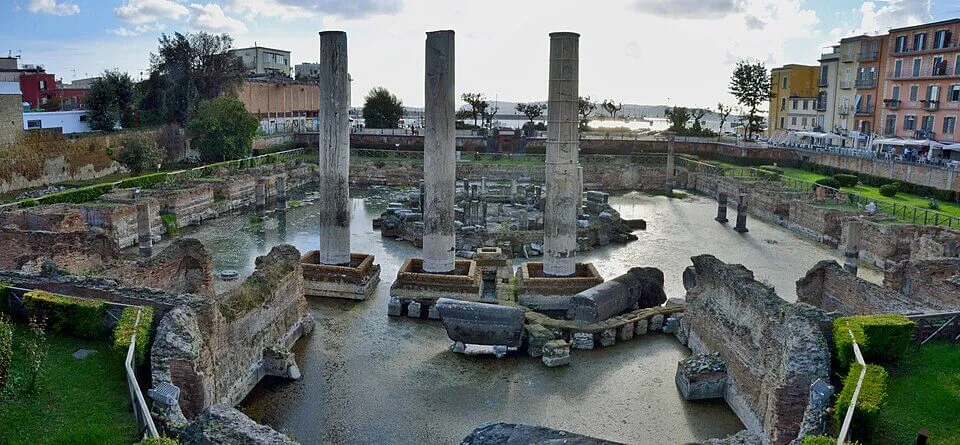
Imagine the Macellum of Puteoli in the third century AD: a food seller setting out crates of mullet and sea urchin in a paved Roman market courtyard, beneath grey granite columns, marble shopfronts, and a circular tholos at the centre. The floor near the drains is wet again. It has been wet before. The sea is not where it used to be. He cannot know that the marble at his back is becoming a tide gauge for a volcano.
Seventeen and a half centuries later, on the evening of 20 May 2024, an INGV seismologist at the Osservatorio Vesuviano in Naples watches a waveform climb on a screen. At 18:10 UTC, 20:10 in Italy, an Md 4.4 earthquake has just hit the Campi Flegrei area near Pozzuoli, the strongest event of the current bradyseismic crisis up to that point. On another monitor, GNSS data show the harbour area rising at centimetres per month. Both signals trace back to the same restless crust that drowned the Roman market. They are reading what Charles Lyell tried to read in 1828, with better instruments and the same basic problem: how do you tell whether a breathing volcano is about to settle, crack, or erupt?
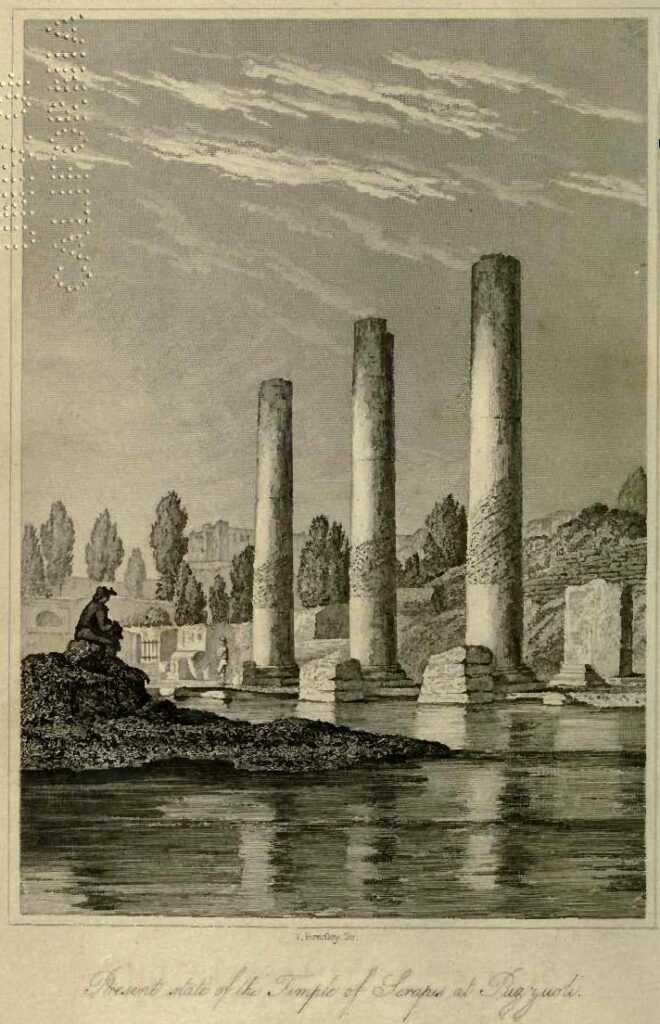
Here is the counterintuitive fact at the centre of this story. The three columns that still stand at the Macellum drowned to a depth of at least 5.8 m (19 ft), were bored by marine bivalves, then rose back into open air; and they did this, at least twice, over centuries, without falling over. That refusal to topple is exactly why Lyell could read them. If the ground had broken violently, the columns would be rubble. Instead they record gradual subsidence and gradual uplift: the slow vertical movement geologists call bradyseism. At Campi Flegrei, the volcano breathes through the town.
Is Campi Flegrei about to erupt? No scientific source currently gives a reliable eruption date. The strongest evidence shows an accelerating unrest system involving uplift, shallow earthquakes, hydrothermal pressure, and increasing magmatic gas input. A 2026 preprint suggests a possible critical transition around 2030–2034, but that is not a peer-reviewed eruption forecast.
A Marketplace That Was Underwater
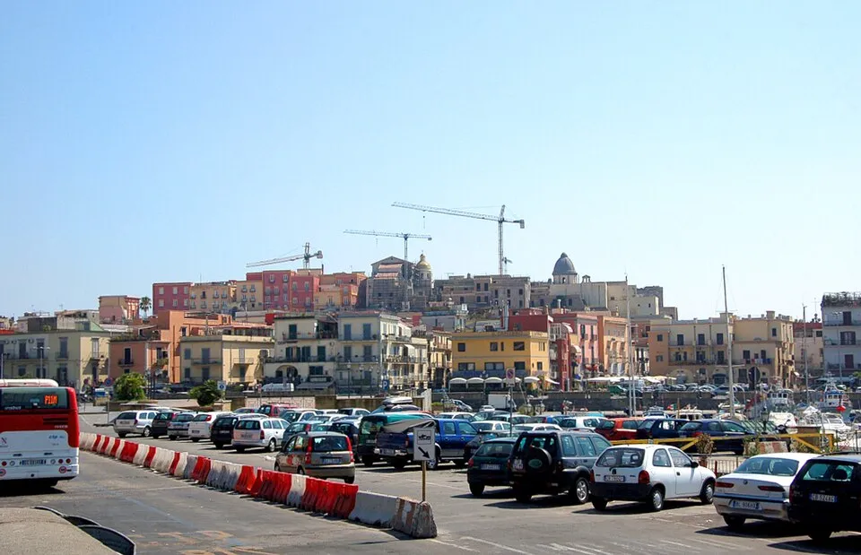
The building is not, despite its old name, a Temple of Serapis. It was a market hall: the Macellum of Pozzuoli, the food market of the Roman colony of Puteoli. The structure is usually dated to the late 1st or early 2nd century AD, with a Severan restoration in the 3rd century. Its temple name came from an 18th-century mistake: excavators found a statue of Serapis and read the whole building through that one object. By the time geologists arrived, the columns had become more important as evidence than as architecture.
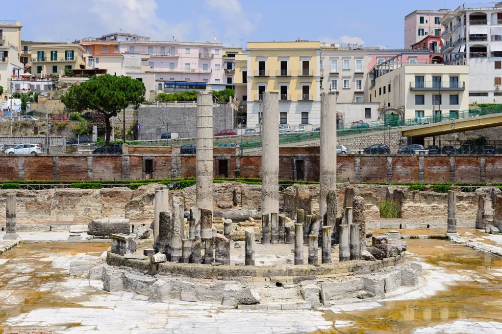
The three intact columns are roughly 12.7 m tall (about 42 ft), cut from cipollino marble, the streaky green-and-white stone quarried on the Greek island of Euboea. Halfway up each column, a dark band of small holes runs around the shaft for several metres. Each hole is the cast of a single Lithophaga lithophaga, the Mediterranean date mussel, a bivalve that bores into limestone and marble by a combination of chemical dissolution and mechanical scraping. Trace fossils of this kind are called gastrochaenolites. Live mussel shells were still wedged into some of the holes when Lyell visited.
That was the puzzle. Date mussels live underwater and they cannot drill into a marble column unless the marble has been submerged in seawater for long enough, decades at minimum, for them to colonise it. The borings are concentrated in a distinct band: high enough to show prolonged marine submergence, but limited enough to show that parts of the columns were protected, buried, or never colonised. Relative sea level had changed; the columns had stayed upright.
In 1828 the British mathematician Charles Babbage, the same Babbage who designed the Difference Engine, conducted a careful survey of the ruins. He measured a brownish encrustation up to about 2.7 m (9 ft) above the floor, and the dense ring of Lithophaga borings extending up to about 5.8 m (19 ft). He read this as a story of progressive submergence: first a shallow brackish pond formed inside the building, then full marine flooding, then re-emergence. His Observations on the Temple of Serapis at Pozzuoli, near Naples, written in 1828, was finally published in 1847.
Lyell visited the same year as Babbage and reached the same physical conclusion. The columns had gone down and come back up, vertically, slowly, in living memory of a continuous human civilisation. He chose an engraving of the three pillars, drawn after John Izard Middleton’s on-site sketches and Andrea di Jorio’s 1820 illustration, as the frontispiece of Principles of Geology, published in 1830. It is the founding visual argument of uniformitarianism. The forces that shape the present shape the past. The Earth is not stage scenery. It moves.
Lyell anticipated the obvious objection: surely a building submerged that thoroughly should have been smashed. He answered it with another field example. “That buildings should have been submerged, and afterwards upheaved, without being entirely reduced to a heap of ruins, will appear no anomaly,” he wrote, “when we recollect that in the year 1819, when the delta of the Indus sank down, the houses within the fort of Sindree subsided beneath the waves without being overthrown.” In 1832, on the very first landfall of HMS Beagle, a 23-year-old Charles Darwin climbed the cliffs at São Tiago in the Cape Verde islands carrying volume one of the Principles. He saw a band of marine shells embedded in volcanic rock high above the sea, applied Lyell’s reasoning, and noted in his journal that he felt “sure at St Jago in some places a town might have been raised without injuring a house.” The columns of Pozzuoli had become a method.
What the Romans Built On
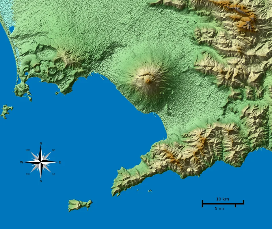
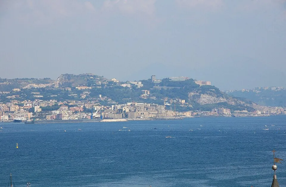
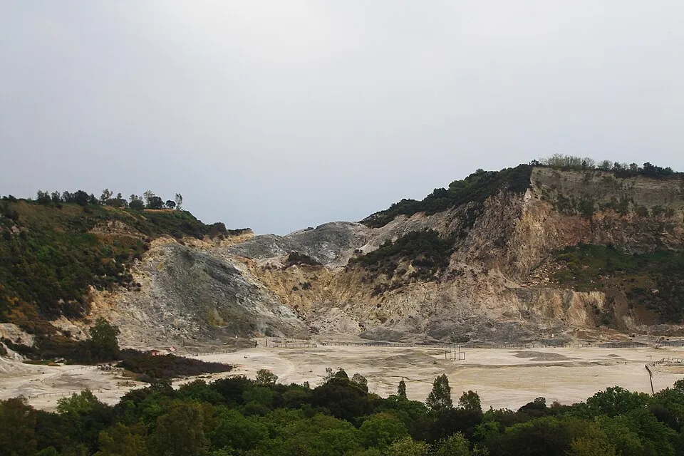
The macellum sits inside something the Romans could not map as a single volcano: the Campi Flegrei caldera, or Phlegraean Fields, a volcanic system west of Naples that spans land and sea around the Bay of Naples and the Gulf of Pozzuoli. Compared with neighbouring Mount Vesuvius, which rises as a cone with a visible summit, Campi Flegrei is a volcanic depression: craters, tuffs, fumaroles, roads, apartment blocks, and harbour walls stitched across the same moving ground.
Two caldera-forming eruptions dominate the history of Campi Flegrei. The Campanian Ignimbrite erupted about 39–40 thousand years ago and was the largest known explosive eruption in Europe in the last 200,000 years. Recent estimates put its dense-rock-equivalent volume around 181–265 km3, while older literature often rounds the erupted products to the order of 300 km3. Its ash was carried far across eastern Europe and into western Russia. Around 15 thousand years ago, the Neapolitan Yellow Tuff eruption formed a smaller nested caldera and produced the yellow volcanic stone that still colours Naples. Since then, more than 70 mostly explosive eruptions have occurred inside the caldera, grouped into three main eruptive epochs. The last one came after a long pause: Monte Nuovo in 1538.
The 1538 Eruption That Built a Mountain in a Week
For most of the Middle Ages, Pozzuoli was sinking. Documents from the 12th to the 15th century describe a coastline retreating, a harbour growing shallow, and the macellum’s columns slowly disappearing under the sea. Then, in the late 1400s, the ground began to come back up. The uplift accelerated through the early 1500s. By the spring of 1538 it had reached several metres. Then, on the night of 29–30 September 1538, after fierce earthquake swarms, a vent opened on the inland side of the small village of Tripergole. In about a week of activity, an explosive-effusive eruption built a 130 m (430 ft) cone of pumice and scoria that the inhabitants named, with the literalism of the desperate, Monte Nuovo, New Mountain. The previous eruption at Campi Flegrei had been roughly 3,000 years earlier. The cone is still there, fenced in as a small nature reserve.

What matters about Monte Nuovo for the present is its preface. Detailed reconstructions by Di Vito and colleagues show ground uplift starting at least 70 years before the 1538 eruption and accelerating in the final decades. Earthquakes and gas emissions intensified in the year before. From the perspective of someone alive before the eruption, the pattern would have felt disturbingly familiar: uplift, earthquakes, gas, uncertainty. But the scale and final acceleration before 1538 were not a simple copy of the modern unrest.
Bradyseism, Explained Without the Jargon
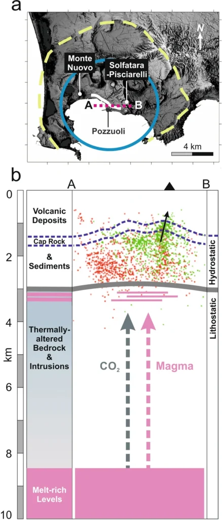
Picture a sponge cake under a glass dome. The cake is a layered pile of weak volcanic rock, soaked with hot water and gas. The dome is the caprock: a tougher, less permeable layer of altered tuff and clay sitting roughly 1–2 km below the surface. Below the cake, somewhere between 4 and 8 km down, sits a body of degassing magma. When the magma releases CO2, water vapour, and sulfur compounds upwards, those gases pressurise the spongy rock under the caprock. The dome bulges. The surface inflates. When the dome cracks and the gas escapes, or when the gas re-condenses, the surface comes back down.
That cycle, repeated, is bradyseism. It is, technically, just slow vertical ground deformation in a volcanic area. Practically, it is what allows Pozzuoli’s harbour to move by centimetres per month, or metres across an unrest episode, without behaving like a cone volcano such as Mount St Helens. The magma is real, but the proximate engine of the unrest is the gas-and-water plumbing system perched above it.
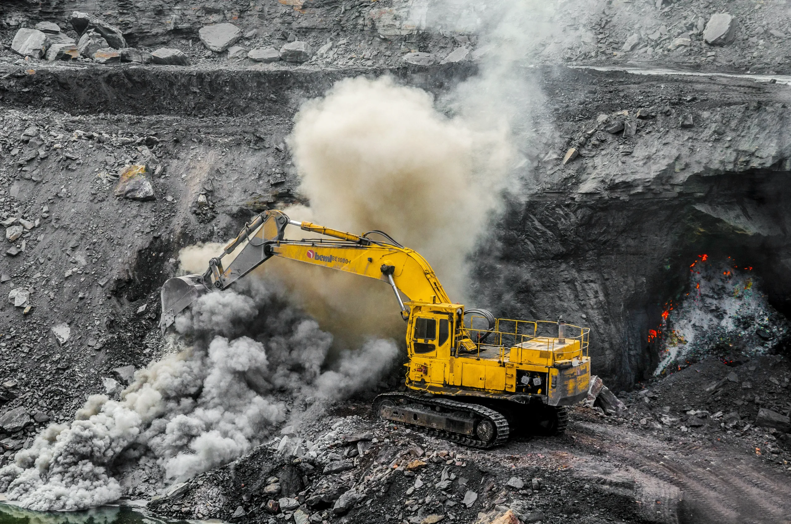
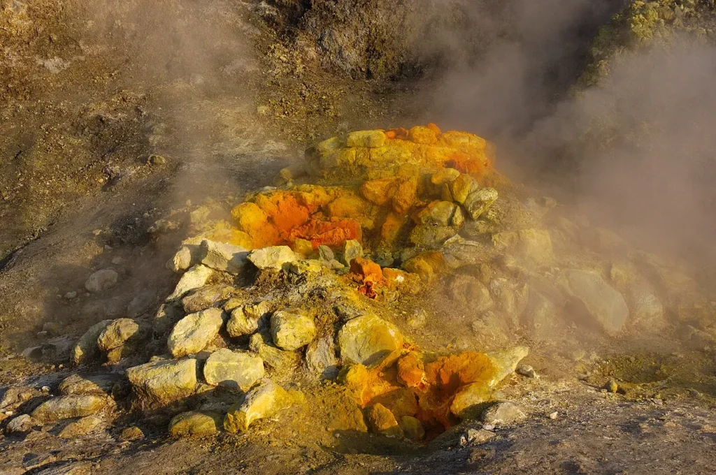
The hottest, smelliest expression of that plumbing sits two kilometres east of the macellum: the Solfatara crater, a yellow-rimmed bowl of fumaroles that the Romans associated with the underworld. The dominant fumarole, Bocca Grande, exhales a mixture of water vapour, carbon dioxide, hydrogen sulfide, and methane at temperatures around 160–175°C (320°F). A few hundred metres to the east, at Pisciarelli, a more aggressive degassing field has expanded since the 2000s, with mud pools and fumarolic activity that make the area important for monitoring and dangerous outside controlled access.
Why Lyell’s Columns Are Still a Calibration Tool
For two thousand years the columns recorded the integrated motion of the caldera floor. The lowest Lithophaga borings begin a few metres above the original Roman pavement, which means the macellum was already used for some centuries above sea level. Then it dropped, slowly, until water flooded the floor and date mussels colonised the marble up to about 5.8 m. Then it rose. Then, almost certainly, it dropped again before being excavated in 1750. The carved bands on the columns are not a single drowning. They are the residue of multiple cycles, smeared on top of each other, on the same stone shaft.
Modern instruments, tide gauges, levelling lines, GNSS receivers, satellite InSAR, resolve these movements at the millimetre. The macellum is now a calibration target. When InSAR images of Pozzuoli show the harbour rising by 12 cm in a year, the shadow line on the marble agrees. Lyell did not have an interferometric satellite. He had three columns.
The 2005 Unrest That Never Stopped
Modern bradyseismic crises at Campi Flegrei have arrived in waves. After the 1538 Monte Nuovo eruption, the ground subsided again for centuries. Then, in 1969–1972, Pozzuoli rose by about 1.7 m without an eruption. A second crisis followed in 1982–1984: about 1.8 m of uplift, more than 16,000 earthquakes, and a maximum local magnitude of about 4.0 in October 1983. The old centre of Pozzuoli was evacuated because the shaking and deformation were damaging buildings. Again, no eruption followed.
The town was supposed to relax. Instead, beginning quietly in 2005, it started to rise again. By April 2025, INGV reported about 144 cm of uplift during the current bradyseismic phase, with the deformation centred near Pozzuoli and accompanied by increasingly frequent earthquake swarms. INGV, the Istituto Nazionale di Geofisica e Vulcanologia, whose Neapolitan branch is the Osservatorio Vesuviano, now tracks the caldera with seismic, geodetic, thermal, and geochemical monitoring networks. There was no comparable crisis at Lyell’s door.
The 2024–2025 Quake Swarms
For most of the post-2005 unrest, earthquakes were small. The rate increased after 2018 and accelerated again after 2021, as uplift, gas release, and swarm activity intensified together. On 27 September 2023, an Md 4.2 earthquake rattled Pozzuoli. On 20 May 2024, an Md 4.4 event struck at 18:10 UTC and triggered inspections, evacuations, and damage assessments across the affected municipalities. On 13 March 2025, INGV recorded an Md 4.6 earthquake at 01:25 local time, one of the highest-magnitude events of the current bradyseismic crisis. Another Md 4.6 event followed on 30 June 2025 at 12:47 Italian time, confirming that the seismic hazard had not faded after the March shock. By the first eight months of 2025, Stanford’s summary of the Science earthquake-catalog paper reported five earthquakes above magnitude 4 in the area.
The hazard from these earthquakes is now immediate enough to stand beside the eruption hazard, not behind it. A 2024 Nature Communications study led by Iunio Iervolino combined fault mapping, earthquake relocation, stress-drop analysis, deformation data, and ground-motion modelling to estimate reference moment magnitudes in the Mw 4.4–5.1 range. The point is blunt: Campi Flegrei can hurt people and buildings even if it does not erupt.
What the New Papers Actually Say
The recent studies disagree in emphasis, but they are not random pieces of evidence. They are looking at different parts of the same machine: the earthquakes, the fluids, the caprock, the deeper magma system, and the long-term acceleration. Some strengthen the case for shallow hydrothermal pressure. Some strengthen the case for fresh magmatic gas. One scenario paper asks what would happen if decades of uplift reflect magma injection at about 4 km depth. A separate preprint fits the uplift and seismic strain curves and argues for a possible regime change in the early 2030s. Those are not the same claim.
The 54,000-Earthquake Catalog: Tan, Tramelli et al. 2025
The largest single improvement in the earthquake record came from machine learning. In a Science paper published in September 2025, Xing Tan, Anna Tramelli, and colleagues from Stanford, INGV-Osservatorio Vesuviano, and the University of Naples Federico II applied an AI detector to continuous seismic data from 21 January 2022 to 20 March 2025. The result expanded the catalogue from about 12,000 detected earthquakes to more than 54,000. In plain terms, conventional processing had missed roughly three quarters of the small events.
The denser catalog did more than count better. It sharpened the geometry of the caldera. The distribution of relocated hypocentres outlined a previously diffuse ring fault system, a roughly circular fracture along the old NYT collapse boundary that channels much of the seismicity at very narrow depth ranges, mostly between 1 and 3 km. Two intersecting faults converge directly under the densely built town centre of Pozzuoli. Bill Ellsworth, the Stanford co-author, told reporters that an earthquake in the magnitude 5 range “is not out of the question.” The team makes the catalog publicly available, which means hazard models in other groups can be re-run on far better data.
Burst-Like Swarms and a Geodetic Hole (Giudicepietro et al. 2025)
A second paper, led by Flora Giudicepietro at the Osservatorio Vesuviano and published in Nature Communications in February 2025, identified a new style of seismicity that began appearing in 2021. Instead of isolated quakes, the network started recording “burst-like” swarms: tight cascades of small earthquakes with inter-event times so short that they often blur into a single signal on a seismogram. Twenty-six co-authors from INGV and the CNR’s remote-sensing institute mapped these swarms onto a single area east of Pozzuoli that includes Solfatara, Pisciarelli, and a region the same group had earlier identified as a “geodetic anomaly”, a patch around Mt. Olibano that has been uplifting more slowly than its surroundings, with a deficit of roughly 9 cm by October 2023.
The interpretation matters. Burst-like swarms have been documented at other volcanoes, Yellowstone, Mammoth, Aso, in connection with shallow phreatic explosions, where pressurised fluid in the hydrothermal system finds a sudden pathway upward. The Giudicepietro paper does not predict an eruption. It argues that since 2021 the dominant process at Campi Flegrei is no longer simple inflation of the caprock but episodic, localised release of overpressured fluids through fractures around the most actively degassing crater in the caldera. The harbour is not the only thing breathing. The hydrothermal system is convulsing.
Light Sulfur and Magma Volatiles (Caliro et al. 2025)
If the seismicity papers diagnose how the rocks are moving, Stefano Caliro’s team in Nature Geoscience diagnosed what is moving them. Their February 2025 paper analysed four decades of fumarole gas measurements from Pisciarelli and Solfatara. Since 2018, the sulfur emitted from these vents has gotten dramatically lighter isotopically and more abundant. The change is much sharper than the equivalent shift seen during the 1982–1984 crisis.
The argument, supported by simulations of magmatic degassing combined with petrological evidence from melt inclusions, is that the new sulfur signal cannot be explained by the hydrothermal system alone. It points to fresh magmatic gas, exsolving from a deeper, more mafic body of magma at depths of at least 6 km, decompression-driven, and finding its way to the surface through the same fault network that the seismic catalog has now imaged. A commentary by Bruno Scaillet, Raffaello Cioni, and Clive Oppenheimer in the same issue called this “the smoking gun” for a magmatic origin of the present unrest, while cautioning that magmatic degassing is not the same as imminent eruption.
3D Imaging of Caprock and Reservoir (De Landro et al. 2025)
The fourth piece is structural. De Landro and co-authors’ Nature Communications paper (volume 16, article 4814, 2025) used the relocated seismicity together with a tailored rock-physics experiment on volcanic samples to build the highest-resolution 3D image yet of the upper few kilometres of the caldera. The model identifies three layered domains: a gas-rich reservoir below 2 km depth; a deformed, partially sealing caprock between roughly 1 and 2 km; and a brittle basement below 3.5 km. The maximum surface uplift sits directly above the gas reservoir. Earthquakes migrate downward from the caprock as fluid pressure rebalances, and stress changes trigger deeper events along the inner-caldera ring faults, the same faults the Tan, Tramelli et al. catalog illuminated. A separate Communications Earth & Environment paper by Roberto Isaia, Antonio Troiano, Maria Giulia Di Giuseppe and colleagues used 3D magnetotelluric imaging to map the crust beneath Campi Flegrei down to about 20 km. Their model identifies a low-resistivity anomaly at roughly 8–20 km depth, interpreted as a mid- to lower-crustal mush zone containing about 10% melt, with shallower pathways through which melt and fluids may move upward.
Taken together, the papers point to pressure transfer rather than a simple “magma rising to the surface” story. Caliro’s sulfur data strengthen the case that deeper magmatic gases are entering the system. Giudicepietro’s burst-like swarms and De Landro’s imaging show where that pressure is being stored, released, and redirected in the shallow crust. The dangerous part is not one dramatic signal. It is the way several independent signals now describe a pressurised hydrothermal-caprock system that is changing faster than it did for most of the post-2005 unrest.
A Critical Transition Around 2030–2034?
The most provocative recent contribution comes from Luca Caricchi’s group at the University of Geneva, in collaboration with Stefano Carlino at INGV-Osservatorio Vesuviano. Caricchi, Lormand, Carlino, Pivetta, and Simpson published a scenario-based forecast in Communications Earth & Environment in January 2026. They combined existing data, thermal modelling, and physical-property calculations of magma to ask a simple, hard question: if the unrest of the last 75 years is being driven by injection of magma at 4–5 km depth, what is happening in that reservoir, and what could it do?
Their scenario is deliberately conditional. If the major unrest episodes since 1950 were driven by magma injection, then potentially eruptible magma may now exist at about 4 km depth. Their model estimates a current shallow reservoir smaller than the one required for a Monte Nuovo-scale eruption; at the inferred supply rate, another couple of decades of accumulation would be needed to reach internally triggered eruption conditions. That does not mean “safe.” It means the strongest conclusion of the paper is not an eruption date, but a warning about a system that may already contain eruptible magma while still lacking the reservoir volume inferred for 1538.
A separate arXiv preprint posted in April 2026 takes a different route. It does not model a magma reservoir. It fits the RITE GNSS uplift series and cumulative seismic strain with a regularised finite-time singularity, a statistical form used for accelerating systems approaching rupture or regime change. The authors argue that this fit outperforms simple exponential growth and that independent seismic and geodetic fits converge on a critical time, tc, around 2030–2034, with projected uplift of about 4 m by the early 2030s. That is a preprint result, not a peer-reviewed forecast.
This is the number that ended up in newspaper headlines. It deserves careful unpacking. A finite-time singularity in this context is a regime-change forecast, not an eruption date. It says that the present dynamics, whatever they are, cannot continue smoothly past a certain moment. Something has to give. That something might be an eruption. It might equally be a phreatic explosion, the formation of a new caprock-piercing fault system, a step change to faster uplift, a sharp drop, or a gradual transition into a different style of unrest. The math does not know which. Christopher Kilburn’s group at the UCL Hazard Centre had reached a similar conclusion in a 2017 Nature Communications paper using elastic-brittle failure models: each unrest episode at Campi Flegrei since 1950 has left the crust closer to its rupture threshold than the one before, even though no eruption followed. Carlino and Kilburn have continued to argue, in subsequent work, that the caldera is in a progressively pre-eruptive state, while declining to commit to a date.
The evidence is strongest where independent measurements overlap. Gas chemistry points to a stronger magmatic volatile contribution since 2018. Seismicity and deformation show a shallow system storing and releasing pressure in bursts. Imaging places a gas-rich reservoir below the altered caprock, not a shallow body of magma already on its way to the surface. The Caricchi scenario keeps magma at 4 km in play, but as a conditional model. The finite-time-singularity preprint is more speculative: useful as a warning that the present trend may not continue smoothly, not as an eruption calendar. None of these papers is an eruption forecast. Together, they say Campi Flegrei is becoming harder to treat as a harmless repeat of the 1980s.
How Italy Is Preparing, and Where the Plan Has Holes
Italy’s national emergency planning for volcanic risk at Campi Flegrei now divides the area into a red zone and a yellow zone. The red zone is the area exposed to pyroclastic flows; in an alarm phase, preventive evacuation is the only protective measure for the population. It contains about 500,000 residents. The yellow zone is exposed mainly to significant ash fall and contains more than 800,000 residents. The two-million figure sometimes used in media discussion belongs to the wider Neapolitan metropolitan setting, not to the official red-zone population.
The plan uses operational phases that escalate from attention to pre-alarm and alarm. In an alarm phase, residents of the red zone must leave before the eruption, using autonomous travel or assisted transport through waiting areas, meeting areas, and twinned regions elsewhere in Italy. From 9 to 12 October 2024, the Department of Civil Protection and the Campania Region ran Exe Flegrei 2024, a national exercise of the volcanic-risk plan. On 11 October at 5 p.m., the IT-alert system sent a test message across Campania for this volcanic scenario. The final debriefing reported more than 700 civil-protection operators, 1,000 volunteers, more than sixty entities and administrations, and more than 1,500 citizens involved.
The harder lesson is that evacuation planning is being tested while the earthquake problem is already real. After the 20 May 2024 swarm, Civil Protection reported more than 1,100 building inspections in Pozzuoli, 138 evacuated buildings, accommodation-assistance requests, and several school buildings judged unfit for use. That is the practical gap in the public conversation: residents are asked to prepare for a possible future eruption while also living through present-day seismic damage, inspections, closures, and displacement.
The unresolved scientific input to the plan is warning time. The 1538 Monte Nuovo eruption followed decades of deformation, but the final escalation was short. A future eruption could give clear warning; it could also move from unrest to crisis faster than a civil plan would like. The official alert system therefore cannot depend on one dramatic number. Civil Protection states that alert-level changes are decided from changes in monitored parameters and hazard assessments provided by competence centres, after consultation with the Major Risks Commission. That is the correct logic. It is also why a single earthquake, uplift pulse, gas anomaly, or preprint curve should not be sold to the public as “the forecast.”
What Lyell Could Not Have Known
When Lyell stood among the columns in 1828, he had a tape measure, a hammer, his eyes, and a hypothesis. He did not know that the rock under his feet had collapsed twice in a previous geological epoch and produced an ash sheet that may have darkened skies as far as the East European Plain. He did not know that, sixteen kilometres east, Vesuvius would erupt sixteen times in the next century. He did not know that the marble of his frontispiece was being drilled, not by some now-extinct beast, but by a clam still alive in the bay below his hotel. He did not know that later models would place possible magma accumulation and magmatic-fluid sources kilometres beneath the caldera.
He did not know that a dense urban region, with over a million people in official volcanic-risk planning zones and millions more nearby, would grow around the evidence he made famous.
That is the difference between his question and ours. Lyell was trying to convince a sceptical audience that the Earth has a deep history. He won. The columns are a museum piece for that argument now: on the reverse of the Lyell Medal, on the cover of geology textbooks, and in the literature of Campi Flegrei unrest. The new question runs the other way. Given a calibrated bradyseism record, satellite geodesy, GNSS stations, gas chemistry, a machine-learned catalogue of more than 54,000 earthquakes, isotopically light sulfur, possible eruptible magma at 4 km depth, and about 1.65 m of uplift at the RITE GNSS station since November 2005, according to INGV’s April 2026 monitoring summary. What do you do with a city that lives on a breathing volcano?
Italy’s answer, so far, is to monitor, plan, and accept that the population cannot simply be moved. The scientific community’s answer is to keep refining the resolution: to know the difference between the caprock leaking and the caprock breaking, between an episode of bradyseism and the prelude to an eruption, between Lyell’s slow vertical breath and the kind that ends with a new mountain in a week. One non-peer-reviewed model argues that the present acceleration could approach a critical transition around 2030–2034. That should be treated as a warning signal, not as an eruption forecast. Whether that regime change is “another long bradyseismic cycle, then back to subsidence” or “a small eruption inside the caldera” or “a damaging earthquake on the ring fault under Pozzuoli” is something none of these papers claims to know.
The columns will record it either way. They have been recording for two thousand years. They will record the next centimetre as accurately as they recorded the first.
The next time the harbour at Pozzuoli rises a few millimetres, the satellites will measure it, the GNSS stations will log it, and the three marble columns will keep doing what they have done for two thousand years: stand there, quietly recording the volcano.
Editor’s note on sources
Two source details deserve explicit clarification. The scenario paper by Caricchi, Lormand, Carlino, Pivetta and Simpson is Scenario-based forecast of the evolution of 75 years of unrest at Campi Flegrei caldera (Italy), Communications Earth & Environment 7, 37 (2026), DOI 10.1038/s43247-025-03140-0. It does not give a 2030–2034 eruption forecast; it models a conditional magma-injection scenario and concludes that potentially eruptible magma may exist at about 4 km depth, while the present reservoir remains smaller than the one inferred for Monte Nuovo in 1538. The 2030–2034 finite-time-singularity result comes from a separate arXiv preprint, Accelerating unrest at Campi Flegrei signals a critical transition within the next decade, and should be treated as non-peer-reviewed. The earthquake-catalog paper is Tan, Tramelli et al., Science 390, eadw9038 (2025), DOI 10.1126/science.adw9038, not “Bobbio et al.”