Introduction
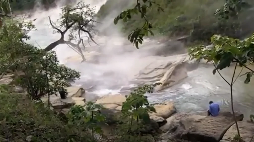
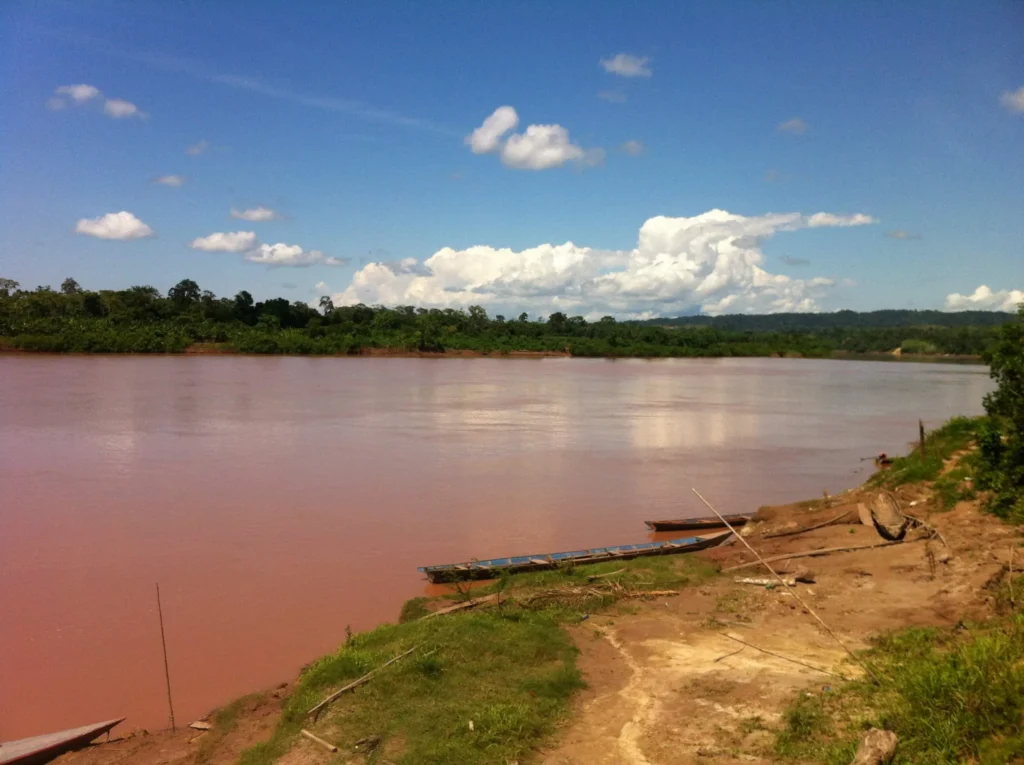
Walk the bank of the Shanay-timpishka and the first thing you notice is the sound: a low, constant simmer, like a kettle that never quite settles. Then the heat reaches your face. Plumes of vapor lift off the surface and disappear into the canopy, and the mud at the water’s edge is too hot to stand on barefoot. A hand dipped in the wrong spot comes back scalded. This is the Shanay-timpishka — the Boiling River of the Amazon, a real river in the central Peruvian Amazon, wide enough that you cannot jump across it, hot enough in places to cook an animal that falls in, and it sits hundreds of kilometers from the nearest volcano.
For years, most geoscientists assumed a river like this could not exist outside a volcanic zone. The river itself proved them wrong; the mechanism behind it is still being worked out.
The Legend of “A River That Boils”
The geoscientist Andrés Ruzo grew up hearing about the river from his grandfather, wrapped inside a 16th-century story about the Spanish conquest of Peru. After the Inca emperor Atahualpa was captured and killed, the story goes, the survivors who staggered out of the Amazon told of trees that blotted out the sun, warriors with poisoned arrows, spiders that ate birds, snakes that swallowed men whole, and a river that boiled.
Ruzo treated it as a campfire tale for about twelve years. The local Asháninka name, Shanay-timpishka, translates roughly as “boiled with the heat of the sun”, from shanay, the heat of the sun, and timpu, the verb “to boil.” Communities along its banks, Mayantuyacu, Santuario Huishtín, and the Shanay-timpishka Center, have used and revered the water for generations, long before any outsider arrived with a thermometer.
Finding It: Andrés Ruzo’s 2011 Expedition
The turn came while Ruzo was a PhD student at Southern Methodist University, building the first detailed heat-flow map of Peru to scout the country’s geothermal energy potential. He asked colleagues, oil and gas companies, and government experts whether a boiling river could exist in the Amazon. The answer was unanimous: no. Boiling rivers exist, they said, but always near volcanoes, and there are no volcanoes in the Amazon. End of story.
Except a family dinner reopened it. When Ruzo mentioned his frustration, his aunt interrupted: “No, Andrés, I’ve been there. I’ve swum in that river.” She knew the way. The river was guarded by a shaman at Mayantuyacu, a healing sanctuary, and her friend was married to him. In November 2011, guided by his aunt, Ruzo traveled from Pucallpa, by car, then motorized canoe, then on foot through the jungle, and became the first geoscientist granted shamanic permission to study the site.
What he found was not a misunderstanding. As he recounted in his 2014 TED talk, “The average temperature in the river was 86 degrees Celsius, not quite boiling, but definitely close enough.” His verdict on the legend was blunt: “It’s not a legend.” He told the fuller story in his 2016 TED Book, The Boiling River: Adventure and Discovery in the Amazon.
How Hot Is It, Really?
Here are the numbers worth holding onto. The whole river system runs about 9 km, but only the lower stretch, roughly 6.3 km (3.9 mi), is thermal. At its headwaters it behaves like any ordinary jungle stream, around 27 °C (81 °F). Downstream, after it crosses fault zones, it transforms.
- Hottest temperature ever measured: 99.1 °C (210.4 °F), recorded in a hot spring feeding the river.
- Hottest average river temperature recorded: nearly 95 °C (203 °F).
- Typical hot-reach average Ruzo cites: around 86 °C (187 °F).
- Maximum width: roughly 25–30 m (about a two-lane road).
- Maximum depth: roughly 4.5–6 m.
At sea level water boils at 100 °C, so the river never quite reaches a rolling boil along its whole width, but it gets close, and at that temperature the distinction stops mattering for anything that falls in. Ruzo has described how animals that tumble into the hot reaches die fast: the eyes cloud to milky white almost instantly, then the body cooks from the outside in.
The Real Mystery: Heat With No Volcano
Big thermal rivers are almost always heated by a nearby magma source. The Shanay-timpishka is the exception that makes geologists sit up. As Ruzo told National Geographic, “We’re over 700 kilometers [435 miles] away from the nearest active volcanic center, in the middle of a sedimentary basin.” It sits on no plate boundary and above no known magma chamber, which is exactly what makes it scientifically remarkable, and according to the Boiling River Project, it is the world’s largest documented non-volcanic thermal river. Ruzo has put the rarity plainly: “I’m still unable to find another non-volcanic geothermal system of this magnitude. It’s unique. It’s special on a global scale.”
When he started, Ruzo carried three hypotheses. One: a hidden volcanic or magmatic system that everyone had missed. Two: a non-volcanic hydrothermal system, where water sinks deep, heats up, and rises fast. Three, the one that worried him most, that the river was not natural at all but the product of an oil-field accident, since the site sits only a few kilometers from the oldest active oil field in the Peruvian Amazon. The cautionary example in his mind was Lusi, the Java mud volcano that erupted after a drilling operation in 2007 and has not stopped since.
Geochemical testing ruled out the volcanic explanation. The oil-accident scenario was investigated and set aside: there was a well more than a mile away, but the operator’s activity did not account for the river. The second option survived, and the evidence keeps pointing back to it.
How a River Boils Without Magma
The leading explanation is a deep-circulation, fault-fed hydrothermal system, and it runs on a principle every geology student learns. The Earth gets hotter with depth. That increase is the geothermal gradient, and away from volcanic zones it averages about 25 °C for every kilometer you descend, a figure rooted in the global heat-flow dataset compiled by Pollack, Hurter, and Johnson in Reviews of Geophysics in 1993.
Feed rainwater into that system and the arithmetic works. Rain falls on the rainforest, and possibly on higher ground. The water seeps into deep-rooted faults and percolates into the crust, where the geothermal gradient bakes it. Pressure and buoyancy then drive it back up along the same fault network, surfacing as hot springs that supercharge the river along its thermal reach. Maria Richards of SMU’s Geothermal Laboratory, who joined Ruzo in the field, has suggested the river is fed by several fault segments rather than a single one.
How deep does the water have to go? Working from a normal background gradient and the region’s mean annual temperature of about 80 °F, AccuWeather meteorologist Jim Andrews estimated that the water feeding the springs must descend at least 3,000 meters, perhaps deeper, to account for the heat lost on the way back up. Deep enough to load up on heat, fast enough on the return that it does not bleed it all away before surfacing.
This is not an exotic, one-off mechanism. The peer-reviewed literature on amagmatic hydrothermal systems, hot springs with no magma beneath them, describes exactly this plumbing. Work by Audrey Taillefer and colleagues on fault-controlled circulation, published in Geochemistry, Geophysics, Geosystems in 2018, shows meteoric water infiltrating at altitude, warming at depth along the geothermal gradient, and rising rapidly through permeable faults before it can cool. A 2021 study of the Grimsel Pass system in the Swiss Alps documented meteoric water reaching depths beyond 10 km and temperatures above 250 °C with no magma involved at all. And tellingly, a 2024 study of southern Peru’s hydrothermal systems found fault-aligned hot springs at considerable distances from active volcanoes, fed by topography-driven rainwater recharge. The mechanism the Boiling River appears to use is documented elsewhere. What sets the Shanay-timpishka apart is its sheer scale.
One more detail makes the river more remarkable rather than less. Regional heat flow across the Andean foreland is actually low, on the order of 40 milliwatts per square meter, slightly below the neighboring Brazilian Shield. The Boiling River is not sitting on an unusually hot patch of crust. It is a concentrated plume of fault-focused upflow punching through a cool regional background, which is precisely why it stands out.
What the Water Chemistry Revealed
One measurement, more than any other, undercut the volcano theory. Volcanic and magmatic waters tend to be chemically loaded, acidic or alkaline, heavy with dissolved metals. Ruzo found the opposite. Using a handheld water-quality meter, he measured an anomalously low electrical conductivity. In his telling, the Boiling River’s waters were cleaner, lower in dissolved content, than the bottled mineral water Evian.
Combined with isotopic and geochemical sampling across years of fieldwork, the signature pointed to meteoric water, rain and snowmelt that fell at the surface, rather than fluids cooked off a magma body. That is the chemical fingerprint of a deep-circulation hydrothermal system, not a volcanic one. It is also where the most evocative version of the story needs a careful hand: Ruzo has floated the possibility that some of this water originates as far away as glaciers in the Andes, seeping down and traveling underground before surfacing scalding. That is a hypothesis, an attractive one, not a settled fact, and it is worth flagging as such.
The strangest thing about the science here is also the simplest to state: for all the river’s fame, there is still no standalone peer-reviewed journal paper devoted to its geochemistry and hydrology. The geoscience record rests on Ruzo’s TED Book and talk, his SMU heat-flow research, his conference presentations, and careful science journalism in outlets such as National Geographic, Science Friday, and Smithsonian. The fault-fed model is well-supported and is the consensus best explanation. It remains an active, evolving line of study rather than a closed, fully published result, and that gap, oddly, is part of what keeps the river interesting. To go deeper on the underlying mechanism, see our glossary entries on the geothermal gradient, faults, and hydrothermal systems.
The river has, however, finally entered the peer-reviewed literature through an unexpected door: ecology. The thermal gradient that makes the river dangerous also makes it a natural laboratory. Because air temperatures along its banks can swing by up to 11 °C in less than a kilometer, while rainfall, soil, and humidity stay roughly constant, researchers can isolate the effect of heat on the forest in a way no artificial experiment allows. A 2024 study in Global Change Biology, co-authored by Ruzo, used exactly this setup to show that hotter stretches support fewer woody plant species, a small, sobering preview of how tropical forests may respond to a warming world. A companion paper in New Phytologist the same year reached parallel conclusions about the trees’ shrinking thermal safety margins.
Life on the Edge
A river this hot is hostile to almost everything alive, yet a handful of organisms make it home. The organisms that thrive here are extremophiles, specifically thermophiles: microbes adapted to temperatures that cook ordinary cells. They form colorful mats and films clinging to rocks and soil along the banks, shifting in character as the water heats up.
Biochemist Rosa Vásquez Espinoza, who studied the microbes as a doctoral researcher at the University of Michigan, has worked on this community. In 2019, with Ruzo’s help and the blessing of the Mayantuyacu shaman, Maestro Juan Flores, she joined a large expedition, she has described traveling to the river with some 40 researchers from seven countries, taking microbial samples from 19 sites in and along the water. The interest is not only ecological. Thermophiles carry heat-stable enzymes and unusual biochemistry, and their machinery has a track record of seeding useful tools: The thermophile Thermus aquaticus, first isolated from Yellowstone’s hot springs by Thomas Brock and Hudson Freeze in 1969, yielded the heat-stable Taq polymerase that made the polymerase chain reaction practical. PCR is the technique at the heart of modern DNA testing, and it earned Kary Mullis a share of the 1993 Nobel Prize in Chemistry. Vásquez Espinoza has emphasized that the Boiling River’s microbes cannot simply be equated with Yellowstone’s; the river has a different, constantly shifting geochemistry, so its community is genuinely its own. (For a marine cousin of a non-magmatic system, see our explainer on the Lost City Hydrothermal Field.)
Sacred Water: the Asháninka and Yacumama
To the people of Mayantuyacu, the science is one layer over something older. The river is sacred. Its headwaters are marked by a large boulder shaped like a serpent’s head, and local tradition holds that the hot and cold waters are birthed by Yacumama, “Mother of the Waters”, a giant serpent spirit. At the most sacred site, a hot spring mixes with cold stream water beneath the serpent’s “jaws.”
This is myth, distinct from the geology, and worth naming as such. But it is not idle decoration. The river anchors daily life, drinking, cooking, cleaning, brewing medicines, even telling time, with the late-day “hora del vapor” (vapor hour) when cooling air sends great clouds of steam up from the surface. Ruzo has been explicit that gaining the shaman’s permission, and respecting the community’s customs, including pouring sampled water back so it can “return home”, was a precondition of the work, not a courtesy.
A Fragile Wonder
The threat to the Boiling River is not its heat. It is the chainsaw. The river sits in what has been described as the “reddest” of Peru’s deforestation red zones. The clearest measure of the speed of loss is the journey itself: in 2011, reaching the river from Pucallpa took roughly two hours by car, then a 30-to-45-minute canoe ride, then an hour or more of hiking. By 2014 it had collapsed into a direct three-hour drive, no canoe, no walk, because the forest in between had been cleared.
Energy and resource interests circle the area too, and Ruzo has spoken about the moral weight of his own data: before publishing his geothermal findings widely, he chose to slow down and help local Indigenous leaders secure legal title to their land, wary that mapping a large geothermal resource could invite exactly the development that would destroy it. He founded the Boiling River Project, a nonprofit dedicated to studying and protecting the site; the community now legally owns the land, and the campaign for formal government protection continues.
It is a strange position for a scientist: a discovery so significant that publishing it too soon might doom the thing discovered. The question that first grabs you is how a river boils with no volcano for 700 kilometers. The harder question sits underneath it. We still cannot fully trace the plumbing that feeds it, or say with certainty how far that water travels before it surfaces scalding. The river remains a legend only partly proven, real beyond doubt, not yet fully explained, and slowly vanishing into the same forest that once made people question whether it existed.
Frequently Asked Questions
Why is the Boiling River so hot if there’s no volcano?
The leading explanation is a deep-circulation, fault-fed hydrothermal system. Rainwater, and possibly water from as far as the Andes, sinks through deep faults, is heated by the Earth’s normal geothermal gradient (about 25 °C per kilometer of depth), and rises back along faults as hot springs that heat the river. The water’s very low mineral content points to a meteoric, non-volcanic origin. The model is well-supported but still under active study, with no standalone peer-reviewed paper on the river’s geochemistry yet published.
Can the Boiling River actually kill you?
Yes. In its hot reaches the water approaches boiling, and contact can cause third-degree burns in seconds. Animals that fall into the hottest sections die quickly, Ruzo has described their eyes clouding white almost immediately before they cook from the outside in.
Where is the Boiling River located?
In the Peruvian Amazon, Huánuco Region, Puerto Inca Province, Honoria District, near the Mayantuyacu sanctuary (about 8.81°S, 74.74°W). It is a tributary of the Pachitea River, which flows into the Ucayali and then the Amazon. The usual access point is the city of Pucallpa.
Did Andrés Ruzo discover the Boiling River?
Local communities have known it for generations, so “discover” is the wrong word. Ruzo was the first geoscientist to study it, reaching it in 2011 with shamanic permission and bringing it to global scientific and public attention through his research, his 2014 TED talk, and his 2016 TED Book.
Is it safe to visit?
The river can be visited with local guides through Mayantuyacu and nearby centers, and cooler downstream sections, especially after heavy rain, are warm enough to bathe in safely. The hottest stretches are deadly; even standing too close to the steam can injure you. Go with a guide and never approach the hot zones.
Is the Boiling River connected to climate change?
Not as a cause. But because it shows how a tropical ecosystem behaves under sustained extreme heat, researchers have begun using it as a natural case study for how rainforest life might respond to a warming world. A 2024 study in Global Change Biology used the river’s thermal gradient to show that hotter stretches support fewer tree species.
Has the Boiling River been studied in peer-reviewed science?
Partly. As of 2026, the river’s geochemistry and hydrology have not appeared in a standalone peer-reviewed paper; that science rests on Ruzo’s TED Book, conference work, and science journalism. However, the surrounding forest now features in peer-reviewed ecology journals, and the underlying heat mechanism is well-documented in the broader literature on non-volcanic, fault-fed hydrothermal systems.