New seismic imaging shows Bermuda is held up by a thick slab of cooled mantle rock, not a hidden plume, and the result is forcing a rewrite of how intraplate ocean islands stay above water.
A small island, listening
On a windy hillside in St. George’s Parish, behind the old Bermuda Biological Station, a borehole drops into the volcanic basement of the island. At its bottom sits a broadband seismometer, sealed against temperature swings and the patient hum of the Atlantic. The station is called BBSR. It has been running, in one form or another, since 1988, operated for the USGS Albuquerque Seismological Laboratory as part of the Global Seismographic Network (Albuquerque Seismological Laboratory/USGS, 1988).
For most of those decades, BBSR has done what GSN stations do. It records earthquakes that happen somewhere else: a magnitude-7 in Chile, an aftershock cluster in Sumatra, a deep event under the Sea of Okhotsk. Compressional waves arrive first, hours after the rupture. Shear waves trail behind. In between, smaller arrivals, converted phases, internal reflections, carry information about everything the waves passed through on their way to the sensor. A digitizer turns ground motion into 24-bit integers and ships them to a data center in New Mexico, where they sit in archives, waiting for someone to ask the right question.
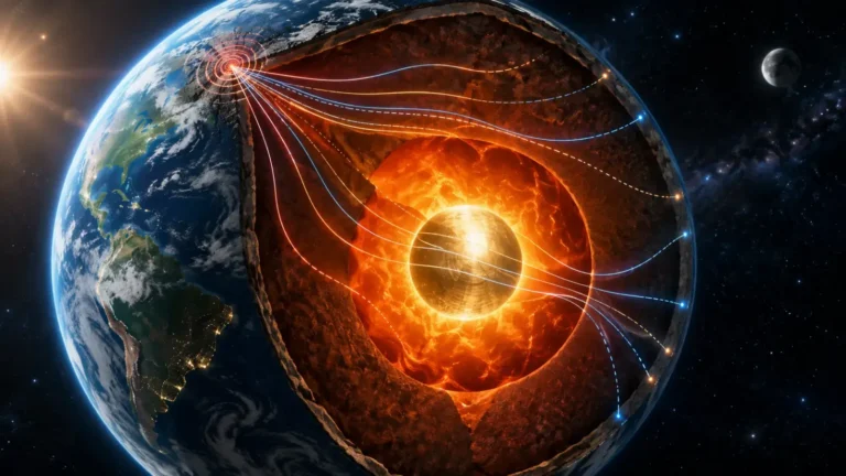
In November 2025, two seismologists asked one. They pulled 396 distant earthquakes from the archive, each with a magnitude of at least 5.5 and an epicentral distance between 30 and 95 degrees from Bermuda, and used them to reconstruct what lies under the island down to about 50 kilometers depth (Frazer & Park, 2025, “Thick Underplating and Buoyancy of the Bermuda Swell,” GRL, DOI 10.1029/2025GL118279). What they found, 20 kilometers below their feet, is the answer to a question geologists have been arguing over for half a century. Bermuda underplating, it turns out, is the reason the island still exists.
Why Bermuda shouldn’t exist
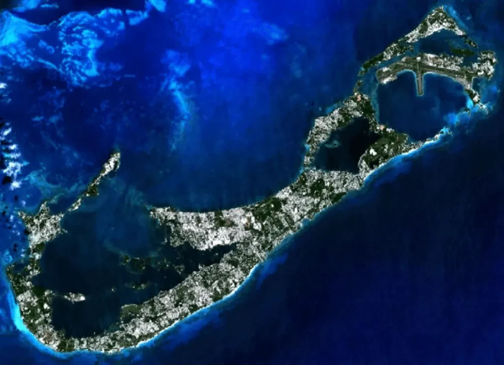
By the rules of ordinary plate tectonics, Bermuda is a problem.
The volcanic basement under the island’s limestone cap was last active around 30 to 35 million years ago. The most reliable radiometric date, a potassium-argon age on lamprophyre sheet intrusions from the 1972 “Deep Drill” core on St. George’s Island, comes in at 33.5 million years (Vogt & Jung, 2007, in Plates, Plumes and Planetary Processes, GSA Special Paper 430). Earlier pillow lavas in the same borehole returned ages of 47 and 91 million years, but those samples are heavily altered and considered unreliable. The most defensible statement is that Bermuda’s last episode of volcanism ended in the early Oligocene, roughly 30–35 Ma, and nothing has erupted since.
That date matters because cooling oceanic lithosphere subsides on a predictable curve. Once a volcano stops feeding, once whatever was pushing the seafloor up goes away, the plate sinks. The Hawaiian–Emperor chain is the textbook case: each volcano rides west off the hotspot, cools, and slowly drops back into the Pacific, leaving a chain of submerged guyots.
Bermuda should have followed the same script and didn’t. The island sits near the summit of the Bermuda Rise, a northeast-trending oval swell of seafloor about 1,500 kilometers long and 500 to 1,000 kilometers wide (S. King & Anderson, 1998), standing roughly 500 meters higher than the abyssal seafloor of equivalent age around it (S. King & Adam, 2014, PEPI). Frazer and Park adopt that same ~500-meter swell height. Either way, this is a real bulge in the Atlantic floor, persisting more than 30 million years after the heat source that supposedly made it should have switched off.
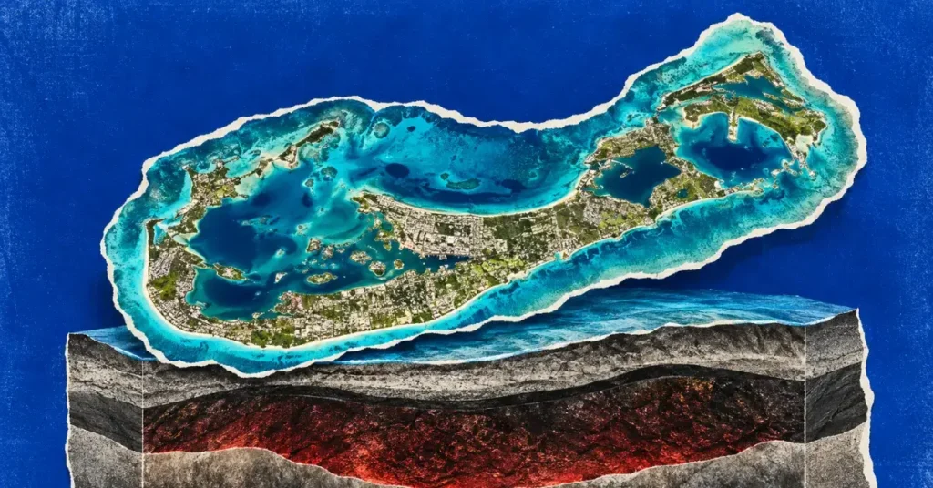
If you sail north from Puerto Rico through the waters popularly called the Bermuda Triangle, you cross the deep abyssal plain, and the real anomaly here is geological, not supernatural. Then the seafloor lifts under your hull, a long, low dome rising for hundreds of kilometers. At the top of the dome, in 45 meters of water, sits a flat-topped pedestal of volcanic rock buried under a kilometer or so of carbonate reef and dune sediments. Tourists see the reef. The pedestal underneath it is the part that shouldn’t be there.
The Hawaii model, and why it doesn’t fit
For most of the past half-century, the standard answer to “why is there a volcanic island in the middle of an ocean plate” has been: a mantle plume. The idea, formalized by W. Jason Morgan in “Convection Plumes in the Lower Mantle” (Nature, 5 March 1971, DOI 10.1038/230042a0), is that narrow columns of hot rock rise from deep in the mantle, possibly from the core–mantle boundary, and impinge on the underside of a tectonic plate. The plume’s heat produces partial melt, which builds a volcano. The plume’s buoyancy lifts the plate around it, producing a swell. As the plate drifts over the plume, a chain of progressively older, progressively more eroded volcanoes trails off downstream.
Hawaii has all the features. There is an active volcano at one end, Kīlauea, throwing lava into the Pacific right now. There is a chain of older, dead volcanoes leading northwest toward the Emperor Seamounts, with ages that increase smoothly with distance. Global seismic tomography images a low-velocity anomaly under Hawaii reaching into the lower mantle, consistent with a hot column rising from depth. The swell beneath Hawaii is supported, in this picture, dynamically. The plate is being held up by the buoyant push of plume material underneath. Take the push away and the plate settles.
Bermuda has none of those features. No active volcano. No age-progressive chain of dead volcanoes trailing toward, or away from, the island. The high-resolution global tomography model SEMUCB-WM1, built by French and Romanowicz (2015, “Broad plumes rooted at the base of the Earth’s mantle beneath major hotspots,” Nature 525:95–99), sees nothing plume-like in the lower mantle below Bermuda. Earlier work proposed a weak thermal plume (J. Morgan, 1983), or edge-driven convection at the edge of the North American craton (S. King & Anderson, 1998), or intermittent upper-mantle upwelling (Vogt, 1991), but none of these models has stuck.
There is also a separate, long-running argument over whether classic deep mantle plumes exist at all. A school led by Gillian Foulger and the late Don Anderson has argued for two decades that many features attributed to plumes are better explained by shallow processes, plate stress, fertile patches of asthenosphere, lithospheric fabric inherited from older tectonics (Foulger & Anderson, 2005, JVGR 141:1–22). Bermuda has long been Exhibit A in their case. It is the swell that refuses to behave like the plume model says a swell should.
This is the puzzle Frazer and Park set out to solve. If there is no plume now and no plume that can be reconstructed for the recent past, what is holding the Bermuda Rise up?
Reading earthquakes from continents away
The technique is called receiver function seismology, and the underlying idea is older than the digital records it now uses.
When a P-wave from a distant earthquake arrives almost vertically beneath a seismic station, it does not arrive cleanly. At every sharp boundary in the rock above the sensor, a contrast in composition, density, or seismic velocity, part of the P-wave converts to an S-wave. The converted wave arrives a fraction of a second later than the direct P, because S-waves travel more slowly. The size of that delay tells you how deep the interface is. The polarity of the converted wave tells you whether the interface is a step up or a step down in seismic impedance. Stack enough of these conversions, from earthquakes coming in at different azimuths and angles, and the structure underneath the station resolves into a vertical profile of layers.
The catch is that the converted phases are tiny, often buried in noise. To pull them out, seismologists need long records, many earthquakes, and careful filtering.
Frazer and Park applied a high-frequency, multiple-taper-correlation receiver function method to BBSR’s archive. They required signal-to-noise ratios above 2 in two frequency bands (0.01–0.5 Hz and 0.5–3 Hz) and applied an additional causality check on each individual event. Out of decades of recordings, 396 distant earthquakes passed all quality controls (Frazer & Park, 2025, GRL). The dataset is small by the standards of dense continental seismic networks, but for an island station in the middle of the Atlantic, with only one usable instrument, 396 clean events is a respectable record.
The output is a stacked image of every interface within the upper 50 kilometers of crust and lithosphere beneath the island. Four prominent layers emerged.
The 20-kilometer raft
The first interface, about 3.3 kilometers down, marks the base of the volcanic edifice, the eroded stump of the original shield volcano. The second and third interfaces split a roughly 7-kilometer-thick oceanic crust into an upper and lower layer, in the usual two-part structure imaged at many ocean basins. The fourth interface is the new one. It sits at about 10.8 kilometers depth, at what would normally be the Moho, the boundary between crust and mantle.
Under most ocean islands, below the Moho, you would expect mantle peridotite, with P-wave velocities around 8 km/s and densities around 3,300 kg/m³. Under Bermuda, the seismic image shows something different. From the fossil Moho at about 11 kilometers down to roughly 31 kilometers depth, the rock has P-wave velocities near 7.3 km/s, too fast to be oceanic crust, too slow to be ordinary mantle. Beneath that, at last, the receiver functions return signals consistent with normal lithospheric mantle.
In other words, between Bermuda’s oceanic crust and the mantle proper sits a 20-kilometer-thick layer that does not belong to either. Frazer and Park interpret this layer as underplating: magma that rose during Bermuda’s last volcanic episode but stalled at the base of the crust instead of erupting, then cooled and solidified into a mafic intrusion frozen between the crust and the mantle (Frazer & Park, 2025, GRL).
Underplated layers have been seen before. Beneath the Canary Islands, beneath the Marquesas, beneath several smaller ocean islands, receiver-function studies have imaged underplates 3 to 10 kilometers thick (Gallart et al., 1999; Leahy et al., 2010; Olugboji & Park, 2016). The Bermuda layer is roughly twice as thick as any previously documented intraplate oceanic underplate.
Thickness is only half of it; density carries the rest of the argument. To support a 500-meter swell, an underplated layer must be less dense than the lithospheric mantle it has replaced: buoyant enough to lift the overlying plate, but heavy enough to sit beneath the crust. Frazer and Park ran the isostatic arithmetic both ways. Against an assumed lithospheric mantle density of 3,300 kg/m³, the underplated material must be about 50 kg/m³ lighter, putting its absolute density near 3,250 kg/m³, a contrast of roughly 1.5 percent (Frazer & Park, 2025, GRL). It sounds small. Multiplied across a 20-kilometer column of rock that may extend 50 to 100 kilometers out from the center of the swell, it is enough to lift the seafloor by the full observed ~500 meters.
The implication is that Bermuda is not being held up by anything hot. The buoyancy is compositional, not thermal. It does not need a plume to keep working, and it will not switch off when a plume moves away, because there is no plume. A thick raft of slightly lighter rock is wedged into the base of the plate, and that raft has been doing the job, on its own, for roughly 30 million years.
“Bermuda is an exciting place to study because a variety of its geologic features do not fit the model of a mantle plume, the classic way for deep material to be brought to the surface,” William Frazer, the paper’s lead author at Carnegie Science, said when the work was announced (Carnegie Science press release, 12 Feb 2026). “We observe thick underplating, something that is not observed at most mantle plumes. Combined with recent geochemical observations, this suggests that there are other convective processes within Earth’s mantle that have yet to be well understood.”
The Pangea connection
Why is Bermuda’s underplate so thick, when other intraplate ocean islands have underplates a third or a quarter of the size? Seismology can describe the layer but cannot, on its own, say where the material came from. For that, the case rests on geochemistry, and on samples cored out of Bermuda’s basement decades ago.
In 2019, Sarah Mazza and seven co-authors, including Esteban Gazel and Alexander Sobolev, published an analysis of Bermuda’s volcanic rocks in Nature, arguing that the island’s lavas were sampling a mantle reservoir nobody had described before (Mazza et al., 2019, “Sampling the volatile-rich transition zone beneath Bermuda,” Nature 569:398–403, DOI 10.1038/s41586-019-1183-6). The Bermuda lavas are silica-undersaturated, meaning they crystallized from melts unusually poor in SiO₂. They are enriched in incompatible trace elements, volatiles including water and CO₂, and they carry a distinctive lead isotopic signature pointing to a young source. The most plausible reservoir, Mazza and her co-authors concluded, is the mantle transition zone, the layer between 410 and 660 kilometers depth, somehow tapped during Bermuda’s brief volcanic life around 33 million years ago. The stronger argument was that this reservoir carried carbon and water that had been subducted into the deep mantle long before the eruptions reached the surface.
Mazza, an outside expert who has separately published on Bermuda’s geochemistry and was not involved in the seismic study, has continued to develop this story. In Mazza et al. (2025, “Zinc isotope constraints on the cycling of carbon in the Bermuda mantle source,” Geology 53(12):1001–1006, DOI 10.1130/G53656.1), she and colleagues used variations in zinc isotopes from Bermuda samples to trace the carbon back to its source. The signal, Mazza told Live Science, points to material driven deep into the mantle hundreds of millions of years before Bermuda existed, during the assembly of Pangea between roughly 900 and 300 million years ago (Pappas, Live Science, 12 Dec 2025).
That timing is not incidental. The central Atlantic, where Bermuda sits, is the seam where Pangea split apart. Whatever carbonated, volatile-rich material had been parked in the mantle below the old supercontinent was still down there when the Atlantic opened. When something, Frazer and Park decline to commit to a specific mechanism, leaving open edge-driven convection and small-scale upwelling, disturbed the mantle below the young Atlantic plate around 33 million years ago, the result was Bermuda. Carbon-rich, low-silica melts rose, some erupted to build the original shield volcano, and a much larger volume stalled at the base of the crust and froze in place.
“There is still this material that is left over from the days of active volcanism under Bermuda that is helping to potentially hold it up as this area of high relief in the Atlantic Ocean,” Mazza told Live Science. “The fact that we are in an area that was previously the heart of the last supercontinent is, I think, part of the story of why this is unique” (Pappas, Live Science, 12 Dec 2025).
If she is right, Bermuda’s underplate is not just a leftover from one Oligocene eruption. It is a structural memory of Pangea, a 20-kilometer slab of partly melted, carbon-tainted mantle that solidified under the new plate and has stayed there ever since.
Ten seismometers to map the Bermuda underplate
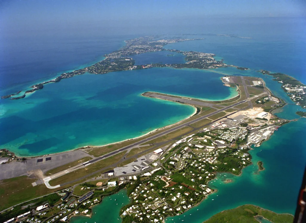
A single seismometer is a thin reed to lean a discovery on. BBSR sits on the eastern end of Bermuda, near the old Biological Station and the entrance to St. George’s Harbor. Receiver functions from one borehole image the layers directly under that borehole. They tell you nothing about whether the same 20-kilometer raft extends across the island, out under the surrounding reef, or further out under the broader Bermuda Rise. They do not say whether the underplate is one continuous slab or a patchwork. They do not resolve its edges.
In February 2026, Frazer and two Carnegie staff scientists, Diana Roman and Lara Wagner, both Harry Oscar Wood Co-Chairs of Seismology at the Earth and Planets Laboratory, returned to Bermuda with ten portable seismometers (Carnegie Science press release, 12 Feb 2026; Carnegie Science feature, 8 May 2026). The instruments, sometimes called Quick Deploy Boxes, were placed across the archipelago in collaboration with the Government of Bermuda, the Bermuda Institute of Ocean Sciences, and the Bermuda Aquarium, Museum and Zoo. Each box pairs a broadband sensor with its own battery, GPS clock, and storage. None of the sites is as quiet as BBSR’s borehole, but ten of them, spread across the island, allow the team to do things the single station cannot. They can compare receiver functions site by site. They can stack converted phases that arrive from different directions onto a map. They can locate small local earthquakes, if any, against an array baseline rather than a single point.
In May 2026, the team returned again to service the network and pull the first major dataset off the instruments (Carnegie Science feature, “Bermuda: Under the Surface,” 8 May 2026). The Carnegie Science update notes only that the team is “returning to check on the instruments, make sure they are functioning properly, and to collect the first major data set.” It reports no preliminary seismic results. The basic claim of the November 2025 paper, that BBSR sees a 20-kilometer underplate directly beneath it, therefore stands undisturbed. Whether the underplate is island-wide, or shaped, or asymmetric, or smaller than the single station would suggest, is the open question the new network is designed to settle.
Several tests come straight out of Frazer and Park’s paper. If the underplate really extends 50 to 100 kilometers from the center of the swell, then receiver functions at all ten new stations should show the same deep interface, at roughly the same depth, with the same polarity. If it does not, if some stations on the western end of the island image the Moho at a normal depth, with normal mantle below it, then the underplate is patchier than the single-station picture implies, and the explanation for the Bermuda Rise will have to grow accordingly.
What else this changes
The most narrowly important consequence of Frazer and Park’s result is local. A real, isostatically sufficient underplate beneath Bermuda removes the need to invoke an active or even a recent thermal anomaly to explain why the island is still there. The Bermuda Rise can be modeled, going forward, as a static, compositionally supported structure. That changes how the Rise should be incorporated into regional models of the central Atlantic, including models of how the North American plate has flexed over the past 30 million years.
The broader implication is that some, possibly many, intraplate ocean islands could be propped up by their own fossil underplates and not by anything currently rising from below. The thermal-plume model is not going away, the geophysical evidence for hot upwellings under Hawaii and Iceland remains strong, but at the intraplate fringe, where swells persist long after volcanism has died, an underplating mechanism may be quietly doing the work that plumes get credit for. Frazer told Carnegie Science he is already looking for comparable layers under other islands. If similar 20-kilometer rafts turn up under, say, the Cape Verdes, or the older Canaries, the Bermuda case stops being one of a kind and becomes the first known example of a wider class.
A third consequence sits in a different room of the building, with the geochemists. If Mazza’s reading is correct, the carbon and volatiles that fed Bermuda’s odd lavas were sequestered in the mantle hundreds of millions of years before the island ever broke the surface, leftovers of the supercontinent cycle, surviving the assembly and breakup of Pangea. That implies the mantle under young oceans like the Atlantic carries a deeper memory of what was there before the basin opened than ocean islands in the older Pacific or Indian basins typically display. Bermuda, in that picture, is a window into Pangean inheritance, not just into a one-off Oligocene eruption.
The anti-plume school will note the obvious. Bermuda is a swell that has been held up for 30 million years without a plume, by a mechanism that does not require deep mantle dynamics at all. Foulger, Anderson, and their colleagues have argued for two decades that shallow processes, underplating, fertile asthenosphere, edge-driven convection, can do most of what plumes were invoked to do (Foulger & Anderson, 2005, JVGR 141:1–22). The Frazer and Park result is consistent with that argument without resolving it. A plume could still have been involved 33 million years ago in delivering the original melts. What is now clear is that no plume is needed to keep the swell standing today.
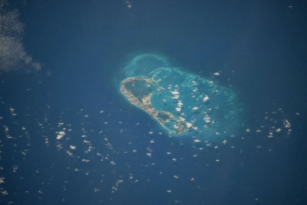
In the borehole at St. George’s, the sensor goes on listening. Another earthquake will hit the digitizer tonight, somewhere along a subduction zone halfway around the planet. Its P-wave will reach Bermuda first, and a fraction of a second later, a smaller, converted S-wave will follow, bouncing off the top of the slab that should not be there, the 20-kilometer raft of cooled mantle rock that has been quietly holding an island above the Atlantic for the better part of 30 million years.