Introduction
A limnic eruption is one of Earth’s strangest killers, an invisible flood of gas from the bottom of a lake. It has happened only twice in living memory, both in Cameroon. The third candidate, Lake Kivu, is thousands of times larger, and cities sleep on its shore.
On the evening of 21 August 1986, the village of Lower Nyos in northwestern Cameroon was winding down from a busy market day. Cattle stood in the dark. People had eaten and gone to bed early. Sometime between 9 and 10 p.m., a sound rolled across the valley, witnesses later described it as a distant rumble, those nearest the water as a bubbling. A column of water and foam rose roughly a hundred metres off the surface of Lake Nyos, a small crater lake cupped in the flank of a dormant volcano. Then a cloud, invisible and heavier than air, slid down the valleys at the speed of a car.
By the time the survivors woke, the valley was dead. More than 1,700 people lay where they had fallen, in doorways, in beds, beside cooking fires that had long gone cold. Cattle, dogs, birds, and insects had died with them, without a mark on their bodies. In the village of Nyos itself, only a handful of roughly 800 people lived. What killed them was not lava, and not water, nor poison in any ordinary sense. It was carbon dioxide, ordinary CO₂, released in a single catastrophic belch from the bottom of the lake. The phenomenon now has a name: a limnic eruption.
The night Lake Nyos exhaled
The scale of the Lake Nyos disaster took the world by surprise, partly because nothing like it had been documented at this magnitude. A team of American scientists, dispatched under the Office of U.S. Foreign Disaster Assistance, reached the lake within weeks. Their findings, published in the journal Science in 1987 by George Kling and colleagues, became the foundational account. The team, which included USGS geologist John Lockwood and geochemist William Evans, concluded that the bulk of the gas was carbon dioxide stored in the lake’s deep water, that the victims died of CO₂ asphyxiation, that the gas was magmatic in origin, and, crucially, that there had been no direct volcanic eruption. The killer had been the lake itself.
The death toll is usually given today as 1,746, the figure that appears in Encyclopaedia Britannica and most reference works, along with more than 3,500 head of livestock. It is worth being precise about the uncertainty: the contemporaneous Science paper reported “at least 1,700,” and the medical literature of the time used “around 1,700.” The exact count was never perfectly established in a remote region where whole families died together and burials happened fast. Both figures point at the same horror; the higher number reflects a fuller later tally.
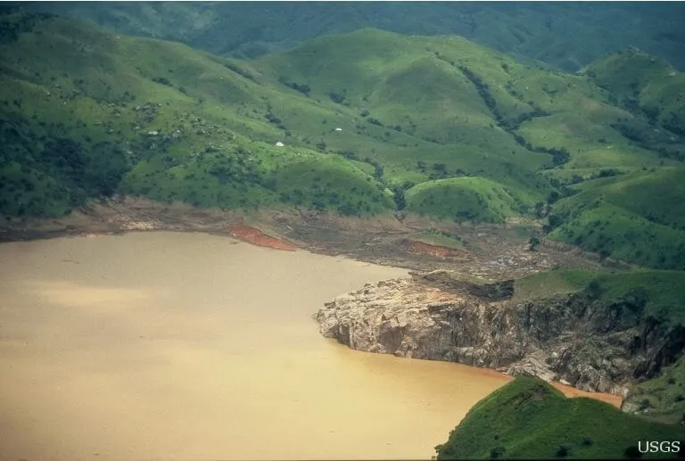
The lake bore its own evidence. Photographs taken in the days after by USGS geologist John Lockwood show water turned a deep rust-brown, iron from the depths churned to the surface, and a fringe of vegetation flattened by a wave. The carcasses of more than three thousand cattle lay scattered across the hills.
What is a limnic eruption?
Picture an unopened bottle of sparkling water. The liquid looks still, yet it holds far more dissolved carbon dioxide than it could at ordinary pressure, because the sealed cap keeps the contents pressurised. Crack the cap and the gas rushes out of solution as bubbles. That is the physics, governed by Henry’s Law, that underlies every limnic eruption, except the “cap” is the sheer weight of hundreds of metres of water.
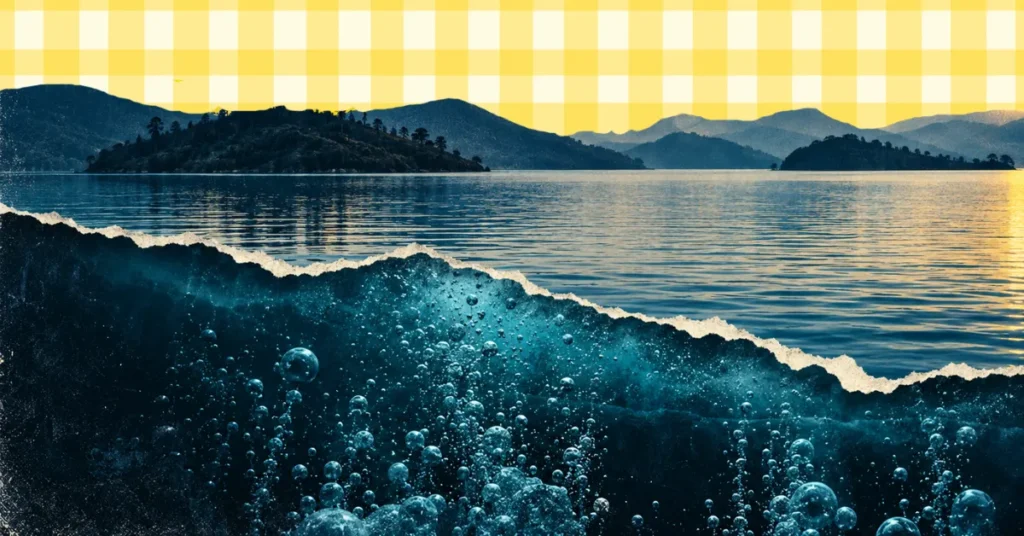
In a deep, calm lake fed by volcanic CO₂, gas seeps up from below and dissolves into the cold bottom water. Pressure increases and temperature drops as you descend, and both conditions let water hold more gas. Over decades or centuries, the deep layer becomes loaded, at Nyos, the bottom water held several times its own volume in dissolved CO₂. As long as that water stays put, the gas stays dissolved. The danger is in the disturbance. A landslide, a slug of cold rain, a pulse of volcanic heat from below, or simply an internal overturn, any of these can lift a parcel of deep water upward. As it rises, pressure falls, bubbles form, and the bubbly water becomes buoyant, so it rises faster, releasing more gas in a runaway chain reaction. A column of gas and water punches to the surface. The CO₂, about 1.5 times denser than air, then pools and flows downhill, hugging the ground and displacing the oxygen people and animals need to breathe.
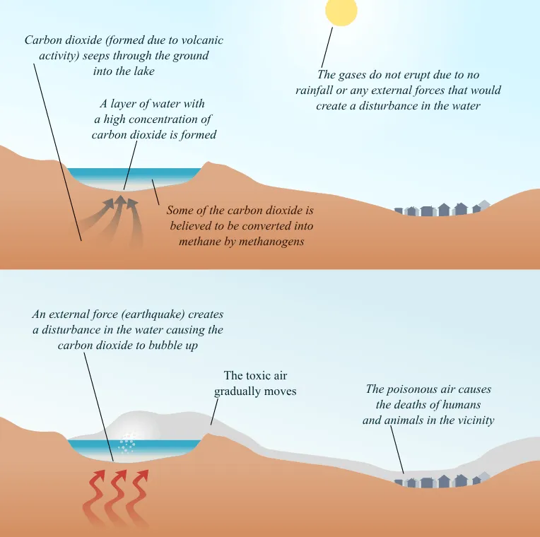
Death by CO₂ is quiet. According to the U.S. National Institute for Occupational Safety and Health, an atmospheric concentration of 100,000 ppm, 10 percent CO₂, is immediately dangerous to life, and exposure at that level “for only a few minutes can cause loss of consciousness.” Survivors of Nyos described a warm sensation, a faint smell, and then nothing, they woke hours later, dazed, to find their families gone.
Lake Monoun: the overlooked first warning
Nyos was not the first. Two years earlier, on 15 August 1984, a smaller lake about 100 km to the southeast had done the same thing. Lake Monoun killed 37 people, several of them on a road at dawn, and at first the deaths were blamed on foul play, a chemical attack was even suspected, in a politically tense period. It took the work of volcanologist Haraldur Sigurdsson and colleagues, published in the Journal of Volcanology and Geothermal Research in 1987, to diagnose the true cause: a sudden release of carbon dioxide from the lake’s deep water, the same mechanism that would devastate Nyos.
Monoun is a cautionary tale within a cautionary tale. The signal was there, but it was small, local, and easy to explain away. Had it been understood faster, the response at Nyos might have come sooner. Together the two Cameroonian lakes established limnic eruptions as a distinct class of natural hazard, one that, unlike most volcanic threats, scientists came to regard as both predictable and, remarkably, preventable.
Lake Kivu: the dangerous cousin
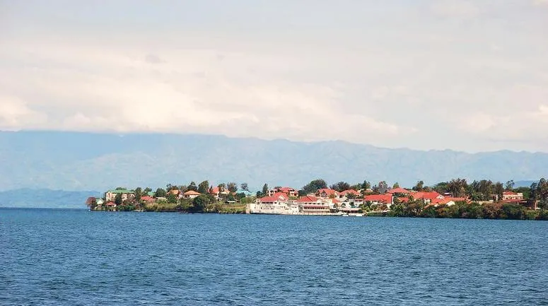
If Nyos and Monoun are the warnings, Lake Kivu is the reason anyone is still paying attention. Straddling the border between Rwanda and the Democratic Republic of the Congo, in the western branch of the East African Rift, Kivu is no small crater pond. It is one of the African Great Lakes: a maximum depth of about 485 metres (older sources say 475 m, but recent peer-reviewed work uses 485), a surface area of roughly 2,370 square kilometres, and a volume on the order of 550 cubic kilometres. By volume, Kivu is roughly 2,000 times the size of Lake Nyos, the operator ContourGlobal uses that “2,000 times” figure, while a 2025 University of Calgary modelling study (published in the journal’s 2026 volume) cites a “3000 times larger size” relative to the Cameroon lakes. Either way, the difference is one of category, not degree.
And it is loaded. The standard estimate, originating with the German scientist Tietze in 1978 and still cited today, is that Kivu’s stratified deep water holds roughly 300 cubic kilometres of dissolved CO₂ and 60 cubic kilometres of dissolved methane (CH₄). The methane is the difference that makes Kivu uniquely dangerous. At Nyos, the threat was asphyxiation. At Kivu, the deep water holds a vast reservoir of flammable gas, so a large release would carry not just a suffocation hazard but the risk of fire and explosion. The lake also sits within sight of the Virunga volcanoes, including Nyiragongo, one of the most active volcanoes in Africa, whose lava lake looms over the Congolese city of Goma on the northern shore.
How many people live in harm’s way? The figure repeated across the scientific and news literature is about two million on the immediate shores. The same modelling study, published in the Royal Society of Chemistry journal Environmental Science: Processes & Impacts by Hadi Saboorian-Jooybari and Hassan Hassanzadeh of the University of Calgary, widens the lens, noting that the lake sits within a far denser and much wider catchment than the Cameroonian lakes, which the authors estimate is home to roughly 5.7 million people. Either way, this is not a remote valley with a few hundred farmers. It is a populated lakeshore, with cities, fishing fleets, and lakeside resorts.
What keeps the gas down is the lake’s extraordinary structure. Kivu does not mix the way ordinary lakes do. Its deep water is warmer and far saltier than the surface, fed by warm, saline, gas-rich groundwater springs entering below about 260 metres. The salt makes the deep water dense enough that the warmth cannot lift it, so the layers stay locked in place, a condition limnologists call meromixis. The Calgary study describes a “staircase” of stacked layers separated by sharp density steps, or chemoclines, at depths around 85, 191, 257, 313, and 390 metres, and coins the term “quadruple-diffusive convection” for the interplay of heat, salt, CO₂, and methane. Only the top 60 metres or so circulates and supports fish. Below that, the water has been sitting, accumulating gas, for centuries.
Is the danger growing?
This is where the picture gets more complicated. In 2005, a team including Eawag scientists Martin Schmid and Alfred Wüest reported in Geochemistry, Geophysics, Geosystems that between 1974 and 2004, dissolved CO₂ in Kivu had risen by about 10 percent and methane by 15 to 20 percent. That trajectory, if real and sustained, implied the lake was loading toward eventual saturation, the headline phrase was “increasing risk of uncontrolled gas eruption.” It is the origin of much of the “ticking time bomb” framing that still circulates.
But measurement in a gas-charged lake is genuinely hard, and the 2005 trend rested on comparing data gathered by different methods across decades. To resolve it, an international team ran a careful intercomparison campaign near Gisenyi/Rubavu, Rwanda, from 9 to 13 March 2018, with groups from Eawag, Germany’s UFZ, France’s CNRS, and KivuWatt measuring the same water with different instruments. Their conclusion, published in 2020 in PLOS ONE by Fabian Bärenbold and colleagues at Eawag, was reassuring and pointed. In the deep water, the methane profiles from different techniques agreed to within 5 to 10 percent, and this is the key sentence, “when comparing our data to past measurements, we cannot verify the previously suggested increase in methane concentrations since 1974. We therefore conclude that the methane and carbon dioxide concentrations in Lake Kivu are currently close to a steady state.”
In plain terms: the best modern data do not show methane racing toward a threshold. The risk of a spontaneous limnic eruption from gas buildup alone is not, on current evidence, increasing. The Bärenbold team also measured somewhat less methane than the older standard figures, around 40 cubic kilometres in the deep “resource zone” rather than the higher numbers once used to plan power projects.
The Calgary modelling study reinforces the calmer reading from a different angle. Simulating the lake’s behaviour over the next half-millennium, the authors find that the commonly cited fears, that buoyancy instability could trigger an overturn, or that the water column could spontaneously reach supersaturation, are not supported by their hydrodynamic model under steady-state conditions. None of this means Kivu is harmless. It means the most likely catastrophe is not a lake quietly loading itself to the bursting point, but an external shove.
Defusing the bomb
The most hopeful part of the limnic eruption story is that humans have already disarmed two of these lakes, Nyos and Monoun, and are draining the third for profit.
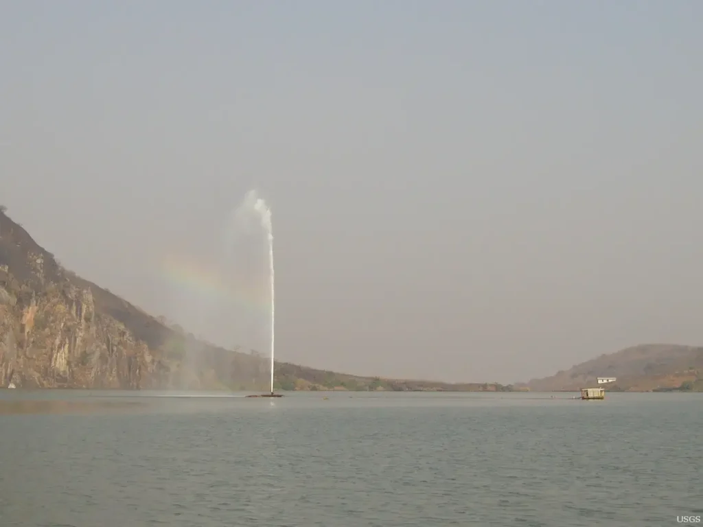
At Lake Nyos and Lake Monoun, a French team led by physicist Michel Halbwachs spent more than a decade engineering a disarmingly simple fix: a pipe. Lower a tube from the surface to the gas-rich deep water and prime it with a pump, and the rising water begins to fizz; the bubbles make the column buoyant, and the flow becomes self-sustaining, a controlled, permanent fountain that bleeds gas out at a safe rate. After feasibility trials at Monoun in 1992 and Nyos in 1995, the first operational pipe at Lake Nyos was commissioned on 30 January 2001, throwing a fountain about 50 metres into the air. Two more pipes followed in 2011 to speed the job. Monoun, the smaller lake, received pipes between 2003 and 2006 and was brought down to safe gas levels, more than 90 percent of its maximum CO₂ removed, by around 2011. Halbwachs, Jean-Christophe Sabroux and Gaston Kayser documented the full arc of the project in the Journal of African Earth Sciences in 2020, reporting that a single well-tuned pipe could now keep pace with the lake’s natural CO₂ recharge.
Kivu is far too large to defuse with a few fountains, and its methane is too valuable to simply vent. So the engineering challenge became a business: extract the gas, sell the energy, and reduce the hazard in the process. That is the premise of KivuWatt, a barge-mounted plant operated by KivuWatt Ltd, a subsidiary of ContourGlobal, with engines supplied by the Finnish firm Wärtsilä and power sold to the Rwanda Energy Group. The facility draws gas-laden water from about 300 metres down, lets the methane bubble out as pressure drops, scrubs it, and pipes the clean gas ashore to generate electricity. It reached commercial operation on 31 December 2015 and was formally inaugurated by Rwandan President Paul Kagame on 16 May 2016.
A decade on, KivuWatt still runs at its Phase 1 capacity of about 26 MW. ContourGlobal wholly owned by the U.S. private-equity firm KKR since the company was taken private in December 2022, states on its own KivuWatt page that the plant’s output represents a significant share of Rwanda’s installed capacity, with an accumulated generation the operator reports as approaching 2 TWh since COD, having “avoided the emission of 1.1 million tons of CO₂” (figures self-reported by the operator). The grander vision, a Phase 2 adding 75 MW to reach roughly 100 MW total has not been built; it has effectively stalled for years, with no construction progress and no formal cancellation. A separate methane plant, Shema Power Lake Kivu, is adding more capacity on the Rwandan side.
What it would take to trigger Kivu and what scientists still debate
If gas buildup alone is not the imminent threat, what is? The honest answer is that the trigger scenarios are where the real uncertainty lives.
The volcano is the obvious worry. When Nyiragongo erupted in January 2002, lava poured into Lake Kivu at Goma, and people feared an overturn. It did not come: a study led by Andreas Lorke in 2004 showed the heat and convection from the lava were confined to the top of the water column, nowhere near the deep gas reservoir. Nyiragongo erupted again on 22 May 2021. The European Commission’s emergency service reported 32 deaths, including people killed during the panicked evacuation, others burned by lava, and several asphyxiated by gases, and around 400,000 people fled Goma. A team led by Gianluca Boudoire, reporting in Scientific Reports in 2022, used a citizen-driven monitoring network to show that gas escaping through the new ground fractures was mostly shallow in origin, not a direct line to deep magma, and, again, the lake’s deep layers were not destabilised. The reassurance is real but bounded: a future eruption could send magma deeper, or open fractures in a worse place. UNESCO-backed researchers studying the region after 2021 concluded that the next eruption is likely to push toward Goma and the lake.
Then there is the question scientists themselves raised: could draining the gas be its own hazard? Extracting methane means pulling up deep water, stripping the gas, and reinjecting the spent water somewhere. Do it wrong, return the water at the wrong depth, and you could erode the very density stratification that keeps the lake stable. The most current evidence is sobering precisely because it is not a clean all-clear. A 2025 study presented at the IAVCEI Scientific Assembly in Geneva by Tomy Doda, Martin Schmid, and colleagues at Eawag, working with Rwanda’s Environment Management Authority and KivuWatt, analysed 2,524 conductivity-temperature-depth profiles collected between 2008 and 2022. They found that reinjected degassed water has formed a new saline layer just above the lake’s main density gradient, and that extraction and injection together have caused a “slow drawdown of that gradient.” Their conclusion is careful: the changes “qualitatively confirm the model predictions, although they seem to proceed faster than expected, highlighting the need for continued monitoring.” In other words, the mitigation has not destabilised the lake, but it is nudging the structure, somewhat faster than the models foresaw. (This finding is so far a conference presentation, not yet a peer-reviewed journal paper, and its data run only to 2022.)
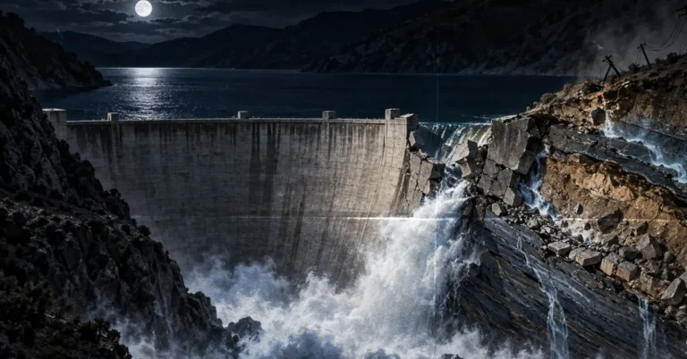
There is also a quieter hazard back at Nyos. The lake is held in by a natural dam of crumbly pyroclastic rock, and geologists, including a USGS assessment and a 2005 UN expert mission, have warned that erosion could eventually breach it, draining the lake in a flood that would reach into Nigeria and potentially trigger another gas release as the pressure drops. Mitigation has been proposed; the dam remains a watch item.
The deepest uncertainty is history itself. Sediment cores from Kivu suggest the lake has undergone large outgassing events roughly every thousand years, wiping out aquatic life and dragging shoreline vegetation into the water. Nobody knows exactly what triggered those past events, or precisely when the last one occurred. That recurrence is the strongest argument that Kivu can erupt, and the reason the cautious, monitored, gas-extracting status quo is the right posture, not complacency.
So is it safe to live and travel there? For ordinary purposes, yes. The dissolved gas sits hundreds of metres down; the surface waters where people swim, fish, and sail are unaffected, and Kivu is in fact one of the safer African lakes for swimming, free of crocodiles, hippos, and the parasite that causes bilharzia. The threat is geological and rare, not something a swimmer encounters. What protects the people on the shore is not luck. It is instruments: a permanent monitoring program, careful management of how the gas is extracted, and a scientific community that, since one terrible night in 1986, has refused to look away.
The lesson of Nyos was that a lake can kill in silence. The achievement of the decades since is that we learned to listen.
Frequently Asked Questions
What is a limnic eruption? A limnic eruption is a rare disaster in which a large volume of dissolved gas, usually carbon dioxide, suddenly escapes from the deep water of a lake. The gas forms a dense cloud that flows over the ground and can suffocate people and animals. Only three lakes on Earth are known to do this: Nyos, Monoun, and Kivu.
What causes a limnic eruption? A disturbance lifts gas-rich water from the depths: a landslide, a slug of cold rain, a pulse of volcanic heat from below or an internal overturn. As the water rises, the pressure falls and bubbles form; the bubbly water rises faster and releases more gas, in a runaway chain reaction.
Has a limnic eruption ever happened? Twice on record, both in Cameroon: at Lake Monoun on 15 August 1984, which killed 37 people, and at Lake Nyos on 21 August 1986, which killed about 1,700 to 1,800 people (most often given as 1,746).
How many people died at Lake Nyos? The Lake Nyos disaster of 21 August 1986 killed roughly 1,700 to 1,800 people; the most commonly cited figure is 1,746, alongside more than 3,500 livestock. The original 1987 Science report by George Kling’s team stated “at least 1,700.” The deaths were caused by carbon dioxide asphyxiation, not by any direct volcanic eruption.
Did anyone survive Lake Nyos? Yes. Survivors described a warm sensation and a faint smell, then nothing; they woke hours later, dazed, to find their families gone.
Could Lake Kivu explode? Potentially, but not imminently on current evidence. Kivu holds about 300 km³ of CO₂ and 60 km³ of methane in its deep water. A 2020 PLOS ONE study found gas levels “close to a steady state,” not racing toward a threshold. The realistic trigger would be an external shock, a volcanic intrusion or major earthquake, rather than gradual buildup.
Is Lake Kivu safe to visit? Yes. The dangerous gases are locked hundreds of metres below the surface, so swimming, boating, and lakeside stays are considered safe, and the lake is continuously monitored. Kivu is also free of crocodiles, hippos, and bilharzia, making it one of the safer African lakes for recreation. Travellers should still follow local guidance.
What is being done to prevent a Lake Kivu eruption? Two things: monitoring and controlled gas extraction. The KivuWatt plant, running since 2016, pulls up deep water, strips out methane to generate about 26 MW of electricity for Rwanda, and reinjects the spent water, gradually reducing the gas load while powering the region. Rwandan authorities and international scientists track the lake’s stratification continuously.
Why is Lake Kivu more dangerous than Lake Nyos? Kivu is roughly 2,000 times larger by volume and holds flammable methane in addition to CO₂, adding a fire-and-explosion hazard that Nyos lacked. It also sits beside the active Nyiragongo volcano, and about two million people live on its immediate shores, versus a few thousand around Nyos in 1986.